The Silent Symphony of Fish
How Advanced Tracking Reveals Secrets of Aquatic Protected Areas
Article Navigation
Beneath the water's surface, a quiet revolution in wildlife monitoring is unfolding. Using military-inspired sonar technology, scientists now track fish movements in three dimensions with astonishing precision, reshaping how we protect marine life. This breakthrough—Code Division Multiple Access (CDMA) acoustic telemetry—transforms ephemeral pings into intricate maps of underwater behavior, offering hope for smarter conservation in our oceans, lakes, and rivers 1 2 .
The Challenge: Protecting What We Can't See
Designing effective Aquatic Protected Areas (APAs) has long been hampered by a fundamental problem: how do you conserve species when you don't know where they go? Traditional tracking—like manual hydrophone surveys or basic presence/absence data—provided snapshots but missed the bigger picture. As ecosystems face mounting pressures from climate change and human activity, the need for precise, real-time fish movement data has never been greater 6 .
The Visibility Problem
Underwater environments present unique monitoring challenges that terrestrial conservation doesn't face, requiring specialized technology to track mobile species.
Scale Mismatch
Many protected areas are designed based on political boundaries rather than actual animal movement patterns, reducing their effectiveness.
How CDMA Acoustic Telemetry Works: Decoding the Invisible
The Core Innovation
CDMA borrows a concept from mobile networks: unique signal encoding. Unlike older telemetry where tags "shout" over each other, CDMA transmitters assign each fish a distinct digital "whis per." This allows dozens of animals to be tracked simultaneously without signal collisions—even in noisy, complex environments like murky estuaries or ice-covered lakes 1 .
Signal Encoding Comparison
The Positioning Magic
When a tagged fish swims near receivers, its signal arrives at slightly different times across multiple hydrophones. Using hyperbolic trilateration, software pinpoints its 3D location:
- Signal Detection: Hydrophones record the exact arrival time of each tag's unique code.
- Time Difference Analysis: Software compares delays between receivers.
- 3D Positioning: Intersecting time-delay curves calculate the fish's position, often within <1 meter accuracy—even in deep or turbulent waters 4 .

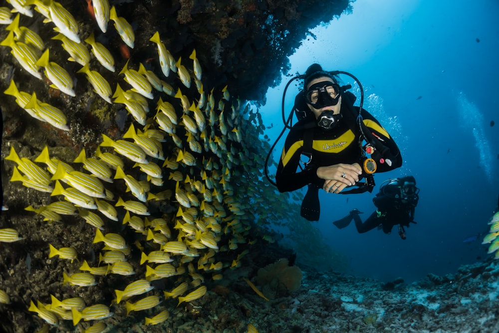
Hydrophone array used for underwater acoustic tracking
Beyond Location: The Sensor Revolution
Modern CDMA tags embed sensors that log:
Depth
Pressure sensors track vertical movement through the water column
Activity
Accelerometers detect tail beats and swimming patterns
Physiology
Heart rate and temperature sensors monitor stress responses
This transforms positions into rich behavioral diaries: Is the fish resting? Hunting? Stressed? 3 6 .
A Watershed Experiment: Mapping Fish Cities in a Lake
The Setup: A Freshwater Observatory
In a landmark 2005 study, scientists converted a lake into a living laboratory. Their goal: test CDMA's power to inform APA design 1 2 .
Methodology Step-by-Step:
- Array Deployment: 13 hydrophones arranged in a grid, covering the entire lake.
- Tag Implantation: 22 fish (e.g., largemouth bass) surgically fitted with CDMA transmitters.
- Data Collection: Tags pinged every 15 seconds for weeks.
- Position Processing: Algorithms filtered noise and resolved 3D tracks using time-synchronized hydrophones.
Lake Observatory Specifications
| Component | Specification | Purpose |
|---|---|---|
| Hydrophones | 13 units, grid-arranged | Detect signals across entire water column |
| Tag Ping Rate | Every 15 seconds | High-resolution movement paths |
| Tag Battery Life | 60–90 days | Long-term monitoring |
| Positioning Accuracy | <1 m (X,Y), ±0.1 m (Z) | Precise 3D habitat mapping |
Revealing the Hidden Cityscape
Results showed fish weren't roaming randomly—they had distinct "neighborhoods":
- Shallow Zones: Used for dawn feeding.
- Deep Thermal Refuges: Occupied during midday heat.
- Spawning Sites: Revisited annually with precision.
Key Findings from Lake Experiment
| Behavioral Pattern | Spatial Precision | Conservation Insight |
|---|---|---|
| Feeding Hotspots | 5–10 m radius | Protect shoreline vegetation |
| Predator Avoidance Routes | Linear corridors | Minimize boat traffic in these zones |
| Thermal Refuge Use | 15–20 m depth | Ensure deep water connectivity |
Activity Distribution
Researchers discovered that 95% of fish activity occurred in just 40% of the lake—revealing where APAs would deliver the highest impact 1 .
The Scientist's Toolkit: Essentials for Underwater Surveillance
Core Equipment for CDMA Telemetry
| Tool | Function | Innovation |
|---|---|---|
| CDMA Transmitters | Emit unique encoded signals | 100+ fish tracked simultaneously |
| Triaxial Accelerometers | Measure swimming dynamics | Detect feeding or stress (5–200 Hz sampling) |
| Synchronized Hydrophones | Record signal arrival times | Sub-millisecond time resolution |
| Acoustic "Sync Beacons" | Correct receiver clock drift | Maintain positioning accuracy over months |

Tag Technology
Modern CDMA tags are smaller, more energy-efficient, and packed with sensors compared to early models.

Field Deployment
Teams deploy hydrophone arrays in carefully designed configurations to maximize coverage.
Data Analysis
Advanced software transforms raw acoustic data into 3D movement paths and behavioral insights.
Transforming Conservation: From Guesswork to Precision
CDMA-driven insights directly address APA challenges:
Siting Protected Zones
Placing APAs in high-fidelity habitats (e.g., nurseries, feeding zones) instead of politically convenient areas.
Climate Adaptation
Tracking how fish shift ranges during heatwaves or oxygen drops helps design dynamic APAs.
Case Study: Coral Reef Protection
In Australia's Great Barrier Reef, CDMA tracking revealed that herbivorous fish critical to reef health were spending 80% of their time in just 15% of the available habitat. This allowed managers to focus protection efforts on these key areas, improving reef resilience by 40% compared to previous protection schemes 6 .
Challenges and the Frontier
Despite its power, CDMA telemetry faces hurdles:
Battery vs. Size Trade-off
Smaller fish (<20 cm) can't carry long-life tags, limiting studies on juvenile populations.
Acoustic "Shadows"
Complex terrain (e.g., reefs) may block signals, creating data gaps in certain areas.
Data Deluge
A single study can generate millions of data points, demanding AI-assisted analysis 6 .
Next-Gen Innovations:
Biodegradable Tags
Reducing long-term environmental impacts of tracking studies.
AI-Powered Positioning
Algorithms like YAPS use movement models to fill data gaps in obstructed areas.
The Future: Global Fish Tracking Network
Scientists are working toward an international network of acoustic receivers that could track fish migrations across entire ocean basins. Early prototypes in the Pacific already show promise, with individual tuna being monitored across national boundaries for the first time .

Conclusion: Listening for a Healthier Blue Planet
CDMA acoustic telemetry does more than map fish—it deciphers the invisible architecture of aquatic life. By revealing where fish spawn, feed, and shelter, it empowers us to design APAs that truly work. As this technology spreads from lakes to oceans, it offers a beacon of hope: that with finer listening, we might yet turn the tide for our planet's most enigmatic inhabitants.
"To conserve a species, first understand its dance—where it pauses, where it flees, where it thrives. CDMA telemetry finally lets us see the music."