Optimizing Conservation Planning: Integrating Ecosystem Service Data for Strategic Biodiversity Outcomes
This article provides a comprehensive framework for researchers and conservation scientists to integrate ecosystem service (ES) data into conservation planning.
Optimizing Conservation Planning: Integrating Ecosystem Service Data for Strategic Biodiversity Outcomes
Abstract
This article provides a comprehensive framework for researchers and conservation scientists to integrate ecosystem service (ES) data into conservation planning. It covers the foundational rationale for this integration, explores advanced methodological and geospatial tools for application, addresses common challenges in data-scarce regions, and outlines validation techniques through policy frameworks and case studies. The content is designed to guide professionals in transitioning from theoretical concepts to practical, efficient, and impactful conservation strategies that align with global sustainability goals.
The Strategic Imperative: Why Ecosystem Services Belong in Modern Conservation
Frequently Asked Questions (FAQs)
FAQ 1: What is the fundamental relationship between biodiversity conservation and ecosystem service provision?
Research indicates that while biodiversity conservation protects substantial collateral flows of ecosystem services, the relationship involves important trade-offs. Studies show weak positive and some weak negative associations between priority areas for biodiversity conservation and the flows of six key ecosystem services (carbon storage, flood control, forage production, outdoor recreation, crop pollination, and water provision). Excluding agriculture-focused services like crop pollination and forage production eliminates most negative correlations. Strategic conservation planning can identify valuable synergies, with biodiversity conservation protecting substantial service flows, while targeting services directly can meet multiple goals more efficiently but cannot substitute for targeted biodiversity protection (biodiversity losses of 44% when only services are targeted) [1].
FAQ 2: What frameworks are available for integrating ecosystem services into conservation planning?
Several established frameworks support this integration. The Open Standards for the Practice of Conservation provide a methodology for conservation project management, including developing situation models and results chains to depict theories of change [2]. Systematic conservation planning frameworks using tools like MARXAN can be adapted to incorporate ecosystem services by treating them as additional "features" for which targets are set, alongside traditional biodiversity features [1]. The NatureServe Vista decision support system offers another comprehensive platform that integrates biodiversity and ecosystem service data, knowledge, models, and analyses to facilitate planning [3].
FAQ 3: How can we address trade-offs between different ecosystem services and biodiversity?
Addressing trade-offs requires a systematic planning approach that:
- Explicitly identifies and quantifies trade-offs through scenario-based analysis [3]
- Uses spatially explicit mapping to visualize conflicts and synergies [1]
- Employs optimization tools like MARXAN to find solutions that balance multiple objectives [1]
- Incorporates both supply and demand for ecosystem services in the analysis [1]
- Engages stakeholders through partnership building and facilitation to resolve conflicts [3] Research demonstrates that strategically targeting biodiversity plus positively associated services offers much promise (relative biodiversity losses of only 7%) compared to targeting all services indiscriminately [1].
FAQ 4: What are the key challenges in modeling and quantifying ecosystem services?
Key challenges include:
- Spatial mismatch: Services are generated and consumed at different scales [1]
- Data limitations: Poor characterization of service flows in biophysical and economic terms at local and regional scales [1]
- Beneficiary consideration: Proper characterization requires considering both supply and demand for services [1]
- Trade-off complexity: Understanding and quantifying relationships between multiple services [4]
- Methodological consistency: Developing standardized approaches for comparing across studies and regions [5] Regulating services are particularly challenging as they have no physical form and are purely public, leading to tendency to overlook their immense value [4].
Troubleshooting Common Experimental & Research Challenges
Challenge 1: Inadequate Spatial Alignment Between Biodiversity and Ecosystem Service Data
Symptoms: Mismatched scales between species distribution maps and ecosystem service models, inconsistent spatial resolution, jurisdictional misalignment.
Solution: Apply the Integrated Ecological Framework developed by NatureServe and partners:
- Establish common planning units (e.g., 500ha hexagons) as the uniform spatial unit of analysis [1]
- Use consistent stratification to divide study areas into subregions across environmental gradients [1]
- Employ spatial modeling tools to harmonize data resolution (NatureServe Vista, MARXAN) [3]
- Conduct gap analysis to identify spatial discrepancies in protection levels [3]
Prevention: Define standardized spatial frameworks at project inception; use homogeneous landscape units that integrate soil properties, land use, and terrain properties for more reliable simulation [5].
Challenge 2: Accounting for Ecosystem Service Demand in Conservation Planning
Symptoms: Conservation plans protect service provision in areas with few beneficiaries, missed opportunities near population centers, inadequate justification for conservation investments.
Solution: Implement beneficiary-aware planning protocol:
- Map both service provision and human population distribution [1]
- Quantify demand using proximity-based metrics (distance to beneficiaries) [1]
- Incorporate flow mechanisms that connect provision to beneficiaries [1]
- Use multi-criteria decision analysis to balance ecological and social priorities
Validation: Compare planned networks against actual service delivery to vulnerable communities through post-implementation monitoring.
Challenge 3: Integrating Traditional Ecological Knowledge (TEK) with Scientific Data
Symptoms: Community resistance to conservation plans, overlooking locally important resources, reduced plan implementation.
Solution: Apply participatory planning framework:
- Respect and integrate local knowledge and traditional ecological knowledge throughout the planning process [3]
- Use structured facilitation to draw out conservation values and requirements [3]
- Combine scientific data with local observations through collaborative mapping
- Establish ongoing partnership mechanisms for plan implementation and updates [3]
Success Indicators: Increased local participation in implementation, improved retention of culturally significant species, enhanced plan adaptability.
Ecosystem Service Data & Methodology Tables
Table 1: Conservation Planning Compatibility of Ecosystem Services
| Ecosystem Service Category | Example Services | Data Availability | Spatial Explicitness | Compatibility with Biodiversity Targets |
|---|---|---|---|---|
| Regulating Services | Carbon storage, flood control, water purification | Moderate to High | High | Generally Positive [1] |
| Provisioning Services | Forage production, crop pollination, water provision | Variable | Moderate | Mixed (often negative associations) [1] |
| Cultural Services | Outdoor recreation, aesthetic value | Low to Moderate | Low to Moderate | Generally Positive [1] |
| Supporting Services | Soil formation, nutrient cycling | Low | Low | Strongly Positive [4] |
Table 2: Methodological Approaches for Ecosystem Service Integration
| Method | Application | Data Requirements | Technical Complexity |
|---|---|---|---|
| MARXAN Optimization | Spatial prioritization for multiple conservation features | Species distributions, ecosystem service models, costs | High [1] |
| Results Chains | Depicting theories of change | Situation models, causal relationships | Moderate [2] |
| Scenario Analysis | Evaluating future threats and alternatives | Land use change projections, climate models | High [3] |
| Trade-off Analysis | Balancing multiple objectives | Spatial data on all services and biodiversity | Moderate to High [1] |
| Benefit-Relevant Indicators | Connecting services to human well-being | Service provision and beneficiary data | Moderate [1] |
Experimental Protocols & Methodologies
Protocol 1: Systematic Conservation Planning with Ecosystem Service Integration
Application: Regional conservation planning that aligns biodiversity protection with ecosystem service provision
Methodology:
- Feature Definition & Mapping: Identify biodiversity features (species, habitats) and ecosystem services as conservation "features" [1]
- Stratification: Divide study area into subregions to stratify features across environmental gradients [1]
- Target Setting: Set quantitative representation targets for each feature in each stratification unit [1]
- Suitability Assessment: Define conservation suitability based on impediments and opportunities [1]
- Network Design: Use optimization algorithms to select priority areas meeting all targets efficiently [1]
Technical Specifications:
- Planning unit size: 100-500ha depending on region size [1]
- Biodiversity targets: Typically 20-40% of viable occurrences or area [1]
- Service targets: Based on current provision levels and beneficiary demand [1]
Protocol 2: Regulating Ecosystem Services Assessment in Karst Systems
Application: Evaluating regulating services in vulnerable karst landscapes, relevant to World Natural Heritage sites [4]
Methodology:
- Systematic Literature Review: Apply Search, Appraisal, Synthesis, and Analysis (SALSA) framework [4]
- RESs Assessment: Focus on water conservation, soil retention, climate regulation [4]
- Trade-off Analysis: Identify synergies and conflicts among regulating services [4]
- Driving Mechanism Analysis: Clarify how factors influence RESs spatio-temporal dynamics [4]
- Enhancement Strategy Development: Formulate adaptive management based on findings [4]
Inclusion Criteria:
- Peer-reviewed publications (2005-present) [4]
- Quantitative RESs assessment methods [4]
- Clear methodological descriptions [4]
- Primary research focus on RESs [4]
Research Reagent Solutions
Table 3: Essential Tools for Integrated Conservation Planning
| Tool/Platform | Primary Function | Application Context | Technical Requirements |
|---|---|---|---|
| NatureServe Vista | Decision support system for conservation planning | Integrating biodiversity and ecosystem service data in land use planning [3] | GIS capabilities, spatial data |
| MARXAN | Conservation planning optimization software | Designing efficient protected area networks with multiple objectives [1] | Spatial data, target setting |
| ARIES (Artificial Intelligence for Ecosystem Services) | Ecosystem service modeling and valuation | Rapid assessment of multiple ecosystem services [5] | Web-based, some modeling expertise |
| Ecopath with Ecosim (EwE) | Ecological modeling for marine systems | Assessing biomass change and fishery impacts [5] | Species interaction data |
| Open Standards for Conservation | Conservation project management framework | Developing situation models and results chains [2] | Stakeholder engagement skills |
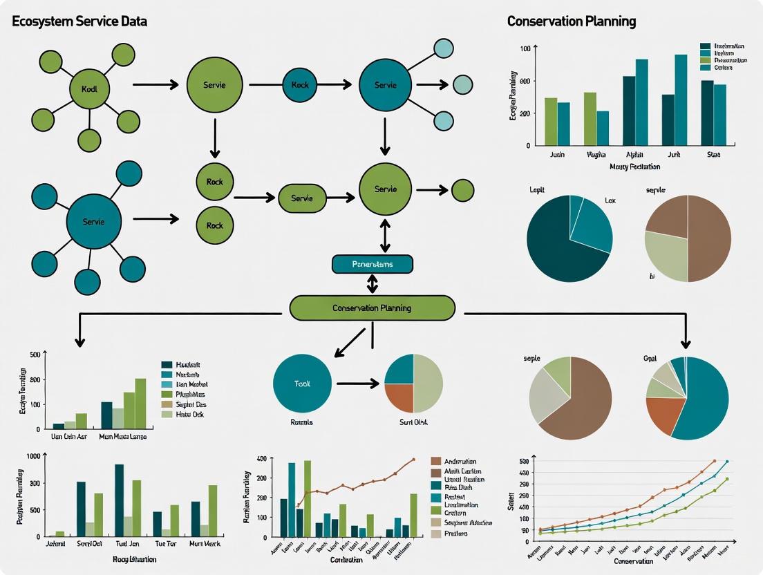
Methodological Workflows & Conceptual Diagrams
Integrated Conservation Planning Workflow
Biodiversity-Ecosystem Service Relationship Map
Frequently Asked Questions (FAQs)
FAQ 1: Why are traditional economic indicators like GDP insufficient for measuring a country's true economic health? GDP is a measure of income and market production but fails to account for the depletion of natural assets that support the economy. It does not include the benefits provided by nature, such as clean air and water, nor the costs of environmental degradation [6] [7] [8]. Using GDP alone is like a business measuring its performance based only on sales while ignoring the decline in its inventory [7].
FAQ 2: What is Natural Capital Accounting (NCA) and how does it work? Natural Capital Accounting (NCA) is a system that integrates a country's natural resources—such as forests, water, and minerals—into its economic planning and decision-making. It uses a structured set of data to track both the stocks (the current amount) of natural resources and the flows (the services and benefits they provide) over time and space [6]. This provides a more complete picture of a nation's wealth and the sustainability of its growth.
FAQ 3: What are the main challenges in monetizing ecosystem services? A primary challenge is moving beyond single indicators. Nature's value spans environmental, social, cultural, and economic dimensions, and focusing on just one or two metrics (like water quality) can miss the bigger picture and undervalue a project's full benefits [9]. Furthermore, the valuation process itself can be complex, requiring robust methods to standardize diverse benefits into a comparable format for decision-makers [10] [9].
FAQ 4: How can researchers and policymakers access standardized data on ecosystem values? The Ecosystem Services Valuation Database (ESVD) is the largest publicly available database of standardized monetary values for ecosystem services globally. It contains over 10,800 values drawn from 30 years of peer-reviewed research and official reports, and is available for free [10].
FAQ 5: What financial risks are associated with the loss of natural capital? The loss of natural capital poses significant transition and physical risks. For example, policies aimed at protecting nature could create transition risks for investors and companies linked to unsustainable commodities like those driving deforestation [8]. Physically, the degradation of ecosystems like mangroves, which provide coastal protection, can lead to substantial property damages, estimated at over $82 billion annually [8]. The World Bank also estimates that a collapse of key ecosystem services could cost the global economy $2.7 trillion by 2030 [6].
Troubleshooting Common Experimental & Methodological Challenges
Challenge 1: Comparing Incommensurable Values
- Problem: How do you compare the value of a cultural heritage site with the value of carbon sequestration from the same area?
- Solution: Instead of trying to force all values into a single monetary number, use a multi-dimensional metrics approach. Translate diverse measures into a consistent currency of relative change from a baseline (e.g., a 15% improvement in soil carbon, a 20% increase in community engagement). This allows decision-makers to see the full spectrum of benefits and trade-offs side-by-side and apply their own weightings based on project priorities [9].
Challenge 2: Integrating Non-Market Values into Cost-Benefit Analysis
- Problem: Many ecosystem services, like climate regulation or scenic beauty, are not traded in markets and lack a clear price.
- Solution: Utilize established databases and classification systems.
- Step 1: Use the Ecosystem Services Valuation Database (ESVD) to find standardized monetary values for a wide range of services and biomes, based on existing global research [10].
- Step 2: Apply the National Ecosystem Services Classification System (NESCS Plus) framework. This EPA tool provides a structured way to analyze how changes to an ecosystem ultimately impact human welfare, ensuring all relevant benefits are considered in policy analysis [11].
Challenge 3: Incorporating Natural Capital Data into Macroeconomic Models
- Problem: Standard economic models used for national planning do not include the contribution of or impacts on natural capital.
- Solution: Use the System of Environmental-Economic Accounting (SEEA), which provides an internationally agreed-upon method to account for material natural resources like minerals, timber, and fisheries. By creating natural capital accounts based on the SEEA, countries can integrate this data into their macroeconomic models to better understand trade-offs and measure sustainability beyond GDP [6]. The World Bank's Changing Wealth of Nations report is a key example of this approach, tracking produced capital, natural capital, and human capital together [7].
Experimental Protocols & Data Presentation
Protocol 1: Developing a Natural Capital Account for a Forest Ecosystem
Objective: To systematically measure and value the stocks and flows of a forest area to inform policy.
Materials & Workflow:
- Define Scope: Determine the geographic boundary and the ecosystem services to be assessed (e.g., timber, carbon sequestration, water filtration, recreation).
- Data Collection:
- Stocks: Measure the physical extent (hectares) and condition of the forest (species composition, health).
- Flows: Quantify the physical flow of services (e.g., tons of CO₂ sequestered, volume of timber, number of recreational visits).
- Valuation: Assign monetary values to the physical flows using methods like:
- Market Price: For goods like timber.
- Benefit Transfer: Applying values from existing databases like the ESVD [10] for services like carbon storage or erosion control.
- Integration: Compile data into asset accounts showing how stocks change over time and flow accounts showing annual contributions to the economy.
- Policy Analysis: Use the accounts to model scenarios, such as the economic impact of deforestation versus conservation for ecotourism [6].
Protocol 2: Conducting a Rapid Benefit Assessment for a Wetland Restoration
Objective: To quickly assess the multiple benefits of a proposed wetland restoration project using non-monetary indicators.
Materials & Workflow:
- Stakeholder Scoping: Use a tool like the EPA's Final Ecosystem Goods and Services (FEGS) Scoping Tool to identify the key beneficiaries and the ecosystem services most important to them (e.g., local residents concerned about flood control, birdwatchers) [11].
- Select Indicators: Choose relevant Rapid Benefit Indicators (RBI) from available data. For a wetland, this could include:
- Environmental: Acres of habitat restored.
- Social: Number of people in areas with reduced flood risk.
- Economic: Estimated reduction in water treatment costs.
- Baseline & Projection: Measure indicator levels before restoration and model expected levels after restoration.
- Analyze Trade-offs: Present the changes in a normalized table or dashboard to show the distribution of benefits across different stakeholder groups and objectives [11].
Quantitative Data on Ecosystem Services and Natural Capital
Table 1: Global Economic Value of Selected Ecosystems and Services
| Ecosystem / Service | Monetary Value | Context & Source |
|---|---|---|
| Mangroves (per hectare/year) | $217,000 Int$ | Mean value for coastal protection, tourism, etc. [10]. |
| Coral Reefs (global, annual) | $375 billion | Total in economic goods and services [10]. |
| Global Ecosystem Services (annual, 2011) | $125 trillion | Total value of all global ecosystem services [8]. |
| Mangroves - Flood Protection (global, annual) | $82 billion | Value of annual property damage reduction [8]. |
Table 2: Trends in Global Renewable Natural Capital (1995-2020)
| Component | Trend | Context & Source |
|---|---|---|
| Overall Renewable Natural Capital (per capita) | Decline >20% | Global average, driven by overexploitation of forests, fisheries, etc. [7]. |
| Marine Fish Stocks (per capita) | Decline >45% | Contributed to a near-zero value in renewable natural capital accounts [7]. |
| Global Forest CO₂ Absorption (2020) | 2.6 Gt CO₂ | Amount absorbed by remaining forest land annually [8]. |
| Deforestation Emissions (1990-2020 avg.) | 3.7 Gt CO₂/yr | Average annual CO₂ emissions from deforestation [8]. |
Table 3: Key Research Reagent Solutions for Ecosystem Service Valuation
| Tool / Resource | Function | Key Features |
|---|---|---|
| Ecosystem Services Valuation Database (ESVD) | Provides standardized monetary values for ecosystem services for use in benefit transfer and cost-benefit analysis. | Free to use; contains over 10,800 values from peer-reviewed literature; global coverage [10]. |
| System of Environmental-Economic Accounting (SEEA) | The international statistical standard for natural capital accounting. Provides the methodological framework for creating national-level accounts [6]. | |
| EnviroAtlas | An interactive mapping tool from the EPA that allows users to explore and analyze ecosystem services data for the United States. | Provides GIS data and maps on numerous ecosystem services [11]. |
| NatureServe Vista | A decision support system for conservation and land use planning. | Integrates data, knowledge, and models to evaluate scenarios and trade-offs [3]. |
| National Ecosystem Services Classification System (NESCS Plus) | A framework for analyzing how policy-induced changes to ecosystems impact human welfare. | Helps systematically identify and categorize ecosystem services for policy analysis [11]. |
Methodological Frameworks and Conceptual Pathways
Natural Capital Integration in Economic Decision-Making
Conceptual Workflow for Integrating Natural Capital into Economic Planning
Conservation Planning Optimization with Ecosystem Service Data
Systematic Conservation Planning Workflow
Frequently Asked Questions (FAQs)
FAQ 1: How can we quantitatively align our local conservation plans with the GBF's 30% protection target? The Kunming-Montreal Global Biodiversity Framework (GBF) Target 3 calls for effectively conserving and managing at least 30% of terrestrial, inland water, and marine and coastal areas by 2030 [12]. To align your research:
- Spatial Planning Tools: Use systematic conservation planning tools like MARXAN to identify priority areas that are ecologically representative and well-connected [1].
- Data Integration: Incorporate maps of Key Biodiversity Areas, ecosystems of high ecological integrity, and areas important for ecosystem services to ensure multiple conservation objectives are met [12] [1].
- Management Effectiveness: Develop monitoring frameworks to ensure these areas are "effectively conserved and managed," which includes equitable governance and integration with wider landscapes [12].
FAQ 2: What methodologies exist to integrate ecosystem service data into conservation planning as encouraged by the GBF? The GBF emphasizes integrating biodiversity and its multiple values into planning processes [12]. A proven methodology involves:
- Mapping Supply and Demand: Map both the supply of ecosystem services (e.g., carbon storage, water provision, pollination) from ecosystems and the demand for these services from people [1] [13].
- Spatial Optimization: Use spatially explicit conservation planning frameworks to identify areas that synergistically protect biodiversity and supply critical ecosystem services. This helps avoid areas with strong trade-offs [1].
- Structured Workflow: Follow a defined protocol for feature definition, stratification, target setting, and cost-assessment, adapting tools traditionally used for biodiversity planning to ecosystem services [1].
FAQ 3: Our models show a trade-off between biodiversity and an ecosystem service. How do we resolve this within the GBF's goals? The GBF requires integrating biodiversity's multiple values across all sectors [12]. When trade-offs arise:
- Strategic Prioritization: Research indicates that targeting biodiversity plus a suite of positively associated services (e.g., carbon storage, flood control, recreation, water provision) can achieve most biodiversity (93%) and service goals with minimal trade-offs [1].
- Multi-Objective Optimization: Employ optimization models that explicitly account for cost-effective outcomes for both biodiversity and services like carbon sequestration to find balanced solutions [14].
- Avoid High-Conflict Services: If possible, focus on synergies. One study found that excluding agriculture-focused services like crop pollination and forage production eliminated negative correlations with biodiversity conservation [1].
FAQ 4: How can we account for uncertainty in species population responses when planning for GBF Target 4 (halting species extinction)? GBF Target 4 requires actions to halt human-induced extinction and reduce extinction risk [12]. To address uncertainty:
- Stochastic Population Models: Use models that incorporate environmental variation and demographic stochasticity to predict population viability under different conservation scenarios [15].
- Advanced Simulation Techniques: Implement methods like Importance Sampling within Monte Carlo simulations to efficiently estimate the probability of meeting population targets, which is crucial for evaluating the viability constraint of a species [15].
Troubleshooting Guides
Problem: Incomplete integration of ecosystem services in spatial plans. Solution: Ecosystem services are often overlooked in spatial planning due to a lack of standardized data and methods [16].
- Recommended Action: Utilize existing mapping resources and tools designed to incorporate ecosystem services into planning at regional and landscape levels [13]. Foster science-policy collaborations and ensure high environmental awareness among decision-makers to create a supportive context [16].
Problem: Insufficient financial resources for implementing ambitious restoration and protection plans. Solution: GBF Target 19 aims to substantially increase financial resources for biodiversity [12].
- Recommended Action:
- Develop a National Biodiversity Finance Plan to mobilize domestic resources [12].
- Explore innovative finance mechanisms such as green bonds, payment for ecosystem services schemes, and biodiversity offsets (with strong safeguards) to leverage private investment [12].
- For researchers, quantify and highlight the co-benefits of conservation, such as carbon sequestration and disaster risk reduction, to access climate finance and other synergistic funding streams [12].
Problem: Difficulty in accessing or transferring technology for effective monitoring. Solution: The GBF establishes a Technical and Scientific Cooperation (TSC) mechanism to facilitate this [17].
- Recommended Action: Engage with the global network of regional and subregional support centers coordinated under the CBD's TSC mechanism. This can provide demand-driven support for capacity building, technology transfer, and access to scientific data and knowledge [17].
Experimental Protocols for Conservation Planning
Protocol 1: Integrated Biodiversity and Ecosystem Service Mapping
Objective: To spatially identify priority areas for conservation that simultaneously protect biodiversity and maintain the flow of key ecosystem services.
Methodology (based on [1]):
- Define Planning Units: Divide the study area into uniform spatial units (e.g., 500-hectare hexagons or grid cells).
- Map Features:
- Biodiversity Features: Map the distribution of species, habitats, and ecosystems of conservation concern.
- Ecosystem Service Features: Map the supply and demand for key services (e.g., carbon stocks in vegetation, water runoff for provision, pollinator habitat for crop pollination, access to green space for recreation).
- Set Representation Targets: For each biodiversity feature (e.g., protect 30% of its area) and ecosystem service (e.g., maintain 90% of current carbon storage).
- Define Socioeconomic Costs: Use a "suitability" layer representing impediments to conservation, such as land acquisition costs or current land-use intensity.
- Spatial Optimization: Run a conservation planning algorithm (e.g., MARXAN, Zonation) to find a network of planning units that meets all representation targets at a minimum cost.
Protocol 2: Cost-Effective Planning for Biodiversity and Carbon
Objective: To optimize conservation investment to protect threatened species while maximizing carbon sequestration.
Methodology (inspired by [14]):
- Model Species Distributions: Use species occurrence data and environmental variables to create habitat suitability models for threatened species.
- Map Carbon Stocks: Utilize land cover data and allometric equations to estimate above- and below-ground carbon storage across the landscape.
- Input-Output Analysis: Frame the problem as an optimization model where the input is the cost of land protection/management and the outputs are the conserved area for species and the total carbon sequestered.
- Identify Priority Areas: The model outputs a spatially explicit plan that shows the most cost-effective areas to protect to achieve a given set of biodiversity and carbon targets.
Visualizing Conservation Planning Workflows
Conservation Planning and Policy Integration
Ecosystem Service Data Integration Framework
The Scientist's Toolkit: Key Research Reagents & Solutions
Table 1: Essential Resources for Conservation Planning Research
| Research Reagent / Solution | Function in Conservation Planning |
|---|---|
| Spatial Planning Software (e.g., MARXAN, Zonation) | Algorithm-based tools to identify optimal and efficient networks of conservation areas that meet specific biodiversity and ecosystem service targets [1]. |
| Ecosystem Service Models (e.g., InVEST, ARIES) | Model and map the supply, demand, and flow of ecosystem services (e.g., carbon storage, water purification, pollination) across a landscape [1] [13]. |
| Stochastic Population Models | Simulate population growth and viability under environmental uncertainty and different management scenarios, crucial for assessing extinction risk as per GBF Target 4 [15]. |
| Monte Carlo Simulation & Importance Sampling | Advanced statistical techniques to estimate probabilities of population persistence and reduce variance in optimization models, leading to more reliable conservation plans [15]. |
| National & Global Biodiversity Data Portals | Provide access to essential data on species distributions, protected areas, and key biodiversity indicators, necessary for setting baselines and monitoring progress toward GBF goals [12] [13]. |
Technical Support Center: Troubleshooting Ecosystem Service Data in Conservation Planning
This technical support center provides troubleshooting guides and FAQs for researchers and scientists integrating ecosystem service data into conservation planning. The content is designed to support your experiments and help navigate common methodological challenges.
Frequently Asked Questions (FAQs)
Q1: Our conservation plan is being criticized for potentially exacerbating social inequalities. How can we better incorporate equity into our ecosystem service models?
- A: Traditional planning that focuses only on the supply of ecosystem services can overlook critical distributional issues. To address this, implement the serviceshed concept in your spatial prioritization. A serviceshed is the geographical area that provides an ecosystem service to a specific group of beneficiaries.
- Diagnosis: Your model likely quantifies demand based only on spatial extent or population density, ignoring beneficiary vulnerability.
- Solution: Disaggregate your study region into servicesheds based on beneficiary location and socio-economic vulnerability. Apportion your conservation budget or targets across these servicesheds. Using a demand metric that weights the number of beneficiaries by their vulnerability level can lead to more equitable outcomes by ensuring conservation resources reach the most vulnerable populations [18].
Q2: We are encountering trade-offs where prioritizing one ecosystem service (e.g., crop pollination) leads to the decline of another (e.g., biodiversity). How should we approach this?
- A: Trade-offs between biodiversity and certain ecosystem services are a common, documented challenge.
- Diagnosis: Your planning framework may be including services with inherent negative correlations to biodiversity conservation goals, such as those focused on agricultural production [1].
- Solution:
- Identify Associations: Conduct a spatial correlation analysis to map the relationships between your biodiversity features and different ecosystem services.
- Strategic Targeting: Consider a conservation network design that strategically targets biodiversity plus the ecosystem services that are positively associated with it. Research has shown this approach can protect substantial service flows with minimal biodiversity loss (e.g., 7% relative loss) compared to targeting biodiversity alone [1].
- Systemic Planning: Use a systematic planning framework like MARXAN to identify these synergies and trade-offs explicitly, allowing for informed decision-making [1].
Q3: How can we move from measuring nature-related risks to actively managing and mitigating them within financial or economic portfolios?
- A: The field is shifting from disclosure to action through nature-positive transition planning and stress testing.
- Diagnosis: Treating nature-related risks as long-term and uncertain leads to inaction.
- Solution:
- Transition Finance: Work with high-impact sectors (e.g., agriculture, forestry) to implement sustainable practices. Develop finance strategies that support this transition, moving beyond investments solely in restoration to mainstreaming nature across operations [19].
- Nature Stress Testing: Integrate nature-related risks into financial risk management. Use frameworks from the Taskforce on Nature-related Financial Disclosures (TNFD) and Network for Greening the Financial System (NGFS) to model scenarios and assess the potential impact (e.g., portfolio value reductions of 4-5%) on your assets [19].
Q4: Our urban conservation projects sometimes have unintended negative effects. How can we better account for ecosystem "disservices"?
- A: A holistic assessment of Nature-based Solutions (NBS) must include both Ecosystem Services (ES) and Ecosystem Disservices (EDS).
- Diagnosis: The intervention (e.g., an urban forest) is being evaluated only for its benefits, not its potential drawbacks.
- Solution:
- Identify Potential EDS: These can include pollen causing allergies, trees damaging infrastructure, or green spaces attracting pests [20].
- Integrated Assessment: Actively monitor and measure both ES and EDS. Factor EDS into your cost-benefit analysis and project design.
- Management: Choose appropriate NBS types and species, and implement management practices to mitigate known disservices. For instance, select low-pollen-producing trees for planting in high-density residential areas [20].
Troubleshooting Guides
Problem: Selected conservation sites do not effectively deliver ecosystem services to the people who need them most.
Investigation and Resolution:
- Understand the Problem: Confirm that your model currently focuses only on the supply of ecosystem services (e.g., wetland area for flood control) without robustly integrating demand (location of flood-vulnerable people) and spatial flow (how the service moves from source to beneficiary) [18].
- Isolate the Issue: Test your model's sensitivity by running it with different demand metrics:
- Metric A: Size of the demand area only.
- Metric B: Number of beneficiaries in the demand area.
- Metric C: Number of beneficiaries weighted by their socio-economic vulnerability. Comparing the outputs will reveal if your model is susceptible to distributional inequity [18].
- Find a Fix:
- Adopt the Serviceshed Approach: Define the serviceshed for your target ecosystem service.
- Refine Demand Quantification: Use Metric C (vulnerability-weighted beneficiaries) to quantify demand within each serviceshed.
- Re-run Spatial Prioritization: Use decision-support software like Marxan to identify sites that efficiently meet conservation targets across all servicesheds, ensuring a more equitable distribution of benefits [18].
Issue: Failure to Align with Global Biodiversity Framework (GBF) Goals
Problem: Conservation projects are not demonstrably contributing to international commitments like the 30x30 target or the Global Biodiversity Framework.
Investigation and Resolution:
- Understand the Problem: Verify if your project is stuck in a "measurement and disclosure" phase without a clear plan to align financial flows or economic decisions with nature-positive outcomes [19].
- Isolate the Issue: Check if your organization has a nature-positive transition plan. Is there a strategy to transform operations and investments, particularly in high-impact sectors?
- Find a Fix:
- Develop a Transition Plan: Set specific, time-bound targets for reducing nature-negative impacts and increasing positive ones, using frameworks from TNFD or GFANZ [19].
- Engage Indigenous Communities: Meaningfully involve Indigenous peoples and local communities as stewards in the design and implementation of projects. This is critical for the legitimacy and long-term success of nature finance initiatives [19].
- Create Innovative Financial Vehicles: Develop targeted financial products that channel capital to critical biodiversity areas, such as those falling under the 30x30 commitment, where significant protection gaps remain (e.g., only 8.4% of marine areas are currently protected) [19].
Experimental Protocols & Data
Protocol: Spatial Prioritization for Ecosystem Services and Biodiversity
This protocol is adapted from established conservation planning methodologies [1] [18].
1. Feature Definition and Mapping:
- Biodiversity Features: Identify and map species, natural communities, and ecosystems. Use "planning units" (e.g., 500 ha hexagons) as your uniform spatial unit.
- Ecosystem Service Features: Map the biophysical supply of selected services (e.g., carbon stocks, flood mitigation capacity). For services with beneficiaries, also map the demand and the flow between supply and demand areas.
2. Stratification:
- Divide the study area into subregions (e.g., by watershed, ecoregion) to ensure features are captured across environmental gradients.
3. Target Setting:
- Set quantitative representation targets for each feature within each stratification unit (e.g., protect 30% of the distribution of a rare ecosystem type).
4. Suitability/Cost Definition:
- Create a spatial layer representing the relative "cost" or difficulty of conservation for each planning unit, incorporating factors like land acquisition cost, current land use, or future degradation risk.
5. Conservation Network Design:
- Use an optimization algorithm (e.g., Marxan, Zonation) to select a network of planning units that meets all biodiversity and ecosystem service targets at a minimum total cost.
Quantitative Data on Nature and Economies
Table 1: Economic Impacts and Gaps in Nature Conservation
| Metric | Value | Context / Implication |
|---|---|---|
| Potential GDP Loss from Nature Loss | 12% (UK estimate) | Illustrates macro-economic threat; impacts are higher in biodiversity-rich countries [19]. |
| Potential Portfolio Value Reduction | 4-5% for some banks | Highlights tangible financial risk from nature-related shocks [19]. |
| Current Global Land Protection | 17.6% | Shows progress and gap towards 30x30 target [19]. |
| Current Global Marine Protection | 8.4% | Significant gap remains towards 30x30 target [19]. |
| Flood Damages Averted by Mangroves | USD 57 billion/year | Example of quantifiable economic benefit from a specific Nature-based Solution in several countries [21]. |
Table 2: Key Research Reagent Solutions for Conservation Planning
| Item / Concept | Function in Research |
|---|---|
| Spatial Prioritization Software (e.g., MARXAN) | An algorithm-based tool to identify efficient, spatially cohesive networks of conservation areas that meet user-defined biodiversity and ecosystem service targets [1]. |
| The Serviceshed Concept | A spatial unit of analysis that defines the area providing an ecosystem service to a specific group of beneficiaries, crucial for integrating equity into planning [18]. |
| IUCN Global Standard for NbS | A set of 8 criteria and 28 indicators to guide the design, implementation, and evaluation of Nature-based Solutions, ensuring they are effective and equitable [21]. |
| Nature-related Financial Disclosure (TNFD) Framework | A risk management and disclosure framework for organizations to report and act on evolving nature-related risks and opportunities [19]. |
| Ecosystem Service Models (e.g., InVEST) | Software models that map and value ecosystem services to quantify the benefits nature provides to people under different land-use scenarios. |
Workflow Visualizations
Diagram 1: Ecosystem Service Conservation Workflow
Diagram 2: Systemic Transition Conceptual Framework
From Data to Decisions: Tools and Techniques for ES Integration
Frequently Asked Questions (FAQs)
Q1: What is the EPA Ecosystem Services Tool Selection Portal and what are its primary applications? The EPA Ecosystem Services Tool Selection Portal is a resource designed to help professionals select the best ecosystem services assessment tools for their specific project needs. Its primary applications are for professionals involved in:
- Ecological risk assessments
- Contaminated site cleanup
- Other decision-making contexts, including natural resource management, park and recreation planning, habitat restoration, and stormwater management [22].
Q2: I'm new to ecosystem services. What background knowledge is required to use the portal effectively? While a background in ecosystem services can be helpful, the language in the Portal is intentionally clear and concise, making it accessible to a wide range of users. Risk assessors, contaminated site practitioners, or others interested in environmental decision-making can review results from the Portal to learn about various tools that pertain to their specific criteria without being experts in the field [22].
Q3: My research involves strategic forest management. Can the principles of the portal be applied to long-term planning for multiple ecosystem services? Yes, the portal's framework aligns with advanced research in optimizing multiple ecosystem services. For example, studies in strategic forest management have successfully used optimization models to incorporate various services—such as education, aesthetics, cultural heritage, recreation, carbon sequestration, water regulation, and water supply—into long-term planning horizons, such as 100 years. These models use techniques like mixed-integer programming to maximize the future utility of ecosystem services, demonstrating the practical application of the portal's core concepts in complex, real-world scenarios [23].
Q4: How does the portal address the spatial mismatch between ecosystem service supply and demand in urban planning? The portal's logic supports tools and frameworks that can be used to address spatial imbalances. Contemporary research optimizes Urban Ecological Infrastructure (UEI) based on ecosystem service supply, demand, and flow. This involves quantifying multiple ecosystem services to identify the spatial extent of UEI, calculating supply and demand indexes to assess if resident needs are met, and using the spatial quantification of ecosystem service flows to optimize the UEI layout, thereby addressing mismatches common in central urban areas [24].
Troubleshooting Common Experimental & Research Challenges
Problem: Difficulty selecting the right assessment tool for a contaminated site cleanup project.
- Solution: The Portal provides a dedicated decision-tree path for "Contaminated site cleanup." Follow this structured path, inputting your specific project criteria (e.g., contaminants present, scale, required outputs) to receive a shortlist of the most relevant tools from the EPA's suite [22].
Problem: My analysis results show a sharp trade-off between timber production and other ecosystem services like carbon storage.
- Solution: This is a common finding in ecosystem service optimization. Research indicates that carbon storage is often the service most sensitive to changes in harvest schedules. To manage this:
- Use the treatment schedules from the portal or related research as a baseline.
- Incorporate standing timber volume and growth increment as key criteria in your model, as these can help determine the future value of other, less sensitive ecosystem services.
- Apply multi-scenario optimization (e.g., Limited, Expansion, and Comprehensive Optimization Scenarios) to visualize trade-offs and identify a balanced management strategy [23].
Problem: Uncertainty in quantifying and mapping the flow of ecosystem services from supply areas to demand areas.
- Solution: This is a current research frontier. To operationalize ecosystem service flow in your planning:
- Define the Service: Clearly identify the service being studied (e.g., recreation, air purification).
- Spatially Quantify Supply and Demand: Use established models to map supply zones (e.g., forests, parks) and demand zones (e.g., urban residential areas).
- Model the Flow: Apply methods like Comparative Ecological Radiation Force (CERF) to model the transfer process from supply to demand. This helps identify specific peripheral areas that should be incorporated into the ecological infrastructure to serve high-demand urban centers [24].
Experimental Protocols for Key Methodologies
Protocol 1: Integrating Ecosystem Services into Strategic Forest Management Planning
This protocol is based on research for maximizing the future utility of ecosystem services using optimization [23].
1. Define Ecosystem Services and Establish Criteria:
- Select the ES to be incorporated (e.g., cultural heritage, carbon, water regulation).
- Establish a set of quantitative criteria and indicators for each ES, which can be informed by expert opinion and stakeholder participation.
2. Simulate Treatment Schedules:
- For each forest stand (management unit), simulate a wide range of potential treatment schedules over the desired planning horizon (e.g., 50 schedules over 100 years).
- Each schedule should include a sequence of management activities like thinning and clear-cutting at specified intervals.
3. Estimate Future Suitability Values:
- For each treatment schedule and each planning period, estimate the suitability value for every ecosystem service based on the established criteria.
4. Apply Optimization Model:
- Use a mixed-integer programming model to select the single optimal treatment schedule for each stand.
- The objective function is to maximize the total future utility derived from the weighted values of all ecosystem services across the entire planning horizon.
- Apply operational constraints, such as even harvest flow or maximum allowable harvest volume.
5. Scenario Analysis and Selection:
- Run the optimization model under multiple scenarios (e.g., different harvest demands, different weights for ES based on Sustainable Development Goals).
- Analyze the trade-offs between scenarios to select a successful and balanced management plan.
Protocol 2: Optimizing Urban Ecological Infrastructure Based on Service Supply, Demand, and Flow
This protocol outlines a method for identifying and optimizing UEI [24].
1. Spatial Quantification of Multiple Ecosystem Services (Supply):
- Select a suite of relevant urban ES (e.g., recreation, climate regulation, water purification).
- Using GIS and ecological modeling tools (e.g., InVEST, SolVES), spatially quantify the supply of these services across the study area.
2. Spatial Quantification of Ecosystem Service Demand:
- Map the demand for the selected ES based on socio-economic data, such as population density and the location of residential areas.
3. Calculate Supply-Demand Balance:
- Compute a supply-demand index to identify areas of spatial mismatch (where demand exceeds supply, often in central urban areas) and spatial balance.
4. Delineate Initial Ecological Infrastructure:
- Identify the spatial extent of existing UEI based on the spatial aggregation of high-value ecosystem service supply areas.
5. Quantify Ecosystem Service Flow and Optimize Layout:
- For services with a spatial flow component (e.g., recreation), model the flow from supply areas to demand areas using a method like Comparative Ecological Radiation Force (CERF).
- Use the results of the flow analysis to identify and incorporate new, strategically located areas (e.g., environmentally beautiful village units on the urban periphery) into the optimized UEI network to better serve high-demand areas.
Research Reagent Solutions
The table below lists key "reagents"—critical datasets, models, and tools—essential for research in ecosystem service assessment and optimization.
| Research Reagent | Function & Application in Ecosystem Services Research |
|---|---|
| EPA Tool Selection Portal | A decision-support framework to identify the most appropriate ecosystem service assessment tool for specific decision contexts like ecological risk assessment or cleanup [22]. |
| Mixed-Integer Programming | An optimization technique used in strategic planning to select optimal management actions (e.g., treatment schedules) for spatial units to maximize utility from multiple ES [23]. |
| GIS & Spatial Analysis | The foundational platform for mapping and quantifying the supply, demand, and flow of ecosystem services across a landscape, crucial for identifying ecological infrastructure [24]. |
| Ecosystem Service Models (e.g., InVEST, ARIES) | Software suites containing specific models to quantify and value multiple ecosystem services, such as annual water yield, nutrient delivery, habitat quality, and scenic quality [25]. |
| Supply-Demand Index | A quantitative metric used to assess the balance or spatial mismatch between the provision of an ecosystem service and the human consumption need for it [24]. |
Workflow Visualization
The following diagram illustrates the logical workflow for navigating the EPA's Tool Selection Portal and integrating its outputs into a broader conservation planning framework.
This technical support center provides troubleshooting guidance and methodological protocols for researchers integrating Geographically Weighted Regression (GWR) and Mixed-Integer Programming (MIP) in spatial optimization projects. Specifically designed for conservation planning with ecosystem service data, this resource addresses common computational challenges and spatial analysis issues encountered when modeling complex socio-ecological systems. The guidance synthesizes proven methodologies from spatial statistics, operations research, and conservation science to enhance the reliability and interpretability of your spatial optimization results.
Core Concepts & Theoretical Framework
Spatial Optimization in Conservation Planning
Spatial optimization for conservation planning involves identifying geographically explicit priorities that efficiently achieve conservation targets while considering multiple constraints and objectives. Systematic conservation planning frameworks, like those implemented in tools such as MARXAN, aim to protect biodiversity and ecosystem services by selecting networks of conservation areas that meet quantitative targets for specific features [1]. When incorporating ecosystem services, planning must account for both the supply of services from ecosystems and the spatial distribution of human beneficiaries [1].
Role of GWR and MIP
Geographically Weighted Regression (GWR) is a spatial statistical technique that allows relationship between variables to vary across a study area, capturing local rather than global patterns. This is particularly valuable in conservation contexts where factors influencing ecosystem services may operate differently in various regions [26] [27].
Mixed-Integer Programming (MIP) is a mathematical optimization approach where some decision variables are constrained to be integers. In conservation planning, MIP formulations can model yes/no decisions about protecting specific parcels of land while meeting conservation targets cost-effectively [1].
Frequently Asked Questions (FAQs)
Q1: Why should I use GWR instead of traditional regression for spatial conservation planning?
Traditional global regression models assume relationships between variables are constant across space, which often doesn't hold true for ecological and socio-economic data. GWR captures spatial heterogeneity, revealing how factors influencing ecosystem services or biodiversity vary geographically. This allows for more targeted and context-appropriate conservation interventions [26] [27]. For example, a study in Shanghai found GWR effectively identified how different urban functions influence population distribution at varying spatial scales [26].
Q2: What are the most common numerical issues when solving MIP models for conservation networks, and how can I avoid them?
The most frequent numerical issues in MIP optimization include:
- Large matrix coefficients: Caused by poorly scaled constraint coefficients
- Large right-hand-side (RHS) values: Result from improperly scaled constraints
- Constraint and bound violations: Solutions that slightly exceed tolerance limits
These issues often stem from models with extreme variations in coefficient magnitudes, such as those using "big M" formulations [28]. To avoid them, reformulate your model to reduce coefficient ranges, rescale variables (e.g., change measurement units), and use the tightest possible coefficients for big M constraints [28].
Q3: How do I interpret "variables dropped from basis" warnings in my MIP optimization log?
This warning typically indicates numerical difficulties where the solver encounters a singular basis and remedies this by dropping variables and forming a different basis [28]. It's often a symptom of underlying numerical issues rather than a problem itself. Address the root cause by improving model formulation and scaling rather than focusing directly on this warning [28].
Q4: What spatial scales are most appropriate for analyzing functional mix with POI data in urban conservation planning?
Research suggests that grid scales of 700m × 700m and below (e.g., 200m × 200m, 500m × 500m) are most suitable for identifying single-function and mixed-function areas in urban environments [26]. The optimal scale depends on your specific study area and research questions, but finer scales generally provide more detailed insights for local conservation planning.
Q5: How can I effectively model trade-offs between different ecosystem services in conservation planning?
Use correlation analysis to identify trade-offs (significant negative correlations) and synergies (significant positive correlations) between ecosystem service pairs [29]. Scenario analysis can quantify how conservation interventions affect these relationships. For example, China's Grain for Green Program was found to create synergies between carbon storage, habitat quality, and soil conservation while intensifying trade-offs with water yield [29].
Troubleshooting Guides
GWR Implementation Issues
Problem: GWR results show unexpected spatial patterns or poor model performance.
| Step | Action | Diagnostic Check |
|---|---|---|
| 1 | Verify bandwidth selection | Ensure adaptive or fixed bandwidth is appropriate for your data density |
| 2 | Check for spatial autocorrelation in residuals | Use Moran's I on residuals; significant values indicate missing spatial processes |
| 3 | Validate scale appropriateness | Test different spatial units (grid sizes) if analyzing functional mix [26] |
| 4 | Assess predictor collinearity | Calculate local variance inflation factors (VIFs) to detect localized collinearity |
Solution Approach: If you discover significant spatial autocorrelation in residuals, consider using Multiscale Geographically Weighted Regression (MGWR), which allows different bandwidths for each variable, better capturing the scales at which different processes operate [26]. For urban functional mix studies, implement a grid search across multiple scales (200m, 500m, 700m, 1000m) to identify the optimal analysis scale [26].
MIP Numerical Instability
Problem: MIP solver warnings about large coefficients, constraint violations, or slow convergence.
| Symptom | Possible Cause | Solution |
|---|---|---|
| Large matrix coefficient warnings | Poorly scaled "big M" constraints | Reduce M values to smallest valid number; use indicator constraints |
| Large RHS warnings | Improperly scaled constraints | Rescale constraints by changing units (e.g., thousands vs. units) |
| Constraint violation warnings | Numerical precision issues | Adjust FeasibilityTol parameter slightly; improve model scaling |
| Slow convergence | Poor formulation or numerical issues | Implement preprocessing; improve initial solution heuristics |
Solution Approach: Follow this systematic workflow when encountering numerical warnings:
Integrating GWR Outputs into MIP Formulations
Problem: How to incorporate spatially varying relationships from GWR into MIP optimization models.
Solution Approach:
- GWR Analysis Phase: Run GWR to obtain local parameter estimates for key relationships (e.g., between land use and ecosystem service provision)
- Parameter Zoning: Cluster similar parameter values into distinct zones using spatial clustering algorithms
- MIP Formulation: Develop zone-specific constraints or objective function coefficients in your MIP model
- Validation: Check that the zoning scheme captures meaningful spatial variation without over-complicating the MIP
Example Implementation: In a conservation planning context, you might use GWR to understand how the relationship between forest cover and water yield varies across a watershed. These spatially explicit relationships can then inform zone-specific constraints in a MIP model designed to prioritize conservation actions.
Experimental Protocols & Workflows
Integrated GWR-MIP Workflow for Conservation Planning
Detailed Methodology: Conservation Network Design with Ecosystem Services
This protocol adapts methodologies from conservation planning literature [1] for integrating ecosystem services into systematic conservation planning:
Step 1: Feature Selection and Mapping
- Identify biodiversity features (species, habitats) and ecosystem services (carbon storage, water provision, recreation)
- Map features to planning units (typically uniform spatial units of 500ha or smaller)
- For ecosystem services, quantify both supply and demand spatial patterns [1]
Step 2: Target Setting
- Set representation targets for biodiversity features (e.g., protect 30% of each habitat type)
- For ecosystem services, set targets based on beneficiary needs or policy goals
- Stratify targets across environmental gradients to ensure resilience
Step 3: GWR Analysis of Spatial Relationships
- Implement GWR to understand local relationships between potential conservation areas and ecosystem service provision
- Use MGWR when different processes operate at different spatial scales [26]
- Formula for GWR: ( yi = \beta0(ui,vi) + \sumk \betak(ui,vi)x{ik} + \epsiloni ) where ((ui,vi)) are coordinates of location i, and (\betak(ui,v_i)) are local coefficients
Step 4: MIP Formulation Develop a MIP model with:
- Decision variables: (x_j \in {0,1}) indicating selection of planning unit j
- Objective: Minimize (\sumj cj xj) where (cj) is cost/suitability
- Constraints: (\sumj a{ij} xj \geq Ti \forall i) where (a{ij}) is amount of feature i in unit j, and (Ti) is target for feature i
- Additional constraints for spatial connectivity or configuration
Step 5: Solution and Validation
- Solve MIP with attention to numerical stability
- Check solution against targets
- Perform gap analysis to identify shortfalls
- Conduct sensitivity analysis on key parameters
Research Reagent Solutions & Essential Materials
Computational Tools for Spatial Optimization
| Tool Name | Type | Primary Function | Application Context |
|---|---|---|---|
| MARXAN | Conservation planning software | Designs conservation area networks using simulated annealing | Systematic conservation planning for biodiversity and ecosystem services [1] |
| NatureServe Vista | Decision support system | Integrates conservation objectives with land use planning | Multi-criteria planning in complex landscapes [3] |
| InVEST | Ecosystem services modeling | Quantifies and maps ecosystem services | Evaluating service provision under different scenarios [29] |
| Gurobi | Mathematical optimization solver | Solves MIP, LP, QP problems | Large-scale conservation optimization [28] |
| MGWR Python Library | Spatial statistics | Multiscale geographically weighted regression | Analyzing spatially varying relationships [26] |
Data Requirements for Conservation Planning with Ecosystem Services
| Data Type | Specific Examples | Sources | Preprocessing Needs |
|---|---|---|---|
| Biodiversity features | Species distributions, habitat maps, ecological systems | Field surveys, remote sensing, museum records | Gap analysis, viability assessment |
| Ecosystem services | Carbon storage, water yield, pollination, recreation | InVEST models, statistical models, primary data | Spatial quantification of service supply and demand [1] |
| Socio-economic data | Land values, population distribution, infrastructure | Census data, land records, economic surveys | Spatial interpolation, cost surface development |
| Land use/cover | Current and historical land cover, protection status | Remote sensing, government databases | Classification, change detection analysis |
| Physical environment | Elevation, soil types, climate variables | DEMs, soil surveys, climate stations | Derivation of slope, aspect, other derivatives |
Advanced Techniques & Specialized Applications
Handling Trade-offs Among Ecosystem Services
Conservation planning often involves navigating trade-offs between different ecosystem services and biodiversity objectives. The research shows that while some services have synergistic relationships (e.g., carbon storage and habitat quality), others involve significant trade-offs (e.g., water yield versus carbon storage) [29].
Protocol for Trade-off Analysis:
- Quantify Services: Use models like InVEST to map multiple ecosystem services [29]
- Correlation Analysis: Calculate pairwise correlations between services across the landscape
- Trade-off Identification: Significant negative correlations indicate trade-offs
- Scenario Testing: Evaluate how different conservation plans affect trade-off relationships
- Spatial Explicit Optimization: Use MIP to find solutions that balance competing objectives
Multiscale Geographically Weighted Regression (MGWR)
MGWR extends standard GWR by allowing different bandwidths for each relationship, better capturing the scales at which different processes operate [26]. This is particularly valuable in conservation contexts where factors operate at different spatial scales.
Implementation Steps:
- Bandwidth Selection: Use golden section search or similar method for each relationship
- Model Calibration: Fit MGWR model using back-fitting procedure
- Scale Interpretation: Analyze bandwidths to understand operative scales of different drivers
- Result Mapping: Visualize local R², parameter estimates, and t-values
Addressing Numerical Issues in Large-Scale MIP
For large conservation planning problems with thousands of planning units, these advanced techniques can improve MIP performance:
Preprocessing Techniques:
- Variable Reduction: Identify and fix redundant variables
- Constraint Tightening: Improve coefficient bounds to strengthen formulation
- Dual Fixing: Fix variables that must take specific values in any optimal solution
Solution Strategies:
- Decomposition: Use row or column generation for structured problems
- Heuristics: Implement construction and improvement heuristics for initial solutions
- Parallelization: Exploit multiple cores for branch-and-bound search
Technical Support & Troubleshooting Guides
This section provides structured guidance for resolving common technical and methodological challenges encountered during spatial analysis and zoning of Ecosystem Service Management Regions.
Troubleshooting Guide: Spatial Analysis & Model Implementation
| Problem Category | Specific Symptoms & Error Messages | Likely Causes | Recommended Resolution Steps | Verification of Success |
|---|---|---|---|---|
| Data Integration & Preprocessing | CRS (Coordinate Reference System) misalignment errors in GIS; value range errors during raster calculation. | Mismatched coordinate systems between source datasets; incorrect unit conversion or data normalization [30]. | 1. Use GIS software (e.g., ArcGIS, QGIS) to reproject all layers to a unified CRS [30].2. Verify unit consistency (e.g., tons/hectare, mm/pixel) across all input data.3. Re-run data normalization protocols. | All spatial layers align correctly; raster calculator functions execute without domain errors. |
| Ecosystem Service Model Execution | InVEST model returns null outputs or "NaN" values; model fails to initialize [31]. | Incorrect file path formats in the model input table; missing required input parameters (e.g., soil depth, biophysical table) [31]. | 1. Check that all file paths in the input .json or .ini are correct and accessible.2. Validate that the biophysical table CSV includes all required land use classes and coefficients.3. Consult the specific InVEST model's user guide for parameter requirements. | Model runs to completion and generates non-null output rasters with expected value ranges. |
| Supply-Demand Coupling Analysis | Coupling Coordination Degree (CCD) results show no spatial variation or illogical values (e.g., >1) [30]. | Inaccurate construction of the comprehensive supply-demand index; incorrect application of the CCD formula [30]. | 1. Recalculate the comprehensive index using the entropy weight method to verify weights [30].2. Audit the CCD formula implementation: ( D = \sqrt{C \times T} ), where ( C ) is the coupling degree and ( T ) is the coordination index. | CCD values are spatially heterogeneous and logically fall within the defined range (e.g., 0-1). |
| Functional Zoning & Clustering | K-means clustering algorithm yields highly imbalanced or non-sensical zone classifications [31]. | Poor selection of the cluster number (k); presence of outliers in the input data skewing results [31]. | 1. Perform elbow method or silhouette analysis to determine the optimal 'k' value before final execution.2. Run outlier detection on input variables (e.g., Z-score) and apply appropriate data transformation. | Resulting zones are spatially contiguous where expected and demonstrate distinct ecosystem service bundles. |
Conceptual Framework for EESMR Identification
The following diagram illustrates the core analytical workflow for defining Enhanced-Efficiency Ecosystem Service Management Regions (EESMR).
Frequently Asked Questions (FAQs)
Methodological & Conceptual Questions
Q1: What are the essential criteria for selecting which ecosystem services to include in an EESMR analysis? A: The selection should be based on the study area's ecological characteristics and management goals. Key criteria include: 1) Relevance to regional ecological security and human well-being, 2) Data availability for robust quantification, and 3) Representativeness of major service types (provisioning, regulating, supporting) [31] [30]. For instance, studies in China's Shennongjia and Jiangxi regions prioritized water yield, carbon storage, soil retention, and habitat quality [31] [30].
Q2: How is the supply-demand relationship of ecosystem services quantitatively measured? A: A common and robust method involves constructing a Comprehensive Ecosystem Service Supply-Demand Index (CESSD). This often employs the entropy weight method to assign objective weights to different services based on their data variability, followed by the application of a Coupling Coordination Degree (CCD) model to quantify the static coordination between supply and demand [30]. The formula for CCD is ( D = \sqrt{C \times T} ), where ( C ) is the coupling degree and ( T ) is a comprehensive coordination index.
Q3: What is the difference between static and dynamic analysis in this context, and why is integrating both important? A: Static analysis (e.g., CCD model) provides a snapshot of the supply-demand balance at a single point in time. Dynamic analysis (e.g., a four-quadrant evolution model) tracks how this relationship changes over multiple periods [30]. Integrating both creates a "static-dynamic" framework, allowing researchers to identify not only current imbalance areas but also zones undergoing dangerous transitions, leading to more proactive and effective management strategies [30].
Data & Technical Implementation Questions
Q4: What are the primary data sources and key tools for quantifying ecosystem services? A: The InVEST (Integrated Valuation of Ecosystem Services and Tradeoffs) model suite is a widely used tool for this purpose [31] [30]. The required data, as applied in recent studies, are summarized in the table below.
Table: Key Research Reagent Solutions & Data Requirements
| Research 'Reagent' (Data/Tool) | Primary Function & Relevance | Common Sources & Specifications |
|---|---|---|
| InVEST Model Suite | A core software platform for spatially explicit modeling of multiple ecosystem services, including water yield, carbon storage, and habitat quality [31]. | Natural Capital Project (Stanford University). Requires input rasters and biophysical tables. |
| Land Use/Land Cover (LULC) Data | The foundational map determining ecosystem service supply potentials. Used as a primary input for most InVEST models [31] [30]. | Classified from Landsat or Sentinel satellite imagery; overall interpretation accuracy should exceed 85% [31]. |
| Normalized Difference Vegetation Index (NDVI) | A key indicator of vegetation cover and photosynthetic activity, highly correlated with services like carbon storage and soil conservation [31] [30]. | Derived from remote sensing imagery (e.g., MODIS, Landsat). |
| Digital Elevation Model (DEM) | Provides topographical data crucial for modeling hydrological processes (water yield) and soil erosion (sediment retention) [30]. | SRTM (Shuttle Radar Topography Mission) or ASTER GDEM datasets. |
Q5: Our K-means clustering results are unstable between software runs. How can this be mitigated?
A: K-means algorithm initialization is stochastic. To ensure reproducible and stable results for zoning: 1) Set a random seed in your coding environment (e.g., random_state in Python's Scikit-learn) before execution. 2) Standardize input variables to have a mean of 0 and standard deviation of 1 to prevent variables with larger scales from dominating the cluster solution [31].
Q6: How can the impact of climate change be incorporated into the EESMR framework? A: Integrate future climate scenario data (e.g., from IPCC CMIP6) into your models. This involves using projected precipitation and temperature data as inputs for the InVEST water yield and other climate-sensitive models. This allows for the delineation of EESMRs that are resilient not only to current but also to anticipated future pressures [32].
Frequently Asked Questions (FAQs)
1. What are the primary types of ecosystem service valuation methods and when should I use them? The primary valuation approaches are biophysical, monetary, and spatially explicit methods. Biophysical models use ecological data and empirical formulas to quantify services like carbon sequestration or water yield [33] [34]. Monetary valuation assigns economic values to these biophysical outputs, helping to represent their importance in decision-making contexts [35]. Spatially explicit methods map the supply, demand, and flow of ecosystem services across a landscape, which is crucial for identifying trade-offs and priority areas for conservation [33] [34]. You should use biophysical models to establish ecological baselines, monetary methods to communicate value to stakeholders and policymakers, and spatially explicit tools to guide spatial planning and identify where interventions will be most effective.
2. My spatially explicit models for the same service are yielding different results. What could be the cause? Discrepancies between models are common and can arise from several sources. A comparative study using the InVEST and ARIES tools on the San Pedro River found that they produced different quantitative results for carbon, water, and viewshed services [33]. Key reasons include:
- Different Underlying Mechanisms: Models may conceptualize and compute service provision differently. For instance, some tools model only the potential supply of a service, while others, like ARIES, attempt to map the actual flow of services from ecosystems to human beneficiaries, accounting for factors that can deplete this flow [33].
- Data Input and Processing: Variations in land-use/land-cover (LULC) data processing can lead to different outcomes. The San Pedro study noted challenges in integrating multiple land-cover datasets, which restricted the analysis for certain geographic areas within the same model run [33].
- Spatial Resolution: The scale and resolution of input data and model computations can significantly impact results.
3. I am working in a data-scarce region. How can I conduct a robust ecosystem service valuation? Conducting valuation in data-scarce environments is challenging but possible by leveraging alternative data sources and tailored approaches [36].
- Use Value Transfer: This method involves adapting existing valuation estimates from similar ecosystems and locations to your study site. The UN SEEA EA technical report discusses this as a practical method, though it requires careful attention to the contextual similarity between the source study and your site [35].
- Employ Expert Elicitation and Citizen Science: You can develop a matrix of ecosystem service supply potential based on land cover types, scored by experts or through local knowledge co-generation [36] [34]. Engaging local stakeholders to contribute data and knowledge can make the valuation process more inclusive and locally relevant while filling data gaps [36].
- Select Appropriate Tools: Opt for models that can function with more generalized data inputs. The progression of tools from qualitative to quantitative and the availability of global datasets can help overcome local data limitations [36].
4. How can I effectively visualize and communicate the trade-offs between different ecosystem services? Communicating trade-offs is a key strength of spatially explicit methods.
- Spatial Mapping: Use tools like InVEST or ARIES to generate maps for multiple services under different scenarios (e.g., current land use vs. a development scenario). Placing these maps side-by-side visually highlights which areas gain or lose specific services [33].
- Trade-Off Curves: For a more analytical approach, use optimization techniques to plot a production possibility frontier. This curve shows the maximum achievable amount of one service given a fixed level of another, clearly illustrating the trade-off relationship. Methods like the Restoration Opportunities Optimization Tool (ROOT) can help identify these relationships and pinpoint priority areas for intervention [34].
- Structured Optimization: Implement optimization models, such as mixed-integer programming, to generate a set of optimal management scenarios that maximize the total utility of multiple ecosystem services, making the trade-offs between different management objectives explicit [23].
Troubleshooting Guides
Issue: Conflicting Results from Different Spatially Explicit Models
Problem: You have used two different modeling tools (e.g., InVEST and ARIES) on your study area, and the quantified values or spatial patterns for a service like water yield or carbon storage do not match.
Solution:
- Verify Input Data Consistency: Ensure you are using identical, pre-processed LULC maps and other key input datasets (e.g., soil, precipitation) for both models. In the San Pedro case study, inconsistencies in LULC data were a major hurdle for a unified analysis [33].
- Interrogate Model Documentation: Carefully review the model's ecological production functions.
- InVEST often uses a production function that links LULC types to service provision via look-up tables [33].
- ARIES models the flow of services from source to sink, which may give a more realistic picture of actual service provision and use [33].
- Understand that different philosophies (potential supply vs. actual flow) will yield different results.
- Compare Relative, Not Absolute, Values: When absolute values conflict, focus on the relative differences between scenarios or across the landscape. Both models may reliably identify the same areas as having "high" or "low" value for a service, which is often sufficient for conservation prioritization [33].
- Conclude with Context: Report results from both models, explicitly state their conceptual differences, and use this as a discussion point about the uncertainties in ecosystem service modeling. A single "true" value may not exist; the range of results from credible models can be informative.
Issue: Addressing Data Scarcity in Local Ecosystem Service Valuation
Problem: You lack the site-specific, high-resolution data required for a detailed biophysical or economic valuation.
Solution:
- Adopt a Value Transfer Approach: This is a standard method recommended for ecosystem accounting.
- Step 1: Identify high-quality valuation studies from ecosystems and regions that are as similar as possible to your study site.
- Step 2: Extract unit values (e.g., Int$/ha/year for a specific LULC type) from these studies. The Ecosystem Service Value Database (ESVD), which contains over 1350 value estimates, can be a source for such data [37].
- Step 3: Adjust these values for income and price differences between the study site and your site, following guidelines like those in the UN SEEA EA technical report [35].
- Develop an Expert-Based Matrix: Create a table with LULC types as rows and ecosystem services as columns. Conven a panel of experts familiar with the region to score the potential of each LULC type to provide each service (e.g., on a scale of 0-5). This creates a rapid, semi-quantitative assessment matrix [36] [34].
- Utilize Coarse-Scale Global Data: Leverage increasingly available global datasets (e.g., remote sensing data for precipitation, evapotranspiration, soil groups) as inputs for models that can use them.
- Acknowledge Limitations: Clearly document all data sources and assumptions. State that the valuation is an estimate based on the best available data and should be used with an understanding of its inherent uncertainty [36].
Experimental Protocols
Protocol 1: Conducting a Spatially Explicit Trade-Off Analysis Using InVEST
This protocol outlines the steps for a scenario-based analysis to inform conservation planning [33] [34].
Objective: To quantify and map changes in key ecosystem services under different land-use scenarios.
Workflow:
Materials and Data Requirements:
- Land Use/Land Cover (LULC) Maps: For a baseline and at least one alternative scenario (e.g., a future development plan or a restoration projection). Resolution should be appropriate for the study scale [33].
- Biophysical Data:
- Carbon Storage: Pools of carbon in aboveground, belowground, soil, and dead organic matter for each LULC class.
- Water Yield: Precipitation, average annual reference evapotranspiration, plant available water content, and root restricting layer depth datasets [33].
- Software: ArcGIS or QGIS with the InVEST toolbox installed.
Step-by-Step Instructions:
- Scenario Definition: Clearly define your land-use scenarios. For example, "Current Conservation" vs. "Agricultural Expansion."
- Data Preparation: Preprocess all spatial data to a common coordinate system, spatial extent, and cell size. Create LULC maps for each scenario.
- Model Parameterization: For each InVEST model, prepare the required input rasters and the biophysical coefficient table that links LULC classes to model parameters.
- Model Execution: Run the chosen InVEST models (e.g., Carbon Storage, Annual Water Yield) for each scenario.
- Analysis: Use map algebra to calculate the difference between scenario outputs. Identify areas where one service increases at the expense of another (trade-offs) or where multiple services increase together (synergies).
- Visualization: Create a dashboard of maps showing the provision of each service and the change between scenarios. Overlay protected areas or other planning boundaries to inform decisions.
Protocol 2: Integrating Monetary Valuation into Ecosystem Accounting
This protocol is based on the UN SEEA Ecosystem Accounting framework for deriving monetary values for ecosystem services [35].
Objective: To assign monetary values to biophysically quantified ecosystem services for inclusion in ecosystem accounts.
Workflow:
Materials and Data Requirements:
- Biophysical Accounts: Tables or maps of the physical supply of ecosystem services for the accounting area and period.
- Valuation Data: Market prices, data from stated preference surveys (e.g., Willingness to Pay), or a database of value unit estimates for value transfer.
- Guidance Documents: The UN SEEA EA technical report on monetary valuation [35].
Step-by-Step Instructions:
- Service Classification: Align your biophysically quantified services with the standard classifications in the SEEA EA (e.g., provisioning, regulating, cultural).
- Method Selection: Choose a valuation method based on the service type and data availability.
- Provisioning Services (e.g., timber, crops): Use market price-based methods.
- Regulating Services (e.g., air filtration, carbon sequestration): Use cost-based methods or value transfer.
- Cultural Services (e.g., recreation): Use stated preference methods or value transfer.
- Value Application: Apply the chosen method. For value transfer, this involves selecting appropriate unit values from the literature and adjusting them for your site's context [35].
- Monetary Calculation: Multiply the biophysical quantity of the service by its per-unit monetary value. For example, tons of carbon sequestered multiplied by the social cost of carbon or a carbon market price.
- Aggregation and Reporting: Compile the monetary values into ecosystem service supply and use tables, consistent with the System of National Accounts (SNA) where possible. These accounts can then be used to track changes over time and inform policy measures like Payments for Ecosystem Services (PES) [35] [38].
Comparative Data Tables
Table 1: Illustrative Global Average Monetary Values of Ecosystem Services by Biome
| Biome | Total Ecosystem Service Value (Int$/ha/year) | Key Services Included | Notes |
|---|---|---|---|
| Coral Reefs | ~350,000 | Disturbance regulation, food production, recreation | Highest value due to biodiversity and coastal protection [37] |
| Open Oceans | ~490 | Climate regulation, nutrient cycling, food production | Lowest value per hectare; vast total area [37] |
Note: These are potential global average values from a synthesis of over 300 case studies. Actual values are highly contextual and location-specific [37]. Int$ denotes international dollars.
Table 2: Comparison of Two Spatially Explicit Ecosystem Service Modeling Tools
| Feature | InVEST | ARIES |
|---|---|---|
| Core Philosophy | Static, land-cover driven production functions; models potential service supply [33]. | Dynamic, agent-based; models service flow from source to sink, accounting for beneficiaries [33]. |
| Key Strength | Relatively simple parameterization; well-suited for rapid scenario comparison [33]. | More realistic representation of how services actually reach people; explicit handling of uncertainty [33]. |
| Data Needs | LULC maps and biophysical coefficient tables [33]. | Requires additional data on service flow paths and beneficiary locations [33]. |
| Valuation Integration | Monetary values can be applied to biophysical outputs for many models [33]. | Monetary values can be applied to biophysical outputs for some services [33]. |
Research Reagent Solutions
Table 3: Key Tools and Data for Ecosystem Service Valuation Experiments
| Item | Function in Analysis | Example Use Case |
|---|---|---|
| InVEST Toolbox | A suite of models for mapping and valuing terrestrial, marine, and freshwater ecosystem services under different scenarios [33]. | Assessing the impact of a new urban development plan on carbon storage and water purification. |
| ARIES Framework | An open-source, AI-assisted modeling platform that rapidly maps ecosystem service sources, sinks, and flows to beneficiaries [33]. | Identifying which communities are most vulnerable to the loss of a specific regulating service. |
| ROOT (Restoration Opportunities Optimization Tool) | A tool to identify priority regions for restoration or conservation based on ecosystem service supply-demand mismatches and trade-offs [34]. | Pinpointing the most cost-effective areas for reforestation to improve water security and reduce soil erosion. |
| ESVD (Ecosystem Service Value Database) | A searchable database containing over 1350 coded value estimates from hundreds of case studies, used for value transfer [37]. | Obtaining a preliminary monetary value for flood protection services provided by wetlands in a data-scarce region. |
Overcoming Real-World Hurdles in Conservation Planning
Frequently Asked Questions (FAQs)
Q1: Why is my satellite imagery analysis producing inaccurate land cover classification? A1: Inaccurate classification often stems from poor atmospheric conditions or low spatial resolution. Ensure you perform atmospheric correction on the raw data. Using a higher-resolution dataset (e.g., moving from 30m Landsat to 10m Sentinel-2) can significantly improve results. Always validate your classifications with ground-truth data from field surveys or citizen science initiatives.
Q2: How can I control the quality of data submitted by citizen scientists? A2: Implement a multi-layered data validation protocol:
- Automated Checks: Use software flags for data points that fall outside expected geographic or value ranges.
- Cross-Verification: Have multiple participants report on the same location or event.
- Expert Review: Periodically have domain experts manually review a subset of submissions to calibrate and train automated systems.
Q3: My habitat connectivity model is failing to process. What could be wrong? A3: This is frequently caused by inconsistent raster cell sizes or coordinate reference systems (CRS) between your land cover and environmental variable datasets. Reproject all raster and vector data to a uniform CRS and resolution before analysis. Check for NoData values that may be disrupting circuit flow algorithms.
Q4: What is the minimum number of citizen science observations needed for a robust species distribution model? A4: There is no universal minimum, as it depends on species rarity and habitat heterogeneity. However, a power analysis should be conducted before data collection. As a general guideline, for common species, aim for hundreds to thousands of spatially independent points. For rare species, employ presence-only models like MaxEnt, which can perform well with fewer than 100 observations if strategically placed.
Troubleshooting Guides
Issue: Poor Contrast in Graphical Outputs and Maps
Problem: Published maps or charts are difficult to read, with text and symbols blending into the background. Solution: Adhere to WCAG (Web Content Accessibility Guidelines) contrast standards [39].
- For normal text: Ensure a contrast ratio of at least 7:1 between foreground (text) and background colors [39].
- For large-scale text (e.g., map headings): Ensure a minimum contrast ratio of 4.5:1 [39].
- Action: Use online color contrast analyzers to check your color pairs. When creating diagrams with tools like Graphviz, explicitly set the
fontcolorattribute to ensure high contrast against the node'sfillcolor[40].
Issue: Geospatial Data Mismatch in Remote Sensing Analysis
Problem: Datasets do not align correctly, leading to failed analysis or erroneous outputs. Solution: Standardize data preprocessing.
- Step 1: Check Metadata: Confirm the Coordinate Reference System (CRS), spatial extent, and acquisition date for all datasets.
- Step 2: Reproject and Resample: Use GIS software (e.g., QGIS, ArcGIS) to reproject all data to a common CRS. Resample raster data to a consistent cell size using an appropriate method (e.g., bilinear for continuous data, nearest neighbor for categorical).
- Step 3: Verify Alignment: Visually inspect the overlays of different layers after processing.
Issue: Low Participation in Citizen Science Program
Problem: Insufficient data is being collected due to lack of user engagement. Solution: Optimize the user experience and outreach strategy.
- Simplify the Protocol: Reduce the complexity of data entry tasks. Use dropdown menus, image recognition, and pre-filled values where possible.
- Provide Immediate Feedback: Implement a system that thanks participants and shows how their data contributes to the project (e.g., "You've helped map 50 acres of forest!").
- Gamify the Experience: Introduce badges, leaderboards, or certifications for different contribution levels.
Experimental Protocols
Protocol 1: Integrating Citizen Science Observations with Satellite Imagery for Species Habitat Modeling
1. Objective: To create a high-resolution habitat suitability model by fusing remote sensing data with in-situ citizen science observations.
2. Materials and Reagents:
- Citizen Science Data: Sourced from platforms like iNaturalist or a custom mobile app.
- Satellite Imagery: Sentinel-2 MSI (MultiSpectral Instrument) Level-2A data.
- Environmental Covariates: Digital Elevation Model (DEM), WorldClim bioclimatic variables.
- Software: R or Python with libraries (e.g.,
sf,raster,dismo).
3. Methodology:
- Step 1: Data Curation
- Download citizen science observations for the target species, filtering for research-grade records.
- Download cloud-free Sentinel-2 imagery for the study area and time period, calculating indices like NDVI and NDMI.
- Step 2: Data Preprocessing
- Spatially thin the species occurrence data to reduce sampling bias.
- Mask all raster layers (imagery, DEM, climate) to a consistent study area boundary.
- Step 3: Pseudo-Absence Generation
- Generate pseudo-absence points randomly within the study area but away from observed presence points.
- Step 4: Model Training
- Extract values from all raster layers at the presence and pseudo-absence point locations.
- Use these values to train a machine learning model, such as a Random Forest classifier.
- Step 5: Validation
- Validate model performance using a held-out subset (e.g., 30%) of the data or via k-fold cross-validation, reporting metrics like AUC (Area Under the Curve) and True Skill Statistic (TSS).
Protocol 2: Assessing Land Use Change Impact on Ecosystem Services
1. Objective: To quantify the impact of past land-use change on carbon sequestration and water yield.
2. Materials:
- Land Cover Maps: Multi-temporal (e.g., 1990, 2000, 2010, 2020) land cover classifications.
- Climate Data: Precipitation and temperature time series from local weather stations or reanalysis data.
- Soil Data: Soil type and texture maps.
- Software: InVEST (Integrated Valuation of Ecosystem Services and Tradeoffs) model or similar.
3. Methodology:
- Step 1: Land Change Analysis
- Reclassify historical land cover maps into consistent categories (e.g., Forest, Urban, Agriculture).
- Calculate transition matrices to quantify the amount and type of land change.
- Step 2: Ecosystem Service Modeling
- Run the InVEST Carbon Storage model for each time point using land cover maps and carbon pool data (biomass, soil, litter).
- Run the InVEST Annual Water Yield model using land cover, precipitation, and soil data.
- Step 3: Trend Analysis
- Calculate the total change in carbon stocks and water yield over the study period.
- Correlate changes in ecosystem services with the dominant land cover transitions to identify key drivers.
Data Tables
Table 1: Comparison of Common Remote Sensing Data Sources for Conservation Planning
| Data Source | Spatial Resolution | Temporal Resolution | Key Uses in Conservation | Cost |
|---|---|---|---|---|
| Landsat 8/9 | 30 m | 16 days | Land cover change, deforestation, long-term trend analysis | Free |
| Sentinel-2 | 10 m | 5 days | Detailed habitat mapping, vegetation health, crop monitoring | Free |
| MODIS | 250 m - 1 km | 1-2 days | Continental-scale phenology, fire monitoring, primary productivity | Free |
| PlanetScope | 3 m | Daily | Fine-scale monitoring, small habitat patches, rapid change detection | Commercial |
Table 2: Essential "Research Reagent Solutions" for Data-Scarce Environments
| Item | Function | Example Application |
|---|---|---|
| Pre-Trained ML Models | Provides a baseline for analysis when labeled training data is scarce. | Using a pre-trained land cover model to quickly classify new satellite imagery before fine-tuning with local data. |
| Data Imputation Algorithms | Estimates missing values in datasets to maintain sample size. | Using K-Nearest Neighbors (KNN) or MICE (Multiple Imputation by Chained Equations) to fill gaps in field-sensor data. |
| Synthetic Data Generators | Creates artificial data that mimics real-world patterns to augment small datasets. | Generating synthetic species occurrence points in suitable habitats to balance a biased citizen science dataset. |
| Transfer Learning Frameworks | Allows a model trained on a data-rich domain to be adapted for a data-poor one. | Adapting a bird species classifier from a well-studied region to identify related species in a new, under-studied region. |
Workflow Diagrams
Habitat Suitability Modeling Workflow
Data Validation and Integration Logic
Ensuring Additionality and Credit Integrity in Conservation Projects
Frequently Asked Questions (FAQs)
1. What is additionality and why is it critical for conservation projects?
Answer: Additionality is the principle that the greenhouse gas (GHG) emissions reductions or carbon removals from a project would not have occurred without the incentive created by carbon credit revenues [41] [42]. It ensures that a project goes beyond the "business-as-usual" scenario to deliver genuine, incremental climate benefits [43]. In the context of conservation, this means that the protected forest, restored wetland, or improved agricultural practice must be directly attributable to the financial support from the carbon market.
It is the cornerstone of credit integrity because purchasing non-additional credits results in no net climate benefit. This leads to wasted expenditure, reputational damage from greenwashing accusations, and, ultimately, a failure to mitigate climate change as global emissions continue unabated [41].
2. What are the common tests used to demonstrate additionality?
Answer: Crediting programs use a combination of analyses to demonstrate additionality, which can be grouped into three main categories:
- Financial Additionality: This test assesses whether the project activity is financially viable and attractive without the revenue from carbon credits. If the project is profitable on its own, it is likely not additional [41] [44] [43].
- Regulatory Additionality: This test verifies that the project's activities are not legally mandated. If a law or regulation requires the activity, it would happen regardless of carbon credit sales and is therefore not additional [41] [44] [42].
- Common Practice Analysis: This test examines whether similar activities are already widespread in the relevant region, sector, and circumstances. If they are, it suggests that other factors (e.g., economic benefits, existing policies) already support the activity, weakening the case for additionality [41] [44].
3. Our project involves reforesting degraded land. What are the key additionality risks we should anticipate?
Answer: Even seemingly straightforward projects like reforestation face significant additionality challenges. Key risks include:
- Inaccurate Baselines: The project's carbon savings are measured against a hypothetical baseline. If this baseline is inflated or not representative, the project may be credited for carbon that would have been sequestered anyway [45]. For example, comparing your project to a region with inherently lower carbon sequestration potential can make your project appear more additional than it is.
- Preexisting Motivations: If the landowner had other strong, non-carbon motivations to reforest the land (e.g., planned government subsidies, soil health improvements, or timber production), the project may not be additional [43].
- Systemic Issues: Certain project types, including Afforestation, Reforestation and Revegetation (ARR), can have systemic issues. For instance, high costs may prevent projects from being viable without carbon revenue, but if carbon prices are too low, they may still fail to bridge the financial gap, calling their additionality into question [41].
4. How can our research team quantitatively assess the baseline scenario for a forest conservation (REDD+) project?
Answer: Establishing a robust, quantitative baseline is essential for avoiding over-crediting. The table below summarizes methodological considerations and emerging best practices, drawing from recent research.
Table 1: Methodologies for Establishing Baselines in Forest Conservation Projects
| Methodological Aspect | Common Challenge | Research-Backed Improvement |
|---|---|---|
| Baseline Carbon Density | Using broad regional averages for forest types can overestimate the baseline, as it doesn't account for local ecological variation [45]. | Integrate species composition and high-resolution environmental data (e.g., soil type, slope, climate) to create a more ecologically constrained baseline [45]. |
| Deforestation Reference | Using a proxy area with similar, but not identical, drivers of deforestation can lead to an inaccurate baseline scenario [41]. | Use spatially explicit models that incorporate direct measurements of historical deforestation rates and their specific drivers (e.g., agricultural expansion, logging pressure) specific to the project area [41]. |
| Leakage Accounting | Failure to account for displaced deforestation or emissions to other areas [42]. | Implement monitoring protocols for nearby areas to quantify and deduct leakage emissions as required by protocols like Verra's VCS [42]. |
5. What is the relationship between additionality, permanence, and reversal risk?
Answer: These are three pillars of carbon credit integrity.
- Additionally ensures the carbon benefit is real and beyond business-as-usual.
- Permanence refers to the long-term durability of the carbon storage, ensuring it won't be re-released into the atmosphere for a defined period (e.g., 100 years) [46].
- Reversal Risk is the potential for a sequestered carbon stock to be lost due to events like wildfire, drought, or logging [42].
A high-integrity project must address all three. For example, an additional reforestation project must also have a plan to monitor and protect the forest and contribute credits to a buffer pool, which acts as an insurance policy against reversals [46] [42].
Troubleshooting Guide: Common Additionality Problems and Solutions
Problem 1: Suspected Non-Additionality Due to Financial Viability
- Symptoms: The project activity has clear, profitable co-products (e.g., timber, crops); the internal rate of return (IRR) is high without carbon revenue.
- Diagnosis: Perform a rigorous investment analysis. Compare the financial attractiveness of the proposed project activity against other realistic alternatives without carbon finance [44].
- Solution: Document all financial assumptions transparently. If the project is only financially viable with carbon credit revenue, clearly demonstrate this viability gap. For projects with co-products, use a standardized methodology that allocates credits only to the additional carbon benefit [47].
Problem 2: Challenges in Demonstrating a Credible Baseline
- Symptoms: The baseline scenario seems unrealistic or is based on overly broad regional data; it fails to convince independent verifiers.
- Diagnosis: The baseline may not adequately control for key environmental or economic variables.
- Solution: Employ the advanced baseline methodologies outlined in Table 1. Utilize spatially explicit conservation planning frameworks, such as MARXAN, which can integrate multiple data layers (biodiversity, carbon stocks, ecosystem services) to create a more robust and defensible baseline scenario [1].
Problem 3: Uncertainty in Regulatory Status
- Symptoms: The legal landscape is complex or enforcement of laws is inconsistent, making it unclear if the activity is truly required.
- Diagnosis: Conduct a thorough review of local, regional, and national laws. Assess the history of enforcement for relevant regulations.
- Solution: The project must demonstrate that it is not required by law. This can involve showing that non-enforcement of a theoretical requirement is widespread, or that the project goes significantly beyond compliance levels [44].
The Scientist's Toolkit: Key Frameworks and Analytical Tools
Table 2: Essential Research Reagent Solutions for Conservation Credit Integrity
| Tool / Framework | Function | Application in Experimental Protocol |
|---|---|---|
| MARXAN | A spatial optimization software for conservation planning [1]. | To identify priority conservation areas that efficiently meet targets for biodiversity and multiple ecosystem services, thereby helping to define a scientifically-rigorous project baseline [1]. |
| Additionally Assessment Framework | A structured set of tests (Financial, Regulatory, Common Practice) to evaluate a project's additionality [44] [43]. | The core protocol for any project development. Provides a step-by-step methodology to build evidence that the project would not have occurred without carbon finance. |
| VCS AFOLU Methodologies | Verified Carbon Standard methodologies for Agriculture, Forestry, and Other Land Use projects [42]. | Provide approved, sector-specific protocols for quantifying GHG reductions and removals, including methods for calculating baselines, addressing leakage, and managing permanence risk. |
| Soil Enrichment Protocol | A standardized protocol for issuing credits for carbon sequestration and emission reductions in agricultural soils [46]. | Provides a clear methodology for field measurements, practice monitoring, and third-party verification for agricultural land management projects. |
| Buffer Pool Mechanism | A collective insurance system where projects contribute a risk-adjusted percentage of their credits to a shared pool [42]. | A mandatory risk-mitigation tool for addressing non-permanence (reversal risk) in land-based carbon projects. |
Experimental Protocol: Workflow for Assessing Additionality
The following diagram maps the logical workflow and decision points for a robust additionality assessment, as synthesized from the cited literature.
Diagram 1: Additionality Assessment Workflow
Managing Trade-offs and Synergies Between Multiple Ecosystem Services
Troubleshooting Guide: Frequently Asked Questions
Q1: Why do my ecosystem service models consistently show high trade-offs, making integrated conservation planning difficult?
A: High trade-offs often result from not accounting for the distinct mechanistic pathways through which drivers affect different ecosystem services. A management action (driver) can impact two services independently, affect one service which then influences another, or both [48].
- Solution: Systematically map the drivers and mechanisms before modeling. Use the framework from Bennett et al. (2009) to diagnose the specific pathway causing the trade-off [48]. For example, a forest restoration policy may create a trade-off between carbon sequestration and food production if it replaces cropland (Pathway b), but a synergy if riparian buffers are restored on agriculturally unproductive land, improving both carbon and crop yields via soil retention (Pathway c) [48].
- Experimental Protocol: To identify these pathways:
- Define Drivers: Clearly specify the policy or management intervention (e.g., reforestation, change in harvest scheduling).
- Model Mechanisms: For each service, identify the key biotic (e.g., nutrient cycling), abiotic (e.g., water flow), and socio-economic processes (e.g., market access) the driver affects.
- Pathway Classification: Categorize the interactions using the four mechanistic pathways to predict whether a trade-off or synergy will occur [48].
Q2: How can I spatially identify and visualize areas of strong trade-offs and synergies in my study region?
A: Use spatial correlation analysis alongside Local Indicators of Spatial Association (LISA) to map clusters of ecosystem service relationships.
- Solution: Calculate correlation coefficients (e.g., Pearson's) between paired ecosystem service values across all planning units. Then, apply the Local Moran's I statistic to classify the spatial relationships into distinct cluster types [49]:
- High-High (Synergy): Areas where high values of both services are found together.
- Low-Low (Synergy): Areas where low values of both services are found together.
- High-Low (Trade-off): Areas with a high value of Service A but a low value of Service B.
- Low-High (Trade-off): Areas with a low value of Service A but a high value of Service B.
- Experimental Protocol:
- Quantify Services: Use models like InVEST or CASA to estimate values for key services (e.g., NPP, water yield, soil conservation) for each raster cell or planning unit [50].
- Calculate Correlations: Perform a pairwise correlation analysis for the services of interest.
- Run LISA Cluster Analysis: Using software like GeoDa or R, execute a bivariate Local Moran's I analysis for each service pair. This will generate a map showing the spatial distribution of the four cluster types listed above [49].
Q3: My conservation plan protects high-value areas for each service individually, but the combined plan seems inefficient. What is wrong?
A: Layering single-service plans is inherently inefficient due to spatial non-congruence of high-value areas and the principles of complementarity. A plan for one service may already include areas valuable for another, but this is not guaranteed.
- Solution: Adopt Systematic Conservation Planning (SCP). Use optimization software like Marxan or prioritizr that operates on the principles of representativeness, complementarity, and persistence [49]. This method selects a portfolio of sites that collectively meet multiple targets simultaneously, rather than stacking top-ranked areas for each service.
- Experimental Protocol:
- Set Targets: Define quantitative conservation targets for each ecosystem service (e.g., protect 30% of the total carbon storage value) [51] [49].
- Define Planning Units: Divide your study area into fine-scale units (e.g., grid cells, subcatchments).
- Run Integrated Optimization: Use an SCP tool to identify the set of planning units that meets all targets for all services at the lowest possible "cost" (e.g., area, economic cost). Research shows this integrated approach achieves greater ecosystem service protection with minimal loss in biodiversity coverage compared to biodiversity-only or single-service scenarios [51] [49].
Q4: Which statistical model should I use to understand the scale-dependent effects of drivers on trade-offs?
A: When drivers operate at different spatial scales, use Multi-scale Geographically Weighted Regression (MGWR).
- Solution: MGWR outperforms traditional Ordinary Least Squares (OLS) and Geographically Weighted Regression (GWR) by allowing each explanatory variable to have its own unique bandwidth, effectively modeling its specific scale of influence [50].
- Experimental Protocol:
- Define Dependent Variable: Use the correlation strength or Local Moran's I value of a service pair as your dependent variable.
- Select Independent Variables: Compile a set of potential natural (e.g., precipitation, elevation, NDVI) and socio-economic (e.g., population density, GDP) drivers [50] [52].
- Run MGWR Analysis: Execute the MGWR model to determine the relationship and, crucially, the spatial non-stationarity and operational scale of each driver. This can reveal, for instance, that precipitation is a dominant driver of trade-offs in upper basins, while economic factors drive them in lower basins [50].
Data Presentation: Key Ecosystem Service Relationships and Methods
Table 1: Common Ecosystem Service Trade-offs and Synergies Documented in Research
| Ecosystem Service Pairs | Relationship Type | Context and Drivers | Citation |
|---|---|---|---|
| Carbon Storage vs. Food Production | Trade-off | Driven by land competition; converting forests to cropland increases food but reduces carbon. | [48] |
| Water Yield vs. Soil Conservation | Synergy | Often found in upper and middle reaches of river basins; influenced by precipitation and land cover. | [50] |
| Habitat Quality vs. Pollination | Synergy | Often co-occur in natural and semi-natural landscapes. | [51] |
| Sand Fixation vs. Water Yield | Trade-off | Observed in Chinese ecological engineering; vegetation measures fix sand but reduce water yield. | [53] |
| Residential Capacity vs. Water Conservation | Trade-off | Driven by urbanization; construction land increases residential capacity but reduces water infiltration. | [52] |
| Food Production vs. Habitat Maintenance | Trade-off | Intensive agriculture increases food output but reduces habitat quality and biodiversity. | [52] |
Table 2: Summary of Analytical Methods for Trade-offs and Synergies
| Method | Primary Function | Key Advantage | Example Tool/Software |
|---|---|---|---|
| Correlation Analysis | Quantifies global relationship strength between two ES. | Simple, easy to implement for an initial diagnosis. | SPSS, R [50] |
| Spatial Overlap Analysis | Maps the co-location of high-value areas for multiple ES. | Visually intuitive; identifies spatial congruence. | ArcGIS, QGIS [51] |
| Local Moran's I (LISA) | Identifies local clusters of trade-offs and synergies. | Reveals spatial heterogeneity of relationships missed by global stats. | GeoDa, R [49] |
| Systematic Conservation Planning (SCP) | Optimizes spatial prioritization for multiple ES and biodiversity. | Efficiently meets conservation targets for all features using complementarity. | Marxan, prioritizr [49] |
| Multi-scale Geographically Weighted Regression (MGWR) | Models spatial heterogeneity and scale of driver influences. | Accounts for different operational scales of various drivers. | MGWR Python Package [50] |
| Bayesian Belief Networks (BBNs) | Models causal relationships and probabilistic dependencies under uncertainty. | Handles missing data, combines quantitative data with expert knowledge. | GeNIe, Netica [52] |
Experimental Workflow for Analyzing Trade-offs and Synergies
The following diagram outlines a robust experimental workflow for analyzing ecosystem service trade-offs and synergies, integrating the methods described in the FAQs.
Experimental Workflow for ES Trade off Analysis
The Scientist's Toolkit: Research Reagent Solutions
Table 3: Essential Tools and Data for Ecosystem Service Research
| Tool/Data Category | Specific Example | Function in Analysis | Key References |
|---|---|---|---|
| ES Modeling Software | InVEST (Integrated Valuation of Ecosystem Services and Tradeoffs) | Suite of models for mapping and valuing multiple ES (e.g., carbon, water yield, habitat quality). | [50] [49] |
| ES Modeling Software | CASA (Carnegie-Ames-Stanford Approach) Model | Estimates Net Primary Productivity (NPP) based on remote sensing and climate data. | [50] |
| Spatial Statistics Software | GeoDa | Open-source software for spatial data analysis, including LISA cluster maps. | [49] |
| Spatial Statistics Software | MGWR Python Package | Performs multi-scale geographically weighted regression analysis. | [50] |
| Conservation Planning Tool | Marxan / prioritizr (R package) | Solves systematic conservation planning problems to identify optimal priority areas. | [49] |
| Probabilistic Modeling Tool | Bayesian Belief Network (BBN) Software (e.g., GeNIe) | Models causal relationships and uncertainties among drivers and ES. | [52] |
| Key Biodiversity Data | IUCN Red List & GBIF Species Occurrence Data | Used as inputs for modeling habitat quality and biodiversity as an ES. | [49] |
| Key Remote Sensing Data | NDVI (Normalized Difference Vegetation Index) | Serves as a proxy for vegetation cover and health in ES models like CASA. | [50] [52] |
Frequently Asked Questions (FAQs)
Q1: Why is engaging Indigenous Peoples and Local Communities (IPLCs) considered a high-impact strategy in conservation?
Engaging IPLCs is a high-impact strategy because they collectively manage over 25% of the world's lands and 17% of all forest carbon, and their stewardship often sustains more biodiversity and achieves greater conservation results than government-protected areas [54]. Their deep, place-based knowledge and connections to nature are critical for the long-term success of conservation initiatives [54].
Q2: What are the core principles for building ethical and effective partnerships with Indigenous and local communities?
Effective partnerships are built on several core principles [54]:
- Community-Led: Conservation plans should be co-created, aligning community priorities with organizational mission and experience.
- Reciprocity: Partnerships should be transformational, not transactional, enabling mutual learning and benefit.
- Respect for Rights: A foundational commitment to respecting, promoting, and upholding human rights, including the principle of Free, Prior, and Informed Consent (FPIC), is non-negotiable.
Q3: How can conservation planning tools, often designed from a non-Indigenous perspective, be adapted for use with Indigenous communities?
Many standard conservation planning tools can be adapted to be more useful and effective within Indigenous communities. Guidance exists for integrating non-ecological values and the cultural importance of natural values into the planning process. This includes using innovative facilitation methods and developing communication materials that share results effectively with local community members [55].
Q4: What is the "serviceshed" concept and how does it help address equity in conservation planning for ecosystem services?
The serviceshed is the geographical area that provides a specific ecosystem service to a defined group of beneficiaries [18]. Using this concept in spatial prioritization helps resolve equity issues by ensuring conservation resources are allocated to areas that directly benefit vulnerable communities. It moves planning beyond just the supply of services to incorporate their flow and the socio-economic vulnerability of the beneficiaries [18].
Troubleshooting Guide: Common Challenges in Community Engagement
Problem: Conservation plans are technically sound but lack community buy-in and fail in implementation.
Impact: Conservation actions are ineffective or unsustained, wasting resources and potentially eroding trust between communities and external organizations [54].
Context: This often occurs when planning is expert-driven and does not adequately incorporate local worldviews, values, and knowledge systems [55].
| Solution Tier | Estimated Time | Key Actions |
|---|---|---|
| Quick Fix | 1-2 Meetings | Pause and Listen. Halt plan implementation. Initiate informal meetings with community elders and leaders to understand their primary concerns and aspirations for their lands and waters [54]. |
| Standard Resolution | Several Months | Co-develop a Plan. Use adapted participatory planning processes (e.g., Healthy Country Planning) that integrate cultural values and traditional knowledge with scientific data. Establish clear, mutual roles and responsibilities [54]. |
| Root Cause Fix | Ongoing | Implement a Partner-Centered Framework. Adopt a long-term framework like the Voice, Choice, and Action (VCA) model. This involves building relationships to support community rights, capacity, participation in governance, and sustainable livelihoods [54]. |
Problem: Ecosystem service models prioritize conservation in areas that do not benefit the most vulnerable populations.
Impact: Conservation efforts may perpetuate or exacerbate social inequities by failing to protect the flow of essential services (e.g., flood attenuation, heat mitigation) to socio-economically disadvantaged groups [18].
Context: Traditional spatial planning often prioritizes areas of high ecosystem service supply but ignores the spatial flow of services to people and their varying levels of vulnerability [18].
| Solution Tier | Estimated Time | Key Actions |
|---|---|---|
| Quick Fix | 1-2 Weeks (Analysis) | Incorporate Social Demand Data. Overlay maps of ecosystem service supply (e.g., wetland locations) with data on beneficiary location and socio-economic vulnerability (e.g., flood-prone, low-income neighborhoods) [18]. |
| Standard Resolution | 1-3 Months | Apply the Serviceshed Concept. Define servicesheds for critical services. Use spatial optimization software (e.g., Marxan) to prioritize conservation sites within these servicesheds, weighting the demand metric by the number of beneficiaries and their vulnerability status [18]. |
| Root Cause Fix | Integrated into all Projects | Adopt an Equity-First Analytical Framework. Systematically quantify ES demand using metrics that account for both the number of beneficiaries and their vulnerability. This ensures conservation directly addresses inequity by prioritizing areas where need is greatest [18]. |
Experimental Protocol: Integrating Servicesheds and Equity into Spatial Prioritization
Objective: To identify priority conservation areas for ecosystem services that explicitly address distributional and socio-economic equity using the serviceshed concept.
Methodology Overview: This protocol adapts a systematic conservation planning framework, using the Marxan algorithm-based software, to incorporate the provision of ecosystem services (ES) to vulnerable beneficiaries [18] [1].
Materials and Software Requirements
| Item Name | Function / Purpose |
|---|---|
| GIS Software (e.g., QGIS, ArcGIS) | For spatial data management, analysis, and map creation. |
| Marxan Software | An algorithm-based spatial optimization tool for designing conservation networks [1]. |
| Land Cover / Land Use Map | To identify ecosystems that supply the target ecosystem services (e.g., wetlands, forests). |
| Socio-economic Data | Census data on population density and vulnerability indices (e.g., income, age, health) to characterize demand [18]. |
| Biophysical Models | To map and quantify the supply of specific ecosystem services (e.g., flood attenuation capacity, carbon storage). |
| Demand Area Maps | Spatial data identifying areas where ES demand is concentrated (e.g., flood-prone zones, urban heat islands) [18]. |
Step-by-Step Procedure
Define Focal Ecosystem Services and Study Area: Select ES critical to human well-being in the region (e.g., flood attenuation, heat island mitigation). Define the geographical boundaries of the planning region [1].
Map Ecosystem Service Supply: Use biophysical models and land cover data to map and quantify the capacity of each planning unit (e.g., a hectare or km² grid cell) to supply the focal ES [1].
Map Ecosystem Service Demand and Identify Beneficiaries:
- Demand Area: Map the spatial extent of the area in need of the service (e.g., all flood-prone areas) [18].
- Beneficiaries: Spatialize population data within the demand area.
- Vulnerability: Apply a vulnerability index to the beneficiary data to create a weighted demand score.
Delineate Servicesheds: For each ES, delineate servicesheds by defining the geographical area that provides the service to a specific group of beneficiaries. This can be done by:
- Grouping by Location: Creating watershed-based servicesheds for flood attenuation, where all beneficiaries downstream of a wetland are in the same serviceshed [18].
- Grouping by Vulnerability: Creating servicesheds based on clusters of high-vulnerability beneficiaries.
Set Conservation Targets: Apportion the overall conservation budget or target across the different servicesheds in proportion to their weighted demand score (from Step 3). This ensures resources are allocated equitably based on need [18].
Run Spatial Prioritization Analysis in Marxan:
- Inputs: Load planning units, ES supply layers, and the apportioned targets for each serviceshed.
- Cost Layer: Use a suitability layer representing impediments to conservation (e.g., land cost, degradation) [1].
- Execution: Run Marxan to identify a network of sites that efficiently meets the equity-adjusted ES provision targets.
Validate and Interpret Results: Compare the output priority areas with those from a traditional approach (without servicesheds) to evaluate gains in equity. Engage community stakeholders to review and validate the resulting maps [18].
Research Reagent Solutions: Essential Tools for Community-Led Conservation
This table details key "reagents" or resources required for effective, community-led conservation work.
| Research Reagent / Resource | Function / Explanation |
|---|---|
| Voice, Choice, and Action (VCA) Framework | An evidence-based strategy with four pillars (Rights, Capacity, Participation, Livelihoods) and three foundations (Equity, Knowledge, Finance) to guide ethical partnerships [54]. |
| Free, Prior, and Informed Consent (FPIC) Protocol | A specific procedure to ensure the right of Indigenous peoples to give or withhold consent to projects affecting their lands and resources, a core human rights standard [54]. |
| Adapted Participatory Planning Tools | Guidance and methods for adapting conservation planning tools (e.g., Conservation Action Planning, Open Standards) to be consistent with an Indigenous world view and way of working [55]. |
| Serviceshed Delineation Methodology | The analytical process of defining the geographical area providing an ecosystem service to a specific group of beneficiaries, crucial for equitable spatial planning [18]. |
| Spatial Prioritization Software (Marxan) | Industry-standard software for systematic conservation planning, capable of integrating ecosystem service supply, demand, and spatial flow data to identify optimal conservation areas [18] [1]. |
| Community-Level Monitoring Framework | A set of common measures and guidelines co-developed with communities to track interlinked human well-being and environmental outcomes for adaptive management [54]. |
Workflow Visualization: Integrating Community & Equity into Conservation Planning
The diagram below illustrates a systematic workflow for embedding stakeholder engagement and equity considerations into conservation planning.
Community & Equity Workflow
Measuring Success and Ensuring Impact in Conservation Initiatives
Frequently Asked Questions (FAQs) & Troubleshooting Guides
This section addresses common technical challenges researchers face when implementing technology-driven Measurement, Reporting, and Verification (MRV) systems for ecosystem services.
FAQ 1: My satellite-based soil carbon model shows high uncertainty in specific regions of the study area. What are the primary causes and solutions?
- Potential Causes:
- Insufficient Ground-Truth Data: The model may lack a sufficient number of high-quality, georeferenced soil samples from the specific agro-ecological region for calibration [56].
- Soil Moisture Interference: Soil moisture can significantly alter the soil's backscattering properties, confounding the satellite signal and leading to inaccurate Soil Organic Carbon (SOC) estimates [56].
- Inadequate Model Validation: The model may not have been rigorously validated on an independent dataset from that specific region, masking its performance limitations [56].
- Troubleshooting Steps:
- Stratified Sampling: Implement a stratified soil sampling plan based on soil type and land use to collect new, targeted ground-truth data from the high-uncertainty areas [57].
- Temporal Filtering: Target satellite imagery from low-moisture windows to reduce the confounding variable of soil moisture [56].
- Uncertainty Quantification: Use geospatial Bayesian uncertainty analysis to rigorously quantify the model's uncertainty and apply a conservative uncertainty deduction to final results, which can range from 10% to 30% depending on project conditions [56].
FAQ 2: My AI model for forest carbon estimation is performing well on training data but poorly on new, unseen satellite imagery. How can I improve its generalizability?
- Potential Causes:
- Overfitting: The model has learned the noise and specific patterns of the training data rather than the underlying generalizable relationships.
- Non-Stationary Data: The new satellite imagery may come from different sensors, atmospheric conditions, or seasons, which the model was not trained to handle.
- Troubleshooting Steps:
- Data Augmentation: Augment your training dataset with variations in imagery, such as different angles, lighting, and simulated atmospheric conditions [58].
- Multi-Source Data Fusion: Integrate diverse data streams into your model, such as combining optical imagery (Sentinel-2, Landsat) with radar data (Sentinel-1, ALOS-2) and LiDAR to create a more robust feature set [58] [56].
- Independent Validation: Continuously validate the model against independent datasets it has never seen before to identify blind spots and areas for improvement [56].
FAQ 3: How can I reliably establish a historical baseline for carbon stocks in a reforestation project area?
- Potential Causes:
- Data Scarcity: Lack of on-the-ground historical data for the project site.
- Land Use Change: Complex history of land-use changes makes it difficult to determine a counterfactual scenario.
- Troubleshooting Steps:
- Leverage Satellite Archives: Utilize long-term data archives from satellites like Landsat to analyze historical land cover and vegetation density going back decades [56].
- Biogeochemical Modeling: Employ established models like the Rothamsted Carbon (RothC) model. This model can simulate belowground carbon processes and historical SOC stocks by using historical climate data, soil texture, and land-use information [56].
- Causal Inference: Use AI-driven analysis of similar control areas to model a business-as-usual scenario and credibly demonstrate the project's additionality [59].
Experimental Protocols & Methodologies
This section provides detailed methodologies for key experiments and processes in technology-driven MRV.
Protocol: Developing a Satellite-Based Soil Carbon Model
This protocol outlines the steps for creating a machine learning model to estimate Soil Organic Carbon (SOC) using satellite data [56].
Objective: To build and validate a predictive model for Soil Organic Carbon (SOC) stocks at 30cm depth, aligned with methodologies like Verra's VM0042.
Materials & Data Requirements:
- Ground-Truth Data: A large, globally-sourced archive of georeferenced soil samples (>>1 million) with robust metadata, analyzed using standardized lab methods. Samples should include SOC and bulk density measurements [56].
- Satellite Data: Multi-year, multispectral, and radar-based observations from satellites (e.g., ALOS-2, Sentinel-1, Sentinel-2, Landsat) [56].
- Environmental Covariates: Data on elevation, topographic wetness, soil texture, and weather variables [57] [56].
- Computing Infrastructure: Cloud-based or high-performance computing resources capable of handling large geospatial datasets and running machine learning algorithms.
Procedure:
- Data Preprocessing:
- Feature Engineering: For each soil sample, extract satellite-measured features (e.g., spectral signatures, backscattering coefficients) from the exact time and location of collection, creating "paired observations" [56].
- Model Training: Feed the paired observations into a machine learning algorithm (e.g., geospatial Bayesian model) to train it to recognize the relationship between satellite signals and ground-truthed SOC levels [56].
- Uncertainty Quantification & Validation:
- Use Monte Carlo simulations (100+ iterations) to generate predictive posterior distributions of SOC change and quantify uncertainty [56].
- Rigorously test the model on an independent validation dataset to evaluate real-world predictive accuracy. Target R² values between 40–60% against independent data are reported as achievable benchmarks [56].
- Mapping and Reporting: Generate high-resolution SOC maps and calculate minimum detection thresholds (e.g., 1 tCO₂e/acre at 95% confidence) for carbon crediting purposes [56].
Workflow: Integrated MRV for Forest Carbon Projects
The following diagram illustrates the integrated workflow for monitoring forest carbon using digital MRV.
Data Presentation: Satellite Sensor Specifications for Ecosystem MRV
The table below summarizes key satellite sensors and their applications in MRV for ecosystem services, enabling informed selection for conservation planning research.
| Sensor / Platform | Primary Data Type | Spatial Resolution | Key Application in MRV | Example in Context |
|---|---|---|---|---|
| Sentinel-2 [57] [56] | Optical (VIS/IR) | 10-60 m | Vegetation health, land cover classification, soil property mapping (with ML) | Monitoring crop cover and practices for agricultural soil carbon projects [56]. |
| Landsat 8/9 [57] [56] | Optical (VIS/IR) | 15-30 m | Long-term land use change analysis, historical baseline establishment | Analyzing deforestation history over decades to prove additionality for a REDD+ project [56]. |
| Sentinel-1 [57] [56] | Radar (SAR) | 5-40 m | Surface moisture estimation, penetration through clouds, vegetation structure | Providing all-weather data to complement optical sensors and reduce data gaps [56]. |
| ALOS-2 [56] | Radar (L-band SAR) | 3-10 m | Soil dielectric properties, penetration to surface soil, biomass estimation | Used by Boomitra to penetrate surface vegetation and measure soil properties related to SOC [56]. |
| LiDAR [58] | Active Laser | Very High (<1-5 m) | Canopy height, 3D forest structure, individual tree counting | Pachama uses LiDAR to assess forest carbon stocks with high accuracy for carbon credit verification [58]. |
| Planet [60] | Optical | 3-5 m | High-frequency (near-daily) monitoring, forest canopy change | Planet's Forest Carbon Monitoring provides quarterly, 3-meter resolution insights into canopy height and carbon density [60]. |
The Scientist's Toolkit: Essential Research Reagents & Solutions
This table details key datasets, models, and tools that form the essential "reagents" for conducting technology-based MRV research.
| Tool / Solution Name | Type | Primary Function in MRV Research |
|---|---|---|
| Georeferenced Soil Samples [56] | Ground-Truth Dataset | Serves as the fundamental validation dataset for calibrating and training satellite-based soil carbon AI models. Quality and quantity directly impact model accuracy. |
| RothC Model [56] | Biogeochemical Model | Simulates the turnover of organic carbon in soil. Used to project SOC stocks for historical baselines and future forecasts between direct satellite observations. |
| Stratified Sampling Plan [57] | Methodological Protocol | A tool for optimizing field efforts. Uses remote sensing data to stratify an area, ensuring soil samples are collected efficiently to capture spatial variability and minimize costs. |
| Verra VM0042 [56] | Methodology Standard | The leading verified carbon standard methodology for agricultural land management. Provides the rigorous framework for quantifying soil organic carbon, ensuring research outputs are market-ready. |
| Digital MRV (dMRV) Platform [59] | Integrated Software System | A platform (e.g., from Pachama [58] or Boomitra [56]) that combines satellite data, AI analytics, and project management tools to automate the monitoring, reporting, and verification cycle. |
Frequently Asked Questions: Policy & Research Integration
FAQ 1: How can our research demonstrate alignment with major policy frameworks like the TNFD and CSRD? The TNFD (Taskforce on Nature-related Financial Disclosures) and the EU's CSRD (Corporate Sustainability Reporting Directive) are highly aligned, making integrated reporting feasible. The TNFD's LEAP (Locate, Evaluate, Assess, Prepare) assessment methodology is explicitly recognized within the European Sustainability Reporting Standards (ESRS) under the CSRD [61]. This means a single assessment process can inform disclosures for both frameworks. Furthermore, all 14 of the TNFD's recommended disclosures are reflected in the ESRS [61]. Researchers can use the published correspondence mapping between TNFD and ESRS to ensure their data collection and analysis supports both policy validation mechanisms simultaneously [61].
FAQ 2: What is a major data challenge in nature-related financial risk assessment? A primary challenge is the gap between high-level hotspot analysis and asset-specific, granular data. Most financial institutions currently conduct initial hotspot evaluations to identify sectors with high impacts and dependencies on nature [62]. However, nature-related risks are highly localized, and assessments are more meaningful when they incorporate value chain insights and asset-specific location data [62]. A 2025 survey revealed that 63% of institutional investors believe they do not have sufficient data to effectively measure nature-related risks, impacts, and dependencies [62]. Overcoming this requires moving from sector-wide heatmaps to deeper, granular assessments at the portfolio and asset level.
FAQ 3: Our research involves modeling future urban expansion. How can policy frameworks validate our scenario planning? Policy frameworks like the SDGs and national biodiversity strategies provide the goals and targets against which different development scenarios can be evaluated. Research can design scenarios (e.g., Business-as-Usual, Ecological Conservation, Economic Priority) and use ecosystem service models (like InVEST) to quantify trade-offs [63]. The framework of "double materiality" used in the CSRD—which considers both financial materiality and impact on people and the environment—provides a robust validation mechanism [64] [61]. By assessing which scenarios best mitigate negative environmental impacts (aligning with CSRD and TNFD) and contribute to SDG goals (like SDG 11 for sustainable cities and SDG 15 for life on land), researchers can provide policymakers with evidence-based recommendations for spatial planning [63].
FAQ 4: What is the current market adoption status of the TNFD framework? Adoption of the TNFD recommendations is growing rapidly. As of the 2025 TNFD Status Report, 620 organisations from over 50 countries, representing over USD $20 trillion in Assets Under Management (AUM), have committed to start reporting aligned with the TNFD recommendations [65]. Furthermore, more than 500 first- and second-generation TNFD reports have already been published. A survey conducted for the report found that 63% of companies and financial institutions believe their nature-related issues are as significant, or more significant, than their climate-related issues [65].
Quantitative Data on Frameworks and Adoption
Table 1: Key ESG & Nature Reporting Frameworks in 2025
| Framework/Standard | Acronym | Primary Focus | Key Characteristics & Alignment |
|---|---|---|---|
| Taskforce on Nature-related Financial Disclosures [64] | TNFD | Nature-related dependencies, impacts, risks, and opportunities. | Market-led; Adopted by 620+ organizations; Its LEAP approach is recognized by CSRD; Aligned with TCFD pillars [64] [65] [61]. |
| Corporate Sustainability Reporting Directive [64] | CSRD | Mandatory EU sustainability reporting. | Legal requirement for in-scope companies; Uses European Sustainability Reporting Standards (ESRS); Requires double materiality assessment [64] [66]. |
| International Sustainability Standards Board [67] | ISSB | Global baseline for sustainability-related financial disclosures. | Aims to create a global standard for investors; IFRS S1 (general) and IFRS S2 (climate) are its first standards; Incorporated the TCFD [67]. |
| Global Reporting Initiative [64] | GRI | Impact of business on economy, environment, and people. | Stakeholder-focused; Comprehensive; Works with ISSB on interoperability [64] [67]. |
Table 2: Key Adoption Metrics from the TNFD 2025 Status Report [65]
| Metric | Figure | Significance |
|---|---|---|
| Global TNFD Adopters | 620+ organisations | Demonstrates significant early-market uptake of the framework across over 50 countries. |
| Assets Under Management (AUM) | > USD $20 trillion | Shows substantial weight of financial capital behind nature-related disclosures. |
| Published Reports | 500+ reports | Indicates that commitment is translating into actionable disclosures. |
| Average Disclosures per Report | 8.7 (out of 14) | Suggests that early adopters are reporting on a majority of the TNFD's recommended disclosures. |
Experimental Protocols for Conservation Planning
Protocol 1: Integrating the TNFD LEAP Approach into Conservation Research
The TNFD's LEAP approach provides a structured methodology to assess nature-related issues, which can be directly applied to validate conservation planning research [68] [61].
Locate your interface with nature.
- Methodology: Spatially map your research area or asset's direct and value-chain locations. Use GIS data to overlay with areas of importance for biodiversity and ecosystem services (e.g., Key Biodiversity Areas, protected areas, watersheds).
- Data Inputs: Satellite imagery, land-use/cover maps, supply chain logistics data, biodiversity datasets.
Evaluate your dependencies and impacts.
- Methodology: Quantify the ecosystem services the research system depends on (e.g., water, pollination, soil quality) and its negative impacts (e.g., pollution, habitat degradation). Tools like the InVEST model can be used for this biophysical assessment [63].
- Data Inputs: Field measurements, literature reviews, models like InVEST for services like carbon sequestration, habitat quality, and water yield [63].
Assess your material risks and opportunities.
- Methodology: Analyze how the dependencies and impacts evaluated in Step 2 translate into material risks (e.g., reputational, regulatory, market) and opportunities (e.g., resource efficiency, new markets). This step directly connects ecological data to financial and strategic materiality, a core requirement of CSRD and TNFD [61] [62].
- Data Inputs: Outputs from Step 2, regulatory databases, market analysis reports.
Prepare to respond and report.
- Methodology: Develop strategies to mitigate risks and realize opportunities. Disclose and report findings using TNFD recommendations and/or ESRS, leveraging the published correspondence mapping between the two [61].
- Outputs: Conservation management plans, corporate sustainability reports, TNFD/CSRD-aligned disclosures.
This workflow can be visualized as a continuous cycle of assessment and strategy, integrating research directly into policy validation.
Protocol 2: Scenario-Based Analysis of Urban Planning Policies
This protocol is designed to optimize conservation in land-use planning, as exemplified in research on eco-fragile areas [63].
Scenario Definition: Define distinct urban development scenarios for a future year (e.g., 2035).
- Natural Conservation (NC): Simulates a continuation of current development trends.
- Ecological Conservation (EC): Prioritizes environmental protection, restricting urban expansion in key ecological zones.
- Economic Priority (EP): Prioritizes economic development, allowing for more extensive urban sprawl [63].
Urban Expansion Simulation:
- Methodology: Use spatially explicit models like the FUTURES model to project urban land growth under each scenario. FUTURES uses seed points, development pressure layers, and suitability factors to simulate patch growth [63].
- Data Inputs: Historical land-use maps, slope, distance to roads, protected areas, zoning plans.
Ecosystem Service (ES) Assessment:
- Methodology: Use models like InVEST to quantify multiple ecosystem services for each scenario. Common services include Carbon Sequestration, Soil Retention, Food Production, and Habitat Quality [63].
- Data Inputs: Land-use/cover maps, soil data, precipitation data, biodiversity data.
Trade-off and Synergy Analysis:
- Methodology: Calculate the total Ecosystem Service Value (ESV) for each scenario. Use statistical correlation analysis (e.g., Pearson correlation) to identify synergies (where two services increase together) and trade-offs (where one service increases at the expense of another) between different ecosystem services [63].
- Output: Identification of the scenario that best balances urban development with the conservation of critical ecosystem services, providing a validated, data-driven basis for policy recommendations.
The Scientist's Toolkit: Research Reagent Solutions
Table 3: Essential Tools and Data for Policy-Aligned Conservation Research
| Tool/Solution | Type | Primary Function in Research | Policy Alignment |
|---|---|---|---|
| InVEST Model [63] | Software Suite | Maps and quantifies multiple ecosystem services (e.g., carbon, habitat, water) under different land-use scenarios. | Generates data on ecosystem impacts and dependencies for TNFD (Evaluate) and CSRD reporting. |
| FUTURES Model [63] | Spatial Model | Projects future urban growth and land-use change patterns under different policy scenarios. | Informs strategic planning and risk assessment for TNFD (Assess) and urban sustainability under SDG 11. |
| LEAP Approach [68] [61] | Assessment Framework | Provides a structured process (Locate, Evaluate, Assess, Prepare) for analyzing nature-related issues. | The core methodology recommended by TNFD and recognized by the EU's ESRS (CSRD) for materiality assessment [61]. |
| ENCORE Tool [62] | Data Tool | Helps users understand the dependencies of economic sectors on natural capital. | Supports high-level, sector-based initial risk screening ("hotspot" analysis) for TNFD and finance sectors. |
| Global Biodiversity Models | Data | Provide spatial data on species distributions, protected areas, and biodiversity intactness. | Essential for assessing impacts on "habitat quality" and for reporting against CSRD (ESRS E4) and SDG 15. |
Technical Support Center: Troubleshooting Guides and FAQs
This technical support center is designed for researchers and scientists optimizing conservation planning with ecosystem service data. The guides below address common methodological and data-related challenges encountered in this interdisciplinary field.
Frequently Asked Questions (FAQs)
Q1: What are the most critical factors for successful urban forest governance, and which should be prioritized with limited resources? Based on a study of Canadian municipalities, the most important success factors for urban forest governance are Financial resources, Data-driven decision-making, and clearly defined Goals, objectives, and targets [69]. When resources are limited, experts recommend prioritizing these same three factors to ensure the most significant impact on program success [69].
Q2: Beyond canopy cover, what other performance indicators should we use to assess urban forest management success? A criteria and indicators (C&I) approach provides a more comprehensive assessment than canopy cover alone [70]. A robust C&I framework for strategic urban forest management should evaluate at least 25 criteria across three areas [70]:
- The Vegetation Resource: Including species mix, age distribution, and tree condition.
- The Community Framework: Including policies, laws, and community support.
- The Resource Management Approach: Including planning cycles and resource allocation.
Q3: How do the size and connectivity of green infrastructure (GI) sites influence their multifunctionality in urban areas? A 2025 systematic review confirms that GI connectivity across urban boundaries enables a wider range of ecosystem service flows than connectivity within the city [71]. Furthermore, while research often focuses on large GI sites, a significant gap exists in understanding the multifunctionality of single, small GI sites common in dense urban areas. Manipulating size and connectivity can enhance multifunctionality but may also increase ecosystem disservices, which must be accounted for in planning [71].
Q4: What is a robust methodological framework for ranking conflicting forest management scenarios? A hybrid decision-support framework that combines optimization and participatory approaches is effective [72]. The methodology involves:
- Using Linear Programming (LP) to develop scenarios that maximize single ecosystem services (e.g., timber production, wildfire resistance) [72].
- Eliciting stakeholder preferences through an Analytic Hierarchy Process (AHP) survey to weight different management models and ecosystem services [72].
- Integrating these weights into a Multi-Criteria Decision Analysis (MCDA) to rank the scenarios, ensuring outcomes reflect stakeholder values [72].
Troubleshooting Common Experimental and Planning Challenges
Issue: Inability to determine the root cause of ecosystem service trade-offs in a planned green infrastructure network.
- Recommended Protocol:
- Understand the Problem: Map the proposed GI network and list all target ecosystem services (e.g., stormwater management, biodiversity conservation, recreation) [73].
- Isolate the Issue: Use spatial analysis to identify nodes where multiple service flows are concentrated and may be in conflict. Simplify the model by removing one service variable at a time to observe the effect on others [71].
- Find a Fix or Workaround: Model different connectivity configurations or adjust the size of specific GI patches. If a perfect solution is elusive, develop a workaround by prioritizing services based on stakeholder input from an AHP survey [72].
Issue: Received poor stakeholder engagement feedback during a participatory planning process.
- Recommended Protocol:
- Understand the Problem: Analyze feedback to determine if the issue was a communication breakdown, lack of transparency, or perceived irrelevance of the questions asked [74].
- Isolate the Issue: Compare your engagement method to best practices for adaptive management, which is iterative and participatory by nature [73]. Was the process a one-time event instead of a continuous dialogue?
- Find a Fix or Workaround: Re-engage stakeholders with clearer communication. Adopt an adaptive management approach: integrate their initial feedback as monitoring data, establish a continuous feedback mechanism, and refine your management strategy transparently over time [73]. Position yourself as an advocate for their concerns to build trust [74].
Experimental Protocols & Data Presentation
Quantitative Success Factors in Urban Forest Governance
Table 1: Expert-Ranked Success Factors for Urban Forest Governance in Canadian Municipalities [69]
| Success Factor | Average Importance Rating (out of 10) | Priority in Resource-Limited Settings |
|---|---|---|
| Financial Resources | 9.6 | High |
| Data-Driven Decision-Making | 9.4 | High |
| Goals, Objectives, and Targets | 9.1 | High |
| Vision | 8.9 | Medium |
| Laws / Policy | 8.9 | Medium |
| Community Support | 8.9 | Medium |
| Federal Government Involvement | 3.0 | Low |
Detailed Experimental Protocol: Multi-Criteria Decision Analysis for Conservation Planning
This protocol is adapted from research on ranking landscape-level management scenarios using stakeholder preferences and ecosystem service performance data [72].
Objective: To rank different conservation planning scenarios in a way that balances ecological output with social preferences.
Methodology:
- Scenario Development using Linear Programming (LP):
- Develop a set of distinct management scenarios using LP optimization models. Each scenario should be designed to maximize (or minimize) a single, key ecosystem service (e.g., "Maximize Timber Production," "Maximize Wildfire Resistance," "Maximize Carbon Sequestration") [72].
- Stakeholder Preference Elicitation using Analytic Hierarchy Process (AHP):
- Identify and recruit a diverse group of stakeholders (e.g., scientists, policy makers, local community representatives).
- Design an AHP survey that requires participants to pairwise compare the importance of different stand-level forest management models and their associated ecosystem services.
- Analyze the survey results to derive a set of weighted preferences for each management model and ecosystem service [72].
- Scenario Ranking using Multi-Criteria Decision Analysis (MCDA):
- Input the performance data for each LP-generated scenario into an MCDA software platform (e.g., Criterium Decision Plus - CDP).
- Apply the stakeholder-derived weights from the AHP survey to the relevant criteria within the MCDA.
- Execute the MCDA to produce a final ranking of the scenarios based on the weighted preferences [72].
The Scientist's Toolkit
Table 2: Key Research Reagent Solutions for Ecosystem Service Data Research
| Research Reagent / Tool | Function in Analysis |
|---|---|
| Linear Programming (LP) Models | An operations research method for developing optimal resource allocation scenarios, used to create planning alternatives that maximize specific ecosystem services [72]. |
| Analytic Hierarchy Process (AHP) | A structured technique for organizing and analyzing complex decisions, used to quantitatively elicit and weight stakeholder preferences for different management outcomes [72]. |
| Multi-Criteria Decision Analysis (MCDA) | A framework for evaluating multiple conflicting criteria in decision-making, used to integrate quantitative ecosystem service data with stakeholder preferences to rank planning scenarios [72]. |
| Criteria and Indicators (C&I) Framework | A set of standardized performance measures used to comprehensively assess the sustainability and success of urban forest management beyond simple canopy cover metrics [70]. |
| Policy Arrangement Approach (PAA) | An analytical framework for understanding governance, breaking it down into four dimensions: actors, resources, rules of the game, and discourses, to diagnose governance success factors [69]. |
Workflow Visualization
Comparative Analysis of Ecosystem Service Valuation Methods and Outcomes
Technical Support Center: Troubleshooting Ecosystem Service Valuation
Frequently Asked Questions (FAQs)
1. What are the main categories of ecosystem services used in valuation? Ecosystem services are typically classified into three main categories according to the System of Environmental-Economic Accounting (SEEA): Provisioning services (material and energy contributions like food and water), Regulating services (climate regulation, flood control, water purification), and Cultural services (recreation, spiritual, and aesthetic benefits) [75].
2. When should I use the Equivalent Value Factor (EVF) method versus the Gross Ecosystem Product (GEP) method? The EVF method is heavily influenced by dynamic equivalent factors and land uses with emphasis on water equivalent factors, making it more suitable for natural ecosystem assessment. The GEP method employs a wider range of indicators and is more suitable for highly urbanized regions. A 2023 Beijing case study found EVF more appropriate for natural ecosystems while GEP better accommodated urbanized areas [76].
3. What is the Ecosystem Services Valuation Database (ESVD) and how do I use it? The ESVD is a publicly available database containing over 9,400 value estimates from more than 1,300 studies across 140 countries. You can access it at esvd.net and use various filters (ecosystem types, services, country, valuation method) to search for specific valuations. Results can be displayed in table or map format and downloaded for analysis [77] [78].
4. Is monetary valuation necessary for ecosystem service assessment? No, monetary valuation is not required for meaningful ecosystem service assessment. Significant information can be organized in physical terms to support analysis and decision-making. Monetary valuation raises ethical considerations and should be applied carefully within specific decision contexts rather than as a general approach to "price nature" [75].
5. How do I handle inconsistent valuation results between different methods? Significant disparities can occur between different valuation methods in terms of value, functional classification, application scope, and trends. In comparative studies, EVF and GEP methods produced different values (423.43 × 10⁹ yuan vs. 493.83 × 10⁹ yuan in 2018 for Beijing) and showed different trends over time. Method selection should consider your specific ecosystem context and research objectives [76].
Troubleshooting Guides
Problem: Inconsistent Valuation Outcomes Across Methods
Symptoms: Different valuation methods yield significantly different results for the same ecosystem; Conflicting trends over time; Disagreements in service prioritization.
Diagnosis and Solution:
Table 1: Method Selection Guide Based on Ecosystem Context
| Ecosystem Context | Recommended Method | Rationale | Limitations |
|---|---|---|---|
| Highly urbanized areas | GEP framework | Employs wider range of indicators; better accounts for anthropogenic influences | More data intensive; may overlook some natural ecosystem functions |
| Natural ecosystems | Equivalent Value Factor (EVF) | Specifically designed for natural systems; emphasizes water and land use factors | Less suitable for urban hybrid ecosystems |
| Regional conservation planning | Spatially explicit framework (e.g., MARXAN) | Identifies trade-offs and synergies between biodiversity and multiple services | Complex implementation; requires substantial spatial data [1] |
| Cultural ecosystem services | Combined methods (Travel Cost, Resource Rent) | Captures both market and non-market values; better reflects recreational benefits | May require primary data collection through surveys [79] |
Step-by-Step Resolution:
- Clearly define your valuation purpose - Are you informing conservation planning, policy decisions, or awareness raising?
- Match methods to ecosystem type - Use Table 1 above to select appropriate methods for your specific ecosystem context.
- Apply multiple methods for comparison - When feasible, use complementary approaches to bracket value estimates.
- Document all assumptions and parameters - Ensure transparency in equivalent factors, spatial scales, and time horizons.
- Contextualize results - Frame findings within methodological limitations and specific decision context.
Problem: Limited Data for Value Transfer
Symptoms: Lack of local primary valuation studies; Difficulty applying benefit transfer from different regions; Uncertain accuracy of transferred values.
Diagnosis and Solution:
Table 2: Data Source Solutions for Ecosystem Service Valuation
| Data Challenge | Solution | Application Notes |
|---|---|---|
| Limited local primary studies | Ecosystem Services Valuation Database (ESVD) | Contains 9,400+ value estimates across 140 countries; values standardized to Int$/ha/year (2020 prices) [77] [78] |
| Need for standardized comparison | Value Transfer Tool (VTT) | Available for tropical forests and agricultural ecosystems; expands to other ecosystems over time [77] |
| Geographic data gaps | Spatial planning tools (MARXAN) | Integrates biophysical and economic data; identifies priority areas for multiple services [1] |
| Missing specific service valuations | Targeted literature review | Use ESVD's "Suggest a Study" function to expand database coverage [77] |
Implementation Workflow:
Problem: Integrating Biodiversity and Ecosystem Service Goals
Symptoms: Conflict between biodiversity protection and ecosystem service optimization; Trade-offs between different services; Difficulty prioritizing conservation areas.
Diagnosis and Solution:
Experimental Protocol for Alignment Analysis:
Define Spatial Planning Units
- Divide study area into uniform spatial units (e.g., 500ha planning units)
- Stratify across environmental gradients to ensure representation
Map Biodiversity and Service Flows
- Biodiversity: Identify key species, communities, ecosystems as "features"
- Ecosystem services: Quantify service flows for each unit (carbon storage, flood control, recreation, etc.)
- Use MARXAN or similar conservation planning software for spatial optimization [1]
Set Conservation Targets
- Biodiversity: Set targets for species representation and ecosystem protection
- Services: Define desired service levels based on beneficiary demand
Analyze Associations and Trade-offs
- Calculate spatial correlations between biodiversity priority areas and service flows
- Identify synergies (positive associations) and trade-offs (negative associations)
Develop Integrated Networks
- Compare different network designs: biodiversity-only, services-only, integrated
- Measure efficiency losses for both objectives in different scenarios
Key Finding: Research shows strategically targeting biodiversity plus positively associated services maintains 93% of biodiversity value while protecting multiple services. Targeting only ecosystem services cannot substitute for targeted biodiversity protection (44% biodiversity loss) [1].
Experimental Protocols and Methodologies
Protocol 1: Equivalent Value Factor (EVF) Method Implementation
Purpose: Standardized valuation of ecosystem services based on land use equivalents.
Materials and Data Requirements:
- Land use/land cover maps for study area
- Equivalent value factors per unit area (from standardized tables)
- Spatial analysis software (GIS capabilities)
Procedure:
- Classify Ecosystem Types - Categorize land area into standard ecosystem types (forests, wetlands, agriculture, urban)
- Assign Equivalent Factors - Apply standardized value coefficients for each ecosystem service type
- Calculate Service Values - Multiply area by corresponding equivalent factors
- Aggregate Results - Sum values across all ecosystem types for total ESV
- Temporal Analysis - Repeat for multiple time periods to track changes
Troubleshooting Notes: This method shows strong sensitivity to water equivalent factors and may overemphasize certain natural services in urban contexts [76].
Protocol 2: Gross Ecosystem Product (GEP) Framework Application
Purpose: Comprehensive valuation particularly suitable for urbanized regions.
Materials and Data Requirements:
- Multiple environmental monitoring datasets
- Economic valuation parameters
- Biophysical modeling capacity
Procedure:
- Service Identification - Select relevant ecosystem services based on regional characteristics
- Biophysical Quantification - Measure physical service flows using environmental monitoring and modeling
- Economic Valuation - Apply appropriate valuation methods to each service type:
- Market pricing for provisioning services
- Replacement cost for regulating services
- Travel cost/contingent valuation for cultural services
- Quality Adjustment - Incorporate ecosystem condition factors
- Aggregation - Sum values across all services for total GEP
Troubleshooting Notes: GEP employs more indicators than EVF and better captures urban ecosystem complexities but may show fluctuating trends due to multiple influencing factors [76].
Comparative Data Analysis
Table 3: Beijing Case Study Results - EVF vs. GEP Methods (2009-2018)
| Valuation Aspect | EVF Method | GEP Method | Interpretation |
|---|---|---|---|
| 2018 Total Value | 423.43 × 10⁹ yuan | 493.83 × 10⁹ yuan | Different accounting approaches yield ~16% difference |
| Decadal Trend | Notable increase over time | Fluctuated over the period | EVF more sensitive to land use changes; GEP responsive to multiple factors |
| Functional Classification | Standard ecosystem service categories | Wider range of indicators | GEP better captures complex urban service flows |
| Application Scope | More suitable for natural ecosystems | Preferred for urbanized regions | Context-dependent method selection crucial |
| Primary Influences | Dynamic equivalent factors, land use changes | Multiple socioeconomic and environmental factors | Different driver sensitivities affect outcomes [76] |
The Scientist's Toolkit
Table 4: Essential Resources for Ecosystem Service Valuation Research
| Resource/Solution | Function | Access/Application |
|---|---|---|
| Ecosystem Services Valuation Database (ESVD) | Centralized repository of global valuation studies; enables benefit transfer | Publicly available at esvd.net; registration required [77] |
| Value Transfer Tool (VTT) | Estimates ecosystem service values using transfer functions | Currently available for tropical forests and agricultural ecosystems [77] |
| MARXAN Software | Spatial conservation planning tool; optimizes protected area networks | Identifies priority areas balancing biodiversity and ecosystem services [1] |
| SEEA Classification Framework | International standard for ecosystem accounting | Provides consistent categories for services, assets, and valuation approaches [75] |
| Natural Capital Protocol | Decision-making framework for organizations | Complements SEEA for private sector applications [75] |
Conclusion
The integration of ecosystem service data is no longer an optional enhancement but a core component of effective and resilient conservation planning. This synthesis demonstrates that a systematic approach—combining robust methodological tools, strategic optimization to overcome data and implementation hurdles, and rigorous validation through policy and technology—is essential for achieving the dual goals of biodiversity protection and human well-being. The future of conservation lies in leveraging these integrated frameworks to direct resources efficiently, validate outcomes transparently, and ultimately secure a nature-positive economy. For researchers and practitioners, this means embracing adaptive, technology-enabled strategies that are grounded in local contexts and aligned with global sustainability targets.
References
- 1. Conservation Planning for Ecosystem Services - PMC - NIH [https://pmc.ncbi.nlm.nih.gov/articles/PMC1629036/]
- 2. New USAID Biodiversity Programming How-To Guides [https://www.conservationstandards.org/2016/10/08/new-usaid-biodiversity-programming-how-to-guides/]
- 3. Conservation Planning Services [https://www.natureserve.org/products/conservation-planning-services]
- 4. Progress in regulating ecosystem services research [https://www.nature.com/articles/s40494-025-01674-2]
- 5. Ecosystem Services Modeling - an overview [https://www.sciencedirect.com/topics/earth-and-planetary-sciences/ecosystem-services-modeling]
- 6. Natural Capital [https://www.worldbank.org/en/topic/natural-capital]
- 7. Going Beyond GDP to Measure the Changing Wealth of Nations [https://environment.yale.edu/news/article/going-beyond-gdp-measure-changing-wealth-nations]
- 8. Beyond GDP growth: why natural capital matters [https://www.schroders.com/en/global/individual/insights/beyond-gdp-why-natural-capital-matters/]
- 9. Quantifying nature's value: moving beyond single indicators [https://truii.com/stories/natural-capital/quantifying-natures-value-moving-beyond-single-indicators/]
- 10. Ecosystem Services Valuation Database | Foundation for ... [https://www.esvd.info/]
- 11. Ecosystem Services Research | US EPA [https://www.epa.gov/eco-research/ecosystem-services-research]
- 12. 2030 Targets (with Guidance Notes) [https://www.cbd.int/gbf/targets]
- 13. Mapping Ecosystem Services [https://nicholasinstitute.duke.edu/project/mapping-ecosystem-services]
- 14. An integrated approach to cost-effective biodiversity and ... [https://www.sciencedirect.com/science/article/pii/S2351989424005407]
- 15. Wildlife Conservation Planning Using Stochastic Optimization ... [https://research.fs.usda.gov/treesearch/12042]
- 16. Practical applications of ecosystem services in spatial ... [https://www.sciencedirect.com/science/article/pii/S1462901121000344]
- 17. TSC Mechanism [https://www.cbd.int/tsc/tscm]
- 18. Using the ecosystem serviceshed concept in conservation ... [https://www.sciencedirect.com/science/article/abs/pii/S2212041624000032]
- 19. Trend Report Nature and Finance: Looking ahead to 2025 [https://www.unepfi.org/themes/ecosystems/trend-report-nature-finance-looking-ahead-to-2025/]
- 20. Nature-based solutions, ecosystem services, disservices ... [https://www.sciencedirect.com/science/article/pii/S2468584423000259]
- 21. Nature-based Solutions [https://iucn.org/our-work/nature-based-solutions]
- 22. Ecosystem Services Tool Selection Portal [https://www.epa.gov/eco-research/ecosystem-services-tool-selection-portal]
- 23. Using Optimization for Maximizing Future Utility of ... [https://crojfe.com/archive/volume-46-no-2/using-optimization-for-maximizing-future-utility-of-ecosystem-services/]
- 24. Research on the Optimization of Urban Ecological ... [https://www.mdpi.com/2073-445X/13/2/208]
- 25. Optimization of territorial ecological space under the ... [https://www.sciencedirect.com/science/article/pii/S1470160X24012093]
- 26. Enhancing Detailed Planning from Functional Mix ... [https://www.mdpi.com/2073-445X/13/12/2154]
- 27. Evaluating logistic regression and geographically weighted ... [https://www.nature.com/articles/s41598-025-85173-1]
- 28. Understanding log warnings for MIP problem [https://support.gurobi.com/hc/en-us/community/posts/9148564677521-Understanding-log-warnings-for-MIP-problem]
- 29. The Grain for Green Program Intensifies Trade-Offs ... [https://www.mdpi.com/2072-4292/13/19/3966]
- 30. Ecosystem Service Management Zoning Based on Supply ... [https://www.mdpi.com/2071-1050/17/17/7766]
- 31. Incorporating ecosystem services into functional zoning ... [https://www.nature.com/articles/s41598-023-46182-0]
- 32. Impact assessment frameworks for Nature-based Solutions ... [https://iucn.org/blog/202511/science-task-force-paper-spotlight-impact-assessment-frameworks-nature-based-solutions]
- 33. A case study from the San Pedro River, Arizona [https://www.sciencedirect.com/science/article/abs/pii/S2212041613000545]
- 34. Advancing the optimization of urban–rural ecosystem ... [https://link.springer.com/article/10.1007/s10980-024-01849-5]
- 35. Monetary valuation for ecosystem services and assets for ... [https://seea.un.org/content/monetary-valuation-ecosystem-services-and-assets-ecosystem-accounting]
- 36. A comparative analysis of ecosystem services valuation ... [https://www.sciencedirect.com/science/article/pii/S2212041616304259]
- 37. Global estimates of the value of ecosystems and their ... [https://www.sciencedirect.com/science/article/pii/S2212041612000101]
- 38. Sub-Regional Biophysical and Monetary Evaluation of ... [https://www.mdpi.com/2073-445X/14/2/216]
- 39. Text has enhanced contrast | ACT Rule | WAI [https://www.w3.org/WAI/standards-guidelines/act/rules/09o5cg/]
- 40. fontcolor [https://graphviz.org/docs/attrs/fontcolor/]
- 41. Additionality explained [https://www.sylvera.com/blog/additionality-carbon-offsets]
- 42. Frequently Asked Questions [https://verra.org/faq/]
- 43. Understanding Additionality in Carbon Markets [https://www.cnaught.com/blog/understanding-additionality]
- 44. What Makes High-Quality Carbon Credits [https://offsetguide.org/what-makes-high-quality-carbon-credits/]
- 45. The importance of additionality and accurate baselines for ... [https://blogs.edf.org/growingreturns/2023/03/03/carbon-credit-integrity/]
- 46. Additionality, Permanence, & Reversal Risk: High-Integrity ... [https://agricapture.com/additionality-permanence-reversal-risk-high-integrity-carbon-credits/]
- 47. A primer on additionality and carbon removal [https://carbonbasedcommentary.substack.com/p/a-primer-on-additionality-and-carbon]
- 48. Assessing ecosystem service trade-offs and synergies [https://pmc.ncbi.nlm.nih.gov/articles/PMC6722157/]
- 49. Conservation Planning of Multiple Ecosystem Services in ... [https://www.mdpi.com/2071-1050/16/6/2511]
- 50. Research on the Trade-Offs and Synergies of Ecosystem ... [https://www.mdpi.com/2071-1050/15/12/9689]
- 51. Global synergies and trade-offs between multiple ... [https://www.nature.com/articles/s41598-019-41342-7]
- 52. Understanding the trade-off and synergy effects of ... [https://www.nature.com/articles/s41598-025-99579-4]
- 53. How to manage the ecosystem services effectively and fairly? [https://www.sciencedirect.com/science/article/abs/pii/S0959652624019255]
- 54. Partnering with Indigenous People and Local Communities [https://www.nature.org/en-us/about-us/who-we-are/how-we-work/community-led-conservation/]
- 55. Using Conservation Action Planning with Indigenous ... [https://www.conservationgateway.org/ConservationPlanning/ActionPlanning/Guidance/Adaptations/UsingConservationActionPlanningwithIndigenousCommunities/Pages/using-conservation-action.aspx]
- 56. Measuring soil carbon from space [https://boomitra.com/inside-boomitras-proven-technology/]
- 57. SatMRV [https://business.esa.int/projects/satmrv]
- 58. Top 10 MRV Startups Revolutionizing Nature-Based ... [https://www.naturetechmemos.com/p/top-10-mrv-startups-revolutionizing-nature-based-solutions-in-2025]
- 59. MRV and Digital MRV in Carbon Projects [https://anaxee.com/monitoring-reporting-and-verification-mrv-digital-mrv-dmrv-in-carbon-projects/]
- 60. Top 15 SMEs Driving AI-Driven Carbon Management in 2025 [https://www.omdena.com/blog/top-15-smes-driving-ai-driven-carbon-management-in-2025]
- 61. TNFD and EFRAG publish correspondence mapping [https://tnfd.global/tnfd-and-efrag-publish-correspondence-mapping/]
- 62. Integrating Nature into Finance: Key Challenges Facing the ... [https://www.sustainalytics.com/esg-research/resource/investors-esg-blog/integrating-nature-into-finance--key-challenges-facing-the-financial-sector]
- 63. Integrating ecosystem services conservation into the ... [https://www.sciencedirect.com/science/article/abs/pii/S0264275123000124]
- 64. A 2025 Guide to CSRD, GRI, SASB, TCFD & More [https://ecoactivetech.com/choosing-esg-framework-2025-guide/]
- 65. TNFD 2025 Status Report [https://tnfd.global/tnfd-2025-status-report/]
- 66. Omnibus: Converting CSRD Compliance Into A Strategic ... [https://www.forbes.com/sites/sap/2025/11/13/omnibus-converting-csrd-compliance-into-a-strategic-business-advantage/]
- 67. 10 Top ESG Reporting Frameworks Explained and ... [https://www.techtarget.com/sustainability/feature/Top-ESG-reporting-frameworks-explained-and-compared]
- 68. New Innovation Challenge puts Nature Intelligence in the ... [https://tnfd.global/new-innovation-challenge-puts-nature-intelligence-in-the-hands-of-small-businesses/]
- 69. What makes urban forest governance successful? [https://www.sciencedirect.com/science/article/abs/pii/S1618866720307184]
- 70. Criteria and Indicators for Strategic Urban Forest Planning ... [https://auf.isa-arbor.com/content/37/3/108]
- 71. Exploring the relationship between urban green infrastructure ... [https://pmc.ncbi.nlm.nih.gov/articles/PMC11893650/]
- 72. Ranking landscape-level management planning scenarios ... [https://www.frontiersin.org/journals/forests-and-global-change/articles/10.3389/ffgc.2025.1707550/full]
- 73. Urban green infrastructure: bridging biodiversity ... [https://www.frontiersin.org/journals/ecology-and-evolution/articles/10.3389/fevo.2024.1440477/full]
- 74. The complete guide to customer service troubleshooting [https://devrev.ai/blog/customer-service-troubleshooting]
- 75. Natural Capital and Ecosystem Services FAQ [https://seea.un.org/content/natural-capital-and-ecosystem-services-faq]
- 76. A comparative analysis of ecosystem service valuation ... [https://www.sciencedirect.com/science/article/pii/S1470160X23010142]
- 77. Frequently Asked Questions | My Site [https://www.esvd.info/frequentlyaskedquestions]
- 78. Economic values for ecosystem services: A global ... [https://www.sciencedirect.com/science/article/pii/S2212041624000123]
- 79. A comparison of valuation methods for cultural ecosystem ... [https://oneecosystem.pensoft.net/article/108556/]