Morphological Spatial Pattern Analysis (MSPA): A Powerful Framework for Ecological Security and Landscape Connectivity
This article provides a comprehensive exploration of Morphological Spatial Pattern Analysis (MSPA), a powerful image-processing technique for analyzing ecological landscape structure.
Morphological Spatial Pattern Analysis (MSPA): A Powerful Framework for Ecological Security and Landscape Connectivity
Abstract
This article provides a comprehensive exploration of Morphological Spatial Pattern Analysis (MSPA), a powerful image-processing technique for analyzing ecological landscape structure. Tailored for researchers, scientists, and drug development professionals, we detail MSPA's core principles in quantifying landscape patterns like cores, bridges, and branches. The scope extends from foundational concepts and methodological workflows—including integration with habitat connectivity assessment and circuit theory—to troubleshooting common challenges and validating results through comparative analysis with other spatial metrics. This guide serves as a critical resource for applying MSPA in ecological research, land-use planning, and environmental impact assessment, highlighting its role in constructing robust ecological security patterns.
What is MSPA? Understanding the Foundations of Landscape Morphology
Morphological Spatial Pattern Analysis (MSPA) is a customized sequence of mathematical morphological operators designed for the precise description of image component geometry and connectivity [1]. This methodology, based solely on geometric concepts, is scale-independent and applicable to any type of digital image across numerous application fields [1]. In ecological research, MSPA has emerged as a powerful technique for quantifying landscape patterns, particularly through the analysis of binary land cover maps such as forest/non-forest masks [2] [3] [1]. The analysis divides foreground areas into seven mutually exclusive pattern classes that collectively describe spatial configuration in meaningful ecological terms [1]. Originally developed as a general image processing technique, MSPA has become increasingly valuable in ecology for identifying critical habitat patches and connectivity pathways that inform conservation planning and landscape management [3] [4].
The MSPA Classification Scheme
The Seven Fundamental MSPA Classes
The MSPA algorithm processes a binary input image (where foreground represents the habitat of interest and background represents all other land cover types) and classifies each foreground pixel into one of seven distinct pattern classes [1]. These classes provide a structural description of the spatial pattern with specific ecological interpretations for habitat analysis.
Table 1: The Seven Fundamental MSPA Pattern Classes and Their Ecological Interpretations
| MSPA Class | Structural Description | Ecological Interpretation | Conservation Significance |
|---|---|---|---|
| Core | Interior areas of habitat patches | High-quality habitat areas buffered from edge effects | Primary conservation targets; often designated as ecological sources [2] [5] |
| Islet | Small, isolated habitat patches | Small habitats with potential value for specialists | May serve as stepping stones for species movement [3] |
| Perforation | Transition zones between core and internal background | Habitat edges surrounding internal non-habitat areas | Ecological transitions; often managed differently than core areas |
| Edge | External habitat boundaries | Habitat periphery with different microclimate conditions | Filter for species movement between core and non-habitat |
| Loop | Corridors connecting different parts of the same core area | Alternative pathways for internal habitat connectivity | Provides redundancy in movement routes within habitats |
| Bridge | Corridors connecting different core areas | Landscape connectivity facilitating species movement | Key conservation priorities for maintaining population connectivity [3] |
| Branch | Corridors connecting core areas to non-core elements | Pathways from core habitats to smaller patches | Potential species movement routes to stepping stones |
MSPA Technical Parameters
MSPA analysis requires the specification of four key parameters that influence pattern classification [1]:
- Foreground Connectivity (4- or 8-connectivity): Determines how pixels are considered connected—either through their edges (4-connectivity) or including diagonals (8-connectivity).
- Edge Width: Defines the thickness of the edge and perforation zones, directly affecting core area delineation.
- Transition: Controls whether transition pixels (loop or bridge pixels that traverse an edge or perforation) are displayed as separate elements.
- Intext: Determines whether internal background areas (within foreground objects) receive additional classification.
These parameters must be carefully selected based on the specific research questions, species characteristics, and spatial scale of analysis [1].
MSPA in Ecological Research Workflow
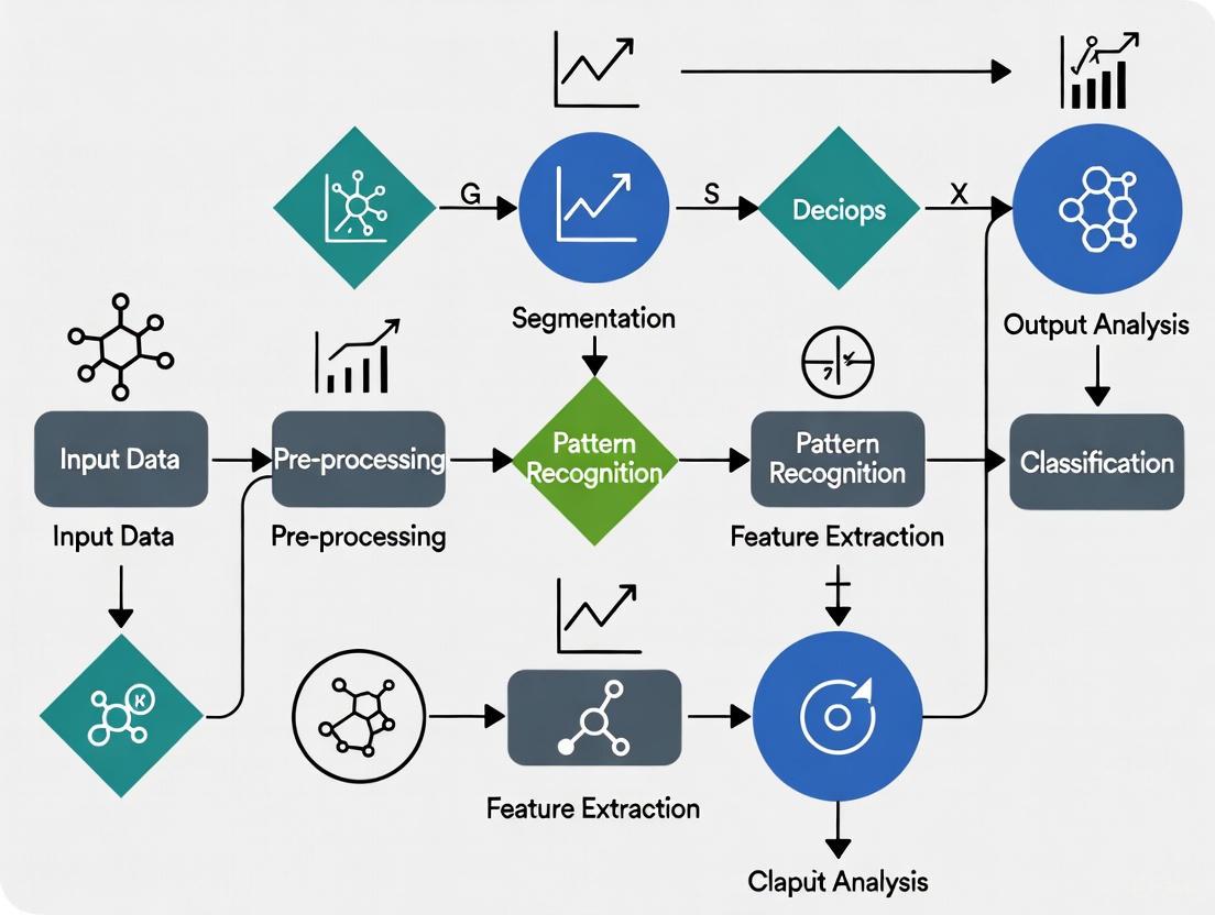
The application of MSPA in ecological research follows a structured workflow that transforms raw spatial data into actionable ecological insights. The diagram below illustrates this integrated methodological framework.
Diagram 1: Integrated MSPA Ecological Research Workflow. This flowchart illustrates the sequential process from land cover data to ecological network delineation, highlighting the central role of MSPA in identifying core habitats and structural connectivity.
MSPA Integration with Ecological Models
Coupling MSPA with Circuit Theory and MCR Models
In contemporary ecological research, MSPA is rarely used in isolation. It is most powerful when integrated with ecological models such as the Minimal Cumulative Resistance (MCR) model and circuit theory to construct comprehensive ecological networks [2] [5] [3]. This integration follows a systematic protocol:
Ecological Source Identification: MSPA-derived core areas serve as primary ecological sources in the network [3] [4]. For example, in a study of Shenzhen City, ten core areas identified through MSPA were used as ecological sources for network construction [3].
Resistance Surface Development: Landscape resistance surfaces are created based on factors such as land use type, elevation, slope, vegetation index, and human disturbance intensity [5] [4].
Corridor and Node Delineation: Circuit theory or MCR models are applied to identify ecological corridors, pinch points, and barrier points between MSPA-identified sources [2] [5].
Table 2: MSPA Integration Protocols in Recent Ecological Studies
| Study Area | MSPA Ecological Sources | Integrated Model | Key Outputs | Application Context |
|---|---|---|---|---|
| South China Karst Desertification Control Forests [2] | Core areas from forest masks | Circuit Theory | 68-113 ecological corridors; 20-67 ecological nodes | Hierarchical ESP construction for karst desertification control |
| Fuzhou Metropolitan Area [5] | Woodland core areas with habitat connectivity assessment | PLUS and MCR models | 35 ecological corridors; 42 ecological nodes | "Three cores, three areas, multiple corridors" pattern for urban planning |
| Shenzhen City [3] | Ten core areas with maximum importance patch values | MCR and gravity models | Important corridors, stepping stones (35), ecological fault points (17) | Urban ecological network optimization |
| Beijing [4] | Core areas (96.17% of all MSPA types, 82.01% forest) | MCR model with connectivity index | 45 ecological corridors (8 major, 37 ordinary); 29 stepping stones | High-density urban ecological environment sustainability |
Comparative Analysis of MSPA Applications
The application of MSPA varies significantly across different ecological contexts and research objectives. The table below summarizes key methodological variations in recent studies.
Table 3: Methodological Variations in MSPA Applications Across Ecosystems
| Methodological Aspect | Karst Desertification Areas [2] | Metropolitan Regions [5] | Fragmented Urban Landscapes [3] [4] |
|---|---|---|---|
| Primary Habitat Focus | KDC forests | Woodland (over 80% of area) | Forest patches within urban matrix |
| MSPA Scale Setting | Tailored to karst forest patch distribution | Adjusted for metropolitan woodland connectivity | Optimized for urban forest fragmentation |
| Key Challenges Addressed | Severe fragmentation; internal degradation | Urban expansion; habitat fragmentation | Landscape connectivity loss; biodiversity decline |
| Ecorical Sources Criteria | MSPA cores with connectivity analysis | MSPA cores with habitat quality assessment | MSPA cores with landscape index evaluation |
| Supplementary Data | NDVI; karst desertification severity | Land use simulation (PLUS model) | Nighttime light data; human disturbance index |
Detailed Experimental Protocols
Binary Mask Preparation Protocol
The quality of MSPA results depends fundamentally on appropriate binary mask preparation [1]:
Data Acquisition: Obtain high-resolution land cover data (30m resolution recommended) [3] [4]. The GlobeLand30 dataset or similar sources provide suitable baseline data.
Habitat Classification: Classify the landscape into binary categories (foreground/background) based on research objectives. Common classifications include:
Spatial Resolution Consideration: Ensure pixel size aligns with species mobility scales and research questions. Finer resolutions detect smaller habitat elements but increase processing requirements.
Projection and Alignment: Convert all spatial data to a consistent coordinate system (e.g., UTM WGS_1984) using GIS software such as ArcGIS or QGIS [4].
MSPA Parameter Configuration Protocol
Optimal MSPA parameter settings vary by research context [1]:
Connectivity Selection:
- Use 8-connectivity for highly mobile species or continuous habitat processes
- Use 4-connectivity for less mobile species or to reduce diagonal connectivity effects
Edge Width Determination:
- Set based on known edge effect distances for target species
- Typical range: 1-5 pixels (30-150m at 30m resolution)
- Conduct sensitivity analysis with multiple values to assess robustness
Transition Parameter:
- Set to "show" when analyzing connectivity pathways
- Set to "hide" when focusing on closed perimeter characteristics
Intext Setting:
- Enable (Intext=1) for detailed analysis of internal background structures
- Disable (Intext=0) for simplified seven-class output
Ecological Source Identification Protocol
Following MSPA analysis, core areas are evaluated as potential ecological sources [3] [4]:
Core Area Extraction: Isolate MSPA core areas from other pattern classes.
Landscape Metric Calculation: Compute connectivity indices (e.g., patch importance value, connectivity probability) for each core area.
Source Selection: Apply threshold criteria (e.g., minimum patch size, connectivity value) to identify the most significant core areas as ecological sources.
Validation: Compare selected sources with field data on species distribution or expert knowledge when available.
Table 4: Essential Computational Tools and Data Resources for MSPA Ecological Research
| Tool/Resource | Type | Primary Function | Access Information |
|---|---|---|---|
| GuidosToolbox (GTB) | Software package | MSPA implementation with additional image processing tools | Free download; includes MSPA functionality [1] |
| GuidosToolbox Workbench (GWB) | Workflow platform | Extended MSPA analysis with batch processing capabilities | Free download; enhanced version of GTB [1] |
| ArcGIS Plugin | GIS extension | MSPA integration within Esri's ArcGIS platform | Available with documentation [1] |
| QGIS3 Plugin | GIS extension | Open-source MSPA implementation | Available with installation guidelines [1] |
| R Package | Statistical programming integration | MSPA analysis within R environment | Available for computational statistics integration [1] |
| GlobeLand30 | Data resource | 30m resolution global land cover data | http://www.globallandcover.com/ [4] |
| Google Earth Engine | Processing platform | Cloud-based geospatial analysis including binary mask preparation | Accessible via web platform |
| Global Forest Watch | Data resource | Forest cover change data for forest/non-forest masks | Online platform with downloadable data |
Advanced Analytical Framework
The integration of MSPA with dynamic simulation models represents the cutting edge of ecological pattern research. The PLUS (Patch-based Land Use Simulation) model coupled with MSPA enables researchers to project future ecological patterns under different scenarios [5]. This advanced protocol involves:
Historical Land Use Analysis: Examining land use changes across multiple time periods (e.g., 2000, 2010, 2020) to identify change trajectories [5].
Future Scenario Development: Simulating land use patterns under ecological priority scenarios using the PLUS model [5].
Dynamic MSPA Application: Applying MSPA to simulated future land use patterns to anticipate changes in core areas, corridors, and connectivity.
Preemptive Conservation Planning: Using projected MSPA results to identify areas at risk of fragmentation and prioritize conservation interventions.
This integrated approach moves beyond static pattern description to dynamic pattern prediction, enabling proactive rather than reactive conservation planning. As demonstrated in the Fuzhou Metropolitan Area study, this methodology can significantly improve woodland fragmentation under ecological priority scenarios by 2030 [5].
Morphological Spatial Pattern Analysis (MSPA) is a customized sequence of mathematical morphological operators designed to describe the geometry and connectivity of image components [1] [6]. As a pixel-based image analysis technique, MSPA classifies the foreground of a binary image into seven mutually exclusive, visually distinct morphological classes: Core, Islet, Perforation, Edge, Loop, Bridge, and Branch [1] [6]. Since its methodology is based solely on geometric concepts, MSPA can be applied at any scale and to any type of digital image across numerous application fields, including landscape ecology, urban planning, manufacturing quality control, and medical imaging [1].
The strength of MSPA lies in its ability to transform a simple binary map (e.g., forest/non-forest or green space/non-green space) into a detailed map of structural patterns that can inform functional connectivity [1] [3]. This provides researchers with a powerful tool to quantify spatial patterns, with particular emphasis on the connections between different parts of a landscape as measured at varying analysis scales [7]. The analysis results in numerous mutually exclusive feature classes which, when merged, exactly reconstitute the original foreground area [1].
The Seven MSPA Classes: Definitions and Ecological Significance
The following table provides detailed definitions and ecological interpretations for each of the seven primary MSPA classes.
Table 1: Definitions and ecological significance of the seven MSPA classes.
| MSPA Class | Morphological Definition | Ecological Significance & Interpretation |
|---|---|---|
| Core [1] [3] | The interior area of foreground patches. | Represents the most ecologically stable habitat interiors, crucial for supporting sensitive species and maintaining core ecological processes. These areas typically provide the highest habitat quality [3]. |
| Islet [1] [6] | Small, isolated foreground patches. | Represents small, isolated habitats with limited ecological value due to their size and isolation. They may serve as minor stepping stones but are highly susceptible to edge effects [8]. |
| Perforation [1] [6] | The internal background pixels that form "holes" inside core areas. | The transition zone from the core to the internal background. Ecologically, it can represent natural openings or human-induced perforations within a habitat matrix [1]. |
| Edge [1] [3] | The outer boundary of foreground patches, located between the core and the external background. | Acts as a transition zone between habitat interiors and the surrounding matrix. While important for certain edge species, a high proportion of edge can indicate habitat fragmentation and increased exposure to external disturbances [3]. |
| Loop [1] [6] | Redundant connections between branches within the same core area. | Indicates alternative pathways for ecological flows within a single habitat patch, potentially enhancing resilience and connectivity within complex core areas [1]. |
| Bridge [1] [3] | Foreground pixels that connect two or more disjoint core areas. | Functions as critical ecological corridors, facilitating the movement of organisms and the flow of ecological processes between different core habitats. These are priority areas for conservation to maintain landscape connectivity [3]. |
| Branch [1] [6] | Connectors that link core areas, edges, or bridges to isolated foreground pixels like islets. | Serves as a connecting pathway to smaller or more isolated habitat elements. While less robust than bridges, they can still facilitate ecological flows to peripheral areas [1]. |
The following diagram illustrates the logical relationships and spatial configuration of the seven MSPA classes within a conceptual landscape.
Quantitative Data and MSPA Parameters
MSPA Output Classifications
While the landscape is initially divided into the seven basic classes, the full MSPA segmentation provides a more detailed classification. The following table summarizes the quantitative output of a typical MSPA analysis, showing the area and proportion of the landscape occupied by each class based on an example provided in the search results.
Table 2: Example quantitative output from an MSPA analysis, showing the area and proportion for each class [9].
| MSPA Class | Sub-class or Example | % of Foreground Area | % of Total Data Pixels | Number of Patches |
|---|---|---|---|---|
| Core | Medium (m) | 75.09% | 32.19% | 1196 |
| Islet | - | 3.26% | 1.40% | 2429 |
| Perforation | - | 2.17% | 0.93% | 423 |
| Edge | - | 13.54% | 5.80% | 890 |
| Loop | - | 0.60% | 0.26% | 541 |
| Bridge | - | 1.42% | 0.61% | 765 |
| Branch | - | 3.93% | 1.68% | 4685 |
| Background | External | - | 57.14% | 2319 |
| Opening (Porosity) | - | 1.50% | 2291 | |
| Missing Data | - | - | 0.03% | 51 |
Key MSPA Parameters
The MSPA analysis is controlled by four key parameters that allow users to fine-tune the results to their specific research context and scale. The default values are commonly used, but adjustment is recommended based on the research question and data resolution [1] [9].
Table 3: Key parameters for configuring an MSPA analysis in software such as GuidosToolbox [1] [9].
| Parameter | Options | Default | Ecological Interpretation & Effect |
|---|---|---|---|
| Foreground Connectivity [1] | 4- or 8-connectivity | 8 | Defines pixel connectivity. 8-connectivity is standard for simulating unrestricted movement; 4-connectivity may be used for more restricted movement. |
| Edge Width [1] | Integer ≥ 1 | 1 | Determines the width (in pixels) of the Edge class. Increasing this value expands the edge zone at the expense of the Core area, directly influencing the perceived fragmentation. |
| Transition [1] | 0 (off) or 1 (on) | 1 | Controls whether Loop or Bridge pixels that traverse an edge or perforation are shown (1) or hidden (0). Affects the visual continuity of class perimeters. |
| IntExt [1] | 0 (off) or 1 (on) | 1 | When active (1), further classifies the internal background (perforations) into sub-classes like Core-Opening and Border-Opening, adding detail to the analysis of internal holes. |
Experimental Protocols and Workflows
General MSPA Workflow for Ecological Applications
The following diagram outlines the standard end-to-end workflow for applying MSPA in an ecological research context, from data preparation to the application of results.
Protocol: Integrating MSPA with Circuit Theory for Ecological Network Conservation
This protocol details a specific application of MSPA, combining it with Circuit Theory to identify the spatial range of Ecological Networks (ENs) and priority areas for conservation, as demonstrated in a study on the Shandong Peninsula urban agglomeration [10].
Objective: To construct a spatially explicit ecological network by identifying ecological sources via MSPA and simulating ecological flows with Circuit Theory to delineate corridors, pinch points, and barriers [10].
Materials and Reagents:
- Software: GIS software (e.g., ArcGIS, QGIS), GuidosToolbox (GTB) or GuidosToolbox Workbench (GWB) for MSPA, and tools for Circuit Theory analysis (e.g., Circuitscape) [1] [9] [10].
- Data: Land Use/Land Cover (LULC) map of the study area.
Procedure:
- Data Preparation and MSPA Analysis:
- Reclassify the LULC map into a binary raster. Define the habitat of interest (e.g., forest, wetland) as the foreground (value 2) and all other classes as the background (value 1) [1] [10].
- Input the binary raster into GuidosToolbox. Set the MSPA parameters (e.g., Connectivity=8, EdgeWidth=1) based on the target species or ecological process [1] [9].
- Execute the MSPA analysis. The output will be a raster map where each pixel is assigned to one of the seven MSPA classes.
Identification of Ecological Sources:
Construction of Ecological Resistance Surface:
- Construct a resistance surface based on a habitat risk assessment. This surface assigns a cost value to every cell in the landscape, representing the perceived resistance to species movement. Lower values represent more permeable landscapes [10].
- The resistance surface can be calibrated using factors such as land use type, nighttime light intensity (as a proxy for human activity), and impervious surface area [10].
Simulation with Circuit Theory:
- Input the identified ecological sources (from Step 2) and the resistance surface (from Step 3) into a Circuit Theory model (e.g., Circuitscape) [10].
- The model simulates ecological flows as electrical current, calculating a cumulative current value across the landscape. Areas with high cumulative current values represent probable movement pathways and are identified as ecological corridors [10].
- Within these corridors, pinch points (areas where current is concentrated, indicating critical connectivity areas) and barriers (areas with low current flow, indicating blocked connectivity) are identified [10].
Delineation of the Ecological Network and Priority Areas:
- The spatial range of the ecological corridors is determined based on the spatial extent of the effective cumulative current values [10].
- Pinch points are designated as priority areas for conservation, as their loss would disproportionately disrupt connectivity.
- Barriers are designated as priority areas for restoration, where measures to reduce resistance (e.g., creating green passages) can restore ecological flows [10].
Table 4: Essential software, data, and analytical models used in MSPA-based ecological research.
| Tool / Resource | Type | Function & Application in MSPA Research |
|---|---|---|
| GuidosToolbox (GTB) / GWB [1] [9] | Software | The primary software packages providing the MSPA application. They are free to use and include MSPA along with many other spatial analysis tools. |
| GIS Software (e.g., ArcGIS, QGIS) [3] | Software | Used for pre-processing input data (creating binary masks), post-processing, and visualizing MSPA results. A QGIS plugin for MSPA is available, though with limited features compared to GTB [1]. |
| Binary Foreground/Background Mask [1] | Data | The fundamental input for MSPA. The researcher (expert) defines what constitutes the foreground (e.g., forest, wetland, green space) based on the research question, typically derived from land cover data. |
| Land Use/Land Cover (LULC) Data [10] [3] | Data | The most common base data used to create the binary mask for MSPA analysis in ecological studies. Resolution and classification accuracy are critical. |
| Circuit Theory Model (e.g., Circuitscape) [10] | Analytical Model | Used in conjunction with MSPA to simulate ecological flows and identify key connectivity areas (corridors, pinch points) based on resistance surfaces. |
| Minimum Cumulative Resistance (MCR) Model [11] [3] | Analytical Model | A common model integrated with MSPA to extract potential ecological corridors and construct ecological networks by calculating the least-cost path for ecological flows across a resistance surface. |
Application Notes: Quantifying Core Areas via MSPA
Quantitative Analysis of Ecological Source Dynamics
Morphological Spatial Pattern Analysis (MSPA) serves as a pivotal methodology for systematically identifying and classifying the spatial patterns of ecological landscapes, with core areas representing the most stable and vital foundational sources within an ecological network [12]. The following table synthesizes quantitative findings from empirical studies that employed MSPA to monitor the spatiotemporal evolution of these core areas.
Table 1: Quantitative Dynamics of Ecological Core Areas and Corridors Derived from MSPA
| Study Area / Period | Core Area Extent & Change | Number of Primary Corridors | Key Spatial Distribution Trends | Implications for Ecological Stability |
|---|---|---|---|---|
| Ningbo City, China (2000-2020) [12] | Exhibited an uneven distribution, primarily located in western, southern, and coastal Hangzhou Bay regions. | Underwent a significant reduction from 26 (in 2000) to 17 (in 2020). | Primary corridors concentrated in central, southern, and western regions in 2000; by 2020, distribution shifted mainly southerly. | The reduction and shift weakened species spread and ecosystem stability, particularly reducing north-south ecological interaction. |
| Central Beijing, China [13] | Integrated evaluation using InVEST and MSPA to determine the importance of ecological sources. | Information was used to construct an Ecological Security Pattern (ESP) using circuit theory. | The study provided an integrated framework for evaluating ecological security patterns in urban centers. | The pattern is crucial for protecting biodiversity and maintaining regional sustainable development. |
Functional Interpretation of MSPA Outcomes
The quantitative data presented in Table 1 underscores the critical role of core areas as the foundation of ecological networks. The significant reduction in primary ecological corridors in Ningbo City over two decades highlights the pervasive impact of landscape fragmentation, often driven by large-scale changes in land use and increasing complexity of patches [12]. The consequent weakening of interaction between ecological sources, as observed in the north-south dynamic, directly and adversely impacts species dispersal and the overall stability of the ecosystem [12]. Constructing and maintaining robust ecological networks through the identification and protection of core areas is therefore vital for improving landscape connectivity, protecting biodiversity, and ensuring regional sustainable development [12].
Experimental Protocols
Detailed Methodology for MSPA-Based Ecological Network Construction
This protocol provides a step-by-step methodology for identifying core areas as foundational ecological sources and constructing ecological networks using MSPA, based on established research practices [12] [13].
Protocol Title: Delineation of Ecological Security Patterns through Morphological Spatial Pattern Analysis (MSPA) and Corridor Modeling.
Objective: To systematically identify core ecological areas, model connectivity corridors, and pinpoint strategic locations for ecological restoration to enhance network stability.
Pre-Experimental Requirements:
- Expertise: Proficiency in Geographic Information Systems (GIS), landscape ecology principles, and the operation of specific software (e.g., GuidosToolbox for MSPA, Linkage Mapper).
- Data Sources: Securely obtain land use/land cover (LULC) raster data for the study area for at least two distinct time periods to assess spatiotemporal change.
- Instruments & Software:
- GIS Software (e.g., ArcGIS, QGIS).
- GuidosToolbox software for performing MSPA classification.
- Linkage Mapper, an ArcGIS toolbox for corridor design.
Safety and Ethical Considerations: Ensure all spatial data used is properly licensed for research purposes. Respect data privacy and usage agreements when handling geographical information.
Procedure:
- Data Preparation and Land Use Classification:
- Acquire LULC raster data and reclassify it to create a binary landscape mask (e.g., foreground vs. background). The foreground typically represents natural ecological land covers (e.g., forest, grassland, wetlands), while the background represents other land uses (e.g., urban, agriculture).
MSPA Execution and Core Area Identification:
- Input the binary landscape mask into the GuidosToolbox software.
- Execute the MSPA function using established parameters and structural element sizes relevant to the study scale.
- The MSPA output will classify the landscape into seven morphological types: Core, Islet, Perforation, Edge, Loop, Bridge, and Branch.
- Extract the "Core" pixels from the MSPA result. These contiguous interior pixels of the foreground patches constitute the preliminary ecological sources.
Refinement of Ecological Sources:
- Evaluate the preliminary core areas based on additional factors such as patch size, ecological importance (e.g., using the InVEST model's habitat quality output), or connectivity importance [13].
- Select the most significant and stable core areas to serve as the final "ecological sources" for corridor modeling.
Corridor Modeling and Network Construction:
- Utilize the Linkage Mapper toolbox within ArcGIS.
- Input the refined ecological sources map.
- Model the least-cost paths or circuit-theory-based corridors between the ecological sources. This identifies the "primary ecological corridors."
Network Optimization and Breakpoint Identification:
- Analyze the modeled corridors to locate "ecological breakpoints"—specific areas where the corridor is narrowest or most vulnerable to disruption.
- Propose locations for "ecological nodes" (e.g., protected stepping stones) and additional "stepping stone patches" to reinforce connectivity at these breakpoints [12].
Troubleshooting:
- Issue: MSPA results show excessive fragmentation.
- Solution: Review the initial binary classification of the LULC data; adjust the classification scheme to ensure it accurately reflects functional ecological land.
- Issue: Modeled corridors are unrealistically straight or do not align with known landscape features.
- Solution: Refine the cost-surface layer used in Linkage Mapper to better represent resistance to species movement across different land cover types.
Reporting Standards: The experimental report must include the original LULC maps, the binary mask used for MSPA, the full MSPA classification result, maps of the final ecological sources and modeled corridors, and a table summarizing the number, area, and distribution of core areas and corridors over time [14].
Workflow Visualization
The Scientist's Toolkit: Essential Research Reagent Solutions
Table 2: Key Computational Tools and Data for MSPA-Based Ecological Research
| Item Name | Function / Application in MSPA Ecology |
|---|---|
| Land Use/Land Cover (LULC) Data | The fundamental input raster data for performing MSPA classification; defines the ecological foreground and non-ecological background of the study landscape [12]. |
| GuidosToolbox | The primary software application used to run the MSPA, which classifies the input landscape into core, edge, bridge, and other morphological classes [12]. |
| Linkage Mapper | A GIS software toolbox that uses least-cost path or circuit theory principles to model ecological corridors between the core areas identified by MSPA [12]. |
| InVEST Model | A suite of software models used to map and value ecosystem services; often integrated with MSPA to assess habitat quality and refine the selection of core ecological sources [13]. |
| Circuit Theory Models | A theoretical framework and associated tools (e.g., Circuitscape) applied to model landscape connectivity, treating the landscape as an electrical circuit to predict movement and identify pinch points [13]. |
MSPA's Application in Assessing Habitat Fragmentation and Connectivity
Morphological Spatial Pattern Analysis (MSPA) represents a significant advancement in the quantitative analysis of landscape patterns for ecological research. Unlike traditional landscape metrics, MSPA applies mathematical morphology principles to raster land cover data, enabling the automatic classification of landscape structures into distinct spatial pattern classes relevant to ecological function [3]. This method provides a precise, objective framework for identifying habitats critical to maintaining landscape connectivity and assessing the impacts of habitat fragmentation—a process identified as one of the most important causes of biodiversity loss [15]. The technique has evolved into an essential component of ecological network construction, particularly when integrated with functional connectivity models like circuit theory and minimum cumulative resistance (MCR) [16] [10].
The fundamental strength of MSPA lies in its ability to dissect landscape structure into seven mutually exclusive spatial classes based on pixel-level connectivity and morphological operations. This classification provides critical insights into structural connectivity—the physical arrangement of habitat elements—which serves as a foundation for assessing functional connectivity that governs ecological flows and species movement [17]. When applied within ecological security pattern (ESP) frameworks, MSPA enables researchers to systematically identify core habitat areas, stepping stones, and potential corridors that maintain ecological processes across fragmented landscapes [16] [18].
Core MSPA Methodology and Classification
MSPA Spatial Pattern Classes
MSPA classifies each foreground pixel (typically representing habitat or vegetation) into one of seven distinct spatial categories based on its morphological position and connectivity:
Table 1: MSPA Spatial Pattern Classification and Ecological Significance
| MSPA Class | Morphological Definition | Ecological Function | Conservation Priority |
|---|---|---|---|
| Core | Interior habitat areas surrounded by similar habitat | Provides critical habitat for sensitive species, maintains ecosystem processes | Highest - primary ecological sources |
| Edge | Habitat perimeter adjacent to different land cover | Experienced edge effects, modified microclimate | Moderate - requires buffer management |
| Bridge | Connecting elements between core areas | Facilitates landscape connectivity and species movement | High - crucial for maintaining meta-populations |
| Loop | Alternative connections between core areas | Provides redundant pathways, enhancing network resilience | Moderate-High - maintains connectivity alternatives |
| Islet | Small, isolated habitat patches | May serve as temporary habitat or stepping stones | Variable - context dependent |
| Perforation | Internal boundaries within core areas | Creates habitat heterogeneity but reduces core area | Low-Moderate - management may be required |
| Branch | Dead-end connections from core areas | Limited connectivity value, potential ecological traps | Low - limited functional significance |
These structural classifications enable researchers to move beyond simple habitat area measurements to understand the spatial configuration of habitats and its implications for ecological processes [3] [17]. Core areas identified through MSPA typically serve as ecological sources in network construction, while bridges and loops form the structural basis for potential corridors [16] [10].
Technical Workflow for MSPA Implementation
The standard MSPA implementation follows a structured analytical workflow that transforms land cover data into ecologically meaningful spatial patterns:
Data Preparation and Processing Steps:
- Land Cover Classification: Begin with high-resolution land use/land cover (LULC) data derived from satellite imagery (e.g., Landsat, Sentinel) or aerial photography. The classification should accurately distinguish between habitat (foreground) and non-habitat (background) areas [16] [19].
- Binary Mask Creation: Convert the land cover data into a binary raster where habitat classes of interest (e.g., forests, natural vegetation) are designated as foreground (value = 1) and all other classes as background (value = 0) [3] [15].
- MSPA Parameterization: Process the binary map using specialized software (typically GuidosToolbox) with appropriate structuring element size (usually 8-pixel connectivity) and edge width parameters tailored to the study organisms and landscape scale [17] [15].
- Connectivity Assessment: Calculate landscape connectivity indices (e.g., probability of connectivity, integral index of connectivity) for core areas to evaluate their functional importance within the landscape network [16] [10].
- Ecological Source Identification: Select the most significant core areas based on size, connectivity value, and ecological context to serve as primary sources in subsequent ecological network modeling [3] [18].
Quantitative Applications in Habitat Fragmentation Assessment
Case Study Applications and Metrics
MSPA has been successfully applied across diverse ecosystems to quantify fragmentation patterns and identify conservation priorities. The following table synthesizes key quantitative findings from recent applications:
Table 2: MSPA Application Across Ecosystem Types and Key Findings
| Ecosystem/Region | Study Focus | Key MSPA Metrics | Fragmentation Findings | Citation |
|---|---|---|---|---|
| South China Karst | Desertification control forests | Core area percentage, fragmentation index | Severe fragmentation with patch area significantly decreasing as karst desertification severity increases | [16] |
| Çankırı Forest, Turkey | Forest habitat connectivity | Component connection, network analysis | Forest area increased by 23% over 30 years, but fragmentation persisted due to uncoordinated afforestation | [15] |
| Shandong Peninsula Urban Agglomeration | Ecological network construction | Core area distribution, corridor connectivity | Identified 6,263.73 km² ecological sources and 12,136.61 km² corridors with specific pinch points (283.61 km²) | [10] |
| Taihu Lake Basin, China | Cross-regional ecological security | Structural connectivity, corridor nodes | Pattern included 20 ecological sources, 37 corridors, 36 protection nodes, and 24 restoration nodes | [18] |
| Shenzhen City, China | Urban ecological networks | Core area importance, corridor width | Optimal ecological corridor width identified between 60-200 meters for urban biodiversity | [3] |
Fragmentation Indices and Landscape Metrics
When integrated with complementary landscape analysis tools, MSPA generates quantitative indicators of habitat fragmentation:
- Patch Size Distribution: MSPA analysis in South China Karst revealed that core forest areas decreased substantially with increasing karst desertification intensity, demonstrating how environmental degradation directly fragments habitats [16].
- Structural Connectivity Metrics: Applications in Turkey's Çankırı forest ecosystem utilized MSPA with network analysis to test corridor creation between fragmented forest patches, identifying opportunities to improve connections through targeted restoration [15].
- Edge Effect Quantification: Urban studies in Shenzhen employed MSPA to quantify edge habitats and determine optimal ecological corridor widths of 60-200 meters for maintaining urban biodiversity [3].
The combination of MSPA with graph-based connectivity indices enables a comprehensive assessment of both the structural patterns and functional implications of habitat fragmentation, providing robust scientific support for conservation planning [17].
Integration with Ecological Connectivity Models
MSPA-Circuit Theory Framework
The integration of MSPA with circuit theory represents a powerful methodological advancement for modeling ecological connectivity. This combined approach leverages the structural identification capabilities of MSPA with the functional movement simulation of circuit theory:
This integrated framework addresses a critical limitation of traditional MSPA by incorporating functional connectivity - how landscapes actually facilitate or impede species movement based on resistance features [10] [18]. Circuit theory simulates ecological flows as electrical current moving through a resistant landscape, identifying:
- Pinch Points: Areas where movement channels are constricted (high current density)
- Barriers: Areas that strongly impede connectivity (low current flow)
- Alternative Routes: Multiple potential pathways for ecological flows [10]
MSPA-MCR Model Integration
Similarly, the combination of MSPA with the Minimum Cumulative Resistance (MCR) model enhances ecological network construction:
- MSPA provides objectively identified ecological sources based on structural connectivity and landscape metrics, overcoming the subjective source selection that often plagues MCR applications [3].
- MCR then calculates the accumulated cost for species movement between these sources, identifying optimal corridor routes while considering landscape resistance [3].
This coupling was effectively demonstrated in Shenzhen City, where researchers extracted ten core areas based on MSPA and landscape metrics, then used MCR to construct corridors which were further optimized with stepping stones (35 locations) and ecological fault points (17 locations) [3]. The resulting network included classified corridors (11 important, 34 general, and 7 potential) with specified width parameters for urban conservation planning.
Application Notes and Experimental Protocols
Standard Protocol for MSPA-Based Fragmentation Assessment
Objective: To quantify habitat fragmentation patterns and identify core ecological areas for conservation planning using MSPA.
Materials and Software Requirements: Table 3: Essential Research Tools and Resources for MSPA Analysis
| Category | Specific Tools/Data | Purpose/Function | Data Sources |
|---|---|---|---|
| Remote Sensing Data | Landsat 8/9, Sentinel-2 | Land cover classification | USGS EarthExplorer, ESA Copernicus |
| GIS Software | ArcGIS, QGIS | Spatial data processing and analysis | Commercial/Open Source |
| MSPA Software | GuidosToolbox | Morphological spatial pattern analysis | European Commission JRC |
| Connectivity Analysis | Conefor, Linkage Mapper | Graph-based connectivity metrics | Open source conservation tools |
| Validation Data | Field surveys, species occurrence records | Ground truthing of habitat models | Field collection, GBIF |
Methodological Steps:
Land Cover Classification and Validation
- Acquire recent satellite imagery appropriate for the study scale (e.g., 10-30m resolution for regional assessments)
- Perform supervised classification using ground-truthed training data to create a land cover map
- Validate classification accuracy with independent reference data (minimum 80% accuracy recommended)
Binary Habitat Mask Creation
- Reclassify the land cover map to distinguish habitat (foreground) from non-habitat (background) classes based on study objectives
- Consider creating multiple scenarios for different habitat definitions or species groups
- Export as a binary raster with 1 (habitat) and 0 (non-habitat) values
MSPA Parameterization and Execution
- Process the binary raster in GuidosToolbox using the MSPA function
- Set the edge width parameter based on the study organisms (e.g., 100m for forest interior species)
- Use 8-pixel connectivity to identify the seven MSPA classes
- Export results as classified MSPA raster and calculate area statistics for each class
Connectivity Analysis and Ecological Source Identification
- Calculate connectivity indices (e.g., probability of connectivity) for core areas using Conefor or similar tools
- Select core areas above specific thresholds (size, connectivity value) as ecological sources
- Generate maps showing the spatial distribution of high-priority core areas and connecting elements
Integration with Functional Connectivity Models
- Develop an ecological resistance surface incorporating land use, topography, and human impact factors
- Apply circuit theory or MCR models to identify corridors and key nodes between ecological sources
- Validate model predictions with field data on species occurrence or movement where available
Specialized Protocol for Urban Ecological Networks
Objective: To construct and optimize ecological networks in urban landscapes using MSPA and circuit theory.
Methodological Adaptation:
- Urban-Specific Resistance Factors: Incorporate urban-specific resistance features including road density, nighttime light intensity, impervious surface percentage, and human population density [3] [10].
- Corridor Width Optimization: Determine appropriate ecological corridor widths based on urban constraints and species requirements (typically 60-200m as identified in Shenzhen) [3].
- Stepping Stone Integration: Identify small urban habitat patches (islets) that can function as stepping stones for species movement between larger core areas [3].
Research Reagent Solutions and Computational Tools
Table 4: Essential Computational Tools for MSPA-Based Fragmentation Analysis
| Tool Name | Primary Function | Application Context | Access |
|---|---|---|---|
| GuidosToolbox | MSPA implementation and basic fragmentation metrics | Core MSPA processing, structural pattern classification | Free, JRC |
| Conefor Sensinode | Graph-based connectivity analysis | Calculating connectivity indices for core areas | Free, standalone |
| Linkage Mapper | Corridor and ecological network modeling | Designing connectivity corridors between core habitats | Free, GIS toolbox |
| Circuitscape | Circuit theory-based connectivity modeling | Identifying pinch points, barriers, and movement pathways | Free, standalone |
| FRAGSTATS | Comprehensive landscape metrics | Complementary landscape pattern analysis | Free, standalone |
These tools collectively provide a comprehensive analytical toolkit for implementing the complete MSPA-connectivity analysis workflow, from initial habitat pattern assessment to functional ecological network design.
Essential Data Requirements and Preprocessing for Effective MSPA
Morphological Spatial Pattern Analysis (MSPA) is a specialized image processing methodology that applies a customized sequence of mathematical morphological operators to describe the geometry and connectivity of image components [1]. Originally developed for general pattern recognition, MSPA has become an invaluable tool in landscape ecology for analyzing spatial patterns of ecological features. The method operates on binary images (foreground/background) and classifies the foreground into seven mutually exclusive pattern classes: Core, Islet, Perforation, Edge, Loop, Bridge, and Branch [1]. This classification enables researchers to quantify critical landscape characteristics that influence ecological processes, biodiversity, and ecosystem functionality.
The fundamental value of MSPA in ecological research lies in its ability to objectively identify and measure structural components of landscapes that serve essential ecological functions. Core areas represent the interior habitats essential for specialist species, while bridges and loops function as ecological corridors that facilitate wildlife movement and genetic flow [1]. Edges represent transition zones between different habitat types, and perforations indicate gaps within otherwise continuous habitat patches. This structural information is crucial for understanding functional connectivity across landscapes and forms the basis for designing effective ecological networks and conservation strategies.
Data Requirements for MSPA
Input Data Specifications
Successful application of MSPA in ecological research requires careful preparation of input data that accurately represents the ecological features of interest. The primary input for MSPA is a binary raster map where pixel values distinctly separate foreground (features of ecological relevance) from background (all other areas) [1]. This binary representation forms the foundation for all subsequent pattern analysis and classification.
Table 1: Essential Data Requirements for MSPA Implementation
| Requirement Category | Specification | Ecological Relevance |
|---|---|---|
| Input Format | Binary raster (foreground/background) | Enables clear distinction between habitat and non-habitat areas |
| Spatial Resolution | Appropriate to ecological processes studied; typically 10-30m for regional studies [20] | Determines detectable detail and minimum patch size |
| Thematic Accuracy | Correct classification of ecological features as foreground | Ensures analysis reflects actual habitat distribution |
| Spatial Extent | Must encompass complete ecological units or landscapes | Prevents edge effects and ensures meaningful connectivity analysis |
| Coordinate System | Projected coordinate system preserving distance and area | Maintains geometric accuracy for spatial measurements |
The binary input mask must be derived from land cover classification or habitat mapping data that accurately identifies the ecological features of interest. For forest ecology applications, this would typically be a forest/non-forest mask [1], while for wetland studies, it would be a wetland/non-wetland classification. The choice of spatial resolution is critical, as it determines the minimum detectable feature size and influences the representation of habitat connectivity. Studies in urban ecological contexts, such as the Zhengzhou City analysis, have successfully utilized land use data with a resolution of 10m × 10m [20].
Data Preprocessing Workflow
The transformation of raw spatial data into a properly formatted binary mask for MSPA involves several critical preprocessing steps that ensure analytical accuracy and ecological relevance.
The preprocessing workflow begins with acquisition of raw spatial data, which may include satellite imagery, aerial photography, or existing land cover maps. For the Zhengzhou City study examining urban ecological sources, researchers obtained remote sensing images from platforms including Geospatial Data Cloud and the Natural Resources Satellite Remote Sensing Cloud Service Platform [20]. These images underwent visual interpretation using ArcGIS 10.8 software to generate land use data with 10m × 10m resolution, categorized into woodland, water, grassland, arable land, construction land, and unused land [20].
The classification step involves converting raw data into thematic categories relevant to the ecological research questions. This may employ automated classification algorithms, manual digitization, or a hybrid approach. The resulting thematic map then undergoes accuracy assessment using ground truth data, high-resolution imagery, or independent validation datasets to ensure reliable representation of ecological features. Following validation, the thematic map is converted to a binary mask by reclassifying all relevant ecological features as foreground (typically value 1) and all other areas as background (typically value 0). Finally, resolution standardization ensures the binary mask matches the intended analysis scale and is compatible with MSPA processing requirements.
MSPA Parameter Configuration
Critical Analysis Parameters
MSPA provides four key parameters that allow researchers to tailor the analysis to specific ecological contexts and research questions. Proper configuration of these parameters is essential for obtaining ecologically meaningful results that accurately reflect the spatial patterns and processes under investigation.
Table 2: MSPA Parameters and Their Ecological Interpretation
| Parameter | Technical Function | Ecological Significance | Recommended Settings |
|---|---|---|---|
| Foreground Connectivity | Defines pixel connectivity rule (4 or 8) | Determines how habitat patches are defined and connected | 8-connectivity for animal movement; 4-connectivity for plant dispersal |
| Edge Width | Sets the width of the edge zone (in pixels) | Defines transition zone depth between habitat interiors and matrix | Based on known edge effect distances for target species |
| Transition | Controls display of pixels connecting across edges | Highlights or suppresses corridors that cross habitat boundaries | Show transitions for connectivity analysis; hide for patch integrity assessment |
| Intext | Enables/disables internal texturing of perforations | Differentiates internal gaps from external background | Enable for detailed habitat fragmentation analysis |
The Foreground Connectivity parameter fundamentally influences how habitat patches are identified and connected. Using 8-connectivity (considering all adjacent pixels, including diagonals) typically results in more continuous habitat patterns, which may better represent movement potential for many wildlife species. In contrast, 4-connectivity (considering only orthogonally adjacent pixels) creates a more restrictive connectivity model that may be appropriate for species with limited dispersal capabilities or when analyzing habitat patterns for plants with specific dispersal mechanisms [1].
The Edge Width parameter directly controls the spatial extent of edge effects in the analysis. Increasing the Edge Width expands the non-core area at the expense of core habitat, potentially reclassifying some core pixels as edge [1]. This parameter should be calibrated based on empirical research about edge effect distances for the target ecosystem and species. For example, forest edge effects on microclimate and species composition may extend 50-100 meters into habitat patches, which would inform appropriate Edge Width settings when working with forest habitat masks.
MSPA Processing Workflow
The complete MSPA workflow integrates parameter configuration with the binary input data to generate the detailed pattern classification that facilitates ecological interpretation.
The MSPA algorithm processes the binary input map according to the specified parameters, systematically classifying each foreground pixel into one of the seven pattern classes. Core areas represent the interior regions of habitat patches that are not influenced by edge effects [1]. Islets are small, isolated habitat patches that lack core area due to their size. Perforations represent gaps within core areas, such as natural clearings or human-made openings within forested landscapes. Edge pixels form the boundary between core areas and the background matrix.
Connectivity elements include Bridges that connect different core areas, Loops that form redundant connections between core areas, and Branches that represent dead-end connections from core areas to other class types [1]. The identification and quantification of these connectivity elements is particularly valuable for understanding landscape permeability and designing ecological networks. In the Zhengzhou City study, MSPA was employed specifically to identify ecological sources across three different development scenarios, demonstrating its application in urban ecological planning [20].
Ecological Interpretation and Application
Interpreting MSPA Results in Ecological Context
The translation of MSPA structural classes into ecologically meaningful information requires careful consideration of the specific ecosystem and research objectives. Each MSPA class corresponds to distinct ecological functions that influence species distribution, population dynamics, and ecosystem processes.
Core areas typically represent the highest quality habitat for area-sensitive and interior-dependent species [1]. The spatial configuration and size distribution of core areas directly influences population viability for many specialist species. In the Zhengzhou urban ecology study, core forest patches identified through MSPA were considered primary ecological sources that exerted the strongest ecological effects on the urban environment [20]. The Largest Patch Index (LPI) of these ecological sources showed an upward trend in future scenarios, suggesting that large, contiguous patches would dominate ecological source expansion [20].
Connectivity elements (Bridges, Loops, and Branches) play crucial roles in maintaining functional connectivity across landscapes [1]. Bridges serve as essential corridors for wildlife movement and genetic exchange between core areas. The identification of these connecting structures enables conservation planners to prioritize protection of landscape elements that maintain ecological networks. MSPA has demonstrated capability in detecting connecting structures such as wildlife corridors and riparian connections, as illustrated by its application to water masks in Finland, where it successfully identified rivers connecting multiple lakes [1].
Integration with Ecological Models
MSPA classifications typically serve as input for further ecological analysis and modeling rather than as final products. The structural patterns identified through MSPA provide the foundation for assessing functional connectivity and modeling ecological processes across landscapes.
In comprehensive ecological assessments, MSPA is frequently integrated with additional analytical approaches to develop complete ecological security patterns. As demonstrated in research on Beijing's ecological security pattern, MSPA can be combined with the InVEST model and multifactor indices to provide a holistic evaluation of ecological network functionality [13]. Similarly, the Zhengzhou study integrated MSPA with the PLUS model to simulate future ecological source patterns under different development scenarios, including natural evolution, cropland protection, and ecological protection scenarios [20].
This integration of MSPA with predictive modeling approaches enables researchers and planners to evaluate potential impacts of future land use change on ecological networks and identify strategic priorities for conservation intervention. The combination of structural pattern analysis (MSPA) with functional assessment (InVEST) and scenario modeling (PLUS) provides a powerful framework for evidence-based landscape planning and conservation prioritization.
Research Reagent Solutions
Table 3: Essential Tools and Software for MSPA Implementation
| Tool Category | Specific Solutions | Function in MSPA Research | Access Information |
|---|---|---|---|
| Specialized Software | GuidosToolbox (GTB), GuidosToolbox Workbench (GWB) | Primary MSPA execution platform with complete feature set | Free download available |
| GIS Platforms | ArcGIS, QGIS | Data preprocessing, binary mask preparation, and result visualization | Commercial and open-source options |
| GIS Plugins | MSPA plugins for ArcGIS, QGIS3, and R | Limited MSPA functionality within host GIS environments | Available with documentation |
| Remote Sensing Data | Landsat, Sentinel, Aerial Imagery | Source data for binary mask creation | Various open access and commercial sources |
| Spatial Analysis Tools | R, Python with spatial libraries | Custom analysis and automation of MSPA workflows | Open source |
The GuidosToolbox (GTB) and GuidosToolbox Workbench (GWB) represent the primary software solutions for conducting MSPA analysis, as they include the complete MSPA implementation with full feature set [1]. These freely available tools provide access to all MSPA parameters and analytical capabilities. For researchers working within established GIS environments, MSPA plugins are available for ArcGIS, QGIS3, and R, though these may not provide the complete feature set available in the dedicated GTB/GWB software [1].
The preparation of binary input masks typically requires standard GIS software such as ArcGIS or QGIS for data preprocessing, classification, and format conversion. The Zhengzhou City study utilized ArcGIS 10.8 for visual interpretation of remote sensing imagery to generate land use data [20]. For advanced analytical workflows and automation, programming environments such as R and Python with specialized spatial libraries provide flexibility for customizing MSPA applications and integrating results with other ecological models.
Implementing MSPA: A Step-by-Step Guide from Analysis to Ecological Security Patterns
The identification of ecological sources is a foundational step in constructing ecological networks for biodiversity conservation and sustainable landscape planning. Ecological sources are habitat patches that are crucial for maintaining regional ecosystem functions, facilitating species movement, and ensuring ecological connectivity [10]. This protocol details a integrated methodology that combines Morphological Spatial Pattern Analysis (MSPA) with Habitat Quality Assessment to objectively identify and prioritize these critical ecological areas. This integrated approach addresses limitations of using either method alone by simultaneously evaluating structural connectivity through MSPA and functional ecological value through habitat quality assessment [21] [22]. The framework is particularly valuable in rapidly urbanizing regions where habitat fragmentation threatens ecological sustainability [10] [3].
MSPA provides a precise, mathematical methodology for segmenting and classifying landscape patterns based on geometric concepts applied to binary raster images [1]. When applied to ecological land types (e.g., forest, wetland), it automatically identifies seven distinct spatial pattern classes that differ in their ecological function and connectivity value [1]. Meanwhile, habitat quality assessment evaluates the condition and suitability of habitats to support species or ecological communities based on multiple environmental factors [23]. Combining these approaches ensures identified ecological sources possess both structural importance within the landscape mosaic and high functional ecological value.
Theoretical Framework and Integration Rationale
MSPA Fundamentals and Ecological Interpretation
MSPA operates on binary images (foreground/background) and classifies the foreground into seven mutually exclusive spatial pattern classes [1]. The ecological relevance of each class is as follows:
- Core: Interior habitat areas that provide essential shelter and breeding grounds for species sensitive to disturbance [1] [21]
- Bridge: Connecting pathways between core areas that facilitate landscape connectivity
- Edge: Transition zones between core and non-habitat areas, important for edge-tolerant species
- Loop: Alternative connecting pathways that provide redundancy in ecological networks
- Branch: Connectors that lead to dead ends, offering limited connectivity value
- Perforation: Internal boundaries within core areas created by small-scale disturbances
- Islet: Small, isolated patches that may serve as stepping stones but lack core area characteristics
The core areas identified through MSPA typically form the initial candidate pool for ecological sources due to their spatial characteristics and potential habitat functionality [21] [3]. Studies have shown that core areas often constitute the majority of ecological source areas, with one study reporting core areas representing 80.69% of all landscape types identified through MSPA [21].
Habitat Quality Assessment Components
Habitat quality assessment evaluates the capacity of an area to support sustainable populations of specific species or communities. Advanced assessment techniques incorporate:
- Remote sensing data from satellite imagery (e.g., Landsat, Sentinel) and drone-based surveys for habitat mapping and monitoring [23]
- Environmental variables including vegetation indices, land use intensity, proximity to human disturbances, and topographic factors [21]
- Machine learning algorithms such as Random Forest and Support Vector Machines for habitat quality prediction and classification [23]
Integration Benefits
The synergistic combination of MSPA and habitat quality assessment provides:
- Objectivity in source selection by reducing subjective judgment in identifying ecologically significant areas [3]
- Structural-functional complementarity by ensuring sources are both well-connected spatially and ecologically viable [22]
- Conservation efficiency by prioritizing areas that offer maximum ecological benefit for conservation investment [10]
- Multi-scale applicability with methods adaptable from local to regional scales [1]
Experimental Protocols
Data Preparation and Preprocessing
Table 1: Required Data Sources and Specifications
| Data Type | Spatial Resolution | Sources | Primary Use |
|---|---|---|---|
| Land Use/Land Cover | 30 m or higher | Landsat 8 OLI/TIRS, Sentinel-2 | MSPA foreground definition, resistance surface |
| Digital Elevation Model (DEM) | 30 m | Geospatial Data Cloud | Topographic analysis, resistance factor |
| NDVI | 30 m | Derived from Landsat 8 | Vegetation health assessment |
| Road Networks | Vector | OpenStreetMap, national databases | Disturbance factor for resistance |
| Water Bodies | Vector/Raster | National hydrography datasets | Hydrological connectivity |
| Administrative Boundaries | Vector | National census agencies | Analysis unit definition |
Step 1: Land Cover Classification
- Acquire recent remote sensing imagery appropriate for your study area scale (e.g., Landsat 8 OLI/TIRS with 30m resolution for regional studies) [21]
- Perform supervised classification using software such as ENVI 5.3 or equivalent open-source alternatives
- Classify land cover into minimum categories: woodland, water body, grassland, cultivated land, construction land, and other land [21]
- Verify classification accuracy through field validation and confusion matrix analysis (target overall accuracy >85% with Kappa coefficient >0.8) [21]
Step 2: Binary Habitat/Non-habitat Mask Creation
- Reclassify land cover data into binary format based on ecological relevance to research objectives
- Assign value 2 to foreground (ecological habitats: typically forest, woodland, natural grasslands, wetlands) [21]
- Assign value 1 to background (non-habitat areas: typically urban, agricultural, other human-modified lands)
- Export as 8-bit GeoTIFF format for compatibility with MSPA analysis tools [21]
MSPA Analysis Protocol
Step 1: Software Setup and Parameter Configuration
- Utilize GuidosToolbox (GTB) or GuidosToolbox Workbench (GWB) software, which includes dedicated MSPA functions [1]
- Configure four critical MSPA parameters:
- Foreground Connectivity: 8-connectivity recommended for most ecological applications (diagonal movement allowed) [1]
- Edge Width: Set based on research scale and target species; typically 1-3 pixels (review effects in MSPA guide) [1]
- Transition: Set to 1 to maintain transition pixels between classes [1]
- Intext: Set to 1 to enable segmentation of internal background areas [1]
Step 2: MSPA Execution and Interpretation
- Run MSPA analysis on binary habitat mask
- Process output to identify core areas exceeding minimum patch size threshold (varies by study; e.g., 17 pixels as used in Qujing City study) [21]
- Extract all seven MSPA classes for comprehensive landscape pattern assessment
- Calculate area and spatial distribution of each MSPA class
Habitat Quality Assessment Protocol
Step 1: Assessment Factor Selection Select factors appropriate to your ecological context and data availability:
Table 2: Habitat Quality Assessment Factors
| Factor Category | Specific Metrics | Data Sources | Ecological Relevance |
|---|---|---|---|
| Landscape Composition | NDVI, Land use intensity | Landsat imagery, classified land cover | Vegetation vigor, habitat suitability |
| Anthropogenic Pressure | Distance to roads, Distance to residential areas, Nighttime light intensity | Road networks, Settlement data, VIIRS DNB | Disturbance intensity, human footprint |
| Topographic Features | Elevation, Slope | DEM derivatives | Environmental filtering, species preferences |
| Hydrological Influence | Distance to water bodies | National hydrography datasets | Riparian connectivity, moisture gradients |
Step 2: Habitat Quality Modeling
- Apply the InVEST Habitat Quality model or similar habitat assessment tools
- Alternatively, employ machine learning algorithms (Random Forest, SVM) for habitat classification and quality prediction [23]
- Normalize all factors to a consistent scale (e.g., 0-1 or 0-100)
- Validate model outputs with field observations or species occurrence data when available
Integrated Ecological Source Identification
Step 1: Preliminary Source Selection
- Extract core areas from MSPA results as candidate ecological sources [21]
- Overlay habitat quality assessment results to identify high-quality patches
- Establish minimum quality thresholds based on habitat assessment scores
- Select patches meeting both structural (core area) and functional (quality) criteria
Step 2: Connectivity Analysis
- Calculate landscape connectivity indices for candidate patches:
- Compute importance value of patches (dPC) to quantify contribution to overall connectivity [21]: Where PC_remove is connectivity after removing patch i
Step 3: Final Ecological Source Designation
- Apply threshold criteria for patch area, habitat quality, and connectivity importance
- Select patches that exceed all established thresholds as final ecological sources
- Document selection rationale and thresholds for reproducibility
Workflow Visualization
Diagram 1: Integrated MSPA-Habitat Assessment Workflow
Diagram 2: MSPA Classification Logic
Research Reagent Solutions and Essential Materials
Table 3: Essential Research Tools and Platforms
| Tool/Platform | Primary Function | Access | Application in Protocol |
|---|---|---|---|
| GuidosToolbox (GTB) | MSPA analysis | Free download | Core spatial pattern analysis [1] |
| ArcGIS | Geospatial analysis | Commercial license | Data preprocessing, overlay analysis, cartography |
| QGIS | Geospatial analysis | Open source | Alternative to ArcGIS for spatial operations |
| InVEST Habitat Quality | Habitat assessment | Free download | Standardized habitat quality modeling |
| R Statistics | Connectivity analysis | Open source | Landscape connectivity metrics calculation |
| Google Earth Engine | Remote sensing processing | Cloud platform | Land cover classification, NDVI calculation |
| FragStats | Landscape metrics | Free download | Additional landscape pattern analysis |
Data Presentation and Analysis
MSPA Results Quantification
Table 4: Example MSPA Class Distribution from Qujing City Study [21]
| MSPA Class | Area (km²) | Percentage of Total Foreground | Ecological Significance |
|---|---|---|---|
| Core Area | 125.42 | 80.69% | Primary ecological source candidate |
| Edge | 15.89 | 10.22% | Transition zone, edge habitat |
| Bridge | 8.76 | 5.64% | Connectivity elements |
| Loop | 2.45 | 1.58% | Alternative pathways |
| Branch | 1.23 | 0.79% | Limited connectivity value |
| Perforation | 0.87 | 0.56% | Internal disturbances |
| Islet | 0.64 | 0.41% | Potential stepping stones |
| Total Foreground | 155.26 | 100% |
Habitat Quality and Connectivity Metrics
Table 5: Ecological Source Selection Criteria from Case Studies
| Selection Criterion | Qujing City [21] | Shandong Peninsula [10] | Shenzhen City [3] |
|---|---|---|---|
| Minimum Core Area | 17 pixels | Not specified | Maximum importance patch values |
| Habitat Quality Factors | Land use, DEM, slope, NDVI | Habitat risk assessment | Landscape index method |
| Connectivity Threshold | dPC value ranking | Cumulative current value | Patch importance value |
| Number of Selected Sources | 14 | Not specified | 10 |
| Percentage of Study Area | Not specified | 8.55% of total area | Not specified |
Application Notes and Troubleshooting
Scale Considerations
- Regional studies (>1,000 km²): Use moderate resolution data (30m) with edge width of 2-3 pixels
- Local studies (<1,000 km²): Use high-resolution data (<10m) with edge width of 1-2 pixels
- Adjust minimum core area threshold based on study extent and target species requirements
Parameter Sensitivity
- Test multiple edge width values and assess impact on core area identification [1]
- Evaluate different habitat quality factor weightings through sensitivity analysis
- Validate MSPA connectivity designations with field observations of species movement
Common Challenges and Solutions
- Challenge: Discrepancy between structural connectivity (MSPA) and functional connectivity (species-specific movement)
- Solution: Incorporate species occurrence data to validate corridor functionality
- Challenge: Computational limitations with high-resolution data over large areas
- Solution: Implement analysis in Google Earth Engine or use tiled processing approaches
- Challenge: Determining appropriate thresholds for habitat quality
- Solution: Use statistical approaches (e.g., natural breaks, standard deviations) or expert consultation
This integrated protocol provides a robust, reproducible methodology for identifying ecological sources that are both structurally significant and functionally viable, forming a critical foundation for ecological network planning and biodiversity conservation in fragmented landscapes.
Coupling MSPA with Circuit Theory to Model Ecological Flows and Corridors
The accelerating pace of landscape fragmentation due to urbanization and land use changes has triggered significant habitat loss and ecosystem degradation, posing substantial threats to regional ecological sustainability and biodiversity [10] [18]. In response, ecological security patterns (ESP) have emerged as crucial spatial regulation schemes that coordinate natural ecosystems with socio-economic systems [10]. Constructing effective ESP requires robust methodologies to identify ecologically significant areas and model the functional connectivity between them.
This protocol details the integration of Morphological Spatial Pattern Analysis (MSPA) with Circuit Theory to address critical limitations in conventional ecological network modeling. While MSPA excels at identifying structurally connected habitats based on landscape pattern morphology [24] [18], Circuit Theory effectively models the functional connectivity and species movement probabilities across heterogeneous landscapes [10] [18]. This powerful combination enables researchers to not only identify ecological corridors but also determine their specific spatial ranges, key nodes, and priority areas for conservation and restoration [10].
Theoretical Framework and Integration Rationale
Complementary Methodological Strengths
The integration of MSPA and Circuit Theory creates a synergistic framework that overcomes the limitations of each method when used in isolation:
MSPA provides a precise, mathematical characterization of landscape structure based on raster geometry and connectivity, automatically classifying each pixel into distinct morphological classes (e.g., cores, bridges, loops) [24]. This structural analysis identifies potential ecological sources based on physical configuration but does not explicitly model species movement or functional connectivity.
Circuit Theory models landscape connectivity by analogizing ecological networks as electrical circuits, where species movement represents current flow, habitats represent nodes, and the landscape matrix represents resistors [10] [18]. This approach accommodates the stochastic wandering behavior of species and identifies pinch points and barriers - critical areas that significantly influence connectivity.
Key Advantages Over Traditional Approaches
Traditional approaches like the Minimum Cumulative Resistance (MCR) model can determine corridor direction and optimal routes but cannot clarify the spatial extent of corridors or identify key nodes within them [10]. The MSPA-Circuit Theory coupling addresses these limitations by:
- Objectively identifying ecological sources based on structural connectivity rather than expert opinion [18]
- Simulating multiple potential movement pathways rather than single optimal routes [10]
- Quantifying corridor widths and specific spatial boundaries based on cumulative current flow [10]
- Pinpointing precise locations for conservation priority areas (pinch points) and restoration needs (barriers) [18]
Data Requirements and Preparation
Core Data Types and Specifications
Table 1: Essential Data Requirements for MSPA-Circuit Theory Analysis
| Data Category | Specific Datasets | Spatial Resolution | Key Applications |
|---|---|---|---|
| Land Cover/Land Use | Land use/land cover (LULC) classification | 30m or finer (e.g., from Landsat, Sentinel) | MSPA classification, resistance surface base |
| Vegetation Indices | Normalized Difference Vegetation Index (NDVI) | 30m or finer | Habitat quality assessment [24] |
| Topographic Data | Digital Elevation Model (DEM), slope, aspect | 30m (e.g., SRTM, ASTER GDEM) | Resistance surface factor |
| Anthropogenic Factors | Nighttime light data, impervious surface area, road networks, population density | Compatible with land cover data | Resistance surface modification [10] |
| Administrative Boundaries | Study area boundary, protected areas | Vector format | Analysis scope, conservation planning |
Data Pre-processing Protocol
- Spatial Alignment: Reproject all datasets to a common coordinate system and extent using GIS software (e.g., ArcGIS, QGIS) [18].
- Resampling: Resample all raster data to a consistent spatial resolution (recommended: 30m × 30m) using bilinear interpolation for continuous data and nearest neighbor for categorical data [18].
- Land Cover Reclassification: Reclassify land cover data into a binary map (forested/non-forested or natural/anthropogenic) as input for MSPA analysis [24].
- Data Integration: Create a unified geodatabase with all processed layers to ensure analytical consistency.
Experimental Protocols and Methodological Workflows
The following diagram illustrates the integrated analytical workflow for coupling MSPA with Circuit Theory:
Protocol 1: Ecological Source Identification via MSPA
MSPA Classification
Objective: Identify structurally connected core habitats serving as potential ecological sources.
Procedure:
- Input Data Preparation: Convert reclassified binary land cover map to appropriate format for GuidosToolbox (the primary software for MSPA analysis).
- Parameter Configuration:
- Set edge width to correspond with actual ecological processes (typically 1-5 pixels)
- Specify the eight core MSPA classes: Core, Islet, Perforation, Edge, Loop, Bridge, Branch
- MSPA Execution: Run the analysis using GuidosToolbox or similar specialized software.
- Core Area Extraction: Extract "core" areas from MSPA results as potential ecological sources based on their central position and connectivity function [24].
Ecological Source Refinement
Objective: Refine MSPA-identified core areas through ecological significance assessment.
Procedure:
- Connectivity Analysis: Calculate landscape connectivity indices (e.g., Probability of Connectivity, Integral Index of Connectivity) for core areas using Conefor software [18].
- Habitat Quality Assessment: Integrate additional habitat quality metrics such as NDVI or ecosystem service valuation to validate ecological importance [10] [24].
- Final Source Selection: Select the most ecologically significant core areas (typically based on size, connectivity, and habitat quality thresholds) as final ecological sources for subsequent analysis.
Protocol 2: Ecological Resistance Surface Construction
Base Resistance Surface
Objective: Create a spatially explicit representation of landscape resistance to species movement.
Procedure:
- Factor Selection: Identify relevant natural and anthropogenic factors influencing species movement in the study area (e.g., land use type, elevation, slope, distance to roads, nighttime light intensity) [10].
- Resistance Assignment: Assign resistance values (1-100) to each factor class, with higher values indicating greater resistance to movement.
- Weight Determination: Use Analytical Hierarchy Process (AHP) or expert consultation to determine relative weights for each factor based on ecological importance [18].
- Surface Generation: Create integrated resistance surface using weighted overlay analysis in GIS:
Resistance = Σ(Weight_i × Factor_i)
Resistance Surface Correction
Objective: Enhance resistance surface accuracy by incorporating anthropogenic disturbance.
Procedure:
- Anthropogenic Indicators: Incorporate high-resolution data on human footprint (e.g., impervious surface percentage, population density, nighttime light intensity) [10].
- Spatial Modification: Apply correction factors to base resistance values in areas of high anthropogenic pressure.
- Validation: Cross-validate resistance surface with known species occurrence data or movement patterns when available.
Protocol 3: Ecological Corridor and Node Identification via Circuit Theory
Circuit Theory Simulation
Objective: Model ecological flows and identify connectivity pathways between ecological sources.
Procedure:
- Input Preparation: Prepare ecological sources (from Protocol 1) and resistance surface (from Protocol 2) in compatible formats for Circuitscape software.
- Parameter Settings:
- Set focus points as identified ecological sources
- Apply short-circuit region approach for large study areas
- Select appropriate connection scheme (pairwise or cumulative)
- Model Execution: Run Circuitscape analysis to calculate cumulative current flow across the landscape [10] [18].
- Current Map Generation: Generate cumulative current value maps representing probability of movement.
Corridor and Node Identification
Objective: Delineate specific spatial boundaries of ecological corridors and identify key nodes.
Procedure:
- Corridor Demarcation: Determine ecological corridor boundaries based on cumulative current values, using statistical thresholds (e.g., values above 25% percentile indicate corridor areas) [10].
- Pinch Point Identification: Identify areas with high current density but narrow width as priority conservation points [18].
- Barrier Detection: Locate areas with high potential current flow but actual high resistance as priority restoration areas [18].
- Network Construction: Integrate sources, corridors, and nodes into a comprehensive ecological network.
Data Analysis and Interpretation
Quantitative Output Metrics
Table 2: Key Metrics for Ecological Network Assessment
| Metric Category | Specific Metrics | Calculation Method | Ecological Interpretation |
|---|---|---|---|
| Structural Metrics | Core area size, Number of corridors, Network density | MSPA statistics, GIS analysis | Habitat fragmentation degree, structural connectivity |
| Functional Metrics | Cumulative current value, Pinch point area, Barrier area | Circuitscape output, spatial analysis | Movement probability, connectivity criticality |
| Network Metrics | Connectivity index, Corridor width, Node centrality | Conefor, Circuit theory | Network robustness, potential bottlenecks |
Interpretation Guidelines
- Current Value Interpretation: Higher cumulative current values indicate higher probability of species movement and greater ecological flow [10].
- Pinch Point Significance: Pinch points represent critical areas where movement pathways converge - their protection is crucial for maintaining connectivity [18].
- Barrier Implications: Barriers indicate areas where restoration efforts would most effectively improve landscape connectivity.
- Corridor Width Assessment: Effective corridor width should be determined based on target species requirements and current density patterns.
The Scientist's Toolkit: Essential Research Reagents and Solutions
Table 3: Essential Tools and Platforms for MSPA-Circuit Theory Analysis
| Tool Category | Specific Tools/Platforms | Primary Function | Application Notes |
|---|---|---|---|
| MSPA Analysis | GuidosToolbox | MSPA classification | User-friendly interface, batch processing capability |
| Connectivity Analysis | Conefor Sensinode | Landscape connectivity metrics | Essential for evaluating ecological source importance |
| Circuit Theory | Circuitscape (ArcGIS, standalone) | Current flow modeling | Core platform for corridor simulation [10] |
| Spatial Analysis | ArcGIS, QGIS, Fragstats | Geoprocessing, spatial statistics | Primary platform for data integration and cartography |
| Remote Sensing Data | Landsat, Sentinel-2 | Land cover classification | 30m resolution suitable for regional studies |
| Anthropogenic Data | VIIRS Nighttime Light, OSM | Resistance surface correction | Critical for urban agglomeration studies [10] |
Application Contexts and Case Study Insights
Regional Application Examples
The integrated MSPA-Circuit Theory approach has been successfully applied across diverse ecological contexts:
- Urban Agglomerations: In the Shandong Peninsula urban agglomeration, this approach identified 6,263.73 km² of ecological sources and 12,136.61 km² of ecological corridors, revealing short, dense intra-group corridors and longer, narrower inter-group connections [10].
- Karst Regions: For desertification control forests in South China Karst, the method detected severe fragmentation and internal degradation, extracting 68-113 ecological corridors and 20-67 ecological nodes across different study areas [24].
- Lake Basins: In the Taihu Lake ecological region, researchers identified 20 ecological sources, 37 ecological corridors, 36 critical protection nodes, and 24 restoration nodes, enabling targeted "four zones and one belt" optimization planning [18].
Integration with Broader Research Frameworks
This methodological integration fits within comprehensive ecological research frameworks through:
- ESP Construction-Evaluation-Optimization: Serving as the core analytical component within broader ecological security pattern development [18].
- Biodiversity Conservation Planning: Providing scientific basis for protected area networks and habitat conservation strategies.
- Ecological Restoration Prioritization: Identifying spatially explicit priority areas for restoration interventions.
- Land Use Planning Integration: Informing spatial planning decisions with robust ecological connectivity analysis.
Visualization Standards and Color Protocols
Recommended Color Conventions
Effective visualization enhances interpretation and communication of results:
- Ecological Sources: Use varying shades of green (e.g.,
#34A853for core areas) to represent habitat quality or size [25]. - Resistance Surfaces: Apply sequential color palettes from light (low resistance) to dark (high resistance), using single-hue progressions (e.g., teal:
#D4F4F8to#00282E) [26] [25]. - Current Flow: Utilize warm-colored gradients (e.g., yellow
#FBBC05to red#EA4335) to represent current density from low to high [26]. - Corridor Elements: Apply qualitative color schemes for different corridor types (e.g.,
#4285F4for pinch points,#EA4335for barriers) with sufficient contrast [25].
Visualization Workflow
The following diagram illustrates the logical relationships in ecological network interpretation:
The integration of MSPA and Circuit Theory provides landscape ecologists and conservation planners with a powerful methodological framework for analyzing and designing ecological networks. This approach moves beyond abstract conceptual models to generate spatially explicit, ecologically robust guidance for conservation prioritization and landscape management.
Successful implementation requires careful attention to data quality, parameter selection appropriate to the study region's ecological context, and thoughtful interpretation of results in light of conservation objectives. The protocols outlined herein provide a comprehensive foundation for researchers applying these integrated methods across diverse ecological contexts and spatial scales.
Constructing Ecological Resistance Surfaces for Landscape Connectivity Analysis
Ecological resistance surfaces are spatial representations of the cost of movement for an organism across a landscape. They are foundational for analyzing functional connectivity, which is the species-specific degree to which a landscape facilitates or impedes movement [27]. Within a thesis framework focused on Morphological Spatial Pattern Analysis (MSPA), resistance surfaces provide the crucial link between MSPA's structural pattern descriptions and the functional response of organisms to that structure [1] [28]. MSPA offers a standardized, scale-independent method to segment a binary landscape mask (e.g., forest/non-forest) into mutually exclusive classes such as Core, Edge, Bridge, and Loop, providing a robust structural basis for quantifying landscape resistance [1].
Theoretical Foundation
Landscape Connectivity and Resistance
Landscape connectivity is "the degree to which the landscape facilitates or impedes movement among resource patches" [29]. It is a central concept in landscape ecology and conservation biology, profoundly influencing ecological processes such as gene flow, demographic rescue, and species responses to climate change [29] [28]. Connectivity is not a single property but can be categorized into three distinct types:
- Structural Connectivity: Based solely on the physical arrangement of landscape elements.
- Potential Connectivity: Incorporates the landscape structure and basic species dispersal information.
- Actual (Functional) Connectivity: Measured from the observed movements of individuals, representing realized gene flow and demography [29].
Resistance surfaces are the primary tool for modeling potential and actual functional connectivity, translating landscape features into costs that affect movement [27].
The Role of MSPA in Connectivity Analysis
MSPA provides a geometrically detailed dissection of a landscape's spatial pattern. Its value in constructing resistance surfaces lies in its ability to objectively classify landscape elements into functional categories, which can then be assigned resistance values based on their hypothesized or empirically derived role in facilitating or impeding movement [1] [12]. For example, Core areas typically represent high-quality habitat with low resistance, Bridges act as crucial connectors with moderate resistance, and Branches may represent isolated structures with high resistance. The analysis is highly customizable through parameters like EdgeWidth and Foreground Connectivity (4- or 8-neighbor), allowing the segmentation to be tailored to the ecological context of the target species [1].
Workflow for Integrating MSPA and Resistance Surfaces
The following diagram illustrates the integrated workflow for conducting a connectivity analysis that leverages MSPA.
Application Notes and Protocols
Protocol 1: Preparing Data for MSPA-Based Resistance Surfaces
Objective: To create a binary landscape mask from raw spatial data suitable for MSPA and subsequent resistance surface construction.
- Step 1: Data Identification and Sourcing. Identify and acquire high-resolution land cover/use data (e.g., Copernicus, NLCD). The data must thematically represent the habitat and non-habitat for the focal species or process [1] [27].
- Step 2: Data Preprocessing. Reproject all data layers to a common Coordinate Reference System. Define a consistent spatial extent and resolution (pixel size). The choice of resolution should reflect the scale at which the organism perceives the landscape [27].
- Step 3: Binary Mask Creation. Reclassify the land cover data into a binary map where foreground (value=1) represents the habitat of interest (e.g., forest, wetland) and background (value=0) represents the matrix. The expert user defines this classification based on the ecology of the focal species [1].
- Step 4: MSPA Parameter Setting. Run the MSPA analysis using software like GuidosToolbox. Key parameters must be defined:
Foreground Connectivity: Choose 4- or 8-neighbor connectivity. This choice fundamentally alters the identification of connected patches and linear elements [1].EdgeWidth: Set the width (in pixels) for the Edge and Perforation classes. This parameter directly affects the amount of Core area and should reflect the species' sensitivity to edge effects [1].
Protocol 2: Assigning and Optimizing Resistance Values
Objective: To transform the MSPA-classified map into an ecologically meaningful, optimized resistance surface.
- Step 1: Initial Resistance Assignment. Assign initial resistance values to each of the seven MSPA classes. This can be based on expert opinion or literature review. Core areas are typically assigned the lowest resistance (e.g., 1), while non-habitat classes within the background are assigned the highest. Bridging elements like Bridges and Loops are assigned intermediate values, reflecting their potential connectivity function [1] [28].
- Step 2: Surface Optimization with Empirical Data.
- Data Collection: Gather empirical data on species movement or gene flow. This can include telemetry (GPS tracking), capture-mark-recapture data, or population genetic data [27] [28].
- Model Fitting: Use optimization algorithms to find the resistance values that best explain the empirical data. For genetic data, this involves comparing genetic distances (e.g., Fst) against effective distances derived from the resistance surface using least-cost paths or circuit theory [27]. Tools like
ResistanceGAin R can automate this process. - Validation: Validate the optimized surface using a withheld portion of the data or through independent cross-validation techniques to avoid overfitting.
Protocol 3: Conducting Connectivity Analysis
Objective: To use the optimized MSPA-based resistance surface to model and map landscape connectivity.
- Step 1: Define Ecological Sources. Identify habitat patches that serve as sources and destinations for movement. These are often derived from the Core areas of the MSPA output [12].
- Step 2: Calculate Connectivity Metrics.
- Least-Cost Paths (LCPs): Identify the single path between two source patches that accumulates the least cost. This is implemented in most GIS software.
- Circuit Theory: Use software like Circuitscape to model movement as electrical current flowing across the resistance surface. This approach accounts for all possible paths and is better at identifying pinch points and diffuse movement patterns [29] [27].
- Graph Theory: Represent the landscape as a network of nodes (habitat patches) and links (corridors). Graph metrics like Probability of Connectivity (PC) and Integral Index of Connectivity (IIC) can quantify the importance of individual patches and links for maintaining overall landscape connectivity [28].
- Step 3: Identify Corridors and Barriers. Model cumulative current flow or least-cost corridors to map important connectivity pathways. Conversely, identify areas of high resistance that act as barriers to movement [27] [12].
Data Presentation
MSPA Class Descriptions and Suggested Resistance Values
Table 1: Description of the seven primary MSPA pattern classes and suggested initial resistance values for a forest-dwelling species. These values should be optimized with empirical data.
| MSPA Class | Description | Ecological Function | Suggested Initial Resistance |
|---|---|---|---|
| Core | Interior habitat area, isolated from edges. | High-quality source habitat; minimal movement cost. | 1 |
| Islet | Small, isolated patch of foreground. | Potential stepping stone; may have high mortality risk. | 50 |
| Perforation | Internal boundary between Core and background (hole). | Represents habitat opening/edge; moderate barrier. | 20 |
| Edge | External boundary between Core and background. | Habitat edge; influences movement into/out of core. | 15 |
| Loop | Connection between two parts of the same Core area. | Redundant pathway within a patch. | 5 |
| Bridge | Functional connection between two different Core areas. | Critical linear corridor; facilitates landscape-scale connectivity. | 10 |
| Branch | Dead-end connection from a Core or Bridge. | Cul-de-sac; may not aid in through-movement. | 30 |
Key Computational Tools for Connectivity Workflows
Table 2: A selection of essential software tools for preparing, constructing, and using resistance surfaces in connectivity research, as identified in a 2022 review [27].
| Tool Name | Primary Function | Application in Workflow | Key Features |
|---|---|---|---|
| GuidosToolbox (GTB) | MSPA & Image Processing | Step 1: Data Preparation & MSPA | Open-source; contains the official MSPA implementation [1]. |
| ArcGIS / QGIS | Geographic Information System | Step 1: Data Preparation | Data management, reprojection, reclassification, and visualization. |
| R (amt, adehabitatLT) | Statistical Computing | Step 2: Surface Construction | Analysis of telemetry data via step-selection functions [27]. |
| ResistanceGA | R Package | Step 2: Surface Optimization | Uses genetic algorithms to optimize resistance surfaces from genetic or movement data [27]. |
| Circuitscape | Connectivity Analysis | Step 3: Using Surfaces | Implements circuit theory to model connectivity and identify pinch points [29] [27]. |
| Linkage Mapper | Connectivity Analysis | Step 3: Using Surfaces | GIS toolbox to model least-cost corridors and networks between core areas [12]. |
| Conefor | Graph Theory Analysis | Step 3: Using Surfaces | Computes graph-based connectivity metrics (e.g., PC, IIC) [28]. |
The Scientist's Toolkit
Research Reagent Solutions
Table 3: Essential materials and data types required for constructing and validating ecological resistance surfaces.
| Category | Item / Data Type | Function in Analysis |
|---|---|---|
| Spatial Data | Land Cover/Land Use Maps | Forms the base data for creating the binary habitat mask and initial resistance hypotheses. |
| Empirical Data | GPS Telemetry Data | Provides direct evidence of animal movement paths for quantifying functional connectivity and validating/optimizing resistance surfaces [27]. |
| Population Genetic Data | Provides measures of realized gene flow, used to optimize resistance surfaces to reflect successful dispersal and reproduction [28]. | |
| Software | GuidosToolbox (GTB/GWB) | Performs the MSPA analysis to deconstruct the binary landscape into structural pattern classes [1]. |
| R / Python Libraries | Provides a flexible environment for statistical analysis, data manipulation, and running specialized packages for connectivity analysis [27]. | |
| Conceptual Framework | Circuit Theory | A paradigm for modeling connectivity that considers all possible movement paths across the landscape, implemented in tools like Circuitscape [29] [27]. |
| Graph Theory | A conceptual framework for representing the landscape as a network, allowing for the computation of metrics that quantify connectivity and patch importance [28]. |
Visualizing MSPA Patterns
The following diagram illustrates the logical relationships between the seven primary MSPA classes, showing how they are derived from a binary foreground/background mask.
Morphological Spatial Pattern Analysis (MSPA) provides a robust framework for classifying landscape patterns and identifying critical elements that maintain ecological connectivity. As a method based on mathematical morphology, MSPA partitions the foreground of a binary image (typically natural land cover like forests or green spaces) into seven mutually exclusive classes: Core, Islet, Perforation, Edge, Loop, Bridge, and Branch [1]. Within this framework, ecological nodes represent crucial habitat patches, while pinch points and barriers function as critical control points that either facilitate or impede ecological flows. The identification of these elements has become fundamental in ecological network construction, environmental impact assessment, and conservation planning, particularly in fragmented landscapes affected by human activities such as urbanization and mining [30] [3].
The significance of pinpointing these key areas lies in their direct impact on landscape connectivity and ecosystem functionality. Ecological nodes serve as stepping stones for species movement, pinch points represent areas where ecological flows are concentrated and vulnerable, while barriers obstruct biological movement and material exchange. Understanding their spatial distribution and characteristics enables conservationists and land-use planners to prioritize areas for protection and restoration, ultimately enhancing the resilience of ecological networks against anthropogenic pressures [31] [32].
Classification and Definitions of Key Areas
MSPA Pattern Classes as Foundations
The MSPA methodology forms the foundational layer for identifying key ecological areas by systematically classifying spatial patterns. The seven MSPA classes provide distinct functional meanings within ecological networks [1]:
- Core areas represent the interior areas of habitat patches and typically function as primary ecological sources with high habitat quality. These areas often constitute the main ecological sources in network construction.
- Bridges connect different core areas and serve as critical corridors for ecological flows between core habitats.
- Loops provide redundant connections within the network, enhancing network resilience through alternative pathways.
- Edges represent the transition zones between core habitats and non-habitat areas, often experiencing edge effects.
- Perforations are internal gaps within core areas that may represent natural openings or human-induced disturbances.
- Branches are dead-end connections extending from cores, edges, or bridges, potentially serving as limited movement pathways.
- Islets are small, isolated habitat patches that may function as stepping stones in otherwise resistant landscapes.
Table 1: MSPA Pattern Classes and Their Ecological Significance
| MSPA Class | Ecological Function | Role in Ecological Networks |
|---|---|---|
| Core | Primary habitat area | Ecological source |
| Bridge | Connecting pathways | Ecological corridor |
| Loop | Alternative pathways | Network redundancy |
| Edge | Habitat transition zone | Buffer area |
| Branch | Limited movement pathway | Potential corridor |
| Islet | Isolated habitat | Stepping stone |
| Perforation | Internal gap | Habitat disturbance indicator |
Defining Key Area Typologies
Within the context of ecological networks, key areas can be categorized into three primary typologies based on their functional roles:
Ecological Nodes are strategic locations that play a disproportionate role in maintaining or enhancing landscape connectivity. They include both structural nodes (identified through MSPA as core areas) and functional nodes (identified through connectivity analysis) [3]. These nodes serve as origins, destinations, or critical intermediate points for ecological flows, functioning as hubs in the ecological network where multiple corridors converge or originate.
Pinch Points are locations within ecological corridors where movement possibilities become constricted, representing areas of high current density in circuit theory models [32]. These areas are particularly sensitive to disruption because their loss disproportionately affects overall connectivity. Pinch points typically occur in narrow sections of corridors, especially where they pass through or near urban areas and mining zones [30].
Barriers are landscape elements that impede or block ecological flows, creating resistance to species movement and material exchange [32]. They typically consist of anthropogenic land cover types such as urban construction land, mining areas, and transportation infrastructure that fragment natural habitats and disrupt ecological processes [30].
Methodological Framework for Identification
Data Requirements and Preprocessing
The identification of ecological nodes, pinch points, and barriers requires specific spatial data processed through a structured workflow:
- Base Data Collection: Essential datasets include land cover/land use maps (30m resolution recommended), digital elevation models, transportation networks, hydrological data, and specialized datasets such as mining district spatial data for resource-dependent regions [30].
- Binary Mask Preparation: The expert selects appropriate input data representing features of interest, which are pre-processed into a binary foreground/background map where foreground corresponds to the target of interest (e.g., forest, wetland) [1].
- MSPA Parameterization: Critical parameters include foreground connectivity (4- or 8-connectivity), edge width (determining the transition zone between classes), transition (showing or hiding transition pixels), and intext (adding classes inside perforations) [1].
Table 2: Data Requirements for Key Area Identification
| Data Type | Specific Examples | Spatial Resolution | Purpose |
|---|---|---|---|
| Land Cover | CLCD, CORINE | 30m | MSPA input, resistance surface |
| Topography | DEM, Slope | 30m | Resistance factor |
| Infrastructure | Roads, Railways | Vector | Resistance factor |
| Specialized | Mining districts, Protected areas | Varies | Enhanced accuracy |
| Remote Sensing | Landsat, MODIS | 30m-250m | RSEI calculation |
Identification Protocols
Ecological Nodes Identification follows a multi-step protocol:
- MSPA Implementation: Process the binary habitat map using GuidosToolbox with parameters appropriate to the study scale and objectives [1].
- Core Area Selection: Extract core areas from MSPA results based on minimum patch size thresholds relevant to target species or processes.
- Landscape Metrics Calculation: Compute importance values using landscape metrics such as Patch Importance (dPC) to identify structurally significant cores [3].
- Connectivity Analysis: Apply gravity models or graph theory to assess functional connectivity between core areas.
- Node Classification: Categorize nodes based on their structural and functional significance within the network.
Pinch Points Identification utilizes circuit theory-based approaches:
- Resistance Surface Development: Create a comprehensive resistance surface incorporating land cover, topography, and human disturbance factors [32].
- Circuit Theory Application: Implement Circuitscape software to model ecological flows as electrical currents [31].
- Current Density Mapping: Generate current density maps representing the probability of movement across the landscape.
- Threshold Application: Identify areas exceeding specific current density percentiles (typically >75%) as pinch points [32].
- Spatial Delineation: Precisely map pinch point boundaries and quantify their areas for prioritization.
Barriers Identification employs a similar circuit theory foundation:
- Baseline Connectivity Assessment: Model ecological flows without interventions to establish baseline conditions.
- Barrier Analyst Application: Use specialized tools like Barrier Mapper to identify areas where minimal interventions would yield maximal connectivity improvements [32].
- Land Cover Correlation: Analyze the land cover composition of identified barrier areas, typically dominated by construction land, bare land, and cultivated land [30].
- Impact Quantification: Assess the potential connectivity improvement from addressing each barrier.
- Restoration Prioritization: Rank barriers based on their impact magnitude and feasibility of intervention.
Analytical Tools and Research Reagents
Software and Computational Tools
The identification and analysis of ecological nodes, pinch points, and barriers relies on specialized software tools that implement MSPA, circuit theory, and network analysis:
- GuidosToolbox (GTB) and GuidosToolbox Workbench (GWB): Primary software packages for performing MSPA, freely available and including the MSPA processing module [1]. These tools provide both desktop and high-performance computing options for tera-pixel image processing [7].
- Circuitscape: Implements circuit theory to model landscape connectivity by simulating ecological flows as electrical currents [31]. This tool is essential for identifying pinch points and barriers through current density mapping.
- Linkage Mapper: A GIS toolkit that constructs ecological networks and identifies least-cost corridors between core habitat areas [32].
- Barrier Mapper and Pinchpoint Mapper: Specialized extensions within the Circuitscape framework that automatically identify barriers and pinch points in ecological networks [32].
- Google Earth Engine (GEE): A cloud computing platform that facilitates the storage and processing of large volumes of remote sensing data used in MSPA and ecological network construction [30].
Table 3: Essential Research Reagent Solutions for Key Area Analysis
| Tool/Reagent | Primary Function | Application Context |
|---|---|---|
| GuidosToolbox | MSPA implementation | Binary pattern segmentation |
| Circuitscape | Connectivity modeling | Pinch point and barrier identification |
| Linkage Mapper | Corridor mapping | Ecological network construction |
| ArcGIS/QGIS | Spatial data processing | General spatial analysis |
| Google Earth Engine | Big data processing | Large-scale analyses |
| R/python | Statistical analysis | Customized metrics calculation |
Integration of Multi-Scale Data
Advanced identification of key ecological areas requires integrating diverse datasets across multiple scales:
- Remote Sensing Data: Landsat imagery (30m resolution) for land cover classification and vegetation monitoring [30]. MODIS data for broader-scale phenological patterns.
- Ecological Indices: Integration of Remote Sensing Ecological Index (RSEI) with MSPA to combine structural and functional assessments of habitat quality [32].
- Species-Specific Data: When available, species occurrence data and movement parameters to calibrate resistance surfaces for target organisms.
- Anthropogenic Data: Mining district locations, transportation networks, and urban infrastructure to accurately represent resistance factors [30].
Application Contexts and Case Studies
Urban Ecological Planning
In highly urbanized contexts, the identification of key areas focuses on maintaining connectivity despite severe fragmentation. A Shenzhen case study demonstrated how coupling MSPA with the Minimal Cumulative Resistance (MCR) model effectively identified ecological nodes and corridors in a rapidly developing megacity [3]. Researchers extracted ten core areas as ecological sources based on MSPA and landscape metrics, then constructed corridors between them. The study further optimized the network by adding 35 stepping stones and identifying 17 ecological fault points, significantly enhancing urban ecological connectivity [3].
Mining Region Rehabilitation
In resource-dependent cities like Chenzhou, China, mining activities create distinctive patterns of ecological fragmentation. A 2025 study integrated mining district data directly into ecological resistance surfaces, revealing that barriers were predominantly located in mining zones, urban areas, and farmland [30]. The research identified 68 pinch points and 80 barriers, with mining activities causing localized shifts and fragmentation of ecological corridors. This approach enabled targeted recommendations for mining management, including strict approval processes and construction of artificial ecological corridors in pinch point clusters [30].
Coastal City Adaptation
Coastal cities present unique challenges due to their interface between marine and terrestrial systems and heightened vulnerability to climate impacts. A Changle District study combined MSPA with the Remote Sensing Ecological Index (RSEI) to identify ecological sources from both structural and functional perspectives [32]. The research extracted 20 ecological sources and 31 ecological corridors, then identified 6.01 km² as priority pinch points and 2.59 km² as barrier points. The majority of pinch points were forested (60.72%), while barriers were dominated by construction land (55.27%), bare land (17.27%), and cultivated land (13.90%) [32].
Interpretation Guidelines and Conservation Prioritization
Assessment Metrics and Thresholds
Effective interpretation of identified key areas requires standardized metrics and context-specific thresholds:
- Node Significance: Assess using the Probability of Connectivity (dPC) index, with nodes classified as high priority (dPC > 5%), medium priority (dPC 1-5%), and low priority (dPC < 1%) based on their contribution to overall landscape connectivity.
- Pinch Point Criticality: Evaluate based on current density values (normalized 0-1 scale), with areas >0.7 considered high priority, 0.4-0.7 medium priority, and <0.4 low priority for conservation action.
- Barrier Impact: Quantify using improvement in landscape connectivity (ΔdPC) if the barrier were mitigated, with high priority (ΔdPC > 5%), medium priority (ΔdPC 1-5%), and low priority (ΔdPC < 1%).
- Spatial Configuration: Consider physical dimensions with minimum functional widths: 30m for Level 1 corridors, 60m for Level 2 and Level 3 corridors in urban contexts [32].
Management Intervention Strategies
Different key area types require distinct management approaches:
For Ecological Nodes:
- Implement protected area designation for high-priority core nodes
- Enhance habitat quality through invasive species control and native vegetation restoration
- Establish buffer zones around nodes to reduce edge effects
- Maintain structural diversity to support multiple species requirements
For Pinch Points:
- Secure land tenure through conservation easements or acquisition
- Implement restorative planting to maintain or expand corridor width
- Reduce anthropogenic pressures through zoning and regulation
- Establish monitoring programs to detect early signs of degradation
For Barriers:
- Implement ecological engineering solutions such as wildlife crossings
- Restore native vegetation to reduce movement resistance
- Modify human activities through seasonal restrictions or management practices
- Create stepping stones in impassable barriers where complete connectivity is infeasible
The integrated identification and management of ecological nodes, pinch points, and barriers provides a powerful approach for addressing landscape fragmentation and enhancing ecological connectivity across diverse environments, from urban centers to resource extraction regions.
The Ecological Security Pattern (ESP) is a strategic spatial planning framework essential for maintaining ecological stability, protecting biodiversity, and supporting sustainable development in metropolitan areas. It forms a landscape infrastructure composed of ecological sources, corridors, and key nodes that work together to ensure the continuity of ecological processes [33]. As urban areas expand rapidly, they often trigger landscape fragmentation, habitat loss, and a decline in ecosystem services, making the construction of ESPs a critical response for reconciling ecological conservation with urban development pressures [34] [35]. This case study demonstrates the construction of an ESP for a metropolitan area, firmly embedded within the methodological context of Morphological Spatial Pattern Analysis (MSPA). MSPA provides a precise, mathematical, and objective framework for delineating the structural components of an ecological network based on a simple land cover binary mask (e.g., ecological land vs. non-ecological land) [1]. The ensuing protocols detail the steps for applying this integrated approach.
Application Notes & Experimental Protocols
This section provides a detailed, step-by-step methodology for constructing a metropolitan-scale ESP.
Protocol 1: Data Preparation and Pre-processing
The initial phase involves gathering and preparing foundational geospatial data.
- Objective: To compile and process all necessary spatial datasets into a consistent format for subsequent MSPA and resistance surface analysis.
- Materials & Software: Geographic Information System (GIS) software (e.g., ArcGIS, QGIS), land use/land cover (LULC) data, administrative boundary data, and Digital Elevation Model (DEM).
- Procedure:
- Data Collection: Acquire a recent, high-resolution (recommended ≤ 30m) LULC map for the metropolitan area. Auxiliary data may include road networks, water bodies, digital elevation models, and soil data.
- Data Harmonization: Re-project all spatial datasets to a unified coordinate system and ensure consistent spatial resolution. A common practice is to resample data to a 30m x 30m grid.
- Create Binary Foreground-Background Mask: Reclassify the LULC map into a binary raster where
1(foreground) represents core ecological land (e.g., forests, grasslands, wetlands, water bodies) and0(background) represents all other land types (e.g., urban, cropland, barren land). This binary mask is the direct input for the MSPA.
This protocol identifies the core ecological patches that serve as primary habitats and origin points for species dispersal.
- Objective: To identify and prioritize core ecological patches as "ecological sources" for the ESP.
- Materials & Software: GuidosToolbox (GTB) or GuidosToolbox Workbench (GWB) software for MSPA; GIS software.
- Procedure:
- Perform MSPA: Input the binary ecological mask into the MSPA tool. Use default parameters initially (
Foreground Connectivity=8,EdgeWidth=1,Transition=1,Intext=1) [1]. The MSPA algorithm will segment the foreground into seven mutually exclusive classes: Core, Islet, Perforation, Edge, Loop, Bridge, and Branch. - Extract Core Areas: The "Core" class from the MSPA output, representing the interior areas of ecological patches, serves as the preliminary pool of ecological sources [12] [1].
- Evaluate Landscape Connectivity: Calculate connectivity metrics for the core areas. The Probability of Connectivity (PC) and Integral Index of Connectivity (IIC) are widely used. Patches with high PC or IIC values contribute significantly to overall landscape connectivity.
- Select Final Ecological Sources: Apply a threshold (e.g., the largest patch index, or a specific value of PC) to select the most significant and well-connected core areas as the final ecological sources for the network [33].
- Perform MSPA: Input the binary ecological mask into the MSPA tool. Use default parameters initially (
Protocol 3: Constructing the Ecological Resistance Surface
This surface models the landscape's permeability to ecological flows, where higher values indicate greater resistance to movement.
- Objective: To create a raster surface where each cell's value represents the cost or difficulty for species to move across it.
- Materials & Software: GIS software.
- Procedure:
- Identify Resistance Factors: Select factors influencing ecological movement. These typically include land use type, distance from roads, elevation, slope, and human footprint index [35].
- Classify and Assign Resistance Values: Assign a relative resistance value (e.g., 1-100, 1=lowest resistance, 100=highest) to each class within the chosen factors. For example, natural forests may have a resistance of 1, while urban built-up areas have a resistance of 100 [36].
- Generate Resistance Surface: Use a weighted overlay function in GIS to integrate all factor layers into a single composite resistance surface. The weights should reflect the relative importance of each factor based on expert knowledge or literature.
Table 1: Example Framework for an Ecological Resistance Surface
| Factor | Class | Relative Resistance Value (Example) | Rationale |
|---|---|---|---|
| Land Use Type | Forest, Wetland | 1 | Optimal habitat, low resistance |
| Grassland, Shrubland | 10 | Suitable habitat, moderate resistance | |
| Agricultural Land | 30 | High human activity, higher resistance | |
| Urban/Built-up Land | 100 | Maximum barrier, highest resistance | |
| Distance from Roads | > 2 km | 1 | Minimal human disturbance |
| 1 - 2 km | 10 | Low disturbance | |
| 0.5 - 1 km | 30 | Moderate disturbance | |
| < 0.5 km | 50 | High disturbance and collision risk | |
| Slope | 0° - 5° | 1 | Easy to traverse |
| 5° - 15° | 10 | Moderately difficult | |
| 15° - 25° | 30 | Difficult for many species | |
| > 25° | 50 | Very difficult, a significant barrier |
Protocol 4: Extracting Corridors and Pinchpoints using Circuit Theory
This protocol identifies the potential pathways for movement and the critical, narrow sections within them.
- Objective: To model ecological corridors and identify precise locations of pinchpoints and barriers.
- Materials & Software: Linkage Mapper toolbox (which implements Circuit Theory via Circuitscape) in ArcGIS.
- Procedure:
- Input Data Preparation: Prepare the finalized ecological sources (from Protocol 2) and the composite resistance surface (from Protocol 3).
- Run Linkage Mapper: Use the "Build Network and Map Linkages" tool. This tool calculates the least-cost paths between ecological sources and, using circuit theory, simulates "current" flow across the entire resistance surface to predict movement probability.
- Identify Corridors and Key Areas: The output includes:
- Least-Cost Corridors: The most efficient pathways between sources.
- Current Flow Map: A raster showing the probability of movement, with higher current indicating a higher probability of use.
- Pinchpoints: Areas where movement is funneled into a narrow section, making them critical for maintaining connectivity. These are identified from the current flow map.
- Barriers: Areas where a small reduction in resistance could significantly improve connectivity [33] [35].
The following workflow diagram synthesizes the core experimental procedures from Protocols 1 through 4.
Protocol 5: ESP Optimization and Functional Zoning
The final protocol translates analytical results into actionable planning strategies.
- Objective: To synthesize all components into a final ESP and define management zones for implementation.
- Materials & Software: GIS software.
- Procedure:
- Synthesize ESP Components: Integrate ecological sources, corridors, pinchpoints, and barrier points into a single, comprehensive ESP map.
- Conduct Functional Zoning: Overlay the ESP with other spatial data, such as recreational flow patterns or land use conflict maps, to create functional zones. A trade-off matrix between ecological and recreational functions can be used to classify areas into zones such as Ecological Core Zone, Eco-Recreation Key Trade-off Zone, and Recreational Development Zone [33].
- Propose Conservation Strategies:
- Pinchpoints: Prioritize for protection (e.g., land acquisition).
- Barriers: Target for ecological restoration (e.g., wildlife overpasses, vegetation restoration).
- Corridors: Legally protect against further fragmentation and urbanization.
The Scientist's Toolkit: Key Reagents & Research Solutions
This section catalogues the essential analytical tools, datasets, and software required for ESP construction.
Table 2: Essential Research Tools and Solutions for ESP Construction
| Category | Item/Software | Primary Function & Explanation |
|---|---|---|
| Core Analysis Software | GuidosToolbox (GTB) | Open-source software for performing MSPA; classifies ecological landscape structure [1]. |
| Linkage Mapper | A free ArcGIS toolbox for modeling ecological corridors and connectivity using circuit theory and least-cost path methods. | |
| Circuitscape | The underlying engine for circuit theory analysis; models movement as electrical current flow. | |
| Key Data Inputs | Land Use/Land Cover (LULC) Map | Foundational dataset for creating the binary foreground/background mask for MSPA and resistance surfaces. |
| Human Footprint Index | A composite metric quantifying human pressure on the environment; used to weight the ecological resistance surface [35]. | |
| Digital Elevation Model (DEM) | Provides topographical data (slope, elevation) used as factors in constructing the resistance surface. | |
| Analytical Metrics | Probability of Connectivity (PC) | A powerful graph-based metric to assess the importance of individual patches for maintaining overall landscape connectivity. |
| Morphological Spatial Pattern Analysis (MSPA) | A mathematical image processing method that describes the geometric and topological pattern of the ecological landscape [12] [1]. | |
| Conceptual Frameworks | Circuit Theory | Models landscape connectivity by simulating random-walk movements; superior to least-cost path for identifying diffuse movement routes and pinchpoints [33]. |
| Trade-off Matrix | A planning tool used to balance competing land-use functions (e.g., ecology vs. recreation) when optimizing the final ESP [33]. |
The diagram below illustrates the structural classification of a landscape as performed by the Morphological Spatial Pattern Analysis (MSPA) in Protocol 2, which is fundamental to identifying core ecological sources.
Results & Data Synthesis
The application of the above protocols yields quantitative and spatial outputs that define the metropolitan ESP. The following tables summarize potential results based on analogous studies.
Table 3: Exemplified Results from ESP Construction in a Metropolitan Area
| ESP Component | Metric | Result (Exemplified) |
|---|---|---|
| Ecological Sources | Number of Sources | 36 |
| Total Area | 5,807.9 km² | |
| Spatial Distribution | Concentrated in western and northern regions [33]. | |
| Ecological Corridors | Number of Primary Corridors | 98 |
| Total Length | 2,500.55 km | |
| Average Length | 25.5 km | |
| Key Nodes | Pinchpoints Identified | 100 |
| Barrier Points Identified | 146 [33] |
Table 4: Network Connectivity Metrics Under Different Simulation Scenarios (Exemplified Data)
| Scenario | Connectivity Robustness | Global Efficiency | Equivalent Connectivity |
|---|---|---|---|
| Initial Complete Network | 1.00 | 0.29 | 342.80 |
| After Removal of 10 Key Nodes | 0.65 | 0.22 | 285.40 |
| After Removal of 20 Key Corridors | 0.45 | 0.15 | 210.25 |
| After Optimal Restoration | 0.95 | 0.27 | 330.15 |
Discussion
Constructing an ESP based on MSPA and circuit theory provides a robust, scientifically-grounded framework for metropolitan ecological planning. The integration of structural connectivity from MSPA with functional connectivity from circuit theory offers a comprehensive view of the landscape's ecological network [12] [33] [35]. A critical insight from this methodology is the frequent trade-off between conserving patches for their intrinsic stability and managing them for their role in network-wide connectivity. Some highly connected patches may be internally fragmented, while some stable cores may be isolated [35]. This underscores the necessity of the multi-protocol approach outlined here. The final, optimized ESP, characterized by a structure such as "one core, five districts, six corridors, and seven wedges," provides a concrete spatial blueprint for guiding land-use planning, ecological restoration projects, and the development of green infrastructure [33]. This approach effectively bridges the gap between spatial ecology theory and urban planning practice, offering a viable path toward sustainable metropolitan development.
Overcoming MSPA Challenges: Data, Parameters, and Model Integration
Addressing Subjectivity in Ecological Resistance Surface Construction
The construction of ecological resistance surfaces is a foundational step in modeling ecological networks, which are crucial for biodiversity conservation, habitat connectivity, and maintaining ecosystem services in fragmented landscapes [3]. These surfaces quantitatively represent the perceived difficulty or "cost" that species encounter when moving across different landscape elements. However, a significant methodological challenge persists: high subjectivity in selecting resistance factors and assigning their relative weights [16]. This subjectivity can introduce substantial uncertainty and bias into the identification of ecological corridors and nodes, potentially compromising the effectiveness of conservation planning.
Within the framework of Morphological Spatial Pattern Analysis (MSPA) research, ecological resistance surfaces are indispensable for translating static structural connectivity, identified by MSPA, into functional connectivity that reflects ecological processes [37] [3]. The MSPA method objectively identifies core habitat areas and other spatial structures from land cover data [3]. The subsequent construction of the resistance surface determines how these core areas are functionally linked. Therefore, addressing subjectivity in this phase is critical for developing robust ecological security patterns (ESP) that accurately represent the movement of organisms and the flow of ecological processes [16].
This document provides detailed application notes and protocols to minimize subjectivity in constructing ecological resistance surfaces, ensuring that the resulting ecological networks are both scientifically defensible and effective for conservation applications.
Quantitative Framework for Resistance Factors
A multi-factor approach is essential for creating a comprehensive and representative ecological resistance surface. The following table synthesizes common resistance factors used in recent studies, providing a standardized basis for resistance value assignment.
Table 1: Common Factors and Typical Resistance Values for Ecological Resistance Surface Construction
| Factor Category | Specific Factor | Typical Resistance Value Range (Low to High) | Rationale for Resistance Assignment |
|---|---|---|---|
| Land Use/Land Cover | Forest/Woodland | 1 (Low) | Core habitat, high permeability, provides cover and resources [37] [3]. |
| Water Body | 1-10 | Species-dependent; can be a barrier or a corridor [3]. | |
| Grassland/Shrubland | 10-100 | Moderate habitat quality, varying levels of permeability [3]. | |
| Cropland | 100-300 | High human disturbance, low habitat quality, but some species may traverse [3]. | |
| Built-up/Urban Area | 500-1000 (Highest) | Maximum resistance due to intense human activity, impervious surfaces, and physical barriers [37] [3]. | |
| Topographic | Slope | 1-100 | Increasing slope generally increases movement cost for many species [16]. |
| Elevation | 1-100 | Species-specific; can act as a filter based on physiological tolerances [16]. | |
| Ecological Context | Distance from Road | 1-50 | Resistance decreases with increasing distance from disturbance source [3]. |
| NDVI (Vegetation Vigor) | 1-50 | Higher NDVI often correlates with lower resistance due to better habitat quality [16]. | |
| Karst Desertification Severity | 100-500 | Severe desertification significantly increases resistance by degrading habitat structure and function [16]. |
Experimental Protocols for Objective Surface Construction
Protocol A: Integrating MSPA with Landscape Indices for Source Delineation
Objective: To objectively identify and prioritize ecological source areas from MSPA core patches using quantitative landscape connectivity indices, reducing arbitrariness in source selection [37] [3].
Materials and Reagents:
- Software: GuidosToolbox for MSPA, FRAGSTATS or R with 'landscapemetrics' package, GIS software (e.g., ArcGIS, QGIS).
- Input Data: High-resolution land use/land cover (LULC) raster data (e.g., 30m resolution) classified into a binary foreground (natural vegetation) and background (other types) [3].
Methodology:
- MSPA Execution:
- Process the binary LULC raster using GuidosToolbox with the 8-neighbor rule.
- The output will classify the foreground into seven spatial patterns: core, islet, perforation, edge, loop, bridge, and branch [3].
- Core Area Extraction:
- Extract all "core" areas from the MSPA result. These are the initial candidate ecological sources.
- Landscape Index Calculation:
- For each core patch, calculate key landscape connectivity indices. The Probability of Connectivity (PC) index and dPC (the importance of an individual patch for maintaining overall connectivity) are highly recommended for their strong functional basis [3].
- Alternatively, simpler indices like patch area can be used, with larger patches generally being prioritized.
- Source Prioritization:
Protocol B: AHP-Based Resistance Weighting
Objective: To systematically assign weights to different resistance factors using the Analytical Hierarchy Process (AHP), minimizing expert bias through mathematical consistency checks.
Materials and Reagents:
- Software: Spreadsheet software (e.g., Microsoft Excel, Google Sheets) or specialized AHP software.
- Input Data: A list of relevant resistance factors (from Table 1) for the study area and target species.
Methodology:
- Factor Selection: Assemble a panel of experts in ecology, landscape ecology, and the study area. Based on literature and expert knowledge, select the key factors (typically 4-6) to include in the resistance model [16].
- Pairwise Comparison Matrix:
- Experts perform pairwise comparisons for all factors, judging their relative importance for influencing species movement on a scale of 1 (equal importance) to 9 (extreme importance of one over the other).
- This results in a reciprocal matrix
A = [a_ij], wherea_ijrepresents the importance of factorirelative to factorj.
- Eigenvector Calculation:
- Calculate the principal eigenvector of the pairwise comparison matrix. This eigenvector represents the relative weights of each factor.
- Consistency Check:
- Calculate the Consistency Ratio (CR). A CR value of less than 0.10 is considered acceptable, indicating that the expert judgments are sufficiently consistent. If CR > 0.10, the judgments must be reviewed and revised [16].
- Weight Application: The derived weights are then used to combine the individual factor rasters into a final, composite resistance surface using a weighted overlay function in GIS.
Protocol C: Calibration Using Species Occurrence Data
Objective: To empirically calibrate the resistance surface by using real species distribution or movement data, moving from a hypothetical to an evidence-based model.
Materials and Reagents:
- Software: GIS software, statistical software (e.g., R with
glm,maxent, orSDMpackages). - Input Data: Georeferenced species occurrence data (e.g., from GBIF, field surveys) or telemetry data. Raster layers for all candidate resistance factors.
Methodology:
- Data Preparation:
- Extract values from all resistance factor rasters at species presence locations.
- Generate a set of random "pseudo-absence" or "background" points across the study area.
- Statistical Modeling:
- Use a species distribution model (SDM), such as MaxEnt or a Generalized Linear Model (GLM), to relate species presence/absence to the environmental predictors (resistance factors).
- Coefficient Extraction:
- The coefficients (β) from the GLM or the response curves from MaxEnt indicate the direction and magnitude of each factor's influence on species presence.
- Surface Transformation:
- Transform the factor values into resistance values. For a GLM, resistance can be derived as
R = exp(-Σ(β_i * X_i)), which translates the probability of presence into a cost value (lower cost in suitable areas). - This creates a resistance surface directly informed by the species' observed relationship with the landscape.
- Transform the factor values into resistance values. For a GLM, resistance can be derived as
The Scientist's Toolkit: Research Reagent Solutions
Table 2: Essential Tools and Data for Constructing Ecological Resistance Surfaces
| Tool/Data Category | Specific Example | Function and Application Note |
|---|---|---|
| Spatial Analysis Software | GuidosToolbox / Graphab | Specialized software for conducting MSPA and analyzing landscape graphs [3]. |
| ArcGIS / QGIS | Core GIS platforms for spatial data management, raster calculation, and MCR/circuit theory modeling [37] [3]. | |
| R (landscapemetrics, gdistance, SDM) | Open-source statistical computing for calculating landscape metrics, building resistance surfaces, and running species distribution models [16]. | |
| Key Data Inputs | Land Use/Land Cover (LULC) Data | The foundational dataset for MSPA and for defining land cover-based resistance. Requires a reclassified binary image for MSPA [37] [3]. |
| Digital Elevation Model (DEM) | Source for deriving topographic resistance factors like slope and elevation [16]. | |
| NDVI (Normalized Difference Vegetation Index) | Satellite-derived index used as a proxy for habitat quality and vegetation vigor in the resistance surface [16]. | |
| Modeling Frameworks | Minimal Cumulative Resistance (MCR) | A widely used model to calculate the least-cost path and cumulative cost between ecological sources, forming the basis of corridor identification [37] [3]. |
| Circuit Theory | A model that treats the landscape as an electrical circuit, allowing for the identification of multiple movement pathways and pinching points (ecological nodes) [16]. |
Integrated Workflow for Objective ESP Construction
The following diagram synthesizes the protocols above into a comprehensive, sequential workflow for constructing an objective Ecological Security Pattern, from data preparation to network optimization.
Subjectivity in ecological resistance surface construction remains a significant challenge, but it can be effectively mitigated through the rigorous application of the protocols outlined herein. By leveraging the objectivity of MSPA for source identification, employing systematic methods like AHP for factor weighting, and pursuing empirical calibration with species data, researchers can develop more robust and reliable ecological security patterns. This structured approach significantly enhances the scientific foundation of landscape planning, providing conservation practitioners with credible tools for designing ecological networks that effectively preserve biodiversity and ecosystem functionality in the face of ongoing environmental change.
Within the framework of Morphological Spatial Pattern Analysis (MSPA), the identification and planning of ecological corridors are critical for mitigating landscape fragmentation. A paramount challenge in this domain is the objective and precise determination of ecological corridor width. The width of a corridor directly influences its core ecological functions, including facilitating species movement, maintaining genetic flow, and countering edge effects. An inadequately narrow corridor may fail to support viable populations or allow negative external influences to penetrate its core, while an impractically wide one may be unfeasible in resource-constrained urban landscapes. This application note details protocols for determining ecological corridor width by integrating the structural identification capabilities of MSPA with functional assessments of landscape resistance and species requirements, thereby providing a methodology to balance analytical objectivity with practical precision.
Core Methodologies and Accompanying Data
The determination of ecological corridor width is not a one-size-fits-all process but rather an interdisciplinary exercise that synthesizes landscape structure, species ecology, and spatial modeling. The dominant methodologies, often used in concert, are summarized in Table 1 below.
Table 1: Core Methods for Determining Ecological Corridor Width
| Method Category | Key Principle | Reported Width Ranges | Primary Applications | Key Considerations |
|---|---|---|---|---|
| Species-Centric & Empirical | Determines width based on the movement range and habitat requirements of specific target species or references from previous studies. [38] | 15m (small mammals), 60-200m (general urban suitability), 100-500m (multiple species). [3] [39] [40] | Conservation planning for flagship/umbrella species; preliminary planning. | Highly specific but can be data-intensive; requires reliable species movement data. [38] |
| Buffer Zone & Gradient Analysis | Sets a width threshold by analyzing changes in land use, habitat quality, or landscape pattern indices across different buffer distances from the corridor centerline. [41] | 30m for Level 1 corridors, 60m for Level 2/3 corridors (as demonstrated in a coastal city case study). [41] | Optimizing corridors in complex urban-coastal interfaces; balancing ecological benefits with construction costs. [41] | Allows for multi-factor analysis; the "optimal" width is sensitive to the selected indicators and thresholds. [38] [41] |
| Model-Based (Circuit Theory) | Uses cumulative current density from circuit theory models to define the spatial extent of corridors, where higher current values indicate more critical pathways. [41] [40] | Width is derived from areas where cumulative current value > 0. [41] | Identifying all potential movement paths and key "pinch points"; prioritizing corridors for landscape connectivity. [41] | Provides a robust, probabilistic surface of movement but requires careful parameterization of the resistance surface. [41] |
| MSPA-Guided MCR Modeling | Integrates structurally identified core areas from MSPA as "ecological sources" in a Minimum Cumulative Resistance (MCR) model which simulates least-cost paths for connectivity. [3] [12] | A suitable ecological corridor width of 60-200m was identified through this coupled approach in Shenzhen City. [3] | Constructing and optimizing urban ecological networks; objective identification of ecological sources and corridors. [3] [12] | Combines structural connectivity (MSPA) with functional connectivity (MCR); mitigates subjectivity in source selection. [3] |
Detailed Experimental Protocols
Protocol 1: MSPA-Guided MCR Model for Corridor Delineation
This protocol outlines the steps for constructing ecological corridors using a coupled MSPA and MCR approach, a method demonstrated to enhance the objectivity of ecological network planning. [3] [12]
Workflow Overview:
Materials and Reagents:
- GIS Software: Platform capable of raster analysis (e.g., ArcGIS, QGIS).
- MSPA Tool: GuidosToolbox or equivalent software.
- Land-Cover Data: High-resolution (e.g., 30m) land-use/land-cover raster data.
- Resistance Factors: Spatial data layers for elevation, slope, road networks, population density, and NDVI.
Step-by-Step Procedure:
- Data Preparation: Convert land-cover data into a binary raster (e.g., foreground: natural vegetation, background: other). This is a prerequisite for MSPA. [3]
- MSPA Execution: Process the binary raster using MSPA to classify the landscape into seven pattern classes: core, islet, perforation, edge, loop, bridge, and branch. [3]
- Ecological Source Identification: Extract the "core" areas from the MSPA result. To refine these structurally identified cores based on functional quality, integrate them with an index like the Remote Sensing Ecological Index (RSEI). Select the core areas with the highest ecological quality as the final ecological sources for your study area. [41]
- Resistance Surface Construction: Create a comprehensive resistance surface based on factors that influence species movement (e.g., land-use type, human disturbance). Assign resistance values (e.g., 1-100) to each factor class, where higher values indicate greater movement cost. [3]
- Corridor Simulation: Use the MCR model (implemented in tools like Linkage Mapper) to calculate the cumulative resistance for movement between ecological sources. The least-cost paths between sources form the preliminary, line-based ecological corridors. [3] [12]
Protocol 2: Determining Optimal Width via Gradient Analysis
This protocol is applied after the corridor's central path (least-cost path) has been identified. It determines the optimal width by analyzing ecological metrics across a gradient of buffer distances.
Workflow Overview:
Materials and Reagents:
- GIS Software: For spatial buffer creation and zonal statistics.
- Landscape Metrics Tool: FRAGSTATS or equivalent.
- Land-Cover/Land-Use Data.
Step-by-Step Procedure:
- Buffer Creation: Generate a series of concentric buffers around the preliminary corridor lines at set intervals (e.g., 30m, 60m, 90m, 120m, 200m).
- Metric Calculation: For each buffer width, calculate key landscape metrics. Crucial metrics include:
- Land Use Composition: Percentage of natural land cover (e.g., forest, grassland) versus anthropogenic land cover (e.g., construction land, bare land). [41]
- Habitat Quality: Assessed through indices or expert opinion.
- Landscape Pattern Indices: Such as patch density or connectivity indices.
- Trend Analysis: Plot the calculated metrics against the buffer width. Analyze the trends to identify a "threshold" or "point of diminishing returns." For instance, the width at which the proportion of natural land cover no longer increases significantly, or where internal habitat conditions stabilize, can be selected as the optimal width. [41]
- Validation (Optional but Recommended): Overlay the proposed corridor width with a current density map generated from circuit theory (using tools like Circuitscape). Ensure that the designated width adequately encompasses areas of high current density, which represent critical movement pathways. [41]
The Scientist's Toolkit: Key Research Reagents and Solutions
Table 2: Essential Research Tools for MSPA and Corridor Width Analysis
| Tool/Solution | Function/Description | Application Context |
|---|---|---|
| GuidosToolbox | A dedicated software application for performing MSPA and other raster-based spatial analyses. | Used for the initial, objective identification of core ecological areas based solely on land-cover patterns and structural connectivity. [3] |
| Linkage Mapper | A GIS toolbox designed to model ecological corridors based on least-cost path principles. | Applies the MCR model to define least-cost paths between ecological sources identified via MSPA, creating the backbone of the corridor network. [3] [12] |
| Circuitscape | A tool that applies circuit theory to model landscape connectivity by treating the landscape as an electrical circuit. | Used to identify "pinch points," barriers, and the relative importance of different corridors based on current flow, informing width and prioritization. [41] |
| FRAGSTATS | The premier software for computing a wide array of landscape pattern metrics. | Essential for the gradient analysis protocol, used to quantify landscape structure within different corridor buffer widths. [40] |
| Remote Sensing Ecological Index (RSEI) | A comprehensive index integrating greenness, humidity, heat, and dryness to evaluate ecological quality. | Coupled with MSPA cores to ensure selected ecological sources are not only structurally sound but also functionally healthy. [41] |
The determination of ecological corridor width remains a complex but essential task in applied landscape ecology. No single method provides a perfect solution; however, the integration of MSPA for structural objectivity with functional models like MCR and circuit theory creates a robust, multi-dimensional framework. By adhering to the detailed protocols outlined herein—particularly the sequential application of MSPA-MCR for corridor delineation followed by gradient analysis for width specification—researchers and practitioners can advance beyond subjective guesswork. This approach yields defensible, precise, and ecologically meaningful width recommendations that are critical for the successful implementation of ecological networks, especially within the challenging context of rapidly urbanizing landscapes.
Mitigating the Impacts of Data Resolution and Landscape Scale
A critical challenge in morphological spatial pattern analysis (MSPA) ecology research lies in mitigating the confounding impacts of data resolution and landscape scale on analysis outcomes. The sensitivity of MSPA to input data parameters can lead to significantly different ecological interpretations of the same landscape, potentially compromising the validity of identified ecological networks, core areas, and corridors [3]. These methodological uncertainties necessitate standardized protocols to guide researchers in evaluating and controlling for these effects. This document provides detailed application notes and experimental protocols to formalize approaches for addressing data resolution and landscape scale dependencies within MSPA-based ecological studies, ensuring robust, comparable, and interpretable results for applications in biodiversity conservation and landscape planning.
Theoretical Framework: Resolution and Scale in MSPA
Core Concepts and Definitions
- Data Resolution: Refers to the spatial grain size of input land cover data, typically defined by pixel size (e.g., 30m, 10m). Finer resolution data capture more spatial detail but increase computational load and may introduce noise, whereas coarser resolution data generalize landscape features, potentially obscuring critical structural elements [3].
- Landscape Scale: Encompasses both the extent (the overall geographic area of the study) and the articulation of spatial patterns within that extent. The scale of analysis directly influences the perceived connectivity and fragmentation of the landscape.
- MSPA Sensitivity: MSPA classifies a binary landscape (foreground vs. background) into seven distinct pattern classes: core, islet, perforation, edge, loop, bridge, and branch [3]. The distribution and area of these classes are highly sensitive to the interaction between the physical size of landscape elements, the data resolution, and the chosen scale of analysis.
Impact on Ecological Interpretation
Variations in resolution and scale can alter the fundamental understanding of a landscape's connectivity. A habitat patch identified as a core area at one resolution might be classified as an islet at a coarser resolution, or a connecting bridge might disappear entirely [3]. This directly impacts subsequent analyses, such as the identification of ecological sources for constructing ecological security patterns [13] [42] or ecological networks using models like the minimal cumulative resistance (MCR) model [3]. Consequently, without mitigation, conservation resources may be misallocated.
Experimental Protocols for Sensitivity Analysis
This protocol provides a step-by-step methodology for quantifying the sensitivity of MSPA outcomes to data resolution and landscape scale.
Protocol 1: Data Resolution Sensitivity Analysis
Objective: To evaluate the stability of MSPA pattern classifications across different input data resolutions.
Materials and Reagents:
- A high-resolution land cover map (e.g., 2m or 10m resolution) for your study area.
- GIS software (e.g., ArcGIS, QGIS) with raster processing capabilities.
- MSPA processing software (e.g., GuidosToolbox).
Methodology:
- Data Preparation: a. Define a consistent, representative landscape extent for analysis. b. Reclassify your high-resolution land cover map into a binary foreground (e.g., habitat: forest, grassland) and background (e.g., non-habitat: urban, agriculture) map. c. Resample this binary map to generate a series of coarser-resolution datasets (e.g., 15m, 30m, 60m, 100m) using a majority filter or mode aggregation to maintain thematic integrity.
MSPA Execution: a. Process each resampled binary map using identical MSPA parameters (e.g., edge width set to a fixed value, such as 30 meters). b. Execute the MSPA for each resolution level.
Data Collection and Analysis: a. For each resulting MSPA map, calculate the total area (in hectares or as a percentage of the landscape) for each of the seven pattern classes. b. Compile these results into a summary table (see Table 1). c. Calculate the coefficient of variation (CV) for the area of each MSPA class across the different resolutions to identify the most unstable classes.
Table 1: Exemplar Data Table for Resolution Sensitivity Analysis
| MSPA Class | Area at 10m (km²) | Area at 30m (km²) | Area at 60m (km²) | Area at 100m (km²) | Coefficient of Variation (CV) |
|---|---|---|---|---|---|
| Core | 150.5 | 142.1 | 128.7 | 105.3 | 0.15 |
| Islet | 5.2 | 3.1 | 1.5 | 0.8 | 0.62 |
| Bridge | 8.7 | 7.5 | 5.9 | 4.1 | 0.31 |
| Loop | 4.3 | 3.8 | 2.9 | 1.7 | 0.38 |
| Edge | 25.6 | 28.4 | 30.1 | 29.5 | 0.07 |
| Perforation | 12.1 | 10.9 | 9.2 | 7.4 | 0.19 |
| Branch | 3.6 | 3.2 | 2.1 | 1.2 | 0.45 |
Protocol 2: Landscape Scale Sensitivity Analysis
Objective: To assess the effect of changing landscape extent on MSPA results.
Methodology:
- Multi-Scale Framework: a. Define a set of nested landscape extents (e.g., watershed boundaries, administrative districts, or concentric buffers around a focal region). b. Ensure you have a consistent, fine-resolution binary land cover map that fully covers the largest extent.
MSPA Execution: a. Clip the binary map to each of the nested extents. b. Perform MSPA on each clipped map using the same input parameters as in Protocol 1.
Data Collection and Analysis: a. For each extent, calculate the proportional area of each MSPA class (e.g., Core % = Core Area / Total Foreground Area). b. Compile results into a table (see Table 2). c. Analyze trends: As extent increases, does the proportional importance of core areas stabilize? Do connecting elements like bridges become more or less prevalent?
Table 2: Exemplar Data Table for Scale (Extent) Sensitivity Analysis
| Landscape Extent | Total Area (km²) | Core Area (%) | Islet Area (%) | Bridge Area (%) | Edge Area (%) |
|---|---|---|---|---|---|
| Watershed A | 500 | 58.2 | 2.1 | 3.5 | 12.4 |
| Regional District | 1,200 | 62.5 | 1.5 | 4.8 | 10.1 |
| Provincial Level | 5,000 | 65.3 | 0.8 | 5.2 | 9.5 |
Data Presentation and Workflow Standardization
Effective data presentation is crucial for communicating the complex outcomes of sensitivity analyses. Tabular presentation is the most appropriate method for summarizing the quantitative results of MSPA class areas across different resolutions and scales, as it allows for precise comparison of individual values [43]. For illustrating trends, such as the decline in core area with coarsening resolution, line graphs are highly effective [43] [44]. Furthermore, a standardized workflow ensures consistency across studies.
The following diagram visualizes the integrated experimental protocol for mitigating resolution and scale impacts, incorporating MSPA with subsequent ecological network modeling.
The Scientist's Toolkit: Essential Research Reagents and Materials
The following table details key resources and tools required for executing the described sensitivity analyses and constructing robust ecological security patterns.
Table 3: Research Reagent Solutions for MSPA-Based Ecological Security Patterns
| Item Name | Function / Application | Example / Specification |
|---|---|---|
| Land Cover Data | Serves as the primary input for creating the binary foreground/background map required for MSPA. | National Land Cover Database (NLCD), CORINE Land Cover, or regional equivalents. Resolution (e.g., 30m Sentinel-2, 10m Sentinel-2) is a key parameter [3]. |
| GIS Software | Used for data management, reclassification, resampling, clipping, and visualization of spatial data. | ArcGIS, QGIS, ERDAS IMAGINE. Essential for pre- and post-processing of MSPA data. |
| MSPA Processing Tool | The core software engine that performs the morphological segmentation of the binary landscape image. | GuidosToolbox is a widely recognized and applied software for conducting MSPA [3]. |
| Resistance Surface Data | Provides the spatial cost layer for constructing ecological corridors after identifying core areas via MSPA. | Often derived from land cover types, supplemented by data on slope, elevation, and human disturbance [42] [3]. |
| Circuit Theory/MCR Model | Analytical models used to predict movement pathways and identify corridors, pinch points, and barriers. | The Minimal Cumulative Resistance (MCR) model is frequently coupled with MSPA-identified cores to construct ecological networks [3]. Tools include Circuitscape or ArcGIS Cost Distance tools. |
| Social Network Analysis (SNA) | A method to model and analyze recreational flows or other functional connections, which can be integrated with ESPs. | Used to delineate Recreational Spatial Patterns (RSP) for multi-functional ESP optimization, as demonstrated in Fuzhou City [42]. |
Integrating rigorous sensitivity analysis of data resolution and landscape scale into standard MSPA workflow is not an optional refinement but a fundamental requirement for methodological soundness. The protocols and application notes provided herein empower researchers to quantify uncertainty, establish the domain of applicability for their findings, and produce ecologically meaningful results that can reliably inform conservation planning and landscape management decisions. By adopting these standardized approaches, the field of MSPA ecology can enhance the comparability and robustness of research outcomes, ultimately contributing to more effective ecological security patterns and sustainable landscape designs.
Integrating Dynamic Land Use Simulations (e.g., PLUS Model) with MSPA
The rapid pace of global urbanization has created an urgent need for predictive tools that can simulate future land use change while accounting for ecological consequences. Morphological Spatial Pattern Analysis (MSPA) provides a powerful framework for characterizing the spatial structure of landscapes, particularly in identifying ecologically valuable cores, corridors, and other spatial elements essential for maintaining biodiversity and ecosystem connectivity [45]. When integrated with dynamic land use simulation models like the Patch-generating Land Use Simulation (PLUS) model, researchers gain a transformative capacity to project not just where urban growth might occur, but how it will impact ecological patterns and functions over time.
This integration addresses a critical research gap in spatial ecology and urban planning. While traditional land use models excel at predicting conversion probabilities based on socioeconomic and biophysical drivers, they often lack the sophisticated spatial pattern analysis necessary to evaluate impacts on ecological networks. Conversely, MSPA provides detailed structural assessments but benefits enormously from forward-looking scenarios provided by simulation models. Combining these approaches creates a powerful methodological framework for designing ecological security patterns that can inform conservation prioritization in developing landscapes [13].
Theoretical Foundation
Morphological Spatial Pattern Analysis (MSPA)
MSPA applies mathematical morphology principles to categorize landscape patterns into distinct structural classes based on their form and connectivity. Using binary land cover data (typically forest/non-forest or natural/anthropogenic), the algorithm delineates seven fundamental spatial pattern classes:
- Core areas: Interior areas of habitat patches that exceed a specified edge distance
- Bridges: Connecting corridors between different core areas
- Loops: Redundant connections that form circuits within habitat networks
- Edge areas: Transition zones between core and non-habitat
- Perforations: Internal gaps within core areas
- Branches: Dead-end connections extending from cores
- Islets: Small, isolated habitat patches disconnected from core areas
This classification enables quantitative assessment of landscape connectivity, fragmentation vulnerability, and ecological network functionality [45]. The method has been successfully applied in diverse contexts from urban green space protection in Ottawa to regional ecological security pattern evaluation in Beijing [45] [13].
PLUS Model Framework
The PLUS model combines a land expansion analysis strategy with a cellular automata-based multitype patch simulation. Key components include:
- Land Expansion Analysis Strategy (LEAS): Extracts potential drivers of land use change from historical transitions
- Cellular Automata (CA): Simulates spatial competition among land use types under development probability
- Random Patch Seeds: Generates realistic land use patterns through a patch-generation mechanism
The model's advantage lies in its ability to simultaneously simulate multiple land use types while maintaining realistic spatial patterns across complex transition rules.
Integration Rationale
Integrating PLUS simulations with MSPA creates a synergistic framework where:
- PLUS projects where and when land use changes may occur under different scenarios
- MSPA evaluates how these changes affect landscape structural connectivity
- Feedback mechanisms allow ecological constraints from MSPA to inform subsequent simulations
This integrated approach is particularly valuable for assessing ecological security patterns – interconnected networks of ecological spaces that maintain natural processes and biodiversity – under future development pressure [13].
Data Requirements and Preprocessing
Successful integration requires careful data preparation across multiple spatial domains. The following table summarizes core data requirements:
Table 1: Data Requirements for PLUS-MSPA Integration
| Data Category | Specific Datasets | Spatial Resolution | Temporal Requirements | Primary Purpose |
|---|---|---|---|---|
| Land Use/Land Cover | Historical land use/land cover (LULC) maps | 30m or finer | Minimum two time points (5-10 year interval) | PLUS model calibration and validation |
| Driver Variables | Digital Elevation Model (DEM), slope, proximity to roads, urban centers, water bodies | Consistent with LULC data | Contemporary for calibration; projected for scenarios | Land use change probability estimation |
| Socioeconomic Data | Population density, GDP, transportation networks | Commune/district level | Historical and projected | Demand projection for land use transitions |
| Ecological Data | Protected areas, biodiversity hotspots, species occurrence records | Varies by dataset | Contemporary | Ecological constraint identification |
| Administrative Boundaries | Regional delineations, study area extent | Vector polygon | N/A | Analysis zoning and result aggregation |
Data Preprocessing Protocol
Spatial Alignment
- Resample all raster datasets to common resolution and extent
- Establish consistent coordinate reference system across all layers
- Verify spatial alignment through overlay analysis
MSPA Input Preparation
- Reclassify land cover data to binary habitat/non-habitat map
- Determine appropriate edge width parameter based on ecological literature
- Validate habitat classification with field data or high-resolution imagery
PLUS Model Inputs
- Develop transition probability matrices from historical land use changes
- Normalize driver variables to consistent measurement scales
- Calibrate neighborhood weights through sensitivity analysis
Integrated Methodological Protocol
The integrated analytical workflow proceeds through sequential stages with feedback loops for scenario refinement:
PLUS Model Implementation
Calibration Protocol
Extract Land Expansion
- Analyze transitions between two historical land use maps (e.g., 2000-2010)
- Identify persistent patterns of conversion for each land use type
- Calculate transition areas and rates for Markov chain analysis
Develop Transition Probability
- Apply random forest algorithm to identify driver importance
- Generate probability surfaces for each transition type
- Validate model accuracy through k-fold cross-validation
Define Simulation Parameters
- Establish neighborhood rules for different land use types
- Set conversion costs based on transition feasibility
- Determine demand constraints using socioeconomic projections
Scenario Projection Protocol
Develop Scenario Narratives
- Business-as-usual: Extrapolation of historical trends
- Ecological priority: Integration of conservation constraints
- Rapid development: Emphasis on economic growth priorities
Execute Simulations
- Run multiple iterations to account for stochastic elements
- Generate probability maps for each land use class
- Create final scenario maps using majority rule
Validate Model Performance
- Compare simulated maps with actual land use for validation period
- Calculate Figure of Merit (FOM) and related spatial metrics
- Assess positional and quantitative accuracy
MSPA Implementation Protocol
Habitat Map Preparation
Define Habitat Classes
- Identify land cover types constituting functional habitat
- Consider species-specific requirements if targeted conservation
- Apply expert validation through Delphi method or similar approaches
Generate Binary Maps
- Convert future land use scenarios to binary habitat/non-habitat
- Maintain consistent classification rules across scenarios
- Document assumptions and limitations of binary representation
MSPA Analysis
Parameter Selection
- Set edge width parameter based on literature and sensitivity analysis
- Determine connectivity distance for corridor identification
- Select appropriate raster resolution balancing detail and computation
Execute MSPA Classification
- Process each scenario through GUIDOS Toolbox or equivalent
- Generate the seven MSPA classes for each scenario
- Calculate class proportions and spatial distribution
Connectivity Analysis
- Identify critical corridors and stepping stones
- Assess network connectivity using graph theory metrics
- Evaluate potential fragmentation impacts
Ecological Security Pattern Assessment
The core analytical integration occurs through synthesizing PLUS outputs with MSPA-derived ecological networks:
Application Case Study: Ottawa National Capital Region
A recent implementation in Canada's National Capital Region demonstrates the practical application of MSPA-informed spatial modeling [45]. While utilizing the SLEUTH-3r urban growth model rather than PLUS, the study exemplifies the MSPA integration methodology:
Study Design
- Temporal Scope: 1990-2020 for calibration; projections to 2050
- Spatial Resolution: 30-meter raster cells
- Scenario Development: Two exclusion layers – one standard, one incorporating MSPA-derived green space cores
- Validation Approach: Historical map comparison with high-resolution imagery
Implementation Protocol
Green Space Delineation
- Applied MSPA to identify core green areas using 30m edge distance
- Calculated core importance using Conefor software
- Mapped connectivity corridors with Circuitscape
Scenario Development
- Created standard exclusion layer: waterbodies, protected areas, floodplains
- Developed MSPA-enhanced exclusion: added green space cores and corridors
- Modeled 23,850 hectares required urban growth by 2050
Evaluation Framework
- Compared scenarios using TOPSIS multi-criteria decision analysis
- Assessed impacts on green space cores and urban form
- Prioritized scenarios preserving connectivity and compact development
Key Findings
- MSPA-informed scenarios consistently outperformed conventional approaches in protecting ecological connectivity
- Compact growth scenarios (10% of projected growth) showed superior ecological outcomes
- Integration benefits included identification of critical corridors vulnerable to future development
Research Reagent Solutions
The methodological integration requires both computational tools and spatial datasets, analogous to "research reagents" in experimental sciences:
Table 2: Essential Research Tools for PLUS-MSPA Integration
| Tool Category | Specific Solution | Primary Function | Application Notes |
|---|---|---|---|
| Land Use Simulation | PLUS Model (via ArcGIS or standalone) | Multi-type land use change simulation | Requires Java environment; integrates with LEAS module |
| Spatial Pattern Analysis | GUIDOS Toolbox | MSPA classification of binary patterns | Online or standalone version available; batch processing capability |
| Connectivity Assessment | Conefor Sensinode | Graph theory-based connectivity metrics | Essential for quantifying node importance in ecological networks |
| Circuit Theory Analysis | Circuitscape | Modeling landscape connectivity resistance | Identifies potential corridors and pinch points |
| Geospatial Processing | QGIS with GRASS/SAGA plugins | Data preprocessing and spatial analysis | Open-source alternative to commercial GIS platforms |
| Statistical Analysis | R with raster, sp packages | Statistical evaluation and visualization | Critical for model validation and metric calculation |
Analytical Outputs and Interpretation
Core Metrics for Evaluation
The integrated approach generates quantitative indicators for cross-scenario comparison:
Table 3: Key Performance Indicators for Scenario Assessment
| Metric Category | Specific Indicator | Calculation Method | Ecological Interpretation |
|---|---|---|---|
| Landscape Pattern | Core Area Percentage | (Core area / Total habitat) × 100 | Habitat quality and interior species support |
| Structural Connectivity | Integral Index of Connectivity | Conefor-based probability calculation | Landscape permeability for species movement |
| Network Complexity | Edge Density | Total edge length / Area | Fragmentation vulnerability and edge effects |
| Scenario Performance | TOPSIS Score | Multi-criteria decision analysis | Overall scenario attractiveness balancing ecological and development goals |
Interpretation Framework
Comparative Scenario Analysis
- Rank scenarios by ecological impact metrics
- Identify trade-offs between development and conservation
- Locate spatial conflicts between growth areas and ecological networks
Conservation Prioritization
- Identify irreplaceable cores and corridors across scenarios
- Flag areas requiring protective designations
- Develop mitigation strategies for vulnerable connections
Planning Recommendations
- Delineate ecological red lines for protection
- Suggest targeted restoration opportunities
- Inform zoning and land use policy decisions
The integration of dynamic land use simulations like the PLUS model with MSPA represents a significant methodological advancement in spatial ecology and landscape planning. This protocol provides researchers with a comprehensive framework for projecting and evaluating the ecological impacts of future land use change, moving beyond simple habitat loss assessments to sophisticated evaluations of landscape structural connectivity.
The case study from Ottawa demonstrates the practical utility of this approach for informing sustainable urbanization strategies that balance development needs with ecological conservation [45]. As demonstrated in Beijing ecological security assessments, this integration enables the identification of key areas for maintaining landscape functionality under growth pressure [13].
Future methodological refinements should focus on dynamic feedback mechanisms, where ecological constraints identified through MSPA directly influence subsequent simulation iterations, creating truly integrated scenario modeling. Additionally, species-specific sensitivity parameters could enhance the ecological relevance of connectivity assessments, moving from general habitat patterns to functional connectivity for priority conservation targets.
Optimizing MSPA for Urban Environments and Highly Fragmented Landscapes
Morphological Spatial Pattern Analysis (MSPA) is a customized sequence of mathematical morphological operators designed to describe the geometry and connectivity of image components in binary patterns [1]. Initially developed for general landscape analysis, MSPA classifies each foreground pixel into seven distinct pattern classes: Core, Islet, Perforation, Edge, Loop, Bridge, and Branch [1]. This precise classification enables researchers to quantitatively assess landscape structures and their functional connectivity.
In urban environments and highly fragmented landscapes, traditional MSPA application faces significant challenges. The inherent fragmentation, small patch sizes, and complex matrix composition of urban areas can lead to analytical limitations. Studies have demonstrated that core areas can diminish rapidly in fragmented contexts; in Shandong Province, primary core areas declined dramatically from 82.44% to 30.28% of total arable land between 1990 and 2023 [46]. Similarly, research in South Jiangsu Province showed core farmland decreased from 65.8% to 54.37% during 1985-2010, while islet farmland nearly doubled [47]. These transformations highlight the critical need for optimized MSPA methodologies that can accurately represent ecological patterns in increasingly fragmented landscapes.
Quantitative Benchmarks for Urban and Fragmented Landscapes
Table 1: Characteristic MSPA Class Distributions Across Landscape Types
| Landscape Type | Core (%) | Edge (%) | Islet (%) | Bridge (%) | Loop (%) | Branch (%) | Perforation (%) | Study Context |
|---|---|---|---|---|---|---|---|---|
| Urban (Wuhan) | 88.29 | 9.74 | 0.25 | 0.14 | 0.22 | N/R | 0.63 | Central urban area [48] |
| Agricultural (South Jiangsu) | 54.37-65.8 | ~33.5 | ~2.1 | ~0.3 | ~0.4 | ~2.2 | ~0.5 | Farmland fragmentation [47] |
| Regional (Yellow River Source) | 80.53 | N/R | N/R | N/R | N/R | N/R | N/R | Regional conservation [49] |
Table 2: Optimal MSPA Parameter Settings for Fragmented Landscapes
| Parameter | Standard Setting | Optimized for Fragmentation | Effect of Adjustment | Citation |
|---|---|---|---|---|
| Foreground Connectivity | 8-connectivity | 4-connectivity | Reduces diagonal connections, better for linear features | [1] |
| Edge Width | Default (1 pixel) | 2-5 pixels | Increases non-core area, may transform small cores to islets | [1] [50] |
| Transition | Show transition | Hide transition | Maintains closed perimeters for perforation and edge classes | [1] |
| Intext | 0 | 1 | Adds secondary classification inside perforations | [1] |
| Pixel Size | Variable | 30m or finer | Preserves small habitat patches in urban areas | [48] |
Integrated Methodological Framework for Urban Applications
MSPA Circuit Theory Integration
The integration of MSPA with circuit theory represents a significant advancement for urban ecological network planning. This combined approach allows researchers to not only identify ecological patterns but also simulate biological flows through heterogeneous urban matrices [10]. In the Shandong Peninsula urban agglomeration, this integration identified 6,263.73 km² of ecological sources, 12,136.61 km² of ecological corridors, 283.61 km² of pinch points, and 347.51 km² of barriers, providing a comprehensive basis for conservation prioritization [10].
MSPA-MCR Model Integration
The coupling of MSPA with the Minimum Cumulative Resistance (MCR) model provides a robust framework for identifying ecological corridors in fragmented landscapes [3]. This integration was successfully implemented in Shenzhen City, where ten core areas with maximum importance patch values were extracted as ecological sources, after which corridors were constructed using the MCR model [3]. The research further identified that suitable ecological corridors in urban environments are typically 60 to 200 meters wide, providing crucial guidance for urban conservation planning.
Detailed Experimental Protocols
Protocol 1: Standard MSPA Analysis for Fragmented Landscapes
Application: Baseline morphological pattern assessment of urban landscapes
Workflow:
- Data Preparation
- Obtain high-resolution (≤30m) land cover data (e.g., FROM-GLC, GlobeLand30)
- Reclassify into binary foreground/background map
- For urban contexts: assign natural ecological resources (forest, water, grassland) as foreground (value: 2)
- Assign anthropogenic landscapes (construction, agriculture) as background (value: 1) [48]
Parameter Configuration
- Set connectivity to 4-connectivity for more conservative connectivity assessment
- Adjust edge width to 2-3 pixels to account for edge effects in small patches
- Set Transition parameter to "hide" to maintain closed perimeters
- Enable Intext (value: 1) for detailed perforation analysis [1]
MSPA Execution
- Process binary map using GuidosToolbox or equivalent MSPA implementation
- Classify results into seven MSPA classes
- Calculate relative percentages of each class
Output Analysis
- Quantify core area loss and fragmentation indicators
- Identify potential connectivity elements (bridges, loops)
- Map spatial distribution of morphological classes
Protocol 2: Integrated Ecological Network Identification
Application: Comprehensive urban ecological network planning
Workflow:
- Ecological Source Identification
- Perform MSPA analysis per Protocol 1
- Identify core areas exceeding minimum patch size (urban: 1-5ha, regional: 10-50ha)
- Evaluate landscape connectivity using dPC index or equivalent
- Select patches with high connectivity values as ecological sources [48]
Resistance Surface Construction
- Develop comprehensive resistance factors incorporating:
- Assign resistance values (1-100) based on permeability to species movement
Corridor Simulation
- Apply Minimum Cumulative Resistance model between ecological sources
- Use Linkage Mapper or Circuit Theory to identify potential corridors
- Calculate cumulative current recovery value to determine corridor width
- Identify pinch points and barriers using current flow analysis [10]
Network Optimization
- Identify stepping stones to enhance connectivity
- Locate barriers for restoration prioritization
- Define hierarchical network structure (primary, secondary corridors)
Table 3: Essential Research Tools for Urban MSPA Analysis
| Tool/Resource | Function | Application Context | Access |
|---|---|---|---|
| GuidosToolbox (GTB) | Primary MSPA implementation | Complete MSPA analysis with full parameter control | Free download [1] |
| ArcGIS/QGIS MSPA Plugin | GIS-integrated MSPA | Workflow integration within GIS environments | Plugin installation [1] |
| Linkage Mapper | Corridor identification | Ecological network construction after MSPA | Free toolbox [10] |
| Circuitscape | Circuit theory analysis | Current flow and pinch point identification | Open source [10] |
| GlobeLand30 | 30m land cover data | Binary map creation for urban areas | Public dataset [48] |
| Night Light Data | Anthropogenic pressure assessment | Resistance surface correction | Various sources (e.g., Luojia-1) [48] |
Analytical Framework for Urban Applications
Scale Sensitivity Analysis
MSPA results demonstrate significant scale dependence that must be accounted for in urban applications. Research has established that "the quantification of forest pattern with MSPA is sensitive to scale" [50], with increasing pixel size leading to generalization that removes small features or transforms them into different MSPA classes. In urban environments with small habitat patches, this sensitivity necessitates:
- Multi-scale analysis using pixel sizes from 10-30m
- Edge width calibration specific to urban patch sizes
- Threshold analysis to determine optimal parameters for each context
Fragmentation Metrics Correlation
Advanced MSPA analysis incorporates correlation with traditional landscape metrics to validate findings. Studies have demonstrated strong positive associations between MSPA classes and landscape metrics, with mean Moran's I = 0.6516 for bivariate spatial autocorrelation and mean r = 0.9225 for Pearson correlation between Aggregation Index (AI) and Percentage of Landscape (PLAND) [46]. This validation is particularly important in urban contexts where patch configuration is complex.
Driving Factor Analysis
Multiscale Geographically Weighted Regression (MGWR) effectively identifies drivers of MSPA patterns in urban landscapes. Research has shown that slope gradient exhibits the greatest explanatory power for Perimeter-Area Fractal Dimension (PAFRAC), Patch Density (PD), and Aggregation Index (AI) in fragmented landscapes [46]. Meanwhile, NDVI, nighttime light index, and GDP emerge as primary drivers for Connectance Index (CONNECT), Patch Cohesion Index (COHESION), and PLAND respectively [46], highlighting the importance of incorporating socioeconomic factors in urban MSPA analysis.
Application-Specific Considerations
Urban Thermal Environment Management
MSPA classification of green spaces provides critical insights for urban heat island mitigation. Research has demonstrated that different MSPA classes exhibit varying cooling effects, with core, edge, bridge, and branch areas contributing significantly to cooling, while islets hinder cooling effectiveness [8]. Perforation and loop classes demonstrate dual effects, showing the complexity of green space configuration impacts on land surface temperature [8].
Agricultural Landscape Planning
In agricultural contexts, MSPA effectively tracks fragmentation trends and informs consolidation strategies. The method has successfully documented how core farmland decreases while islet farmland increases in intensively developing regions [47]. This analysis supports identification of priority areas for connectivity conservation and strategic land use planning to maintain agricultural viability.
Conservation Priority Setting
Integrating MSPA with connectivity analysis enables science-based conservation prioritization. The combination identifies not only structural patterns but also functional connectivity elements, allowing researchers to pinpoint critical pinch points, barriers, and stepping stones [10] [49]. This approach was successfully implemented in the Yellow River Source Region, where 10 stepped stone patches were added to optimize the ecological network and enhance regional connectivity [49].
Through these optimized protocols and applications, MSPA transforms from a descriptive analytical tool to a proactive planning instrument that can effectively address the unique challenges of urban environments and highly fragmented landscapes.
Validating MSPA Results: Performance Metrics and Comparative Frameworks
Assessing MSPA Performance with Landscape Connectivity Metrics
Morphological Spatial Pattern Analysis (MSPA) is a customized sequence of mathematical morphological operators targeted at the description of the geometry and connectivity of image components [1]. Based on geometric concepts only, this methodology can be applied at any scale and to any type of digital images in any application field [1]. The foreground area of a binary image is divided into seven visually distinguished MSPA classes: Core, Islet, Perforation, Edge, Loop, Bridge, and Branch [1]. The integration of MSPA with landscape connectivity metrics represents a significant advancement in ecological research, enabling researchers to move beyond simple structural assessment to functional landscape evaluation.
In contemporary ecological research, MSPA serves as a crucial tool for identifying structural elements of landscapes, while connectivity metrics quantify the functional relationships between these elements. This integration is particularly valuable for urban green infrastructure (UGI) network construction, where understanding both pattern and process is essential for effective conservation planning [51]. The combination of these approaches allows researchers to address critical ecological challenges including habitat fragmentation, biodiversity loss, and ecosystem service degradation.
Table 1: The Seven MSPA Pattern Classes and Their Ecological Significance
| MSPA Class | Ecological Significance | Conservation Priority |
|---|---|---|
| Core | Interior habitat area, minimal edge influence | High - primary conservation focus |
| Islet | Small, isolated habitat patches | Variable - potential stepping stones |
| Perforation | Transition zone between core and internal background | Medium - habitat quality dependent |
| Edge | Habitat perimeter, edge habitat | Low-Medium - species specific importance |
| Loop | Redundant connections between cores | Medium - network resilience |
| Bridge | Critical connecting pathways between cores | High - connectivity maintenance |
| Branch | Dead-end connections from cores | Low - limited connectivity value |
Landscape Connectivity Metrics Framework
Landscape connectivity metrics provide quantitative measures of how landscape patterns facilitate or impede ecological flows. These metrics can be broadly categorized into structural connectivity metrics that describe physical patterns, and functional connectivity metrics that incorporate species behavior and movement capabilities [51]. When integrated with MSPA, these metrics transform spatial pattern analysis into meaningful ecological assessments.
Structural connectivity refers simply to landscape patterns and is not necessarily associated with the movement behavior of any particular organism [51]. Traditional approaches like FRAGSTATS provide numerous metrics but suffer from representation overlap and selection challenges [51]. In contrast, graph theory-based connectivity metrics have emerged as powerful tools that incorporate species dispersal behavior and landscape resistance [51]. Key metrics include the Integral Index of Connectivity (IIC) and Probability of Connectivity (PC), which estimate the strength of ecological flow between patches by incorporating diffusion distance and behavioral responses [51].
Table 2: Key Landscape Connectivity Metrics for MSPA Integration
| Metric Category | Specific Metrics | Application with MSPA | Interpretation Guidelines |
|---|---|---|---|
| Graph-Based Metrics | IIC, PC, FLNC | Quantify importance of MSPA core areas | Higher values indicate greater patch importance for overall connectivity |
| Distance-Based Metrics | Effective Distance, Least-Cost Path | Applied to MSPA bridges and branches | Identify optimal corridors between core areas |
| Topological Metrics | Betweenness Centrality, Clustering Coefficient | Analyze MSPA network structure | Identify critical stepping stones and network connectivity |
| Circuit Theory Metrics | Current Flow, Pinch Points | Applied to MSPA structural networks | Predict movement patterns and critical areas |
The functional connectivity is closely related to species' habits and perception, with high operability in ensuring the integrity and continuity of the urban ecological process [51]. The selection of appropriate metrics depends on research objectives, with each metric offering unique insights into different aspects of landscape connectivity.
Integrated Methodology: MSPA with Connectivity Analysis
Workflow Integration
The integration of MSPA with landscape connectivity metrics follows a systematic workflow that transforms raw spatial data into actionable ecological insights. This methodology has been successfully applied in various contexts, including desertification control forests in South China Karst [16] and urban green infrastructure planning in Beijing [51].
Binary Mask Preparation Protocol
Objective: Create a binary foreground/background mask suitable for MSPA analysis.
Materials Required:
- Land use/land cover (LULC) data (raster format, minimum 30m resolution recommended)
- Geographic Information System (GIS) software (e.g., ArcGIS, QGIS)
- GuidosToolbox (GTB) or GuidosToolbox Workbench (GWB) for MSPA processing [1]
Procedure:
- Data Acquisition and Preprocessing:
- Obtain LULC data for the study area
- Reclassify LULC classes into binary habitat (foreground) and non-habitat (background) based on research objectives
- Ensure consistent spatial resolution and coordinate system
MSPA Parameterization:
MSPA Execution:
- Process binary mask using GTB/GWB MSPA function
- Generate 7-class MSPA output plus additional internal classes if Intext=1
- Validate output against original binary mask
Quality Control:
- Verify that sum of all MSPA classes equals original foreground area [1]
- Check edge effects and boundary conditions
- Assess sensitivity to connectivity parameter choices
Experimental Protocols for Connectivity Assessment
Landscape Connectivity Metric Calculation
Objective: Quantify the connectivity importance of MSPA-identified core areas.
Materials Required:
- MSPA output (core areas as patches)
- Species dispersal distance parameters
- Connectivity analysis software (Conefor, Graphab, or equivalent)
Procedure:
- Patch Attribute Calculation:
- Calculate area for each MSPA core patch
- Extract spatial coordinates for patch centroids
- Document adjacency relationships between patches
Dispersal Distance Threshold Testing:
- Establish multiple distance thresholds based on literature review
- Test sensitivity of connectivity to distance parameters
- Identify optimal threshold for maximal connectivity representation
Connectivity Metric Computation:
- Calculate IIC and PC for each distance threshold [51]
- Compute node-level metrics (dIIC, dPC) to quantify patch importance
- Rank patches by connectivity contribution
Application Note: In karst desertification control forests, researchers found that testing multiple dispersal distances (e.g., 5km, 10km, 15km, 20km, 25km) revealed that 20-25km was most beneficial for improving landscape connectivity [16].
Integrating Circuit Theory with MSPA
Objective: Identify ecological corridors and pinch points using circuit theory applied to MSPA-defined core areas.
Materials Required:
- MSPA core areas as source patches
- Landscape resistance surface
- Circuitscape software or equivalent
- GIS for spatial analysis
Procedure:
- Resistance Surface Development:
- Create resistance map based on land cover types
- Assign resistance values (1-100) reflecting permeability
- Validate resistance values with empirical data when available
Circuit Theory Application:
- Input MSPA core patches as focal nodes
- Run pairwise connectivity analysis between all cores
- Calculate current density across the landscape
Corridor and Pinch Point Identification:
- Extract high-current density pathways as corridors
- Identify pinch points (areas where current is concentrated)
- Quantify corridor width and connectivity quality
Experimental Validation: In Beijing urban green infrastructure research, this approach identified 70 source patches and 148 potential corridors, with 6 critical pinch areas showing high migration resistance and large optimization potential [51].
Data Analysis and Interpretation Framework
Quantitative Assessment of MSPA Performance
The performance of MSPA in connectivity assessment can be evaluated through multiple quantitative dimensions. Research in South China Karst demonstrated severe fragmentation of forest patches, with area significantly decreasing as karst desertification severity increases [16]. The connectivity analysis revealed insufficient connectivity and high resistance to ecological flow causing internal degradation [16].
Table 3: Experimental Results from MSPA Connectivity Assessment in Karst Desertification Control Forests
| Research Area | MSPA Core Area (km²) | Number of Ecological Corridors | Number of Ecological Nodes | Key Findings |
|---|---|---|---|---|
| Salaxi (SLX) | 38.7 | 108 | 67 | Highest connectivity but severe fragmentation |
| Hongfenghu (HFH) | 22.4 | 68 | 20 | Moderate connectivity, limited corridors |
| Huajiang (HJ) | 18.9 | 113 | 40 | High corridor density but small core areas |
Statistical Analysis Protocols
Objective: Determine significant relationships between MSPA patterns and connectivity metrics.
Materials Required:
- Statistical software (R, SPSS, or equivalent)
- MSPA class proportions and configuration metrics
- Connectivity metric values (IIC, PC, etc.)
Procedure:
- Data Preparation:
- Extract MSPA class percentages for each analysis unit
- Compile corresponding connectivity metric values
- Check data distributions and transformations
Correlation Analysis:
- Calculate Pearson/Spearman correlations between MSPA classes and connectivity
- Test significance with appropriate corrections for multiple testing
- Visualize relationships using scatterplot matrices
Multivariate Analysis:
- Perform multiple regression with connectivity as dependent variable
- Use MSPA class proportions as independent variables
- Check for multicollinearity and model assumptions
Interpretation Guidelines: Bridge and core areas typically show strong positive correlations with connectivity metrics, while islets and branches may show variable relationships depending on landscape context.
The Scientist's Toolkit: Research Reagent Solutions
Table 4: Essential Research Tools for MSPA and Connectivity Analysis
| Tool Category | Specific Tool/Software | Function | Access Method |
|---|---|---|---|
| MSPA Processing | GuidosToolbox (GTB) | Primary MSPA analysis | Free download [1] |
| MSPA Processing | GuidosToolbox Workbench (GWB) | Advanced MSPA workflow | Free download [1] |
| GIS Platform | ArcGIS with MSPA plugin | Spatial data processing and visualization | Commercial license [1] |
| GIS Platform | QGIS3 with MSPA plugin | Open-source spatial analysis | Free open source [1] |
| Connectivity Analysis | Conefor | Graph-based connectivity metrics | Free download |
| Circuit Theory | Circuitscape | Current flow and corridor analysis | Free open source [51] |
| Statistical Analysis | R with landscape ecology packages | Statistical modeling and validation | Free open source |
Advanced Application: Urban Green Infrastructure Case Study
Integrated Structural-Functional Assessment
The integration of MSPA and connectivity metrics enables comprehensive urban green infrastructure (UGI) assessment. Research in Beijing demonstrated that landscape connectivity is obviously polarized, with source patches in mountain and hilly areas having good ecological bases and large areas, while plain areas experience severe fragmentation [51]. This approach successfully identified that the diffusion distance most beneficial to improve landscape connectivity was 20–25 km [51].
The UGI network construction methodology involves:
- MSPA-based structural analysis to identify core ecological patches
- Landscape connectivity assessment to quantify patch importance
- Circuit theory application to model ecological flows and identify corridors
- Pinch point analysis to prioritize areas for restoration and conservation
Validation and Optimization Protocol
Objective: Validate MSPA-connectivity results and optimize ecological networks.
Materials Required:
- Field validation data (species occurrence, movement tracking)
- Independent landscape metrics for comparison
- Conservation priority ranking framework
Procedure:
- Field Validation:
- Conduct species surveys in predicted corridors and pinch points
- Compare observed movement patterns with model predictions
- Adjust resistance surfaces based on validation results
- Network Optimization:
- Identify gaps in current ecological network
- Propose specific restoration interventions
- Simulate network improvement under different scenarios
Success Metrics: Implementation of this protocol in Beijing identified critical conservation areas and provided scientific foundation for targeted restoration strategies [51], demonstrating the practical utility of integrated MSPA-connectivity analysis for ecological planning and management.
Comparing MSPA-Derived Networks with Ecosystem Service Valuation Maps
The integration of structural landscape patterns with functional ecological benefits is a critical frontier in spatial ecology and conservation planning. This protocol details a methodological framework for comparing networks derived from Morphological Spatial Pattern Analysis (MSPA) with Ecosystem Service Valuation (ESV) maps. MSPA provides a rigorous, mathematical-morphological approach for segmenting landscape patterns into distinct structural classes based on a binary foreground/background mask, delivering objective and reproducible spatial diagnostics [1]. Conversely, ESV maps quantify and spatialize the relative importance or economic value of benefits that humans receive from ecosystems, ranging from provisioning services like freshwater to regulating services like climate regulation and cultural services [52] [53]. While MSPA excels at identifying structurally critical hubs and corridors for ecological flows, ESV maps highlight areas of high functional utility for human well-being. Juxtaposing these two analytical outputs allows researchers and planners to identify spatial synergies and trade-offs, thereby enabling more informed and holistic land-use decisions and conservation prioritization [54] [10] [18].
Theoretical Foundation and Key Concepts
Morphological Spatial Pattern Analysis (MSPA)
MSPA is a specialized image processing technique that applies a sequence of mathematical morphological operators to a binary landscape image (e.g., forest/non-forest, wetland/non-wetland) to categorize the foreground pixels into seven mutually exclusive spatial pattern classes [1]. This classification provides a detailed, geometric description of landscape connectivity and structure.
Table 1: Core MSPA Pattern Classes and Their Ecological Interpretations
| MSPA Class | Ecological Interpretation | Role in Ecological Networks |
|---|---|---|
| Core | Interior habitat area, minimal edge influence. | Primary ecological source; sustains core habitat conditions. |
| Bridge | Connecting element between two or more core areas. | Ecological corridor; facilitates landscape connectivity. |
| Loop | Redundant pathway connecting a core area to itself. | Alternative route; enhances network resilience. |
| Islet | Small, isolated patch of foreground. | Potential stepping stone; may support limited biodiversity. |
| Edge | Transition zone between core and background. | Habitat filter; influences species movement. |
| Perforation | Internal transition zone at the edge of a background hole. | Creates internal habitat heterogeneity. |
| Branch | Dead-end connection from a core or bridge. | Cul-de-sac for ecological flows; limited connectivity value. |
The analysis is governed by several key parameters that must be defined by the user, including the foreground connectivity (4- or 8-connected), edge width (which influences the size of the core area), and the treatment of transition pixels [1]. The output is a map where these structural classes form the basis for identifying candidate ecological sources, corridors, and stepping stones, often using additional modeling approaches like circuit theory or the Minimal Cumulative Resistance (MCR) model [54] [3] [10].
Ecosystem Service Valuation (ESV) Mapping
ESV mapping aims to quantify, spatialize, and (in some cases) monetarily value the benefits provided by ecosystems. The valuation can be approached from ecological, economic, or socio-cultural perspectives [52].
- Ecological Approach: Focuses on measuring biophysical structures and processes that underpin ecosystem services (e.g., carbon sequestration, water purification).
- Economic Approach: Estimates the use and non-use values of ecosystems in monetary terms, employing methods like market pricing, revealed preferences, or stated preferences (e.g., willingness-to-pay surveys) [53].
- Social Approach: Based on the values society attributes to each ecosystem service, which can be elicited through participatory mapping, interviews, and surveys to understand perceived importance and preferences [52].
A significant methodological distinction lies between primary valuation (conducting original, site-specific studies) and benefit transfer (applying value estimates from existing 'study sites' to a new 'policy site'). While benefit transfer is less resource-intensive, it can introduce errors and is most reliable when the study and policy sites are ecologically and socio-economically similar [53].
Application Notes: Integrated Analytical Protocol
Phase 1: Parallel Data Processing and Model Execution
This phase involves running the MSPA and ESV analyses in parallel to generate the two core datasets for comparison.
Protocol A: Deriving Ecological Networks from MSPA
Objective: To translate structural MSPA classes into a functional ecological network.
- Input Data Preparation: Create a high-resolution, binary land cover map. The foreground should represent the habitat or ecosystem of interest (e.g., "forest", "wetland"). Accuracy is critical at this stage [1].
- MSPA Execution: Run the MSPA analysis using software like GuidosToolbox (GTB) or a dedicated GIS plugin. Set parameters judiciously:
Foreground Connectivity: Typically 8-connectivity for animal movement.EdgeWidth: Determines the boundary effect; calibrate based on the target species or processes [1].
- Ecological Source Identification: Extract 'Core' areas from the MSPA result. Optionally, refine this set by filtering for core patches above a certain size threshold or by integrating a landscape connectivity index (e.g., the Probability of Connectivity (PC) index) to identify the most structurally important cores [54] [10].
- Corridor and Node Delineation:
- Construct an ecological resistance surface, where non-habitat types are assigned high resistance values and foreground classes (like core and bridge) are assigned low values. This surface can be refined using factors like topography, human disturbance, etc. [3] [18].
- Use circuit theory (e.g., with software such as Circuitscape) or the MCR model to simulate ecological flows and identify:
Protocol B: Generating Ecosystem Service Valuation Maps
Objective: To create a spatial map of ecosystem service supply or value.
- Service Selection: Define the bundle of ecosystem services relevant to the study context (e.g., carbon storage, water yield, recreation, pollination) [53].
- Valuation Approach Selection: Choose between biophysical, economic, or socio-cultural valuation based on data availability and project goals. For a social valuation, follow a structured framework:
- Stage 1: Spatial & Temporal Context: Define the study area and relevant time scale.
- Stage 2: Social Context: Identify and engage a representative range of stakeholders.
- Stage 3: Assessment Methods: Use mixed methods (e.g., surveys, participatory mapping, ranking) to elicit preferences and values [52].
- Mapping and Quantification:
- Use biophysical models (e.g., InVEST, ARIES) to quantify service supply.
- For economic or social value, employ primary methods or a carefully conducted benefit transfer. A Rapid Ecosystem Service Valuation Assessment (RESA) can provide order-of-magnitude estimates by multiplying ecosystem areas by standard unit values, though this has limitations [53].
- Synthesis: Create a composite ESV map by summing normalized values for individual services or by presenting them as a multi-criteria dataset.
Phase 2: Comparative Spatial Analysis Framework
Objective: To systematically compare the spatial configuration of the MSPA-derived ecological network with the ESV map.
Table 2: Spatial Overlap Analysis Matrix for Comparing MSPA and ESV Outputs
| ESV Priority Area | MSPA Structural Class | Spatial Overlap Interpretation | Planning Implication |
|---|---|---|---|
| High-Value ES Area | Core Area | Synergy Zone: Critical area providing both high-quality habitat and high-value services. | Highest priority for strict protection. |
| High-Value ES Area | Bridge/Loop | Critical Flow Zone: Connector vital for both ecological flows and service provision. | Priority for protection and management of corridor functionality. |
| High-Value ES Area | Islet/Branch | Functional Patch: Provides specific services but limited standalone habitat value. | Evaluate for potential enhancement as a stepping stone. |
| Low-Value ES Area | Core Area | Habitat Refuge: High ecological value but perceived low direct service value. | Essential for biodiversity conservation; may require payments for ecosystem services. |
| Low-Value ES Area | Pinch Point | Hidden Corridor: Critical connectivity area not captured by ES valuation. | Priority for protection to maintain network integrity. |
| Low-Value ES Area | Barrier | Restoration Opportunity: Area where restoring connectivity could also enhance services. | Priority for ecological restoration interventions. |
- Spatial Overlay and Zoning: Perform a GIS-based overlay analysis of the two raster datasets (the MSPA ecological network and the ESV map). This will generate a cross-tabulated map revealing zones of alignment and divergence, as conceptualized in Table 2.
- Connectivity vs. Service Hotspot Analysis: Quantify the amount of high-current flow (from circuit theory) that overlaps with high-value ecosystem service areas. This identifies corridors that are functionally critical for both biodiversity and human well-being.
- Gap Analysis: Identify areas that are:
- Structurally critical but functionally undervalued: MSPA cores or pinch points located in low-ESV areas. These are often overlooked by planning focused solely on service provision.
- Functionally valuable but structurally fragmented: High-ESV areas that are classified as 'Islet' or 'Edge' in the MSPA, indicating potential vulnerability.
Workflow Visualization
The following diagram illustrates the integrated analytical protocol for comparing MSPA-derived networks with ESV maps.
Table 3: Key Software Tools and Data Sources for Integrated MSPA-ESV Analysis
| Category | Tool/Resource | Primary Function | Application Notes |
|---|---|---|---|
| MSPA Software | GuidosToolbox (GTB) | Standalone application for performing MSPA. | The most robust and commonly used tool; includes MSPA implementation [1]. |
| Connectivity Modeling | Circuitscape | Implements circuit theory to model ecological flows. | Identifies corridors, pinch points, and barriers; works well with MSPA outputs [10] [18]. |
| Linkage Mapper | GIS toolbox for building ecological networks. | Uses MCR model; can be used alongside or in place of circuit theory [18]. | |
| Ecosystem Service Modeling | InVEST (by Natural Capital Project) | Suite of models for mapping and valuing ecosystem services. | For biophysical quantification of services like carbon, water, habitat quality [53]. |
| GIS & Spatial Analysis | ArcGIS, QGIS | Platform for data preparation, overlay analysis, and cartography. | QGIS is open-source; essential for all spatial operations. |
| Primary Data Sources | Land Cover Maps (e.g., Copernicus, NLCD) | Provides the base data for creating the binary MSPA input. | Resolution and accuracy are paramount. |
| Social Survey Data | Provides primary data for socio-cultural ES valuation. | Required for stakeholder-based valuation approaches [52]. | |
| Socio-Cultural Valuation | Survey Platforms, Participatory Mapping Tools | To elicit and map social values for ecosystem services. | Can be integrated into GIS for spatial analysis of preferences [52]. |
Anticipated Results and Interpretation
The comparative analysis is expected to reveal a complex mosaic of spatial relationships. Synergy zones, where high-value structural elements (like core areas and major corridors) overlap with high-value ESV areas, represent the most compelling targets for consolidated conservation efforts, as protecting them yields a double dividend [18]. Conversely, divergence zones provide critical insights for strategic planning. For instance, identifying a structurally vital MSPA corridor (a "bridge") that traverses an area of low ESV can prevent its neglect and loss due to land conversion. Similarly, discovering a high-ESV area that is highly fragmented according to MSPA (composed of "islets") signals a priority for landscape restoration to ensure the long-term sustainability of the ecosystem services it provides [54] [10].
This protocol provides a standardized yet flexible approach for integrating structural and functional perspectives on landscapes, thereby strengthening the scientific basis for land-use planning and biodiversity conservation.
Morphological Spatial Pattern Analysis (MSPA) and traditional landscape metrics represent two complementary yet distinct approaches to quantifying landscape patterns in ecological research. While traditional metrics derived from the patch-mosaic model have dominated landscape ecology for decades, MSPA offers a geometrically-based framework for characterizing spatial patterns with specific emphasis on connectivity and shape [1] [7]. This Application Note provides a systematic comparison of these methodologies, detailing their theoretical foundations, appropriate applications, and implementation protocols to guide researchers in selecting optimal approaches for ecological pattern analysis. The growing emphasis on connectivity conservation and climate change adaptation has increased demand for analytical tools capable of explicitly characterizing spatial linkages and corridors, positioning MSPA as a valuable complement to traditional landscape metrics [16] [45].
Theoretical Foundations and Comparative Framework
Conceptual Basis and Analytical Approach
Table 1: Fundamental conceptual differences between MSPA and traditional landscape metrics
| Aspect | MSPA | Traditional Landscape Metrics |
|---|---|---|
| Theoretical foundation | Mathematical morphology | Patch-mosaic model |
| Analytical focus | Geometry and connectivity of pattern elements | Composition and configuration of patches |
| Spatial unit | Structuring element and foreground/background | Discrete patches |
| Primary strength | Identifying connecting elements and structural networks | Quantifying landscape composition and fragmentation |
| Connectivity analysis | Direct identification of corridors and bridges | Inferred from patch distribution and proximity |
| Scale sensitivity | Controlled by edge width parameter [1] | Varies by metric and landscape characteristic [50] |
| Implementation software | GuidosToolbox (GTB/GWB) [1] | FRAGSTATS [55] |
MSPA applies a sequence of mathematical morphological operators (e.g., erosion, dilation, opening, closing) to classify the foreground of a binary image into seven mutually exclusive pattern classes: Core, Islet, Perforation, Edge, Loop, Bridge, and Branch [1]. This geometrically-based approach specifically emphasizes the identification and characterization of connecting elements such as corridors and stepping stones, which are crucial for maintaining landscape connectivity [1] [7]. The method operates on a simple binary classification (foreground/background), making it applicable across diverse domains including forest fragmentation analysis [16], wetland connectivity assessment, urban green space planning [45], and even manufacturing quality control [1].
Traditional landscape metrics follow a hierarchical organization based on the patch-mosaic model, quantifying patterns at four distinct levels: cell-level (spatial context of individual cells), patch-level (individual patches), class-level (aggregate properties of patch types), and landscape-level (integrated across all patch types) [55]. These metrics primarily focus on quantifying landscape composition (the presence and amount of patch types) and configuration (spatial arrangement of patches), with particular emphasis on fragmentation patterns [55]. While traditional metrics can infer connectivity from patch distribution and proximity measures, they do not directly identify connecting structures like corridors [55].
Pattern Characterization Capabilities
Table 2: Pattern elements identified by MSPA versus traditional landscape metrics
| Pattern Characteristic | MSPA Approach | Traditional Metrics Approach |
|---|---|---|
| Core habitat areas | Directly identified as Core class | Calculated using various shape and size metrics |
| Edge habitats | Explicitly classified as Edge | Derived from edge density and contrast metrics |
| Connecting elements | Direct identification as Bridge, Loop, Branch | Inferred from proximity and landscape continuity indices |
| Isolated elements | Classified as Islets | Identified through patch isolation and proximity metrics |
| Perforations | Explicitly classified as Perforation | Rarely explicitly quantified |
| Habitat fragmentation | Inferred from class proportions and connectivity | Directly quantified using various fragmentation indices |
| Spatial heterogeneity | Limited to pattern class diversity | Extensive metrics for diversity and heterogeneity |
The seven MSPA classes provide a standardized framework for pattern description that is particularly effective for analyzing structural connectivity and identifying potential ecological corridors [1]. For example, the Bridge class specifically identifies connecting elements between core areas, while Branches represent dead-end connections to cores, edges, or perforations [1]. This explicit characterization of connectivity elements makes MSPA particularly valuable for conservation planning and ecological network design [16] [45].
Traditional landscape metrics offer a more extensive suite of quantifiable pattern characteristics, with hundreds of available metrics capturing various aspects of landscape composition and configuration [55] [56]. These metrics are particularly effective for quantifying fragmentation patterns, with specific metrics available to measure patch density, edge density, shape complexity, contagion, interspersion, and diversity [55]. However, this extensive selection can lead to challenges with metric redundancy and correlation, requiring careful metric selection based on specific research questions [55].
Methodological Protocols
MSPA Implementation Protocol
Protocol 1: MSPA Implementation for Ecological Pattern Analysis
Input Data Preparation
- Obtain land cover/land use data relevant to the research objective (e.g., forest cover, wetland maps, urban impervious surfaces) [16] [45].
- Preprocess data to ensure consistent spatial resolution, extent, and coordinate system.
- Create a binary mask by reclassifying the input data into foreground (feature of interest, value=1) and background (all other areas, value=0) [1]. For forest connectivity analysis, this would typically be a forest/non-forest mask [16].
Parameter Settings
- Foreground Connectivity: Choose between 4-connectivity (considering only orthogonal neighbors) or 8-connectivity (including diagonals) based on the ecological process being modeled. 8-connectivity is typically recommended for animal movement [1].
- Edge Width: Define the width of the edge environment (in pixels). This parameter controls the transition zone between core and non-core areas and should be set based on the sensitivity of target species to edge effects or the spatial scale of analysis [1].
- Transition: Set to show or hide transition pixels that traverse edges or perforations to connect to core areas. Showing transitions maintains connectivity but may break closed perimeters [1].
- Intext: Activate (Intext=1) to add a secondary classification of internal background areas within perforations, useful for distinguishing different types of openings [1].
Execution and Interpretation
- Execute MSPA using available software implementations, preferably GuidosToolbox (GTB) or GuidosToolbox Workbench (GWB) for complete functionality [1].
- Process results to obtain the seven MSPA pattern classes. The initial output provides 23 mutually exclusive feature classes that can be simplified to the seven basic classes for most applications [1].
- Interpret MSPA classes in ecological context. For example, Core areas represent interior habitat, Bridges represent potential ecological corridors, and Islets represent isolated habitat patches [1] [16].
Traditional Landscape Metrics Implementation Protocol
Protocol 2: Traditional Landscape Metrics Implementation
Input Data Preparation
- Obtain or create a categorical map with multiple land cover classes relevant to the research objectives.
- Define the thematic resolution appropriate for the research question, avoiding excessive class fragmentation that may obscure pattern-process relationships.
- Determine the spatial extent and grain (resolution) appropriate for the ecological process under investigation [50].
Patch Definition and Metric Selection
- Define patches using either 4-cell or 8-cell connectivity rules based on the ecological context.
- Select appropriate metric levels based on research questions:
- Choose specific metrics carefully to avoid redundancy, focusing on metrics that have demonstrated ecological relevance to the processes under investigation [55].
Execution and Interpretation
- Calculate metrics using established software such as FRAGSTATS [55].
- Interpret metrics in ecological context, considering known relationships between metric values and ecological processes. For example, higher patch densities often indicate greater fragmentation, while larger core areas typically support more area-sensitive species [55].
- Account for scale dependencies in metric interpretation, as many metrics exhibit sensitivity to changes in spatial extent and grain [50].
Applications in Ecological Research
Comparative Performance in Specific Contexts
Table 3: Application-based comparison of MSPA and traditional landscape metrics
| Application Context | MSPA Advantages | Traditional Metrics Advantages |
|---|---|---|
| Ecological corridor identification | Direct mapping of connecting elements (Bridges) [1] [16] | Indirect inference from proximity and network metrics |
| Habitat fragmentation assessment | Limited to structural connectivity assessment | Comprehensive quantification of multiple fragmentation dimensions [55] |
| Conservation priority setting | Identifies critical connectivity elements [16] [17] | Quantifies habitat amount and configuration for target classes |
| Urban green space planning | Effective for network planning of green infrastructure [45] | Better for quantifying green space distribution equity |
| Climate change impact assessment | Identifies potential range shift corridors | Better for quantifying overall landscape permeability |
| Monitoring programs | Sensitive to structural connectivity changes [17] | Comprehensive tracking of composition and configuration changes |
| Ecological security patterns | Effective for identifying ecological sources and networks [16] | Limited to quantifying pattern without explicit network identification |
MSPA has demonstrated particular effectiveness in applications requiring explicit identification of connecting landscape elements. In ecological security pattern construction, MSPA has been successfully integrated with circuit theory to identify ecological sources, corridors, and nodes for desertification control forests in South China Karst [16]. Similarly, MSPA has informed urban growth modeling in Ottawa by identifying green space cores and connectivity elements for protection during urban expansion [45]. The method's strength lies in its ability to systematically identify spatially explicit connectivity elements that may function as ecological corridors or stepping stones [1] [16].
Traditional landscape metrics excel in applications requiring comprehensive quantification of landscape composition and configuration. They have been widely used in habitat fragmentation studies, land use change analysis, and biodiversity assessments where understanding the amount and distribution of habitat patches is crucial [55] [57]. Recent applications have even extended to population downscaling, where landscape metrics derived from impervious surfaces outperformed traditional dasymetric mapping methods by capturing urban patterning characteristics that correlate with population density [57].
Integration with Complementary Analytical Approaches
Both MSPA and traditional landscape metrics are increasingly integrated with other analytical frameworks to enhance their ecological relevance. MSPA has been effectively combined with circuit theory to model ecological flows and identify pinch points and barriers in ecological networks [16]. It has also been paired with graph-based connectivity indices to assess the quality and functional importance of different structural elements identified through the MSPA classification [17]. This integration helps bridge the gap between structural patterns and functional connectivity.
Traditional landscape metrics are increasingly being incorporated into dynamic analyses that track pattern changes over time. New approaches like DynamicPATCH address limitations of traditional metrics by characterizing gross changes in patch configurations during time intervals, including processes such as patch appearance, disappearance, splitting, merging, expansion, and contraction [56]. This represents an important advancement beyond simple net change analysis between time points.
Essential Research Tools and Reagents
Table 4: Essential software tools for MSPA and landscape metrics analysis
| Tool Name | Primary Function | Key Features | Application Context |
|---|---|---|---|
| GuidosToolbox (GTB/GWB) | MSPA implementation | Complete MSPA functionality with batch processing | Primary platform for MSPA analysis [1] |
| FRAGSTATS | Traditional landscape metrics | Comprehensive metric library at multiple levels | Standard for traditional landscape pattern analysis [55] |
| DynamicPATCH | Dynamic patch transition analysis | Quantifies gross changes in patch configuration | Analyzing patch dynamics over time [56] |
| Conefor | Graph-based connectivity | Quantifies functional connectivity importance | Complementary to MSPA for connectivity assessment [45] |
| Circuitscape | Circuit theory analysis | Models ecological flows and connectivity | Integration with MSPA for ecological security patterns [16] [45] |
| QGIS/ArcGIS | Geospatial data processing | Data preparation, visualization, and integration | Essential preprocessing and postprocessing [45] |
MSPA and traditional landscape metrics offer complementary rather than competing approaches to landscape pattern analysis. MSPA provides superior capabilities for identifying structural connectivity elements and characterizing geometric patterns, making it particularly valuable for conservation planning and corridor design. Traditional landscape metrics offer more comprehensive quantification of landscape composition and configuration, making them better suited for fragmentation assessment and monitoring programs. The choice between these approaches should be guided by specific research questions, with integration of both methods often providing the most complete understanding of landscape patterns and their ecological implications. Future methodological developments will likely focus on enhanced integration of structural and functional connectivity assessments, improved dynamic pattern analysis, and more sophisticated scale-explicit modeling frameworks.
Validating Corridors and Pinch Points with Field Data and Species Occurrence
The rapid expansion of urban and agricultural landscapes has precipitated widespread habitat fragmentation, posing a significant threat to global biodiversity by disrupting ecological connectivity and creating isolated patches of habitat that are too small to support viable populations [3] [58]. Morphological Spatial Pattern Analysis (MSPA) has emerged as a powerful, data-driven methodology for objectively identifying core ecological areas and connecting structures within a binary landscape mask, such as forest/non-forest, providing a robust geometrical framework for constructing ecological networks [3] [1]. However, while spatial models like MSPA, the Minimal Cumulative Resistance (MCR) model, and circuit theory can effectively map potential ecological corridors and pinch points in silico, these predictions remain theoretical without empirical validation [3] [58]. This document provides detailed Application Notes and Protocols for grounding these modelled connectivity pathways in biological reality, thereby transforming GIS-based predictions into scientifically validated conservation tools.
Core Methodologies for Modelling and Validation
Integrating MSPA with Connectivity Modelling
The initial phase of ecological network construction involves the sequential application of spatial models to identify ecological sources and corridors. The integration of MSPA and the MCR model has been demonstrated to significantly optimize the process of building urban ecological networks [3]. MSPA serves as the foundational step, using a sequence of mathematical morphological operators to segment a binary land cover image (e.g., habitat/non-habitat) into seven distinct, mutually exclusive pattern classes: Core, Islet, Perforation, Edge, Loop, Bridge, and Branch [1]. This provides an objective and quantifiable method for identifying core habitat areas (ecological sources) and key connecting elements like bridges and loops [3] [1].
Subsequently, the MCR model is applied to calculate the potential pathways for species movement between the identified ecological sources. The MCR surface is generated based on the resistance of the landscape, which is influenced by factors such as terrain, land use, and human disturbance [3]. The final output is a network of potential ecological corridors and nodes, which can be further classified into important, general, and potential corridors [3]. The table below summarizes the key outputs from a study in Shenzhen City that employed this integrated approach.
Table 1: Quantitative Results from an Integrated MSPA-MCR Analysis of an Ecological Network in Shenzhen City, China [3]
| Analysis Component | Quantitative Result | Description |
|---|---|---|
| Ecological Sources | 10 core areas | Identified using MSPA and landscape index method. |
| Optimization Elements | 35 stepping stones, 17 ecological fault points | Added to optimize the final network structure. |
| Corridor Classification | 11 important, 34 general, 7 potential corridors | Categorized based on the gravity model. |
| Corridor Width | 60 to 200 meters | Determined as suitable through corridor landscape-type analysis. |
Field Validation Protocols for Modelled Corridors
Ground-truthing is a critical, non-negotiable step to confirm that modelled corridors are functional and used by the target species [58]. A multi-faceted approach is required to account for different species behaviors and temporal patterns.
Protocol A: Arboreal and Nocturnal Mammal Surveys
This protocol is designed for species that are tree-dependent, nocturnal, or elusive, such as gliders, possums, and other arboreal mammals [58].
- Objective: To verify the presence of target species and assess habitat suitability within a modelled corridor.
- Key Materials:
- Camera Traps: Motion-activated cameras for continuous, non-invasive monitoring. Deploy units on trees or posts, baiting if necessary for target species.
- Live Trapping Equipment: For small terrestrial mammals (e.g., Sherman traps) and arboreal mammals (e.g., Elliot traps).
- Spotlighting Transects: A high-powered head torch (e.g., ≥4000 lm) for detecting eyeshine in the canopy.
- Detailed Methodology:
- Stratified Sampling: Within the modelled corridor, establish survey sites that represent different habitat types, land uses, and potential pinch points (e.g., areas where the corridor narrows or crosses a barrier).
- Camera Trapping: Deploy cameras at each site for a minimum of 14 consecutive nights. Document the species, number of individuals, and time of activity for each detection.
- Live Trapping: Conduct trapping sessions over a minimum of 5 consecutive nights. Traps should be baited in the afternoon and checked each morning. All captured animals should be identified, sexed, and released at the point of capture.
- Spotlighting: Walk pre-determined transects (100-500 m) at a slow pace (~5 min/100 m), systematically scanning the canopy and mid-storey for eyeshine. Record species, location, and activity.
- Data Analysis: Compare species occurrence data from the corridor with data from the core source areas. Use occupancy modelling or generalized linear models to identify landscape features that correlate with species presence.
Protocol B: Validation of Artificial Crossing Structures
This protocol assesses the functionality of specific structures, such as rope bridges or underpasses, installed to mitigate the barrier effect of linear infrastructure like highways [58].
- Objective: To monitor and quantify the usage of an artificial crossing structure by arboreal and other wildlife.
- Key Materials:
- Camera Traps: Motion-activated cameras focused on both ends and the midpoint of the crossing structure.
- Tracking Tunnels: Placed at structure entrances to record footprints of smaller species.
- Detailed Methodology:
- Continuous Monitoring: Install cameras on the crossing structure for long-term, year-round monitoring.
- Data Recording: For each triggering event, record the species, number of individuals, direction of crossing, and timestamp.
- Maintenance: Conduct regular maintenance visits to ensure equipment is functional and to retrieve data.
- Expected Outcome: A study monitoring a rope bridge over a highway found that usage was species-specific, with only two generalist species (sugar gliders and ringtail possums) recorded using the structure occasionally, highlighting that a single solution may not benefit all target species [58].
The Scientist's Toolkit: Research Reagent Solutions
The following table details essential materials and tools required for the execution of the field validation protocols.
Table 2: Research Reagent Solutions for Field Validation of Ecological Corridors
| Item | Function/Application |
|---|---|
| GPS Unit | Precise geolocation of survey sites, transects, and species observations. |
| GIS Software (e.g., ArcGIS, QGIS) | Spatial analysis, overlay of species data with modelled corridors, and map creation. |
| Binary Land Cover Map | The essential input data for performing MSPA to identify core areas and connecting structures [1]. |
| Motion-Activated Camera Traps | Non-invasive, continuous monitoring of wildlife presence and behavior across diel cycles. |
| Live Traps (Sherman, Elliot) | For the capture and handling of small terrestrial and arboreal mammals for identification. |
| High-Powered Spotlight (≥4000 lm) | Essential for detecting eyeshine during nocturnal surveys for arboreal mammals [58]. |
Workflow and Data Integration
The process of validating ecological corridors is a cyclical workflow of modelling, field assessment, and iterative refinement. The following diagram illustrates the integrated protocol from initial model creation to final, validated conservation planning.
The rigorous validation of modelled corridors through field data and species occurrence is paramount for transforming theoretical landscape connectivity into effective, on-the-ground conservation action [58]. The integrated framework presented here—combining the geometric precision of MSPA, the functional pathway modelling of the MCR model, and the biological grounding of targeted field protocols—ensures that ecological networks are both structurally sound and functionally viable. This methodology allows researchers and conservation managers to move beyond simple corridor identification to scientifically defensible corridor evaluation and optimization, enabling the strategic prioritization of conservation resources, the targeted restoration of ecological breakpoints, and the scientifically-informed design of artificial crossing structures to reconnect our fragmented landscapes.
Benchmarking Against Other Spatial Pattern Analysis Methods
Morphological Spatial Pattern Analysis (MSPA) is a powerful image processing technique that uses mathematical morphology to describe the geometry and connectivity of image components in a binary landscape, typically classifying pixels into seven mutually exclusive categories: Core, Islet, Perforation, Edge, Loop, Bridge, and Branch [1]. This method has gained significant traction in ecological research for analyzing landscape fragmentation and connectivity. However, to properly contextualize its value and applications, it is essential to benchmark MSPA against other prominent spatial pattern analysis methods used in landscape ecology and spatial planning.
This application note provides a structured comparison between MSPA and other key methodologies, detailing their theoretical foundations, appropriate applications, and technical implementation. We present standardized protocols for researchers seeking to apply these methods in ecological network construction and habitat fragmentation analysis, with a particular focus on integrating MSPA with complementary approaches like the Minimal Cumulative Resistance (MCR) model and circuit theory.
Comparative Methodological Framework
Key Spatial Pattern Analysis Methods
Table 1: Comparative Analysis of Spatial Pattern Analysis Methods
| Method | Theoretical Foundation | Primary Applications | Data Requirements | Spatial Output | Key Advantages | Key Limitations |
|---|---|---|---|---|---|---|
| MSPA | Mathematical morphology, image segmentation [1] | Landscape connectivity analysis, fragmentation assessment, habitat network identification [3] [10] | Binary land cover raster (foreground/background) | Seven mutually exclusive pattern classes (Core, Edge, etc.) [1] | Objectively identifies structural connectivity; scale-independent; open source [1] [7] | Limited to structural patterns; does not incorporate species-specific data or ecological processes |
| Minimal Cumulative Resistance (MCR) | Source-sink theory, cost-path analysis [3] | Ecological corridor identification, land suitability analysis, urban planning [3] [31] | Ecological source locations, resistance surface (based on land use, terrain, etc.) | Cumulative resistance surface, least-cost paths and corridors [3] | Models functional connectivity; incorporates landscape heterogeneity and species movement | Subjective parameterization (resistance values); does not define corridor width naturally [10] |
| Circuit Theory | Electrical circuit theory, random walk theory [31] [10] | Predicting movement pathways, identifying pinch points and barriers, conservation prioritization [10] | Ecological source locations, resistance surface | Current density maps, pinch points, barriers [10] | Models multiple movement pathways; identifies critical connectivity areas; less dependent on single least-cost path [10] | Computationally intensive; complex interpretation of results |
| Graph Theory | Network theory, topology [3] | Analyzing landscape network connectivity, quantifying connectivity metrics | Habitat patches, connectivity matrix (e.g., inter-patch distances) | Network graphs with nodes (patches) and links [3] | Computationally efficient for large landscapes; provides quantitative connectivity metrics (e.g., probability of connectivity) | Abstract representation of space; may oversimplify landscape structure |
Quantitative Performance Metrics
Table 2: Performance Metrics for Spatial Pattern Analysis in Ecological Applications
| Performance Metric | MSPA | MCR Model | Circuit Theory | Graph Theory |
|---|---|---|---|---|
| Connectivity Assessment Type | Structural | Functional | Functional | Structural/Functional |
| Ability to Identify Corridor Width | Indirectly (via class geometry) | Poor (requires supplementary analysis) [10] | Good (via current density) [10] | Not applicable |
| Identification of Critical Nodes | No (only pattern classes) | No | Yes (pinch points, barriers) [10] | Yes (centrality measures) |
| Computational Efficiency | High | Moderate | Low to Moderate | High |
| Case Study Application Area | 1997.47 km² (Shenzhen) [3] | 1997.47 km² (Shenzhen) [3] | 12,136.61 km² of corridors identified [10] | Varies by patch number |
| Typical Number of Corridors Identified | N/A (provides structural basis) | 52 (Shenzhen case study) [3] | 498 (Songhua River Basin case study) [31] | Varies by network configuration |
| Integration Capability with Other Methods | High (often integrated with MCR, circuit theory) [3] [31] [10] | High (often uses MSPA outputs as sources) [3] | Moderate (can use MSPA outputs) [10] | Moderate |
Diagram 1: Methodological Integration Workflow for Constructing Ecological Networks.
Integrated Experimental Protocols
Protocol 1: Integrating MSPA with MCR for Ecological Network Construction
Application: This protocol is designed for identifying and optimizing ecological networks in fragmented landscapes, particularly in urban agglomerations [3].
Workflow:
Data Preparation: Obtain or create a land cover map of the study area. Reclassify this map into a binary raster where foreground pixels (value 1) represent the habitat of interest (e.g., forest, wetland) and background pixels (value 0) represent all other land cover types [1] [3].
MSPA Execution: Process the binary raster using MSPA software (e.g., GuidosToolbox). Use the default or customized parameters to classify the foreground into the seven MSPA classes [1].
- Parameter Setting:
- Connectivity: Choose 8-connectivity for a more continuous pattern or 4-connectivity for a more restricted pattern [1].
- Edge Width: Define the analysis scale (in pixels); increasing edge width increases non-core area at the expense of core area [1].
- Transition: Set to show or hide transition pixels to maintain closed perimeters [1].
- Parameter Setting:
Ecological Source Identification: Select the 'Core' areas from the MSPA result. Evaluate these core patches using landscape metrics (e.g., patch area, connectivity index) to identify the most significant patches to serve as ecological sources for the MCR model [3].
Resistance Surface Construction: Create a resistance surface where each cell value represents the cost or difficulty for species movement. This is typically based on land use types, but can be refined using factors like slope, human disturbance indices, or climate data (e.g., snow cover days) [31]. Assign resistance values (e.g., 1-100, with 100 being highest resistance) to each land cover type or factor level.
MCR Model Calculation: Calculate the minimum cumulative resistance from each source to all other cells in the study area using the cost-distance algorithm. The MCR value for a cell represents the least cost of traversing the landscape from a source to that cell [3].
Corridor Extraction: Identify ecological corridors between ecological sources by calculating least-cost paths or using corridor delineation tools based on the cumulative resistance surface [3].
Protocol 2: Coupling MSPA with Circuit Theory for Pinpointing Conservation Priorities
Application: This protocol is suited for identifying the precise spatial range of ecological corridors and specific priority areas for conservation and restoration, such as pinch points and barriers [10].
Workflow:
Follow Steps 1-3 of Protocol 1 to identify ecological sources via MSPA.
Follow Step 4 of Protocol 1 to create a resistance surface.
Circuit Theory Simulation: Input the ecological sources and resistance surface into a circuit theory model (e.g., Circuitscape). The model simulates 'current' flowing across the resistance landscape between pairs of sources [10].
Current Density Mapping: The model outputs a cumulative current map. Areas with high current density represent predicted high-probability movement pathways [10].
Key Area Identification:
Corridor Width Delineation: Determine the spatial width of ecological corridors based on the spatial extent of meaningful current flow, providing a more objective method for defining corridor boundaries than arbitrary buffer distances [10].
The Scientist's Toolkit: Essential Research Reagents & Solutions
Table 3: Key Software Tools and Data Requirements for Spatial Pattern Analysis
| Tool/Solution Name | Type | Primary Function | Application Context | Access/Reference |
|---|---|---|---|---|
| GuidosToolbox (GTB) | Software | Provides MSPA functionality along with other spatial analysis tools [1]. | Creating the initial binary land cover mask and performing MSPA classification [1]. | Free software; includes MSPA [1]. |
| Circuitscape | Software | Implements circuit theory to model landscape connectivity [31] [10]. | Modeling movement pathways and identifying pinch points/barriers from MSPA-derived sources [10]. | Open source; works with ArcGIS, QGIS, R, and as a standalone [31]. |
| Binary Land Cover Mask | Data | A raster dataset where habitat of interest is foreground (1) and non-habitat is background (0) [1]. | Essential input for MSPA; requires expert knowledge for accurate classification [1]. | Derived from land cover maps (e.g., ESA CCI, Corine) or classified satellite imagery. |
| Resistance Surface | Data Model | A raster where cell values represent the cost of movement for species or processes [3] [10]. | Critical input for both MCR and circuit theory models; often based on land use, topography, and human impact [31]. | Constructed in GIS by assigning resistance values to reclassified land cover or other spatial factors. |
| miallib / MSPA Source Code | Library/Code | The open-source C library underlying the MSPA implementation [1]. | For researchers needing to customize the MSPA algorithm or integrate it into other workflows. | Available on GitHub [1]. |
Diagram 2: Dataflow for Spatial Analysis from Source Data to Ecological Network.
Conclusion
Morphological Spatial Pattern Analysis (MSPA) has established itself as an indispensable, geometrically precise tool for deconstructing landscape structure and forging a scientific path toward ecological conservation. By moving beyond simple land cover classification to identify functionally critical spatial elements like cores, bridges, and bottlenecks, MSPA provides an objective foundation for constructing Ecological Security Patterns (ESPs). Its powerful synergy with circuit theory and habitat assessment models enables the creation of concrete, spatially explicit conservation plans, pinpointing priority areas for protection and restoration. Future advancements will likely focus on enhancing dynamic integration with land-use simulation models to forecast ecological impacts, refining corridor width determination methods, and improving the quantification of model uncertainty. For biomedical and clinical research, the principles of spatial connectivity and network analysis demonstrated by MSPA offer a compelling parallel. The methodology provides a conceptual framework for understanding complex biological systems, from the distribution of cells and molecules in tissue sections—as visualized by techniques like Mass Spectrometry Imaging (MSI)—to the functional connectivity within organ systems, suggesting potential for cross-disciplinary methodological exchange in spatial data analysis.
References
- 1. Forest [https://forest.jrc.ec.europa.eu/en/activities/lpa/mspa/]
- 2. Construction of forest ecological security patterns based on ... [https://www.nature.com/articles/s40494-025-01973-8]
- 3. Integrating morphological and the minimal... spatial pattern analysis [https://ecologicalprocesses.springeropen.com/articles/10.1186/s13717-021-00332-2]
- 4. Optimizing the construction of ecological networks in ... [https://www.frontiersin.org/journals/environmental-science/articles/10.3389/fenvs.2024.1325880/full]
- 5. Construction of an Ecological Security Pattern Based on ... [https://www.mdpi.com/2071-1050/17/13/5830]
- 6. Morphological Spatial Pattern Analysis [https://en.planning.org.cn/planning/view?id=843]
- 7. ISPRS-Archives - MORPHOLOGICAL SPATIAL PATTERN ANALYSIS: OPEN SOURCE RELEASE [https://isprs-archives.copernicus.org/articles/XLVIII-4-W1-2022/427/2022/]
- 8. -based green space MSPA and its... morphological pattern [https://pubmed.ncbi.nlm.nih.gov/38882366/]
- 9. (GWB_ Morphology ) — GWB 1.9.8 documentation MSPA [https://gwbdoc.readthedocs.io/en/latest/usage/GWB_MSPA.html]
- 10. Frontiers | Linking MSPA and Circuit Theory to Identify the Spatial Range of Ecological Networks and Its Priority Areas for Conservation and Restoration in Urban Agglomeration [https://www.frontiersin.org/journals/ecology-and-evolution/articles/10.3389/fevo.2022.828979/full]
- 11. Ecological Network Optimization and Security Pattern Development for Kunming’s Main Urban Area Using the MSPA-MCR Model [https://www.mdpi.com/2071-1050/17/8/3623]
- 12. Spatio-temporal pattern evolution analysis of ecological networks... [https://pubmed.ncbi.nlm.nih.gov/39969985/]
- 13. Integrated Evaluation of the Ecological Security Pattern in Central... [https://ideas.repec.org/a/gam/jlands/v14y2025i1p205-d1571364.html]
- 14. A guideline for reporting experimental protocols in life sciences - PMC [https://pmc.ncbi.nlm.nih.gov/articles/PMC5978404/]
- 15. Use of GUIDOS to analyze fragmentation features and test corridor... [https://www.forestscience.at/artikel/2023/02/use-of-guidos-to-analyze-fragmentation-features-and-test-corrido.html]
- 16. Construction of forest ecological security patterns based on MSPA ... [https://www.nature.com/articles/s40494-025-01973-8?error=cookies_not_supported&code=8df016c5-dddd-4c05-8f97-135b1a755fb2]
- 17. An assessment framework for improving protected areas based on morphological spatial pattern analysis and graph-based indicators - ScienceDirect [https://www.sciencedirect.com/science/article/pii/S1470160X21008037]
- 18. Construction, Evaluation, and Optimization of a Regional Ecological ... [https://pmc.ncbi.nlm.nih.gov/articles/PMC9738172/]
- 19. in EIA Assessing Habitat Fragmentation [https://www.numberanalytics.com/blog/assessing-habitat-fragmentation-eia-methodologies-best-practices]
- 20. Multi-scenario simulations and analyses of urban... | Research Square [https://www.researchsquare.com/article/rs-3859424/v1]
- 21. Construction of ecological network in Qujing city based on MSPA and MCR models | Scientific Reports [https://www.nature.com/articles/s41598-024-60048-z]
- 22. The construction of international wetland urban ecological security... [https://link.springer.com/article/10.1007/s11356-024-35255-w]
- 23. Advanced Habitat Techniques Quality Assessment [https://www.numberanalytics.com/blog/advanced-habitat-quality-assessment-techniques]
- 24. Construction of forest ecological security patterns based on MSPA ... [https://www.nature.com/articles/s40494-025-01973-8?error=cookies_not_supported&code=94f27964-3614-45b1-8119-ddeae1ae0fe5]
- 25. Colors | Data Visualization Standards [https://xdgov.github.io/data-design-standards/components/colors]
- 26. What to consider when choosing colors for data visualization - Datawrapper Academy [https://academy.datawrapper.de/article/140-what-to-consider-when-choosing-colors-for-data-visualization]
- 27. An overview of computational tools for preparing, constructing and... [https://link.springer.com/article/10.1007/s10980-022-01469-x]
- 28. Landscape connectivity analysis for conservation: insights from combining new methods with ecological and genetic data | Landscape Ecology [https://link.springer.com/article/10.1007/s10980-011-9700-5]
- 29. Landscape connectivity - Wikipedia [https://en.wikipedia.org/wiki/Landscape_connectivity]
- 30. Integrating mining district data into ecological security pattern... [https://pmc.ncbi.nlm.nih.gov/articles/PMC12056199/]
- 31. Integrating ecological networks and multi-scenario optimization... [https://maxapress.com/article/doi/10.48130/aee-0025-0007]
- 32. Construction and optimization of ecological corridors in coastal cities... [https://www.nature.com/articles/s41598-024-79433-9?error=cookies_not_supported]
- 33. Integrating ecological and recreational functions to optimize... [https://pmc.ncbi.nlm.nih.gov/articles/PMC11700092/]
- 34. Impact of urban expansion on the temporal adaptation and spatial... [https://ecologicalprocesses.springeropen.com/articles/10.1186/s13717-025-00651-8]
- 35. Integrating patch stability and network connectivity to optimize ecological security pattern | Landscape Ecology [https://link.springer.com/article/10.1007/s10980-024-01852-w]
- 36. Frontiers | The construction of an ecological security pattern based on the comprehensive evaluation of the importance of ecosystem service and ecological sensitivity: a case of Yangxin County, Hubei Province [https://www.frontiersin.org/journals/environmental-science/articles/10.3389/fenvs.2023.1154166/full]
- 37. of Construction network using ecological ... morphological spatial [https://pubmed.ncbi.nlm.nih.gov/30325162/]
- 38. Research progress on the width of ecological in corridors ... ecological [https://pubmed.ncbi.nlm.nih.gov/40380853/]
- 39. Designing Effective Ecological Corridors [https://www.numberanalytics.com/blog/designing-effective-ecological-corridors]
- 40. Construction feasibility evaluation for potential ecological ... corridors [https://www.researchsquare.com/article/rs-1726911/v1]
- 41. Construction and optimization of ecological in coastal cities... corridors [https://www.nature.com/articles/s41598-024-79433-9?error=cookies_not_supported&code=1be6e444-1324-451a-9614-67112d3b73ad]
- 42. Integrating ecological and recreational functions to optimize... [https://pubmed.ncbi.nlm.nih.gov/39755789/]
- 43. Statistical data presentation [https://ekja.org/journal/view.php?number=8295]
- 44. 10 Methods of Data That Really Work in 2025 - AhaSlides Presentation [https://ahaslides.com/blog/10-methods-of-data-presentation/]
- 45. -informed SLEUTH urban growth MSPA for... | PLOS One modeling [https://journals.plos.org/plosone/article?id=10.1371/journal.pone.0328656]
- 46. Analyzing cropland fragmentation evolution and driving mechanisms... [https://pubmed.ncbi.nlm.nih.gov/40596014/]
- 47. Analysis of farmland fragmentation in China Modernization... [https://www.nature.com/articles/srep11797?error=cookies_not_supported]
- 48. Combining MSPA-MCR Model to Evaluate the Ecological Network in Wuhan, China [https://www.mdpi.com/2073-445X/11/2/213]
- 49. Construction and Optimization of an Ecological Network in the Yellow River Source Region Based on MSPA and MCR Modelling - PubMed [https://pubmed.ncbi.nlm.nih.gov/36834418/]
- 50. Impact of scale on morphological spatial pattern of forest | US Forest Service Research and Development [https://research.fs.usda.gov/treesearch/31426]
- 51. A method of linking functional and structural connectivity analysis in... [https://link.springer.com/article/10.1007/s11252-022-01201-2]
- 52. A framework for the social valuation of ecosystem services - PMC [https://pmc.ncbi.nlm.nih.gov/articles/PMC4392016/]
- 53. Ecosystem Services Valuation - an overview | ScienceDirect Topics [https://www.sciencedirect.com/topics/earth-and-planetary-sciences/ecosystem-services-valuation]
- 54. Construction of forest ecological security patterns based on MSPA ... [https://www.nature.com/articles/s40494-025-01973-8?error=cookies_not_supported&code=c1b01386-4922-43ec-8534-eda285ab1fd4]
- 55. Patches & Patchiness: Levels of Landscape Metrics [https://fragstats.org/index.php/background/patches-patchiness-levels-of-landscape-metrics]
- 56. DynamicPATCH: method and software for spatially explicit dynamic... [https://link.springer.com/article/10.1007/s10980-025-02120-1]
- 57. Play a Role in Population Downscaling | PNNL Landscape Metrics [https://www.pnnl.gov/publications/landscape-metrics-play-role-population-downscaling]
- 58. Evaluating modelled wildlife corridors for the movement of multiple... [https://link.springer.com/article/10.1007/s10980-023-01628-8]