Comparative Ecosystem Service Valuation Methods: A Guide for Researchers and Scientists
This article provides a comprehensive analysis of established and emerging ecosystem service valuation methods, addressing the critical need for robust valuation in research and policy.
Comparative Ecosystem Service Valuation Methods: A Guide for Researchers and Scientists
Abstract
This article provides a comprehensive analysis of established and emerging ecosystem service valuation methods, addressing the critical need for robust valuation in research and policy. It explores foundational concepts, including the differentiation between ecosystem uses and services, and details a spectrum of methodological approaches from classical economic to modern integrated techniques. The content further tackles common implementation challenges such as non-market valuation and data scarcity, offering practical solutions and optimization strategies. Finally, it examines validation frameworks and comparative analyses to guide method selection, providing scientists and development professionals with a clear, actionable reference for applying these tools in diverse contexts, from natural resource management to biomedical research dependencies on ecological assets.
Foundations of Ecosystem Service Valuation: Core Concepts and Classification Systems
The Millennium Ecosystem Assessment (MA), initiated by United Nations Secretary-General Kofi Annan in 2000 and completed in 2005, established a foundational framework for understanding ecosystem services by assessing the consequences of ecosystem change for human well-being [1]. This comprehensive international assessment involved more than 1,360 experts worldwide and created the first systematic audit of Earth's natural capital, finding that approximately 60% of ecosystem services were being degraded [1]. The MA categorized ecosystem services into four primary types: provisioning, regulating, cultural, and supporting services, creating a standardized classification system that has influenced subsequent frameworks including The Economics of Ecosystems and Biodiversity (TEEB).
These frameworks share a common focus on the critical linkages between ecosystems and human well-being, with the MA particularly highlighting the challenges facing dryland ecosystems where human population is growing most rapidly, biological productivity is least, and poverty is highest [1]. The conceptual breakthrough of these frameworks lies in examining the environment through the lens of ecosystem services, making it easier to identify how ecological changes influence human well-being and to provide information in a form that decision-makers can weigh alongside other social and economic information.
Figure 1: Conceptual Framework Linking MA and TEEB Classification to Human Well-being
Ecosystem Service Valuation Methods
Categorization of Valuation Approaches
Contemporary ecosystem service valuation employs diverse methodological approaches ranging from economic to socio-cultural valuation techniques. The selection of appropriate methods depends on the ecosystem service type, spatial scale, data availability, and intended application.
Table 1: Comparative Analysis of Ecosystem Service Valuation Methods
| Valuation Method | Ecosystem Services Addressed | Key Metrics | Data Requirements | Limitations |
|---|---|---|---|---|
| Resource Rent Method [2] | Provisioning services | Economic surplus from natural resource extraction | Market prices, production costs | Limited to marketed services; ignores non-market values |
| Travel Cost Method [2] | Cultural, recreational | Implied value from travel expenses | Visitor surveys, travel costs | Underestimates local use; assumes single-purpose trips |
| Value Equivalent Factor Method [3] | All service categories | Standardized value coefficients per land unit | Land use data, crop yields, market prices | Relies on transfer of benefit estimates |
| Social Values for Ecosystem Services (SolVES) [4] | Cultural, aesthetic, recreational | Value Intensity Index (1-10) | Public perception surveys, environmental GIS data | Subject to respondent bias; spatially constrained |
| Integrated Valuation (InVEST) [5] | Multiple services simultaneously | Biophysical & economic outputs | Spatial GIS data, environmental processes | Data and time-intensive; requires technical capacity |
Protocol: Equivalent Value Factor Method
The Equivalent Value Factor Method enables standardized estimation of ecosystem service values (ESV) across different land use types, making it particularly valuable for regional-scale assessments and temporal trend analysis [3].
Materials and Reagents
- High-resolution land use/land cover data (30m resolution recommended)
- Agricultural statistical yearbooks (local/regional)
- GIS software (ArcGIS 10.2 or QGIS)
- Economic data on major crop yields and market prices
Experimental Procedure
Land Use Classification: Categorize land use into standardized types: arable land, forest land, grassland, water bodies, wetlands, construction land, and unused land [3].
Equivalent Coefficient Adjustment: Modify the standard equivalent value table based on local ecosystem characteristics and crop types. For example, in Xizang, forest land value represents an average of coniferous, broadleaf-coniferous mixed, broadleaf, and shrub values [3].
Unit Value Calculation: Determine the standard equivalent ESV (D) using the formula:
Based on Xizang data: 5,332.20 kg/hm² yield × 3.95 yuan/kg price = 21,062.19 yuan/hm², resulting in D ≈ 3,009 yuan/hm² [3].
Spatial Analysis: Apply the calculated values to land use maps using spatial analysis tools to generate ESV distribution maps and track changes over time.
Validation: Conduct field validation and cross-reference with local environmental bulletins and statistical yearbooks.
Advanced Valuation Tools and Models
Integrated Software Platforms
InVEST (Integrated Valuation of Ecosystem Services and Trade-offs) is a suite of open-source software models for mapping and valuing ecosystem services provided by land and seascapes [5]. Developed by the Natural Capital Project partnership at Stanford University, it includes 22 distinct models that use a production function approach to explore how changes in ecosystems affect the flow of benefits to people [5].
The SolVES (Social Values for Ecosystem Services) model specifically addresses the challenge of quantifying non-material ecosystem benefits by integrating georeferenced public perception data with environmental variables to map and analyze SVES distributions [4]. This approach has proven effective in identifying social value hotspots and supporting participatory urban planning.
Table 2: Research Reagent Solutions for Ecosystem Service Valuation
| Tool/Model | Primary Function | Input Requirements | Output Format | Technical Capacity Needed |
|---|---|---|---|---|
| InVEST Models [5] | Mapping & valuing multiple ES | GIS data, information tables | Maps, quantitative ES data | Intermediate to advanced |
| SolVES 4.0 [4] | Social value assessment | Survey data, environmental variables | Value maps, hotspot analysis | Intermediate |
| ARIES Explorer [5] | Rapid ecosystem service assessment | Global or user-specific models | Scenario outputs | Basic to intermediate |
| Value Transfer Databases | Benefit transfer estimation | Literature values, meta-analysis | Estimated values | Basic |
Protocol: Social Values Assessment Using SolVES
The SolVES model protocol quantifies perceived social values of urban ecosystems based on subjective public preferences, with particular relevance for cultural services assessment [4].
Materials and Reagents
- Digital survey platform or in-person survey tools
- GIS software with spatial analyst extension
- High-resolution base maps of study area
- Environmental datasets (elevation, land cover, water features, infrastructure)
Experimental Procedure
Survey Design and Administration:
- Develop a survey instrument allocating 10,000 virtual currency units across 8-10 social value types (aesthetic, biodiversity, cultural, recreational, spiritual, therapeutic, etc.)
- Administer to stratified sample of residents and visitors across the study area
- Collect demographic and usage pattern data for subgroup analysis
Data Geoprocessing:
- Process environmental variables to consistent spatial resolution and extent
- Calculate distance metrics to key features (water bodies, trails, urban centers)
- Derive topographic parameters (elevation, slope) from digital elevation models
Model Execution:
- Import survey data and environmental layers into SolVES
- Run value transfer modeling to generate social value maps
- Calculate Value Index (1-10) for each social value type
- Identify statistically significant value-intensity relationships
Spatial Analysis:
- Conduct hotspot analysis using Getis-Ord Gi* statistics
- Perform spatial autocorrelation with Moran's I
- Generate environmental response curves for each value type
Validation and Interpretation:
- Compare model outputs with ground verification data
- Conduct sensitivity analysis on key parameters
- Interpret results in context of urban planning priorities
Figure 2: SolVES Model Workflow for Social Value Assessment
Case Study Applications
Plateau Ecosystem Valuation: Xizang Autonomous Region
A comprehensive study assessed land use changes and ESV dynamics across eight key ecological function zones in Xizang from 2000-2020, revealing a "U-shaped" trend in grassland coverage, rapid ESV gains in wetlands, and losses in snow and barren lands [3]. The research demonstrated that despite their limited area, water bodies contributed disproportionately to total ESV due to their strong regulatory functions [3].
The study introduced an innovative Ecological Compensation Priority Score (ECPS) based on the ratio of non-market ESV to GDP per unit area, identifying the northwestern Qiangtang Plateau desert ecological zone as having the highest priority with a theoretical compensation amount of approximately 1.6 trillion CNY in 2020 [3]. This approach highlights the significant gaps between ecosystem service provision and current fiscal transfers, providing a scientific basis for improving ecological compensation mechanisms in ecologically fragile regions.
Urban Social Value Assessment: Dalian City
Research in five districts of Dalian utilizing the SolVES model revealed that respondents showed pronounced preferences for aesthetic, cultural, biodiversity, and ecological sustainability values, while expressing lower interest in recreational, educational, spiritual, and therapeutic values [4]. The spatial analysis demonstrated that aesthetic values covered the largest area, while spiritual and therapeutic values exhibited particularly limited distributions [4].
The study identified significant correlations between value hotspots, finding that respondents who prioritized aesthetic values also tended to appreciate biodiversity, recreational, spiritual, and therapeutic values [4]. Preferences were strongly influenced by hydrophilic landscapes, convenient transportation, low elevation, and gentle slopes, providing specific guidance for urban planners seeking to optimize resource allocation.
The evolution from the Millennium Ecosystem Assessment to contemporary frameworks like TEEB has established ecosystem service valuation as a critical tool for balancing ecological conservation with socio-economic development. The protocols and applications detailed in this document provide researchers with standardized methodologies for quantifying both market and non-market values of ecosystems across diverse contexts.
Future research directions should focus on enhancing the integration of biophysical and socio-economic valuation methods, improving the resolution of global ecosystem service datasets, and developing more robust benefit transfer functions for data-scarce regions. Additionally, there is growing need for dynamic models that can project ecosystem service changes under alternative climate and development scenarios, particularly for vulnerable ecological zones where the tension between conservation and development is most acute.
Application Notes: Conceptual Differentiation and Quantitative Framework
Core Conceptual Differentiation
The differentiation between ecosystem use and service provision represents a fundamental demarcation in ecological economics. Ecosystem use refers to the direct human appropriation of biotic and abiotic resources, such as harvesting timber or extracting water. In contrast, ecosystem service provision constitutes the capacity of natural systems to generate benefits to humanity, which may or may not be directly consumed or managed. This distinction is critical for accurate valuation methodologies, as it separates the potential supply of benefits from their actualized flow and consumption.
Comparative Analytical Framework
The table below summarizes the core parameters for differentiating ecosystem use from service provision within comparative valuation studies.
Table 1: Comparative Framework for Differentiating Ecosystem Use from Service Provision
| Comparative Parameter | Ecosystem Use | Ecosystem Service Provision |
|---|---|---|
| Core Definition | Direct human appropriation or consumption of ecosystem components [6] | Capacity of an ecosystem to generate benefits, regardless of human use |
| Temporal Dimension | Measured at point of harvest/extraction (realized flow) | Measured over time as a standing potential (potential flow) |
| Spatial Explicitness | Highly localized to the point of extraction | Can be diffuse and landscape-scale |
| Valuation Approach | Market prices, replacement cost | Value transfer, avoided cost, marginal productivity |
| Dependency on Management | High (often requires active management) | Low to medium (can be a passive function) |
| Measurability | Directly quantifiable (e.g., tons, m³) | Often requires proxy indicators or modeling |
| Example: Forests | Volume of timber harvested (m³/year) | Annual carbon sequestration potential (tons CO₂/year) |
| Example: Wetlands | Volume of water extracted for irrigation | Capacity for nutrient filtration and floodwater attenuation |
Experimental Protocols for Comparative Valuation
Protocol A: Quantifying and Differentiating Service Provision vs. Use in a Forest Ecosystem
1. Objective: To empirically measure and distinguish between the service provision capacity and actual use of a defined forest plot.
2. Experimental Design: A longitudinal study comparing a managed forest plot (subject to timber use) with a matched control plot designated as a conservation zone.
3. Materials & Reagents:
- Dendrometers: For precise, non-destructive measurement of tree diameter and growth.
- Soil Core Samplers: For collecting intact soil profiles to analyze organic carbon content.
- Portable Gas Analyzer (e.g., Li-Cor Li-6800): To measure real-time photosynthetic and transpiration rates.
- GPS Receiver: For georeferencing sample plots and defining study boundaries.
- Dataloggers with Sensors: For continuous microclimate monitoring (air/soil temperature, humidity).
4. Step-by-Step Methodology:
- Step 1: Site Establishment. Delineate one-hectare plots in both the managed and control forests. Mark and map all trees within each plot.
- Step 2: Baseline Biophysical Assessment.
- Measure and record Diameter at Breast Height (DBH) for all trees.
- Collect soil cores from a systematic grid (e.g., 10 points per hectare) at 0-15 cm and 15-30 cm depths for lab analysis of soil organic carbon (SOC).
- Deploy dataloggers for continuous microclimate data collection.
- Step 3: Differentiated Measurement.
- Service Provision (Control Plot): Quarterly, re-measure DBH on all trees to calculate biomass accumulation and carbon sequestration. Annually, re-sample soil for SOC to calculate soil carbon storage.
- Ecosystem Use (Managed Plot): Record the species, DBH, and volume of every tree harvested during logging operations. Document the spatial location of each extraction.
- Step 4: Data Analysis.
- Convert biomass data to carbon stocks using allometric equations.
- The service provision is the annual change in total ecosystem carbon (biomass + soil) in the control plot.
- The ecosystem use is the total carbon removed from the managed plot via harvest.
- Compare the two values to understand the trade-off between use and maintained provisioning capacity.
Protocol B: Differentiating Nutrient Filtration Service from Agricultural Use in a Riparian System
1. Objective: To quantify the nutrient filtration service of a riparian wetland and contrast it with the agricultural use of adjacent land.
2. Experimental Design: A comparative water quality sampling campaign along transects running from an agricultural field, through a riparian buffer, and into a stream.
3. Materials & Reagents:
- Automated Water Samplers: For collecting water samples during storm events.
- Water Quality Testing Kits/Probes: For analyzing Nitrate (NO₃⁻), Phosphate (PO₄³⁻), and Total Suspended Solids (TSS).
- Piezometers: For installing groundwater monitoring wells to sample subsurface flow.
- Field Calibrated Flow Meter: To measure discharge in the stream for load calculations.
4. Step-by-Step Methodology:
- Step 1: Transect Establishment. Install a permanent transect of sampling points: in the agricultural field (source), at 10m, 25m, and 50m into the riparian zone, and in the stream.
- Step 2: Water Sampling.
- Collect water samples from each point bi-weekly and intensively during at least two storm events.
- Collect groundwater samples from piezometers at each riparian zone point.
- Step 3: Laboratory Analysis. Analyze all water samples for NO₃⁻, PO₄³⁻, and TSS concentrations following standardized methods [6].
- Step 4: Data Analysis and Differentiation.
- Ecosystem Use: Quantify the total nutrient load (kg/ha/year) exported from the agricultural field (source point). This represents the pressure from human land use.
- Service Provision: Calculate the percentage reduction in nutrient concentration and load between the agricultural source point and the stream. This represents the filtration service capacity of the riparian ecosystem.
- The service is the retention capacity, while the use is the load generated.
Visualization of Methodological Frameworks
Conceptual Workflow for Differentiation
Field Measurement Protocol
The Scientist's Toolkit: Essential Reagents and Materials
Table 2: Key Research Reagent Solutions for Ecosystem Service Valuation
| Reagent / Material | Primary Function in Protocol | Application Context |
|---|---|---|
| Soil Organic Carbon (SOC) Analysis Kit | Quantifies carbon storage, a key regulating service. | Used in Protocol A to measure the carbon sequestration service provision of a forest. |
| Nutrient Analysis Reagents (NO₃⁻, PO₄³⁻) | Measures concentration of nutrients in water samples. | Critical for Protocol B to quantify the water filtration service of a wetland. |
| Dendrometer Bands | Precisely measures tree growth non-destructively. | Used in Protocol A to calculate biomass accumulation and thus carbon sequestration potential. |
| Piezometers | Allows sampling of groundwater to track subsurface pollutant movement. | Used in Protocol B to understand the full pathway of nutrient filtration in riparian zones. |
| Portable Photosynthesis System | Measures gas exchange rates (CO₂, H₂O) of leaves. | Can be added to Protocol A to directly quantify the primary production underlying service provision. |
| Stable Isotopes (e.g., ¹⁵N) | Traces the fate of nutrients through an ecosystem. | Can be added to Protocol B to definitively link agricultural runoff to its retention in the wetland. |
The Critical Challenge of Valuing Intangible and Cultural Services
The accurate valuation of intangible and cultural services represents a critical frontier in ecosystem service and intellectual property research. These assets, which derive their value from intellectual or experiential content rather than physical attributes, now constitute a substantial share of enterprise and ecological value [7] [8]. Despite their significance, their non-material nature poses substantial methodological challenges for researchers and practitioners seeking to quantify their contribution to human well-being and economic systems [9] [10]. This document outlines standardized protocols and analytical frameworks to advance methodological consistency in this complex field, with particular emphasis on comparative approaches that integrate multiple valuation perspectives.
Intangible assets encompass a diverse range of properties including intellectual property (patents, trademarks, copyrights, trade secrets), cultural ecosystem services (recreational, aesthetic, spiritual benefits), and other similar items that derive value from intellectual content rather than physical substance [7] [8]. The critical challenge in valuation arises from their non-physical nature, lack of traditional market prices, and context-dependent value perceptions [9]. This necessitates specialized methodologies that can capture both quantitative and qualitative dimensions of value across different stakeholder perspectives.
Comparative Valuation Frameworks
Table 1: Primary Valuation Methods for Intangible and Cultural Services
| Method Category | Specific Method | Valuation Perspective | Output Metrics | Key Applications | Principal Limitations |
|---|---|---|---|---|---|
| Economic / Stated Preference | Choice Experiments (CE) | Consumer/User preferences | Willingness-to-Pay (WTP), Monetary value | Recreational beach value, Aesthetic preferences [10] | Limited to human preferences, May undervalue ecological contributions [10] |
| Economic / Stated Preference | Contingent Valuation Method (CVM) | Consumer/User preferences | Willingness-to-Pay (WTP), Monetary value | Cultural heritage, Non-use values [10] | Hypothetical bias, Limited to surveyed populations |
| Biophysical / Donor-Side | Emergy Method (EM) | Ecological energy inputs | Solar emjoules (sej), Monetary equivalents | Beach ecosystem services, Sustainability assessment [10] | Does not capture human preferences, Technical complexity |
| Income Approach | Royalty Relief Method | Income generation potential | Net present value, Royalty rate savings | Patents, Trademarks, Technology [11] | Relies on forecasted revenues, Sensitive to discount rates |
| Cost Approach | Reproduction/Replacement Cost | Cost to recreate asset | Monetary cost | Software, Assembled workforce [11] | May not reflect economic value, Depreciation challenges |
| Market Approach | Comparable Transactions | Market benchmarks | Multiples, Market-derived values | Brand names, Franchises [8] | Requires comparable transactions, Market inefficiencies |
Methodological Integration Framework
The most robust valuations emerge from integrating multiple methodological approaches. Research on Korean coastal beaches demonstrates that Choice Experiments (CE) and the Emergy Method (EM) yield complementary valuations that capture both human preference and ecological contribution dimensions [10]. For urban beaches with high visitor numbers, CE and EM values showed convergence, while for rural beaches with significant ecological inputs but fewer visitors, the EM generally yielded higher valuations [10]. This highlights the critical importance of context and the value of a dual-method approach for comprehensive valuation.
Experimental Protocol: Eliciting Nonmaterial Values for Cultural Ecosystem Services
This interview protocol is designed to systematically elicit and characterize the nonmaterial values, needs, and desires that stakeholders associate with ecosystems [9]. The qualitative approach is particularly suited to capturing cultural ecosystem services (CES) such as spiritual values, cultural heritage, and psychological well-being, which are frequently overlooked in conventional biophysical or economic assessments [9].
Materials and Equipment
- Digital Audio Recorder: For accurate capture of interview responses, with participant consent.
- Spatial Maps: High-quality maps of the study area for spatial reference during interviews.
- Interview Protocol Script: Standardized questions with situational (vignette-like) prompts.
- Qualitative Data Analysis Software: Applications such as NVivo or MAXQDA for systematic coding and thematic analysis.
Step-by-Step Procedure
Step 1: Interview Initiation and Ethical Considerations
- Obtain informed consent using institution-approved consent forms.
- Clearly explain the study purpose, confidentiality protections, and data usage intentions.
- Establish rapport with the interviewee to create a comfortable environment for open discussion.
Step 2: Ecosystem-Related Activity Discussion
- Begin with open-ended questions about recreational, subsistence, or other ecosystem-related activities (e.g., "What activities bring you to this area?").
- Probe for management opinions and perceptions (e.g., "What are your thoughts on how this area is currently managed?").
- Systematically address CES categories identified in the Millennium Ecosystem Assessment using structured prompts.
- Utilize situational questions and vignettes to help respondents articulate difficult-to-discuss values.
- Employ spatial maps to help participants identify and describe location-specific values and meanings.
Step 4: Value Exploration and Clarification
- Use open-ended prompts to allow respondents to express diverse ecosystem-related values.
- Encourage expansion on values not explicitly probed by the protocol.
- Document frequently mentioned values as particularly salient for the population.
Step 5: Data Analysis and Interpretation
- Transcribe audio recordings verbatim.
- Code transcripts using modified grounded theory approach to identify emergent themes.
- Analyze for both diversity of values and prevalence (frequency of mention) across interviews.
- Triangulate qualitative findings with quantitative and spatial data where available.
Technical Notes and Limitations
This protocol generates rich qualitative data that explains rather than predicts phenomena [9]. The approach is particularly valuable for capturing local knowledge and perspectives that are inaccessible through purely quantitative methods. Limitations include potential interviewer bias, time-intensive implementation, and challenges in statistical generalization. The protocol is designed to be flexible across cultural and ecological contexts, as demonstrated in successful implementations in diverse locations including Hawaii and British Columbia [9].
Experimental Protocol: Financial Valuation of Intellectual Property Assets
Valuation Framework for Intellectual Property
This protocol provides guidelines for valuing intellectual property and other intangible assets in financial contexts, including transactions, taxation, and financial reporting [11] [8]. The approach emphasizes rigorous identification of the specific asset, its legal framework, and income generation potential.
Materials and Equipment
- Financial Modeling Software: Excel with advanced financial functions or specialized valuation applications.
- Legal Documentation: Patent filings, trademark registrations, license agreements, and related legal instruments.
- Industry Data Sources: Market royalty rate studies, industry growth forecasts, comparable transaction data.
- Accounting Standards Guidance: Relevant standards including ASC 805, ASC 350, and ASC 360 for financial reporting valuations [11].
Step-by-Step Procedure
Step 1: Property Identification and Definition
- Clearly identify the specific intellectual property asset(s) to be valued.
- Define the interest to be valued (e.g., form of ownership, contractual rights, geographic scope).
- Establish the effective valuation date and purpose of the valuation.
Step 2: Information Gathering and Due Diligence
- Collect all relevant legal documentation establishing ownership and protection.
- Gather historical financial data related to the asset's revenue generation.
- Analyze relevant market transactions, industry benchmarks, and comparable royalty rates.
- Document any contractual, legal, or regulatory restrictions affecting use or transfer.
Step 3: Valuation Approach Selection
- Income Approach: Apply when reliable revenue projections exist, using methods such as discounted cash flow or royalty relief.
- Market Approach: Utilize when verifiable comparable transactions are available.
- Cost Approach: Employ for assets with minimal income generation or where reproduction/replacement cost is relevant.
Step 4: Financial Analysis and Value Calculation
- Project expected economic benefits over the asset's remaining useful life.
- Select and apply appropriate discount rates reflecting asset-specific risk.
- Calculate net present value of expected future economic benefits.
- Test sensitivity of results to key assumptions (growth rates, discount rates, etc.).
Step 5: Documentation and Reporting
- Prepare comprehensive valuation report documenting all assumptions, methods, and conclusions.
- Ensure compliance with relevant accounting standards (ASC 805 for business combinations, ASC 350 for impairment testing).
- Disclose all limiting conditions and scope limitations.
Technical Notes and Application Contexts
This protocol is particularly relevant for business combinations (ASC 805), asset acquisitions (ASC 350), tax compliance, and transactional due diligence [11]. Special considerations apply to in-process research and development (IPR&D) assets, which require specific assessment of development completion status, associated risks, and future funding requirements [11]. Professional valuation standards emphasize transparency in assumptions, comprehensive documentation, and adherence to ethical guidelines [8].
Research Reagent Solutions
Table 2: Essential Methodological Tools for Intangible Service Valuation
| Research Reagent | Function/Purpose | Application Context | Key Features |
|---|---|---|---|
| Choice Experiment Software (e.g., NGene, Sawtooth) | Designs and analyzes choice-based surveys | Economic valuation of cultural services [10] | Statistical efficiency, Experimental design capabilities |
| Qualitative Data Analysis Software (e.g., NVivo, MAXQDA) | Codes and analyzes interview transcripts | Cultural ecosystem services research [9] | Thematic analysis, Query functions, Data management |
| Financial Valuation Platforms (e.g., DCF model templates) | Calculates net present value of future benefits | Intellectual property valuation [11] | Discounted cash flow analysis, Sensitivity testing |
| Emergy Evaluation Databases | Provides transformity values for natural resources | Biophysical valuation using Emergy Method [10] | Standardized energy conversion factors, Global benchmarks |
| Spatial Analysis Tools (GIS with participatory mapping) | Georeferences qualitative values and preferences | Cultural ecosystem services mapping [9] | Spatial representation, Layering of qualitative and quantitative data |
| Royalty Rate Databases (e.g., ktMINE, RoyaltySource) | Provides comparable license agreements for market approach | Intellectual property valuation [11] [8] | Industry-specific benchmarks, Verified transaction data |
Workflow Visualization
Valuing intangible and cultural services requires methodological sophistication and often the integration of multiple approaches to capture their full complexity. The protocols outlined herein provide researchers with standardized methods for eliciting, analyzing, and reporting these challenging-to-quantify values. By applying these structured approaches, researchers and practitioners can generate more credible, consistent, and comprehensive valuations that support improved decision-making in environmental management, corporate strategy, and public policy [7] [10]. The continuing development and refinement of these methodologies remains essential as intangible assets continue to grow in importance within both economic and ecological systems.
The economic and social valuation of ecosystem services is a critical tool in environmental management and policy development. This field has undergone a significant evolution, moving from classical methods focused primarily on direct use and market-based values to modern approaches that encompass a broader spectrum of socio-cultural and ecological considerations. This evolution reflects an increasing recognition of the complex ways in which humans interact with and benefit from natural systems [12]. The conceptual shift from viewing nature merely as a resource to be exploited to recognizing it as capital providing essential services has fundamentally transformed valuation practices. Understanding this evolving landscape is essential for researchers, policymakers, and conservation professionals seeking to make informed decisions about natural resource management and biodiversity conservation.
Theoretical Foundations: From Classical to Modern Paradigms
The Classical Valuation Paradigm
Classical valuation approaches were predominantly characterized by their emphasis on economic quantification and utilitarian principles. Early economic thought, as reflected in the works of Petty, Smith, and Ricardo, positioned land and labor as the fundamental sources of value, establishing a framework that would influence natural resource valuation for centuries [13]. This paradigm primarily operated within a "model for valuing used natural resources," focusing almost exclusively on resources with direct market applications, such as minerals and timber [13].
The classical approach was heavily reliant on market-based valuation methods that could easily translate natural resources into monetary terms. This perspective often failed to account for non-market values, cultural significance, and the complex regulatory functions of ecosystems. Valuation during this period served primarily to rank natural assets for economic exploitation rather than to support comprehensive environmental management or conservation planning.
The Modern Valuation Paradigm
The modern valuation paradigm emerged through several conceptual developments, most notably the ecosystem services framework popularized by the Millennium Ecosystem Assessment and the total economic value concept [12] [13]. This paradigm shift represents a fundamental reconceptualization of the human-nature relationship, recognizing that ecosystems provide multiple, interconnected benefits beyond mere resource extraction.
Modern approaches incorporate pluralistic valuation methods that acknowledge ecological, socio-cultural, and economic values as equally important considerations [12]. This expansion in scope has necessitated the development of innovative methodologies capable of capturing both quantitative and qualitative values, with particular emphasis on stakeholder participation and interdisciplinary collaboration [12]. The modern paradigm recognizes that different stakeholders assign different values to ecosystem services based on their cultural background, livelihood dependencies, and worldviews, necessitating more inclusive and context-specific valuation processes.
Comparative Analysis of Valuation Methods
The evolution from classical to modern valuation approaches has resulted in a diverse methodological toolkit. The table below summarizes the key characteristics of these methodological categories:
Table 1: Comparison of Classical and Modern Valuation Methods
| Valuation Category | Specific Methods | Primary Focus | Data Types | Key Applications |
|---|---|---|---|---|
| Economic/Monetary Methods | Resource Rent, Travel Cost, Market Pricing [2] | Monetary quantification of ecosystem values | Market prices, surrogate markets | Cost-benefit analysis, natural resource accounting |
| Socio-Cultural Valuation Methods | Simulated Exchange Value, Consumer Expenditure, Preference Ranking [2] [12] | Social preferences, cultural significance, non-material benefits | Survey data, interviews, participatory mapping | Identifying socially important services, conflict resolution |
| Integrated Assessment Frameworks | Spatial-temporal flows analysis, multi-stakeholder deliberation [12] | Holistic ecosystem service assessment combining multiple value types | Mixed methods (quantitative and qualitative) | Strategic environmental assessment, land use planning |
Economic and Monetary Methods
Economic valuation methods include both classical approaches like Resource Rent (calculating the net price of resources after deducting production costs) and Travel Cost methods (using expenditures to visit ecosystems as a proxy for their recreational value) [2]. These methods are particularly useful for translating ecosystem benefits into monetary units that can be incorporated into traditional economic decision-making frameworks. Modern economic valuation has expanded to include non-market valuation techniques that estimate values for services not traded in conventional markets [14].
Socio-Cultural Valuation Methods
Socio-cultural valuation represents a distinctly modern approach that addresses the limitations of purely economic methodologies. These methods include preference assessment, participatory mapping, and deliberative valuation processes that capture non-material benefits such as cultural identity, spiritual enrichment, and aesthetic appreciation [12]. Unlike economic methods that produce quantitative results in monetary terms, socio-cultural valuation often generates qualitative data about the relationships between people and ecosystems, providing crucial context for interpreting economic values and identifying trade-offs in environmental management.
Experimental Protocols for Ecosystem Service Valuation
Protocol 1: Integrated Social Valuation Framework
The following protocol outlines a comprehensive approach for socio-cultural valuation of ecosystem services, adapted from the framework proposed by (PMC, 2014) [12]:
Objective: To assess social preferences and values for multiple ecosystem services through a structured, participatory process that incorporates diverse stakeholder perspectives.
Materials and Reagents:
- Stakeholder mapping tools (e.g., Power-Interest matrices)
- Data collection instruments (structured questionnaires, semi-structured interview guides)
- Digital recording equipment for qualitative data collection
- Spatial mapping materials (participatory maps, GIS software)
- Data analysis software (e.g., SPSS, NVivo, R)
Procedure:
- Define Spatial-Temporal Context: Delimit study area boundaries and temporal scale, considering both biophysical and sociological dimensions of ecosystem service flows.
- Identify Stakeholders: Systematically identify all relevant stakeholder groups using criteria such as dependence on ecosystem services, influence on management decisions, and vulnerability to environmental change.
- Select Valuation Methods: Choose complementary valuation methods (both qualitative and quantitative) aligned with assessment objectives.
- Data Collection: Implement selected methods through:
- Focus groups with homogeneous stakeholder segments
- Structured surveys assessing perceived importance of different ecosystem services
- Participatory mapping of valued ecosystem services
- Data Analysis: Transcribe and code qualitative data; perform statistical analysis of quantitative data; integrate results across methods.
- Validation: Conduct member-checking with participants to enhance validity; present preliminary findings for stakeholder feedback.
Expected Outcomes: Identification of priority ecosystem services from social perspective; understanding of trade-offs and synergies between different services; documentation of spatial variation in ecosystem service values.
Protocol 2: Travel Cost Method Implementation
Objective: To estimate economic value of recreational ecosystem services by analyzing travel expenditures to access a natural area [2].
Materials:
- Visitor intercept survey instruments
- GIS software for calculating travel distances
- Statistical analysis packages (e.g., Stata, R, Python)
- Secondary data on transportation costs
Procedure:
- Site Selection: Define study area boundaries and identify key access points.
- Survey Design: Develop standardized questionnaire capturing:
- Visitor origin (zip code, coordinates)
- Travel distance and mode
- Time spent traveling and on-site
- Expenditures during visit
- Socio-demographic characteristics
- Sampling: Implement random sampling of visitors across different seasons and days of week.
- Data Collection: Administer surveys through face-to-face interviews, mail, or online platforms.
- Cost Calculation: Assign monetary values to travel time; calculate distance-based costs.
- Model Development: Construct demand function relating visitation rates to travel costs.
- Consumer Surplus Estimation: Calculate economic value using statistical models.
Analysis: The travel cost method generates demand curves for recreational sites, allowing estimation of consumer surplus as a measure of economic value beyond actual expenditures.
Conceptual Framework for Integrated Ecosystem Service Valuation
The following diagram illustrates the modern integrated approach to ecosystem service valuation, highlighting the key stages and decision points:
Integrated Ecosystem Service Valuation Framework
Table 2: Research Reagent Solutions for Ecosystem Service Valuation
| Tool/Resource | Type/Format | Primary Application | Key Features |
|---|---|---|---|
| Social Valuation Toolkit [12] | Methodological framework | Socio-cultural valuation | Stakeholder identification methods, mixed-methods approach |
| Travel Cost Method [2] | Economic model | Recreational value assessment | Surrogate market technique, consumer surplus estimation |
| Resource Rent Approach [2] | Accounting method | Market-based resource valuation | Net price calculation, production cost deduction |
| Spatial-Temporal Analysis [12] | Analytical framework | Ecosystem service flow mapping | Multi-scale assessment, dynamic valuation |
| Stakeholder Preference Assessment [12] | Participatory method | Identifying social priorities | Ranking exercises, deliberative valuation |
Application Notes and Implementation Guidelines
Selecting Appropriate Valuation Methods
Method selection should be guided by assessment objectives, available resources, and decision context. For comprehensive assessments, methodological triangulation using multiple valuation approaches is recommended to capture different dimensions of value [12]. Economic methods are most appropriate when integration with traditional economic analysis is required, while socio-cultural methods are essential for understanding non-material benefits and potential social conflicts.
Practical Implementation Considerations
Stakeholder Engagement: Effective valuation requires inclusive stakeholder identification and engagement strategies. Stakeholders should be grouped according to their relationship to ecosystem services (e.g., users, managers, affected communities) to ensure representative participation [12].
Spatial-Temporal Dimensions: Modern valuation must account for the spatial and temporal dynamics of ecosystem service flows. Multi-scale assessments that consider both local and regional contexts provide more robust results [12].
Data Quality and Integration: Implement quality control measures throughout data collection and analysis. For integrated assessments, develop explicit protocols for combining quantitative and qualitative data, acknowledging the limitations and strengths of each data type.
The conceptual landscape of ecosystem service valuation has evolved significantly from classical economic reductionism to modern pluralistic approaches. This evolution reflects a growing recognition that comprehensive environmental decision-making requires understanding both the economic and socio-cultural values of ecosystems. The future of ecosystem service valuation lies in further developing integrated methodologies that can address complex environmental challenges while acknowledging diverse human values and perspectives. By applying the frameworks and protocols outlined in this document, researchers and practitioners can contribute to more equitable and effective environmental management decisions that reflect the full spectrum of values associated with natural ecosystems.
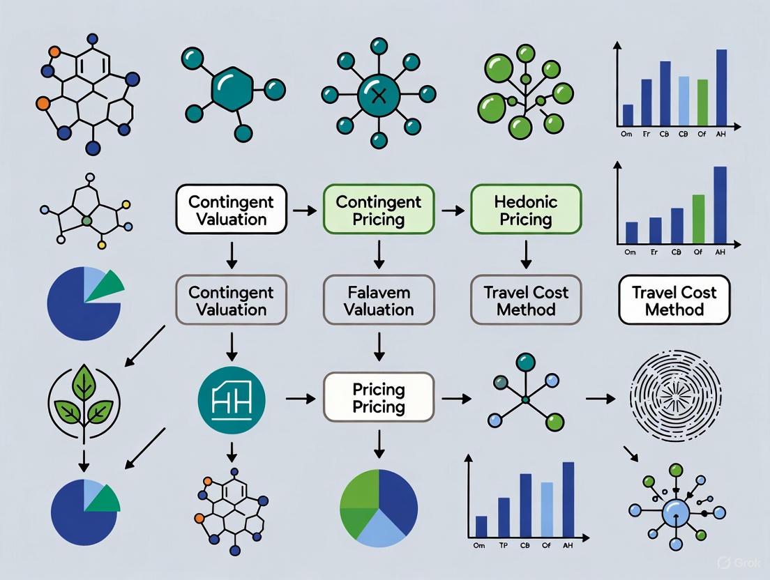
A Practical Guide to Ecosystem Service Valuation Methods
Within the field of environmental economics, revealed preference methods provide a powerful set of tools for estimating the economic value of non-market goods, such as ecosystem services, by observing actual human behavior in related markets [15]. These methods are grounded in the principle that individuals' preferences for environmental amenities are revealed through the choices they make and the costs they incur to access or enjoy these amenities [16]. The two primary revealed preference approaches discussed herein are the Travel Cost Method (TCM), which values recreational sites, and the Hedonic Pricing Method (HPM), which commonly values environmental attributes through property markets. This document provides detailed application notes and experimental protocols for these methods, framed within a broader thesis on comparative ecosystem service valuation. It is designed to equip researchers, scientists, and policy analysts with the practical knowledge to implement these valuation techniques rigorously, supported by structured data, standardized protocols, and visual workflows.
Theoretical Foundations
Revealed preference methods operate on the premise that use values for environmental goods can be deduced from observed behavior in connected markets [15] [16]. Unlike stated preference methods that rely on hypothetical survey questions, revealed preference methods infer value from real-world decisions, thereby avoiding potential hypothetical bias [15]. A critical concept in this domain is that of the final ecosystem service (FES), defined as the components of nature that are directly used, consumed, or enjoyed by humans [17]. For valuation to be accurate and to avoid double-counting, it is essential to distinguish these final services from the intermediate ecosystem processes that support them [17]. Both the Travel Cost and Hedonic Pricing methods are designed to value these final, directly-experienced services.
The Travel Cost Method (TCM): Application and Protocol
The Travel Cost Method values recreational sites by treating the time and monetary cost incurred to travel to a site as the implicit price of accessing that site [18] [16]. By surveying visitors from different geographic zones with varying travel costs, a demand function for the site can be estimated. The area under this demand curve, known as the consumer surplus, represents the total recreational value of the site that is not captured by any entry fees [18].
Detailed Experimental Protocol
Step 1: Study Design and Zonal Delineation
- Research Objective: Define the specific ecosystem service being valued (e.g., recreational swimming, wildlife viewing).
- Zonal Approach: Divide the area surrounding the study site into multiple zones of origin. Zones can be defined by administrative boundaries (e.g., cities, postal codes) or concentric distance bands [18].
- Sampling Framework: Determine the required sample size of visitors. A standard formula using a 95% confidence level and a 5% sampling error can be applied [18]:
n = N / (1 + N(ε)²)whereNis the total visitor population andεis the sampling error (e.g., 0.05).
Step 2: Data Collection via Visitor Surveys
Administer structured questionnaires to a representative sample of visitors on-site. The survey must capture:
- Travel Cost Variables: Round-trip distance traveled, vehicle type, fuel cost, toll fees, access fees, and the opportunity cost of travel time.
- Visitation Data: Number of visits to the site over a specific period (e.g., the past year).
- Socioeconomic Data: Visitor's income, age, education, and place of residence [18].
- Substitute Sites: Information on the availability and quality of alternative recreational sites.
Step 3: Data Analysis and Model Estimation
- Calculate Total Travel Cost: Sum all monetary travel expenses and the value of travel time.
- Estimate Visitation Rate: For the zonal model, calculate the visitation rate per capita for each zone.
- Regression Analysis: Employ a regression model (e.g., Log-Log model) to estimate the demand function [18].
Visitation Rate = f(Travel Cost, Income, Age, Other Socioeconomic Variables) - Calculate Consumer Surplus: Derive the consumer surplus per visit and aggregate it across the total number of visits to estimate the total annual recreational value of the site.
Step 4: Calculate Price Elasticity of Demand
- Estimate the price-demand elasticity from the regression coefficients. This measures how sensitive visitation rates are to changes in travel cost [18]. An inelastic demand (elasticity > -1) suggests that visitation is relatively insensitive to cost increases.
Case Study: Brasília National Park, Brazil
A 2025 study applied the TCM to value the Brasília National Park, collecting 300 visitor surveys [18].
Table 1: Key Results from Brasília National Park TCM Study
| Valuation Component | Estimated Value | Notes |
|---|---|---|
| Travel Cost Coefficient | Negative and Statistically Significant | Confirmed inverse relationship between cost and visits [18] |
| Price Elasticity of Demand | -4.1 | A 1% increase in travel cost reduced visits by 4.1% (elastic demand) [18] |
| Economic Value | ~USD 25 million / year | Total annual recreational use value [18] |
Figure 1: Travel Cost Method Workflow. The diagram outlines the key steps for implementing the Travel Cost Method, from initial study design to the final calculation of economic value.
The Hedonic Pricing Method (HPM): Application and Protocol
The Hedonic Pricing Method is based on the idea that a good's price is determined by the bundle of attributes it possesses. In the context of ecosystem services, the HPM isolates the portion of a property's price that can be attributed to associated environmental amenities, such as clean air, proximity to parks, or water quality [16] [19]. By analyzing property sales data, researchers can estimate people's marginal willingness to pay for improvements in these environmental characteristics.
Detailed Experimental Protocol
Step 1: Define the Environmental Attribute and Study Area
- Final Ecosystem Service: Clearly specify the environmental attribute being valued (e.g., open space, air quality, noise reduction) as a Final Ecosystem Service [17].
- Market Selection: Identify a homogeneous property market (e.g., a single city or metropolitan area) where the environmental attribute varies across properties.
Step 2: Data Compilation
Collect data for a large number of recent property transactions. The dataset must include:
- Dependent Variable: Property sales price.
- Structural Characteristics: Square footage, number of bedrooms/bathrooms, lot size, age of property, condition.
- Locational Amenities: Neighborhood income, school quality, crime rates, proximity to city center.
- Environmental Attribute of Interest: This is the key variable (e.g., distance to a park, air quality index, water clarity).
Step 3: Model Specification and Econometric Analysis
- Model Specification: The first-stage hedonic price function is typically specified as:
Property Price = f(Structural, Locational, Environmental Attributes) - Functional Form: Test different functional forms (linear, log-linear, log-log).
- Regression Analysis: Use multiple regression analysis (e.g., Ordinary Least Squares) to estimate the model. The coefficient for the environmental variable represents the implicit marginal price of that attribute.
Step 4: Deriving Marginal Willingness to Pay
- The marginal implicit price can be used to construct a marginal willingness to pay (MWTP) function for the environmental attribute, which represents the second stage of the analysis and describes how MWTP changes with the level of the attribute.
Case Study: Open Space in Maryland, USA
A hedonic study examined the effect of different types of open space on housing prices in Maryland from 1995-1999 [19].
Table 2: Key Findings from Maryland Open Space HPM Study
| Type of Open Space | Effect on Housing Prices | Interpretation |
|---|---|---|
| Private Conservation Land & Public Non-Military Land | Positive Effect | Homebuyers have a positive willingness-to-pay for proximity to these preserved natural areas [19]. |
| Residential, Commercial/Industrial, and Forested Land | Negative Effect | Proximity to these land types is viewed as a disamenity, negatively impacting property values [19]. |
Comparative Analysis and Research Toolkit
Comparative Framework
When conducting comparative research on ecosystem service valuation, it is critical to understand the strengths, applications, and limitations of each method.
Table 3: Comparison of Revealed Preference Valuation Methods
| Characteristic | Travel Cost Method (TCM) | Hedonic Pricing Method (HPM) |
|---|---|---|
| Primary Application | Valuing recreational use of ecosystems [18] [16] | Valuing environmental amenities via property markets [16] [19] |
| Type of Value Measured | Direct Use Value (Recreation) | Direct Use Value (Amenity) |
| Data Requirements | Visitor surveys, travel data, socioeconomic data | Property transaction data, structural/locational attributes, environmental data |
| Key Outputs | Consumer surplus, demand elasticity, total recreational value | Marginal implicit prices, marginal willingness-to-pay |
| Main Challenges | Valuing travel time, identifying substitute sites, multi-destination trips | Market segmentation, omitted variable bias, complex second-stage estimation |
The Scientist's Toolkit: Essential Research Reagents
This section outlines the key "research reagents" – the essential data inputs and analytical tools – required to implement these valuation methods effectively.
Table 4: Essential Research Reagents for Revealed Preference Studies
| Research Reagent | Function / Purpose | Relevance |
|---|---|---|
| Structured Survey Instrument | Collects data on travel behavior, visitation patterns, and socioeconomic factors. | Critical for TCM data collection [18]. |
| Property Transaction Database | Provides the dependent variable (sales price) and key independent variables for analysis. | Foundational dataset for HPM [19]. |
| GIS (Geographic Information System) | Maps zones of origin (TCM), calculates distances to amenities, and integrates spatial environmental data. | Essential for both TCM (zonal analysis) and HPM (locational attributes) [18] [19]. |
| Econometric Software (e.g., R, Stata) | Performs statistical regression analysis to estimate demand functions (TCM) and hedonic price functions (HPM). | Core analytical tool for both methods [18]. |
| Final Ecosystem Service (FES) Classification (e.g., NESCS Plus) | Provides a standardized framework to define and classify the ecosystem service being valued, ensuring consistency and avoiding double-counting [17]. | Critical for scoping and interpreting studies in both TCM and HPM. |
Figure 2: Method Selection Logic. This diagram guides the selection between TCM and HPM based on the type of Final Ecosystem Service being valued and the policy question at hand.
Application Notes
Stated preference methods are a suite of research tools used to quantify the value of goods, services, or interventions that are not typically traded in traditional markets. These methods are particularly valuable in fields like ecosystem service valuation and healthcare implementation science, where they help determine the relative importance of various attributes to key decision-makers, including patients, providers, and policymakers [20]. By asking individuals to state their preferences in hypothetical scenarios, these methods provide a way to measure "non-use" or "passive use" values—the value people place on simply knowing that a resource or service exists, even if they never directly use it [21].
The core principle behind these methods is the economic theory of rational utility maximization. It assumes that individuals are logical decision-makers who, when presented with a set of choices, will select the option that provides them with the greatest benefit, happiness, or satisfaction [20]. Two prominent stated preference methods are Contingent Valuation and Simulated Exchange Value, each with distinct applications and strengths. Contingent Valuation is one of the only methods capable of assigning monetary values to non-use environmental benefits, such as the existence value of a species or ecosystem [21]. Simulated Exchange Value, on the other hand, is applied in contexts like free-access recreation to estimate the implicit price of ecosystem services [22].
These methods are crucial for policy prioritization and implementation strategy design. For instance, data from Discrete Choice Experiments (a type of stated preference method) can inform policy by calculating predicted uptake probabilities, marginal rates of substitution, and willingness to pay [20]. This allows policymakers to make informed decisions when resource constraints prevent offering all possible options to a population.
Table 1: Core Stated Preference Methods Discussed
| Method Name | Primary Application Context | Key Metric Elicited | Principal Strength |
|---|---|---|---|
| Contingent Valuation [21] | Ecosystem services, particularly non-use values | Willingness to Pay (WTP) or Willingness to Accept (WTA) | Ability to value non-market and non-use goods |
| Simulated Exchange Value [22] | Free-access recreation, ecosystem accounting | Implicit price based on a simulated market | Provides a monetary value for services with no direct market price |
Experimental Protocols
Protocol for Contingent Valuation Method
The Contingent Valuation Method (CVM) is a survey-based approach used to estimate the economic value of environmental services by directly asking people about their willingness to pay (WTP) for a specific hypothetical scenario [21]. The following provides a detailed, step-wise protocol for its application.
1. Problem Definition
- Define the Service: Precisely specify the ecosystem service or good being valued (e.g., preservation of a wildlife habitat, improved water quality) [21].
- Define the Population: Identify the relevant population of stakeholders (e.g., local residents, national citizens) from which the sample will be drawn [21].
2. Survey Design and Development This is the most critical and time-intensive phase.
- Valuation Question Format: Decide on the format for eliciting WTP (e.g., open-ended questions, payment cards, or dichotomous choice) [21].
- Scenario Development: Create a detailed, credible, and understandable hypothetical scenario that describes the service and the change in its provision. This should include:
- The current state and the proposed improved state.
- The mechanism through which the change will be achieved.
- The payment vehicle (e.g., a one-time tax, increased monthly utility bill) [21].
- Pre-Testing and Focus Groups:
- Conduct initial focus groups and interviews with members of the target population to gauge their understanding of the issues and test preliminary scenarios and questions [21].
- Use iterative pre-testing of the survey instrument to ensure clarity, minimize confusion, and identify potential "protest bids" (responses that reject the hypothetical scenario itself rather than revealing a value) [21].
3. Survey Implementation
- Mode Selection: Choose a survey administration method. In-person interviews are most effective for complex questions but are expensive. Mail surveys allow for wide geographical reach but must be kept relatively short. Telephone surveys are less expensive but can be challenging for conveying complex background information [21].
- Sampling: Use standard statistical sampling methods to obtain a randomly selected sample from the relevant population to ensure representativeness [21].
- Administration: Execute the survey using standard methods to maximize response rates (e.g., repeat mailings for mail surveys, multiple call attempts for telephone surveys) [21].
4. Data Compilation and Analysis
- Data Handling: Compile and clean the survey data.
- Statistical Analysis: Employ appropriate statistical techniques to analyze the responses. This includes:
- Calculating mean or median WTP.
- Identifying and adjusting for protest bids and non-response bias. A conservative approach for non-response bias is to assume non-respondents have a zero value [21].
- Extrapolating the sample's average WTP to the entire population to estimate total economic benefits [21].
Protocol for Simulated Exchange Value Method
The Simulated Exchange Value (SEV) method is applied in ecosystem accounting to estimate a monetary value for ecosystem services that are typically enjoyed free of charge, such as recreation in a public park [22] [20]. It simulates a market price where none exists.
1. Define the Ecosystem Service and Unit of Measure
- Clearly specify the service being valued (e.g., recreational visits to a forest park).
- Define the unit of measure (e.g., one visitor-day).
2. Identify a Comparable Market Good
- The core of the SEV method is to find a similar, privately provided good or service that is actually traded in a market [20].
- Example: For valuing recreational visits to a free public park, a comparable market good could be the entrance fee to a similar but privately operated park, recreational facility, or nature reserve that charges an entry fee [20].
3. Data Collection on the Comparable Good
- Gather data on the market price of the identified comparable good.
- This may involve researching fees from private providers or public surveys that report expenditure data for similar recreational activities.
4. Calculate the Simulated Exchange Value
- The market price of the comparable good serves as a proxy for the implicit price of the non-market ecosystem service.
- Total Value Calculation: Multiply the simulated exchange value (price per unit) by the estimated quantity of the ecosystem service consumed.
Table 2: Key Differences in Application Between CVM and SEV
| Aspect | Contingent Valuation (CVM) | Simulated Exchange Value (SEV) |
|---|---|---|
| Valuation Basis | Hypothetical willingness to pay [21] | Proxy market price from a comparable good [20] |
| Data Source | Directly from surveyed individuals [21] | From existing market data for similar services [20] |
| Resource Intensity | High (requires extensive survey development and administration) [21] | Lower (relies on desk research and available data) |
| Primary Strength | Captures non-use and existence values [21] | Pragmatic for valuing free-access use values [20] |
The Scientist's Toolkit
This section details key reagents and tools essential for conducting rigorous stated preference research.
Table 3: Essential Research Reagents and Tools
| Tool / Reagent | Function / Description | Application Context |
|---|---|---|
| Hypothetical Scenario | A detailed, credible description of the good/service being valued and the context of the choice [21]. | Foundation for all stated preference methods; ensures respondent understanding. |
| Payment Vehicle | The method through which a payment would be made (e.g., tax, fee, price increase) [21]. | Anchors the Contingent Valuation question in a realistic payment context. |
| Discrete Choice Experiment (DCE) | A survey method where respondents repeatedly choose their preferred option from competing multi-attribute profiles [20]. | Quantifies trade-offs and determines the relative importance of different attributes of a good or service. |
| Best-Worst Scaling (BWS) | A survey method where respondents select the most and least important items from a set [20]. | Ranks and quantifies the relative importance of multiple factors (e.g., implementation determinants). |
| Latent-Class Analysis | A statistical analysis technique used to identify distinct, unobserved subgroups (classes) within a population that have similar preferences [20]. | Reveals preference heterogeneity beyond simple demographics in DCE and BWS data. |
| Comparable Market Good | A privately-traded good or service that is similar to the non-market ecosystem service being valued [20]. | Serves as the basis for calculating the Simulated Exchange Value. |
Ecosystem service valuation provides critical methodologies for quantifying the economic benefits of nature, enabling informed decision-making in environmental management and policy development. This document details two fundamental quantitative approaches: the Market Price Method (a market-based approach) and the Replacement Cost Method (a cost-based approach). These methods are frequently employed in comparative ecosystem service valuation research due to their reliance on observable, often readily available, economic data [23]. The Market Price Method estimates economic values for ecosystem products or services that are bought and sold in commercial markets, such as timber or commercially harvested fish [24]. In contrast, the Replacement Cost Method estimates values based on the costs of replacing lost ecosystem services or providing substitute services, such as building a levee to replace the flood protection function of a wetland [25]. These approaches are essential for integrating the value of natural capital into cost-benefit analyses, policy design, and resource allocation, thereby making the benefits provided by ecosystems visible in economic and regulatory frameworks [26] [23].
Market Price Method: Application Notes
The Market Price Method is grounded in standard economic techniques for measuring economic benefits from marketed goods. It is used to value changes in either the quantity or quality of a good or service provided by an ecosystem [24]. The core principle involves using market price and quantity data to estimate consumer surplus and producer surplus, which together constitute the total net economic benefit, or economic surplus [24]. Consumer surplus is the difference between what consumers are willing to pay for a good and what they actually pay. Producer surplus is the difference between the revenues producers receive and the variable costs of production [24].
This method is particularly applicable to provisioning services, such as food production (e.g., fish, crops) and raw materials (e.g., timber), which have established markets [23]. A key application is valuing the economic impact of environmental changes, such as pollution cleanup or resource degradation, on the commercial availability of an ecosystem product [24]. The validity of this method hinges on the assumption that market prices reflect the true economic value of the good, which requires functioning, competitive markets with minimal distortions from taxes, subsidies, or other imperfections [24].
Table 1: Key Characteristics of the Market Price and Replacement Cost Methods
| Characteristic | Market Price Method | Replacement Cost Method |
|---|---|---|
| Valuation Basis | Observed market prices and quantities for ecosystem products [24] | Cost of replacing ecosystem services or providing substitutes [25] |
| Core Metric | Economic surplus (sum of consumer and producer surplus) [24] | Expenditure required for replacement or substitution [25] |
| Primary Applicability | Provisioning services (e.g., fish, timber) [24] [23] | Regulating and supporting services (e.g., water purification, flood protection) [23] [25] |
| Data Requirements | Market data on prices, quantities demanded/supplied, and production costs [24] | Cost data for replacement technology, materials, and labor; engineering assessments [25] |
| Key Assumption | Market prices reflect true economic value in a competitive market [24] | The cost of replacement is a valid proxy for the value of the original service, and replacement is socially acceptable [25] |
Market Price Method: Experimental Protocol
Workflow for Quantifying Economic Impact
The following diagram illustrates the step-by-step protocol for applying the Market Price Method to quantify the economic impact of an environmental change on a marketed ecosystem good.
Diagram 1: Workflow for the Market Price Method.
Step-by-Step Procedure
Objective: To measure the total economic benefit (or loss) resulting from an environmental change that affects the production of a marketed ecosystem good, such as the reopening of a commercial fishery after pollution cleanup [24].
Estimate Baseline Consumer Surplus:
- Collect time-series market data on the quantity of the good (e.g., fish) purchased and its price before the environmental change [24].
- Use this data to estimate the market demand function. This may involve statistical analysis to determine the relationship between price and quantity demanded, holding other factors constant.
- Calculate the baseline consumer surplus. For a linear demand curve, this is the area under the demand curve and above the market price. For example, with a maximum willingness to pay of $10, a market price of $5, and a quantity of 10,000 pounds, the consumer surplus is (($10 - $5) × 10,000) / 2 = $25,000 [24].
Estimate Post-Change Consumer Surplus:
- Determine the new market price and quantity demanded after the environmental change.
- Estimate the new market demand function (or adjust the baseline function based on the new equilibrium).
- Calculate the post-change consumer surplus using the new price and quantity. In the example, with a price increase to $7 and a quantity decrease to 6,000 pounds, the new consumer surplus is (($10 - $7) × 6,000) / 2 = $9,000 [24].
Calculate Change in Consumer Surplus:
- Subtract the post-change consumer surplus from the baseline consumer surplus. This represents the economic gain or loss to consumers. In the example, the loss is $25,000 - $9,000 = $16,000 [24].
Estimate Baseline Producer Surplus:
- Gather data on the total revenues and total variable costs of production (e.g., fuel, gear, labor for fishermen) before the environmental change [24].
- Producer surplus is calculated as Total Revenues minus Total Variable Costs. For example, with 10,000 pounds harvested at $1 per pound revenue and a variable cost of $0.50 per pound, the producer surplus is $10,000 - $5,000 = $5,000 [24].
Estimate Post-Change Producer Surplus:
- Gather data on the new total revenues and total variable costs of production after the environmental change.
- Calculate the post-change producer surplus. In the example, with 6,000 pounds harvested, a wholesale price of $1, and a variable cost of $0.60 per pound, the new producer surplus is $6,000 - $3,600 = $2,400 [24].
Calculate Change in Producer Surplus:
- Subtract the post-change producer surplus from the baseline producer surplus. This represents the economic gain or loss to producers. In the example, the loss is $5,000 - $2,400 = $2,600 [24].
Calculate Total Economic Impact:
- Sum the change in consumer surplus and the change in producer surplus to arrive at the total net economic benefit or cost. In the example, the total economic loss from the fishery closure is $16,000 + $2,600 = $18,600, which would represent the benefit of cleanup [24].
Research Reagent Solutions
Table 2: Essential Data and Tools for Market Price Method Analysis
| Item | Function/Description |
|---|---|
| Market Price & Quantity Data | Historical time-series data on prices and volumes of the ecosystem good (e.g., from commercial harvest records, commodity markets). Serves as the primary input for demand curve estimation [24]. |
| Production Cost Data | Data on variable costs incurred by producers (e.g., labor, materials, energy, transportation). Essential for calculating producer surplus [24]. |
| Socioeconomic Datasets | Data on population, income, and prices of substitute goods. Used as control variables in econometric models to isolate the demand for the specific ecosystem good [24]. |
| Econometric Software | Statistical software packages (e.g., R, Stata, Python with statsmodels) used to perform regression analysis and estimate the market demand and supply functions [24]. |
Replacement Cost Method: Application Notes
The Replacement Cost Method is part of a family of cost-based techniques, including the Damage Cost Avoided and Substitute Cost Methods [25]. It estimates the value of an ecosystem service based on the cost of replacing it with a human-made system or technology that provides the same service [25]. The underlying logic is that if society incurs costs to replace a lost ecosystem service, then that service must be worth at least the cost of replacement [25]. This method does not provide a direct measure of economic value as defined by willingness to pay, but it offers a pragmatic and often conservative estimate [25].
This approach is most applicable to regulating services (e.g., water purification, flood control, erosion prevention) and supporting services (e.g., nutrient cycling) [23]. A classic application is valuing the water purification service of a wetland by calculating the cost of building and operating a water filtration plant that would provide the same service [25]. For the results to be valid, the replacement must be functionally equivalent to the original ecosystem service, and the cost of the replacement must be the least costly alternative available. Crucially, there must also be evidence that society would be willing to accept and pay for the substitute service if the ecosystem were lost [25].
Table 3: Illustrative Examples of the Replacement Cost Method
| Ecosystem Service | Replacement Technology | Quantified Example |
|---|---|---|
| Water Purification | Construction and operation of a water treatment plant [25] | New York City invested in watershed protection for the Catskill/Delaware watershed instead of building a \$6-8 billion filtration plant, effectively valuing the natural service at that avoided cost [23]. |
| Erosion & Nutrient Retention | Physical replacement of soil and application of fertilizer [25] | In Korean uplands, the cost of replacing eroded soil and lost nutrients was estimated at W111,200 per hectare per year (W80,000 for soil + W31,200 for nutrients) [25]. |
| Flood Protection | Construction of levees, dams, or retaining walls [25] | The value of a wetland's storm protection can be estimated by the cost of building seawalls or other coastal defense structures [23] [25]. |
Replacement Cost Method: Experimental Protocol
Workflow for Service Valuation
The following diagram outlines the logical sequence for applying the Replacement Cost Method to value a specific ecosystem service.
Diagram 2: Workflow for the Replacement Cost Method.
Step-by-Step Procedure
Objective: To value an ecosystem service (e.g., flood protection from wetlands) by estimating the cost of providing a substitute service (e.g., a levee) [25].
Define Ecosystem Service and Scale:
- Clearly specify the ecosystem service being valued (e.g., flood protection), the level at which it is provided, and the geographic scope of the beneficiaries (e.g., a specific coastal community) [25].
Conduct Ecological Assessment:
- Quantify the current level of service provision by the ecosystem. For flood protection, this involves modeling the reduction in flood frequency, intensity, and spatial extent attributable to the wetlands [25]. This establishes the "service unit" that must be replaced.
Identify Least-Cost Feasible Substitute:
- Brainstorm all technically feasible human-made alternatives that could provide a functionally equivalent service. For flood protection, alternatives could include levees, retaining walls, or drainage systems [25].
- Conduct a preliminary screening to identify the least-cost option among these feasible substitutes.
Engineer and Cost the Substitute:
- Develop detailed engineering specifications for the chosen substitute to ensure it matches the service level identified in Step 2.
- Calculate all associated costs, including:
- Capital Costs: Initial construction, land acquisition, and equipment.
- Operating and Maintenance Costs: Ongoing expenses over the project's lifespan.
- Use local cost data, contractor estimates, or engineering handbooks. The total cost should be annualized or presented as a net present value for comparison [25].
Assess Social Acceptability:
- Gather evidence that the public or relevant stakeholders would be willing to accept the engineered substitute in place of the original ecosystem service [25]. This can be achieved through surveys, public forums, or analysis of past policy decisions. If the substitute is not acceptable, return to Step 3 to identify an alternative.
Calculate Total Replacement Cost:
- The final calculated cost of the substitute service serves as the estimate for the value of the ecosystem service. This value can be used in cost-benefit analysis to justify conservation or restoration actions. For example, if wetland restoration costs less than building a levee, the restoration project provides positive net benefits [25].
Research Reagent Solutions
Table 4: Essential Materials for Replacement Cost Analysis
| Item | Function/Description |
|---|---|
| Engineering Cost Models | Standardized cost estimation tools and databases (e.g., RSMeans, vendor quotes) for construction and infrastructure projects. Used to derive accurate cost estimates for substitute technologies [25]. |
| Ecological Simulation Models | Software for modeling ecosystem functions (e.g., hydrologic models for flood prediction, nutrient cycling models). Used to quantify the level of service provided by the ecosystem [26]. |
| Geospatial Data & Software | GIS (Geographic Information System) data and software (e.g., ArcGIS, QGIS) for mapping service areas, identifying beneficiaries, and planning the spatial configuration of substitute infrastructure [26]. |
| Social Survey Instruments | Designed questionnaires and survey protocols for assessing public willingness to accept engineered substitutes for natural ecosystem services, a critical validity check for the method [25]. |
Benefit transfer is the practice of adapting value estimates from previous primary research to assess the economic value of a similar environmental good or service in a different, often data-scarce, context [27]. This method serves as a critical, cost-effective alternative to conducting new, time-consuming, and expensive primary valuation studies for every new policy scenario [28] [29]. Its application is indispensable for regulatory agencies, like the U.S. Environmental Protection Agency (EPA), which are required to conduct Benefit-Cost Analyses (BCAs) for regulations with economic impacts exceeding $100 million annually [28] [27]. The process is equally vital for environmental valuation in developing countries, where high-quality national primary studies may be unavailable [29]. Despite its practical necessity, benefit transfer inherently involves extrapolation, and its reliability is a subject of ongoing research and refinement within the field of environmental economics [28].
The core challenge of benefit transfer lies in minimizing transfer errors, which are discrepancies between the transferred value and the value that would have been obtained from a primary study at the policy site [27]. A comprehensive review of convergent validity tests found that absolute benefit transfer errors can be substantial, with a median error of 39% across numerous studies [28]. The accuracy of transfers is influenced by several factors, including the method used, the similarity between the study and policy sites, and the type of environmental good being valued [28]. Function transfers, which use valuation functions to adjust for site characteristics, generally tend to be more accurate than simple value transfers [28]. Furthermore, transfers involving environmental quantity changes often show higher accuracy than those for quality changes, and geographic similarity between sites is a key factor in reducing errors [28].
Methodological Approaches in Benefit Transfer
The practice of benefit transfer can be broadly categorized into two main methodological approaches, each with varying levels of sophistication and data requirements. The choice between them depends on the resources available and the required precision for the policy analysis. The table below provides a detailed comparison of these core methods.
Table 1: Core Methodologies for Benefit Transfer
| Method | Description | Data Requirements | Advantages | Limitations |
|---|---|---|---|---|
| Value Transfer | Applies a single unit value or an average of values from one or more study sites directly to a policy site [27]. | Unit value(s) from a primary valuation study; basic demographic/population data for the policy site. | Simple, fast, and straightforward to implement; useful for rapid policy appraisals [27]. | Requires the study and policy sites to be highly similar; can lead to large errors if contexts differ significantly [27] [29]. |
| Function Transfer | Transfers an entire demand or valuation function from a study site, which is then calibrated using the specific characteristics of the policy site [27]. | Valuation function (e.g., from a journal article); detailed data on policy site characteristics (e.g., income, population, environmental attributes). | More accurate and theoretically robust; allows for explicit adjustment for differences between sites [28] [27]. | More data-intensive; requires expertise to implement correctly; the valuation function may not fully capture relevant policy site factors. |
A more advanced technique that falls under the function transfer umbrella is Meta-Analysis Benefit Transfer. This involves the statistical analysis of a large collection of results from individual studies to create a valuation function that explains variations in estimated value based on study characteristics (e.g., methodology, population demographics, environmental attributes) [27] [30]. This method allows for the synthesis of a broader body of knowledge and can provide a more robust basis for transfer. However, it risks losing important contextual details from individual studies in the aggregation process [30]. Its strength in summarizing large amounts of information must be balanced with cautious application to specific policy questions [30].
Application Protocols and Experimental Workflows
Implementing a defensible benefit transfer requires a structured, sequential process. The following protocol outlines the key stages, from problem definition to reporting, and is visualized in the workflow diagram below.
Stage 1: Problem Definition and Study Selection
The initial phase focuses on precisely defining the scope of the analysis and identifying suitable primary studies.
- Define the Policy Context: Clearly articulate the environmental good or service being valued at the policy site and the specific change (in quality or quantity) under consideration [27].
- Identify Potential Study Sites: Systematically search the environmental economics literature for primary non-market valuation studies (e.g., using contingent valuation, travel cost method) that have estimated values for a similar environmental good [29].
- Assess Study Quality and Similarity: Evaluate potential studies based on the convergence of key factors with the policy site [27] [29]. This includes:
- Valuation Methodology: Prefer studies that use similar and reputable valuation methods [29].
- Environmental Good: The good or service valued should be as identical as possible (e.g., water quality improvements, recreation access) [29].
- Socio-Economic and Geographic Context: Prioritize studies from populations and regions that are demographically and culturally similar to the policy site [28]. Geographic proximity often correlates with higher transfer accuracy [28].
Stage 2: Method Execution and Value Calculation
This stage involves the technical execution of the chosen transfer method and the calculation of the final welfare estimate.
- Execute Value Transfer: If using a unit value transfer, apply the average value per unit (e.g., per household, per visit) from the study site to the relevant population at the policy site [27].
- Calibrate Function Transfer: If using a function transfer, obtain the valuation function from the primary study. This function typically expresses Willingness-To-Pay (WTP) as a function of variables like income, education, and environmental attributes. Input the mean values of these variables from the policy site into the function to generate a calibrated value [27].
- Adjust for Income and Scale: A critical step in function transfer, especially in international contexts, is adjusting for differences in income and purchasing power. This often involves using the following formula, where ( WTPp ) is the estimated willingness-to-pay at the policy site, ( WTPs ) is the value from the study site, ( Yp ) and ( Ys ) are the mean incomes at the policy and study sites, and ( \epsilon ) is the income elasticity of demand for the environmental good [31] [29]: [ WTPp = WTPs \times \left( \frac{Yp}{Ys} \right)^\epsilon ] Research indicates that while adjusting for mean income is crucial, further adjustment for income inequality within the policy site offers only minor improvements in accuracy [31].
Stage 3: Reporting and Uncertainty
The final phase ensures the analysis is communicated transparently and its limitations are acknowledged.
- Quantify and Report Transfer Errors: Where possible, report measures of uncertainty, such as confidence intervals, from the primary study or meta-analysis. Explicitly state that the estimate is derived from a benefit transfer and is subject to error [27].
- Document Assumptions and Limitations: Clearly list all assumptions made during the transfer process, including the choice of income elasticity, the rationale for study selection, and any data limitations faced at the policy site [28].
Managing Error and Uncertainty
Acknowledging and managing error is a fundamental part of benefit transfer practice. Errors can be categorized as either measurement error or transfer error [27].
- Measurement Error: This originates from the primary studies used for the transfer. It can stem from the valuation methods themselves or from selection biases, such as publishing only studies with statistically significant results (publication selection bias) [27].
- Transfer Error (Generalization Error): This occurs due to the act of transferring values between sites. It arises from fundamental dissimilarities between the study and policy sites in terms of population characteristics, cultural contexts, or the specific attributes of the environmental good [27]. The convergent validity test is the standard method for assessing transfer error, whereby a transferred value is compared to a value derived from a primary study at the policy site [28] [27].
The Researcher's Toolkit: Essential Reagents for Benefit Transfer
Successfully conducting a benefit transfer requires a suite of "research reagents" — key tools and data inputs. The following table details these essential components.
Table 2: Key Research Reagents for Benefit Transfer
| Research Reagent | Function and Description | Application Example |
|---|---|---|
| Valuation Database | A curated repository of existing non-market valuation studies, often with coded variables (e.g., PROTEUS, EVRI). | Provides a systematic starting point for identifying potential study sites and data for meta-analysis [29]. |
| Valuation Function | A statistically estimated equation from a primary study that relates WTP to explanatory variables. | Serves as the core engine for a function transfer; calibrated with policy site data to generate a context-specific value [27]. |
| Income Elasticity Estimate (ε) | A parameter that quantifies how responsive the demand for an environmental good is to changes in income. | Critical for adjusting values when transferring between sites with different income levels using the income adjustment formula [31] [29]. |
| Socio-Economic Data | Data on the policy site's population, such as mean/median income, household size, education levels, and demographic composition. | Used to calibrate a transferred valuation function or to scale unit values to the affected population [27] [29]. |
| Geographic Information System (GIS) | A tool for capturing, managing, and analyzing spatial data. | Can be used to incorporate spatial trends, define the affected population's geographic scope, and assess spatial similarity between sites [27]. |
| Convergent Validity Test | A methodological protocol that compares a transferred value to a primary value estimate for the same policy site. | Used in research settings to empirically test and report the accuracy and reliability of different benefit transfer methods [28] [27]. |
Application Notes: Integrating Deliberation into Ecosystem Service Valuation
Conceptual Foundation and Rationale
Deliberative valuation represents a methodological shift in ecosystem service valuation, moving beyond purely economic approaches to incorporate diverse stakeholder perspectives through structured group dialogue. This approach is particularly valuable for addressing complex valuation challenges where cultural, social, and ecological values intersect and where traditional non-market valuation methods may fail to capture the full spectrum of values [32]. Within the context of comparative ecosystem service valuation research, deliberative methods provide a complementary approach to quantitative techniques such as travel cost, resource rent, and consumer expenditure methods [2] [32].
The fundamental premise of deliberative valuation is that value is not merely pre-existing and revealed through individual preferences, but can be constructed and refined through informed group discussion. This approach recognizes that ecosystem services often involve public goods with values that are socially constructed and contested [14]. By creating structured forums for dialogue, deliberative valuation aims to generate more legitimate and socially robust value estimates that reflect collective reasoning rather than merely aggregating individual preferences.
Comparative Context with Traditional Valuation Methods
Deliberative valuation fills specific methodological gaps in the ecosystem service valuation toolkit, particularly for cultural ecosystem services which pose unique challenges for traditional economic valuation methods [32]. Research comparing four prominent valuation approaches (resource rent, travel cost, simulated exchange value, and consumer expenditure) found considerable differences in value estimates, with the travel cost method yielding values up to 40 times higher than the resource rent approach in a national park case study [32]. This variation highlights the methodological uncertainty in ecosystem service valuation and suggests the potential value of deliberative approaches in reconciling different value perspectives.
Traditional valuation methods often struggle with capturing the full dimension of cultural ecosystem services, which include recreational, aesthetic, and spiritual values [2] [32]. The simulated exchange value method, identified as particularly promising for cultural services in ecosystem accounting [32], shares some conceptual ground with deliberative approaches in its attempt to model what informed actors would pay for ecosystem services under conditions of perfect information.
Table 1: Comparative Analysis of Ecosystem Service Valuation Methods
| Valuation Method | Key Characteristics | Strengths | Limitations | Suitability for Cultural ES |
|---|---|---|---|---|
| Travel Cost | Infers value from expenses incurred to access ecosystem services | Based on revealed preferences; well-established methodology | Underestimates local use; assumes travel is solely for ES access | Moderate for recreational values |
| Resource Rent | Calculates net price of ES after deducting production costs | Aligned with national accounting principles; avoids double-counting | Often significantly underestimates total economic value | Low, as cultural ES rarely generate direct resource rents |
| Consumer Expenditure | Values ES based on related consumer spending | Captures downstream economic activity; measurable market data | May include spending not directly attributable to ES | High for tourism-related cultural services |
| Simulated Exchange Value | Models price under hypothetical market conditions | Conceptually aligned with accounting principles; comprehensive | Requires significant assumptions about market structure | High, particularly for non-market cultural services |
| Deliberative Valuation | Derives values through structured group discussion | Captures non-material values; builds social legitimacy | Time-intensive; potential for group dominance effects | Very high, especially for aesthetic, spiritual values |
Experimental Protocols
Protocol 1: Structured Deliberative Workshop for Cultural Ecosystem Service Valuation
Purpose and Scope
This protocol provides a standardized methodology for implementing deliberative valuation workshops focused on cultural ecosystem services, particularly in contexts where these values interface with tourism economies and recreational uses [32] [33]. The approach integrates elements from stakeholder engagement frameworks [34] [35] with specialized valuation techniques for cultural ecosystem services.
Materials and Reagents
- Pre-workshop information packages (digital or physical)
- Digital recording equipment (audio/video) with transcription capability
- Facilitation materials (whiteboards, sticky notes, voting dots)
- Value assessment worksheets (structured and unstructured formats)
- Demographic and pre-deliberation questionnaires
- Consent forms meeting ethical standards for social science research
Procedure
Phase 1: Pre-Workshop Preparation (2-3 weeks)
- Stakeholder Mapping and Recruitment: Conduct comprehensive stakeholder analysis using power-interest grids or multi-dimensional mapping techniques [34] [36]. Identify and recruit 15-25 participants representing diverse stakeholder groups (local communities, tourism professionals, policy makers, indigenous representatives, conservation advocates).
- Information Package Development: Compile and distribute balanced information materials describing the ecosystem services in question, including scientific data, traditional knowledge, and contextual information about management trade-offs.
- Baseline Assessment: Administer pre-deliberation surveys to capture initial values, preferences, and knowledge levels.
Phase 2: Workshop Implementation (1-2 days)
- Orientation and Ethical Framing (1 hour): Introduce purpose, establish discussion norms, obtain informed consent, and frame the deliberation around specific valuation questions.
- Information Sharing and Expert Testimony (2-3 hours): Present balanced evidence from multiple perspectives, including ecological data, economic analyses, and cultural significance assessments. Incorporate expert presentations with equal time for competing viewpoints.
- Small Group Deliberation (3-4 hours): Facilitate structured small group discussions (5-7 participants each) using value-focused conversation guides. Employ techniques such as nominal group technique to ensure equitable participation.
- Value Elicitation and Refinement (2-3 hours): Guide participants through iterative value articulation exercises, using both quantitative (rating, ranking) and qualitative (narrative, visual) methods to express values.
- Plenary Synthesis and Collective Reasoning (1-2 hours): Reconvene small groups to share insights, identify areas of agreement and disagreement, and develop collective value statements.
Phase 3: Post-Workshop Analysis and Validation (2-4 weeks)
- Data Integration: Transcribe and code deliberation transcripts, combining with quantitative value assessments.
- Value Aggregation and Analysis: Employ appropriate analytical frameworks to synthesize individual and collective values, noting where deliberation shifted perspectives.
- Result Validation: Conduct member-checking by sharing preliminary findings with participants for verification and feedback.
Troubleshooting and Adaptation
- Power Imbalances: If dominant participants emerge, facilitators should explicitly invite contributions from quieter members and use structured round-robin techniques [37].
- Value Incommensurability: When participants struggle to express values in comparable terms, introduce bridging concepts or multi-dimensional assessment frameworks.
- Context Adaptation: For specific ecosystem types (e.g., forest ecosystems in rural areas [38]), tailor case examples and expert testimony to the local context.
Protocol 2: Deliberative Multi-Method Valuation Integration
Purpose and Scope
This protocol describes a systematic approach for integrating deliberative valuation with traditional economic valuation methods to generate more comprehensive ecosystem service assessments. The approach is particularly valuable in contexts where both monetary and non-monetary values are relevant for decision-making, such as tourism development planning in ecologically sensitive areas [33] [38].
Materials and Reagents
- Results from prior economic valuations (travel cost, resource rent, etc.)
- Multi-criteria decision analysis software or worksheets
- Value integration frameworks and visual aids
- Stakeholder preference assessment tools
- Weighting and prioritization matrices
Procedure
Phase 1: Method Selection and Preparation
- Valuation Method Assembly: Select complementary valuation methods based on the ecosystem services being assessed and decision context. A typical assembly might include: travel cost method (for recreational values), simulated exchange value (for non-use values), and deliberative valuation (for cultural and social values) [32].
- Parallel Valuation Implementation: Conduct selected valuation methods concurrently, ensuring consistent spatial and temporal scope.
Phase 2: Deliberative Integration Workshop
- Methodological Transparency (1-2 hours): Present results from each valuation method, explicitly discussing methodological assumptions, limitations, and what types of values each method captures well or poorly.
- Value Discussion and Critique (2-3 hours): Facilitate discussion where participants critically examine results from different methods, identifying consistencies, contradictions, and potential explanations.
- Weighting and Integration (2-3 hours): Guide participants through structured exercises to weigh the relative importance of different value perspectives based on decision context and societal priorities.
- Integrated Value Construction (1-2 hours): Support participants in developing integrated value statements that incorporate insights from multiple methods, acknowledging uncertainties and value conflicts.
Phase 3: Decision Support Application
- Scenario Testing: Apply integrated values to specific management or policy scenarios relevant to the decision context.
- Recommendation Development: Formulate policy or management recommendations that reflect the integrated valuation outcomes.
- Communication Strategy: Develop tailored communication materials for different audiences (policymakers, public, technical staff) that transparently present the valuation process and results.
Visualization: Deliberative Valuation Workflows
Deliberative Valuation Process Diagram
Multi-Method Valuation Integration Framework
The Scientist's Toolkit: Essential Research Reagents and Materials
Table 2: Essential Research Reagents for Deliberative Valuation Studies
| Research Reagent | Type/Category | Primary Function | Application Notes |
|---|---|---|---|
| Stakeholder Mapping Matrix | Analytical Framework | Identifies and categorizes stakeholders based on influence, interest, and impact [36] | Essential for ensuring representative participation; should be updated iteratively |
| Power-Interest Grid | Visualization Tool | Plots stakeholders based on influence level and concern level to guide engagement strategy [34] | Helps prioritize communication efforts and manage expectations |
| Deliberation Transcript Coding Protocol | Qualitative Analysis Tool | Systematic framework for analyzing discussion content and value construction processes | Should include both deductive and inductive coding approaches |
| Value Elicitation Worksheets | Data Collection Instrument | Structured forms for capturing both quantitative and qualitative value expressions | Should be pilot-tested and adapted to local context and literacy levels |
| Multi-Criteria Decision Analysis Software | Computational Tool | Supports complex weighting and integration of diverse value types | Enables transparent documentation of value trade-offs and priorities |
| Pre-/Post-Deliberation Survey Instruments | Assessment Tool | Measures changes in knowledge, attitudes, and value perspectives through the process | Critical for evaluating deliberative quality and learning outcomes |
| Ethical Approval Documentation | Governance Framework | Ensures research meets ethical standards for social science research | Particularly important when working with vulnerable communities |
| Digital Recording and Transcription System | Data Capture Technology | Creates comprehensive record of deliberation for analysis and accountability | Should include backup systems and secure data storage protocols |
Analytical Framework and Interpretation Guidelines
Quality Assessment Criteria
When implementing deliberative valuation, researchers should systematically evaluate process quality using the following criteria:
- Inclusiveness: Representative participation across relevant stakeholder groups [37]
- Transparency: Clear communication of methodological assumptions and limitations
- Deliberative Quality: Evidence of mutual respect, reasoned argumentation, and preference transformation
- Substantive Quality: Depth of engagement with relevant information and value considerations
- Efficiency: Appropriate use of resources relative to decision importance
Data Interpretation Considerations
Interpretation of deliberative valuation results requires careful attention to:
- Context Dependence: Values emerged through specific deliberative processes may not be directly transferable to other contexts
- Temporal Dynamics: Values may continue to evolve beyond the deliberation period
- Scale Considerations: Deliberative processes typically operate at local scales; aggregation to larger scales requires methodological caution
- Legitimacy: The perceived legitimacy of results depends heavily on process quality and stakeholder buy-in
The integration of deliberative valuation with traditional economic methods creates a more robust foundation for ecosystem governance, particularly in contexts involving tourism development, conservation planning, and natural resource management [33] [38]. By making value conflicts explicit and creating spaces for collective reasoning, this approach supports more legitimate and sustainable decisions about ecosystem use and conservation.
Spatially Explicit Models and Policy Support Systems
Spatially explicit models for ecosystem service (ES) valuation represent a significant advancement in environmental decision-support systems by geographically mapping the supply, flow, and demand of ecosystem services [39] [40]. These models integrate ecological data with geographical information systems (GIS) to visualize and quantify how ecosystem services are distributed across landscapes, enabling policymakers to assess trade-offs and prioritize interventions more effectively [41] [42]. The spatial explicitness of these models is particularly valuable for understanding cross-boundary ecosystem service flows and identifying critical areas for conservation or restoration [40] [42].
The evolution of these models has been driven by recognition that despite significant advances in ecosystem services concept development, valuation at local scales in data-scarce regions remains challenging [39]. Spatially explicit approaches address this gap by leveraging available data through advanced simulation techniques while making spatial relationships and dependencies visually apparent to stakeholders [39] [40]. These models have become essential tools for implementing policies such as the EU Biodiversity Strategy for 2020 and supporting the requirements of environmental regulations like the National Environmental Policy Act (NEPA) [40] [42].
Comparative Analysis of Modeling Approaches
Table 1: Comparative Analysis of Spatially Explicit Ecosystem Service Models
| Model Type | Key Features | Spatial Resolution | Primary Applications | Data Requirements |
|---|---|---|---|---|
| Individual-Based Models (IBM) | Simulates individual organisms and their interactions with environment; high behavioral realism [41] | High-resolution habitat suitability data [41] | Species-specific conservation planning; population dynamics forecasting [41] | Habitat suitability maps; demographic parameters; individual movement data [41] |
| GIS-Based Toolkits (InVEST) | Tiered model approach (Tier 0/1/2) using land-use/land-cover based ecological production functions [42] | Varies with input LULC data resolution [42] | Multi-service tradeoff analysis; scenario planning [42] | LULC maps; biophysical coefficient tables; economic values [42] |
| AI-Enhanced Frameworks (ARIES) | Artificial intelligence and machine reasoning to map service flows from sources to beneficiaries [42] | Adaptable to available data; probabilistic modeling [42] | Assessing actual service provision and use; uncertainty quantification [42] | Source/sink/flow data; agent-based models; service-specific flow paths [42] |
| Social Valuation Frameworks | Participatory mapping; stakeholder engagement throughout process [12] [43] | Dependent on stakeholder input and perceptual scales [12] | Incorporating social preferences; conflict resolution; community planning [12] | Stakeholder survey data; participatory workshop outputs; value typologies [12] |
Selection Criteria for Model Application
Choosing an appropriate spatially explicit model requires consideration of multiple factors. Policy integration needs should drive model selection, with specific attention to the decision context, final users, and intended uses of model outputs [40]. Key considerations include: (1) the spatial and temporal scales of the policy question, (2) data availability and quality, (3) technical capacity of implementing institutions, (4) stakeholder engagement requirements, and (5) resource constraints [40] [43].
For regional to continental scale assessments, models like ESTIMAP provide standardized approaches that support cross-jurisdictional comparisons [40]. For local-scale decision-making, such as BLM field office management units typically less than 1 million hectares, more refined approaches like InVEST or ARIES are preferable [42]. In data-scarce regions or when seeking to enhance policy legitimacy, participatory approaches that incorporate local knowledge through stakeholder engagement are essential [39] [12].
Application Notes: Implementing Spatially Explicit Models
Case Study 1: Little Bustard Conservation in Spain
Experimental Protocol: Individual-Based Model Development
Objective: Develop a spatially explicit demographic IBM to evaluate conservation strategies for the little bustard (Tetrax tetrax) in Extremadura, Spain, where the species faces habitat degradation and anthropogenic mortality [41].
Methodology:
- Habitat Suitability Analysis: Collect and process high-resolution spatial data on vegetation structure, land use patterns, and human infrastructure. Generate habitat suitability maps using species distribution models validated with field observations [41].
- Demographic Parameterization: Estimate survival rates for different life stages (nest, chick, adult) through field monitoring and literature review. Calibrate the model by testing hypotheses about relationships between habitat suitability and demographic parameters [41].
- Individual Agent Programming: Develop behavioral rules for movement, resource selection, and mortality risk. Implement density-dependent mechanisms where appropriate. Validate simulated patterns against empirical observations [41].
- Scenario Simulation: Program alternative management scenarios including (i) habitat improvement only, (ii) mortality reduction only, and (iii) integrated approach. Run simulations over 50-year time horizon (2022-2072) with multiple replicates to account for stochasticity [41].
- Output Analysis: Compare population trajectories, sex ratio dynamics, and spatial distribution patterns across scenarios. Calculate cost-effectiveness metrics for different intervention strategies [41].
Key Findings: Model calibration supported the hypothesis that nest, chick, and adult survival positively correlate with habitat suitability. The unbalanced sex ratio was partially driven by lower female survival in less favorable habitats. Simulations revealed that habitat enhancements alone were insufficient to reverse population declines without complementary efforts to reduce anthropogenic mortality [41].
Case Study 2: San Pedro River Basin Assessment
Experimental Protocol: Comparative Model Application
Objective: Compare approaches to spatially explicit ecosystem service modeling using the InVEST and ARIES frameworks in the San Pedro River basin, Arizona, to inform Bureau of Land Management (BLM) resource decisions [42].
Methodology:
- Study Area Delineation: Define the watershed boundary encompassing the San Pedro River from its headwaters in Sonora, Mexico, to its confluence with the Gila River. Divide into upper (Mexico) and lower (U.S.) sections for comparative analysis [42].
- Scenario Development: Create spatially explicit land use/land cover (LULC) scenarios representing (i) current conditions, (ii) agricultural expansion, (iii) urban growth, and (iv) conservation-oriented management [42].
- Parallel Model Implementation:
- InVEST: Run carbon storage, water yield, and viewshed models using LULC maps and biophysical coefficient tables. Apply valuation data to derive dollar values for biophysically quantified services [42].
- ARIES: Quantify and map ecosystem service "sources" (supply) and "uses" (demand) using ecological production functions. Model service flows between ecosystems and human beneficiaries using agent-based models that account for service-specific flow paths and sinks [42].
- Output Comparison: Statistically compare spatial patterns of service provision, quantify tradeoffs across scenarios, and assess model strengths/weaknesses for specific decision contexts [42].
Key Findings: The application revealed differential capabilities across the modeling systems. InVEST provided more straightforward scenario comparisons for well-quantified services like carbon storage, while ARIES offered more sophisticated representation of actual service flows from sources to beneficiaries. Both tools successfully mapped and quantified tradeoffs that aligned with stakeholder preconceptions about likely gains and losses, thereby providing empirical validation of previously qualitative understandings [42].
Case Study 3: Hranice Karst Groundwater Protection
Experimental Protocol: Multi-Criteria Spatial Assessment
Objective: Develop a novel spatially explicit modeling framework to quantify secondary environmental benefits of groundwater protection strategies in karst landscapes, with application to the Hranice Abyss region [44].
Methodology:
- Risk Factor Mapping:
- Groundwater Vulnerability: Apply hydrological models incorporating soil characteristics, infiltration capacity, and karst geology to map contamination susceptibility [44].
- Land Surface Temperature: Employ high-resolution random forest-based prediction algorithm to downscale LST to 1×1m spatial resolution using land use/land cover data [44].
- Stormwater Retention: Model surface runoff patterns using hydrological simulations based on soil permeability, slope, and vegetation cover [44].
- Public Participation: Conduct online surveys with 150 participants to identify community concerns and priorities regarding climate change impacts, particularly drought, stormwater management, and temperature extremes [44].
- Cumulative Vulnerability Assessment: Standardize all criteria to values 0-1 using normalization formulas. Combine layers using multi-criteria decision analysis to identify areas of highest cumulative vulnerability [44].
- Intervention Scenario Modeling: Design and evaluate nature-based solution scenarios including agricultural practice modifications, land use changes, and green infrastructure implementation [44].
Key Findings: The modeling approach successfully quantified co-benefits of groundwater protection measures, with water retention capacity increasing by up to 30% and an average rise in precipitation retention of 18.2 mm per microbasin. Temperature reductions were more modest, with a maximum decrease of 7.3% (average 1.5°C). The model identified pronounced seasonal and land-use-specific variations, particularly on agricultural land where temperature fluctuations reached 2.6°C between pre- and post-harvest periods [44].
Protocols for Model Implementation and Policy Integration
Protocol for Local-Scale Model Adaptation
Table 2: Stakeholder Engagement Framework for Social Valuation of Ecosystem Services
| Stage | Key Activities | Stakeholder Involvement | Outputs |
|---|---|---|---|
| Spatial & Temporal Context | Delimit study boundaries; identify cross-scale interactions [12] | Consult stakeholders on relevant scales for decision-making [12] | Multi-scale assessment framework; temporal boundaries [12] |
| Social Context | Identify all relevant stakeholders; group by ecosystem use and role in governance [12] | Ensure representation from all social ranges; include key players [12] | Stakeholder classification; sampling strategy [12] |
| Method Selection | Choose appropriate valuation methods (qualitative/quantitative) [12] | Involve stakeholders in method selection to enhance legitimacy [12] | Mixed-methods approach; data collection instruments [12] |
| Data Collection | Implement surveys, interviews, participatory mapping [12] [43] | Active stakeholder participation in data generation [43] | Social preference data; spatial value distributions [12] |
| Analysis & Validation | Analyze data using appropriate statistical methods; validate results [12] | Stakeholder review and confirmation of preliminary findings [43] | Validated value maps; priority rankings [12] |
| Policy Recommendation | Translate findings into policy recommendations [43] | Co-develop policy options with stakeholders [12] [43] | Context-appropriate policy measures [43] |
| Implementation & Monitoring | Support policy adoption; establish monitoring systems [43] | Stakeholder participation in implementation and evaluation [43] | Adaptive management framework; feedback mechanisms [43] |
Implementation Guidelines: The framework should be applied iteratively rather than linearly, with continuous stakeholder feedback [12]. Engagement quality is more important than quantity—focus on meaningful participation of diverse stakeholders rather than large numbers [12] [43]. Methods should combine qualitative and quantitative approaches to capture the full spectrum of values [12]. The process must acknowledge and document power imbalances among stakeholders that might influence outcomes [12].
Protocol for Spatial Data Integration and Modeling
Step-by-Step Procedure:
Define Decision Context: Clarify the specific policy or management decision the model will inform. Identify key decision-makers, timelines, and required outputs [40]. Determine whether the assessment is anticipatory (exploring future scenarios) or evaluative (assessing current conditions) [44].
Assess Data Resources: Inventory available spatial datasets including LULC, biodiversity, hydrological, socioeconomic, and infrastructure data [40]. Identify critical data gaps and develop strategies to address them through field data collection, citizen science, or remote sensing [39] [40].
Determine Spatial Resolution: Select appropriate spatial resolution (grain size) and extent based on decision context rather than simply maximizing resolution [40]. Consider that different ecosystem services may require different scales of analysis [40].
Select and Adapt Models: Choose model complexity appropriate for the decision context and data availability. Adapt existing models to local conditions by incorporating region-specific parameters and relationships [40]. For karst landscapes, incorporate groundwater vulnerability models that account for rapid contaminant transport [44].
Calculate Precision Differential: Quantify the variation between locally adapted model outputs and corresponding large-scale model applications. Use this differential to assess the value added by local adaptation and identify circumstances unique to the specific location [40].
Validate with Local Knowledge: Incorporate local expert knowledge and stakeholder perspectives to validate model outputs [12] [40]. Use participatory mapping approaches to reconcile scientific models with local spatial understandings [12].
Communicate Results Effectively: Tailor communication products to different audiences. Develop intuitive visualizations, executive summaries for policymakers, and technical documentation for practitioners [40] [43].
Table 3: Research Reagent Solutions for Spatially Explicit Ecosystem Service Modeling
| Research Reagent | Function | Application Notes |
|---|---|---|
| Land Use/Land Cover (LULC) Data | Foundation for most ES models; determines service supply potential [42] [44] | Require appropriate classification scheme and spatial resolution; often need local adaptation of global datasets [40] |
| Habitat Suitability Maps | Predict species distributions and habitat quality for IBMs [41] | Derived from species occurrence data, environmental variables; validation with field observations critical [41] |
| Biophysical Coefficient Tables | Quantify relationships between LULC and ecosystem service provision [42] | Often require localization through primary data collection or expert elicitation [40] [42] |
| Stakeholder Engagement Protocols | Ensure social relevance and policy legitimacy of modeling efforts [12] [43] | Must be tailored to local cultural context; require careful facilitation and trust-building [12] |
| Spatial Multicriteria Decision Analysis | Integrate multiple ES assessments and stakeholder preferences [44] | Enables transparent tradeoff analysis; weighting of criteria should involve stakeholders [44] |
| Precision Differential Metrics | Quantify value added by local model adaptation [40] | Compare local vs. regional model outputs; assess spatial heterogeneity capture [40] |
| Citizen Science Data Collection | Address data gaps while enhancing stakeholder engagement [39] | Particularly valuable for cultural services and species monitoring; requires quality control protocols [39] [41] |
Spatially explicit models have transformed ecosystem service valuation from an abstract concept to a practical decision-support tool [39] [40] [42]. The successful application of these models depends critically on selecting approaches appropriate to the decision context, spatial scale, and data availability [40] [42]. While technical sophistication continues to improve, the most significant advances in recent years have addressed the challenge of policy integration through enhanced stakeholder engagement and context adaptation [12] [40] [43].
Future development should focus on (1) improving model accessibility for non-specialists, (2) enhancing integration of social valuation approaches with biophysical models, (3) developing more dynamic models that capture temporal changes and thresholds, and (4) creating more standardized protocols for model validation and uncertainty communication [39] [12] [40]. As these tools become more sophisticated and user-friendly, their potential to mainstream ecosystem thinking into policy and planning processes across multiple governance levels will continue to expand [45] [40] [44].
Overcoming Common Challenges in Ecosystem Service Valuation
Addressing Non-Market Values and the Challenge of 'Valuing the Invaluable'
Within the framework of comparative ecosystem service valuation methods research, quantifying non-market values represents a significant methodological frontier. Ecosystem services are broadly defined as the benefits people obtain from ecosystems [46]. These include provisioning services (e.g., food, water), regulating services (e.g., climate regulation, water purification), cultural services (e.g., recreation, aesthetic value), and supporting services (e.g., nutrient cycling) [47]. While market prices can easily value provisioning services like timber or crops, significant challenges arise when attempting to value regulating and cultural services that do not trade in traditional markets [47]. This application note provides detailed protocols for addressing these non-market values, focusing on practical methodologies for researchers and scientists engaged in environmental valuation.
Core Non-Market Valuation Methods: Protocols and Applications
The accurate quantification of non-market ecosystem service values requires robust methodological approaches. The table below summarizes the primary valuation methods, their applications, and key limitations researchers must consider.
Table 1: Comparative Analysis of Non-Market Ecosystem Service Valuation Methods
| Valuation Method | Core Methodology | Ecosystem Service Applications | Key Limitations |
|---|---|---|---|
| Travel Cost Method [2] [47] | Analyzes expenses incurred by visitors to access natural areas to infer recreational value | Cultural services, recreational areas, national parks | Underestimates non-use values; requires significant visitation data |
| Contingent Valuation [47] | Survey-based approach measuring willingness to pay for preservation or enhancement of specific services | All non-market services, particularly existence and bequest values | Susceptible to hypothetical bias; depends on survey design quality |
| Hedonic Pricing [47] | Examines how proximity to natural features affects property values in real estate markets | Aesthetic values, air quality, noise reduction | Difficult to isolate environmental factors from other property characteristics |
| Benefit Transfer [47] | Adapts monetary estimates from existing studies to new sites with similar characteristics | Rapid assessment of multiple service types | Highly sensitive to ecological and socio-economic comparability between sites |
| Value Equivalent Factor Method [3] | Uses standardized unit values per hectare for different ecosystem types based on land use data | Large-scale assessments of multiple ecosystem services | Requires regional calibration; may overlook local specificity |
Protocol: Travel Cost Method Implementation
Purpose: To estimate the economic value of recreational benefits provided by natural ecosystems.
Workflow:
- Site Selection and Boundary Definition: Define the study area boundaries and identify all major access points.
- Visitor Interception and Survey Administration: Implement systematic sampling across seasons and days of the week to avoid temporal bias.
- Data Collection: Record:
- Origin zipcode/postal code
- Travel distance and time
- Vehicle type and occupancy
- Accommodation costs
- Equipment expenses
- Time spent at site
- Socio-demographic information (income, age, education)
- Cost Calculation: Convert travel time to opportunity cost using appropriate wage rate proxies.
- Demand Curve Estimation: Use statistical models (e.g., zonal travel cost, individual demand models) to relate visitation rates to costs.
- Consumer Surplus Estimation: Calculate the area under the demand curve to estimate total recreational value.
Data Analysis: Employ multiple regression analysis with visitation as the dependent variable and travel cost, substitute sites, and visitor characteristics as independent variables.
Protocol: Value Equivalent Factor Method for Regional Assessment
Purpose: To provide standardized valuation of multiple ecosystem services across large spatial scales.
Workflow [3]:
- Land Use Classification: Utilize remote sensing data (e.g., 30m resolution land use datasets) to classify ecosystem types.
- Equivalent Factor Calibration:
- Determine the economic value of standard unit equivalent based on regional grain production
- Calculate average grain crop yield per unit area (e.g., 5,332.20 kg/hm² in Xizang study)
- Determine average purchase price of major crops (e.g., 3.95 yuan/kg in Xizang)
- Apply principle that "one standard equivalent of ESV is equivalent to 1/7 of the economic value of food production per unit area of farmland"
- Ecosystem Service Value Calculation: Apply calibrated equivalent factors to respective ecosystem areas.
- Spatial Analysis: Use GIS platforms (e.g., ArcGIS) to map ESV distribution and identify hotspots.
- Temporal Tracking: Repeat analysis across multiple time points to assess trends.
Advanced Quantitative Approaches for Regulatory Services
Mathematical Modeling of Regulatory Services
For regulatory services such as erosion regulation, flood regulation, and water purification, process-based models provide more mechanistically accurate valuations. The Soil and Water Assessment Tool (SWAT) and other hydrological models can generate inputs for quantitative indices [46].
Fresh Water Provisioning Index (FWPI) [46]:
Where:
- Qt = water quantity
- MFt = monthly flow
- MFEF = environmental flow requirement
- qnet = net surface runoff
- nt = number of time steps
- WQIavg,t = average water quality index
- et = actual evapotranspiration
Erosion Regulation Service Index (ERSI) [46]:
Where:
- Sy,t = potential soil erosion without vegetation
- Sa,t = actual soil erosion with current vegetation
Protocol: Integrating Process-Based Models with Valuation
Purpose: To quantify regulatory ecosystem services using physically-based modeling approaches.
Workflow:
- Model Selection: Choose appropriate process-based models (e.g., SWAT for hydrological services, InVEST for multiple services).
- Parameterization: Calibrate and validate models using field measurements (e.g., streamflow, water quality data).
- Scenario Development: Create alternative land use/management scenarios for comparison.
- Service Quantification: Calculate service indices using model outputs as inputs to mathematical formulas.
- Economic Translation: Apply non-market valuation techniques (e.g., replacement cost method) to convert biophysical measurements to economic values.
Table 2: Quantitative Framework for Regulatory Service Valuation
| Ecosystem Service | Quantification Approach | Model Inputs Required | Valuation Method |
|---|---|---|---|
| Water Purification | Pollutant loading reduction | Nutrient concentrations, flow rates | Replacement cost (water treatment alternative) |
| Carbon Sequestration | Carbon storage in biomass | Soil organic carbon, biomass measurements | Social cost of carbon or carbon market prices |
| Flood Regulation | Peak flow reduction | Streamflow, precipitation, land cover | Avoided damage costs |
| Erosion Control | Sediment retention | Soil loss rates, sediment delivery | Replacement cost (sediment removal) |
Addressing Spatial Mismatches and Inequality in Service Distribution
Advanced Spatial Analysis Protocol
Purpose: To quantify and map spatial mismatches between ecosystem service supply and demand.
Workflow [48]:
- Multi-Scale Assessment: Analyze service supply and demand at multiple spatial scales (grid, county, watershed).
- Supply-Demand Quantification:
- Supply: Model based on land use/cover, vegetation indices, or process models
- Demand: Estimate using population density, economic activity, land use intensity
- Inequality Assessment: Calculate moving window-based local Gini coefficients to quantify spatial inequality in supply-demand relationships.
- Compactness Evaluation: Compute Urban Compactness Index (UCI) integrating population, economic, and land use dimensions.
- Spatial Continuity Analysis: Use spatial autocorrelation techniques to identify clusters of imbalance.
The Scientist's Toolkit: Essential Research Reagents and Materials
Table 3: Essential Research Reagents and Materials for Ecosystem Service Valuation
| Tool/Resource | Function/Application | Specifications/Platform | Key Features |
|---|---|---|---|
| SWAT (Soil & Water Assessment Tool) [46] | Process-based hydrological modeling for regulatory service quantification | Standalone application with GIS integration | Predicts water, sediment, nutrient movement under different scenarios |
| InVEST (Integrated Valuation of Ecosystem Services & Tradeoffs) [46] | Spatial modeling of multiple ecosystem services and their tradeoffs | Python-based with GIS interface | Modular design for different services; scenario comparison capability |
| ArcGIS Platform [48] [3] | Spatial analysis and mapping of ecosystem service distribution | Commercial GIS software | Advanced spatial statistics, raster calculation, hotspot analysis |
| ColorBrewer [49] | Accessible color scheme selection for data visualization | Online tool or R package (RColorBrewer) | Colorblind-friendly palettes for qualitative, sequential, diverging data |
| RColorBrewer Package [49] | Implementation of colorblind-safe palettes in R statistical programming | R library | display.brewer.all(colorblindFriendly=TRUE) for safe palette display |
| Value Equivalent Factor Database [3] | Standardized unit values for rapid ES assessment | Customizable database | Regionally calibratable factors for different ecosystem types |
Addressing the challenge of "valuing the invaluable" requires methodological sophistication and multi-disciplinary integration. The protocols presented here enable researchers to quantify non-market values through complementary approaches: stated preference methods capture cultural and existence values, process-based models mechanistically quantify regulatory services, and spatial analysis identifies mismatches requiring policy intervention. By applying these standardized yet adaptable protocols, researchers can generate comparable valuations across regions and ecosystems, ultimately supporting more informed environmental decision-making that accounts for the full spectrum of nature's contributions to human well-being.
Navigating Data Scarcity with Citizen Science and Knowledge Co-Generation
Application Note: A Framework for Co-Generated Ecosystem Service Valuation
Ecosystem service valuation in data-scarce regions presents significant methodological challenges. Traditional valuation methods often rely on extensive, high-quality datasets that are frequently unavailable in under-studied or resource-limited contexts. This application note details a robust framework for integrating citizen science with knowledge co-generation to overcome data scarcity, enabling credible ecosystem service valuation. The protocol is specifically designed for researchers and environmental professionals working in contexts where conventional data collection is impractical or insufficient. By mobilizing local knowledge through structured co-production, this approach facilitates the creation of rich, contextually relevant datasets while building local capacity and stakeholder ownership. The framework is particularly valuable for initial ecosystem assessments, baseline studies, and contexts requiring rapid appraisal methods where traditional data collection would be too time-consuming or costly.
Conceptual Foundation: Knowledge Co-Creation in Environmental Research
Knowledge co-creation represents a fundamental shift from extractive research toward collaborative knowledge production that legitimizes diverse knowledge types. Following Wyborn et al. (2019), we define co-production as "processes that iteratively bring together diverse groups and their ways of knowing and acting to create new knowledge and practices to transform societal outcomes" [50]. This approach intentionally integrates scientific knowledge with traditional, tacit, and experiential knowledge forms, creating a pluralistic evidence base particularly suited to complex socio-ecological systems [51]. The theoretical foundation draws from engaged scholarship and participatory action research, emphasizing that community members possess valid knowledge and should be involved throughout the research process [52]. This methodological orientation is especially valuable in data-scarce environments where local knowledge can fill critical information gaps while ensuring research relevance to local contexts and decision-making needs.
Table 1: Knowledge Types Integrated in Co-Production Approaches
| Knowledge Type | Description | Relevance to Ecosystem Valuation |
|---|---|---|
| Scientific Knowledge | Empirical research and datasets from formal studies | Provides methodological rigor and validated assessment techniques |
| Traditional Knowledge | Cultural practices, beliefs, and environmental management systems passed through generations | Offers long-term ecological understanding and sustainable practice insights |
| Tacit Knowledge | Personal, context-specific knowledge acquired through practice and experience | Reveals nuanced system relationships and practical management solutions |
| Experiential Knowledge | Understanding arising from direct engagement with local environment | Informs contextually appropriate valuation parameters and management priorities |
Protocol for Implementing Co-Generated Ecosystem Service Assessment
Phase 1: Diagnostic Scoping and Team Preparation
Objective: Establish foundation for successful co-production by diagnosing context, building team readiness, and identifying key stakeholders.
Step 1: Contextual Power Analysis
- Map the research landscape using the diagnostic framework for knowledge co-production [50]
- Identify existing power dynamics that may influence participation and knowledge validation
- Assess institutional constraints and opportunities for research utilization
- Document historical relationships between researchers and communities
Step 2: Team Reflexivity Assessment
- Conduct structured team reflection using diagnostic questions across four learning domains: cognitive, epistemic, normative, and relational [50]
- Explicitly acknowledge positionality of researcher team and how this influences research framing
- Identify capability gaps and plan for capacity development
- Establish principles for equitable partnership and conflict resolution
Step 3: Stakeholder and Purpose Identification
- Identify diverse knowledge holders using stakeholder analysis techniques
- Clarify purposes for co-production specific to ecosystem service valuation
- Develop engagement ethics protocol including knowledge ownership agreements
- Co-create initial research questions with key stakeholders
Table 2: Diagnostic Questions for Co-Production Readiness Assessment
| Domain | Key Diagnostic Questions |
|---|---|
| Cognitive | What knowledge systems are relevant? What data gaps exist? What interdisciplinary expertise is required? |
| Epistemic | How will different knowledge types be validated? What counts as evidence? How will knowledge integration occur? |
| Normative | What values guide the research? What ethical frameworks apply? What constitutes success for different stakeholders? |
| Relational | What power imbalances exist? How will trust be built? What historical relationships need consideration? |
Phase 2: Co-Production Process Design and Implementation
Objective: Collaboratively design and implement ecosystem service assessment through structured citizen science and knowledge integration.
Step 1: Collaborative Methodology Design
- Adapt the 5-step co-creating knowledge translation (co-KT) framework for ecosystem service valuation [52]:
- Initiation: Establish contact and frame research issues through systematic data collection tools
- Refinement: Build context-specific details into knowledge base through knowledge exchange events
- Interpretation: Jointly analyze knowledge base and integrate evidence
- Intervention: Co-design and pilot ecosystem management interventions
- Integration: Institute improvements as regular practice with community facilitation
- Select appropriate ecosystem service valuation methods (e.g., value equivalent factor method, travel cost method, resource rent method) adaptable to co-production [3] [2]
- Design hybrid data collection protocols combining scientific methods with local knowledge documentation
Step 2: Citizen Science Training and Data Collection
- Develop simplified field protocols for ecosystem service indicators
- Conduct training workshops on data collection techniques
- Establish quality assurance procedures for citizen-collected data
- Implement iterative data validation through cross-checking methods
Step 3: Knowledge Integration and Validation
- Facilitate participatory mapping sessions for spatial ecosystem data
- Conduct structured focus groups for qualitative valuation assessment
- Employ deliberative valuation techniques for weighting ecosystem services
- Implement triangulation procedures across different knowledge sources
Phase 3: Data Analysis and Ecosystem Service Valuation
Objective: Generate comprehensive ecosystem service valuations through integrated analysis of co-produced data.
Step 1: Data Processing and Harmonization
- Apply the value equivalent factor method for ecosystem service valuation, adapting equivalent factors to local context [3]
- Calculate standard equivalent ESV value based on local economic parameters:
- Determine average grain crop yield per unit area (e.g., 5,332.20 kg/hm²)
- Calculate average purchase price of major crops (e.g., 3.95 yuan/kg)
- Apply principle that "one standard equivalent of ESV is equivalent to 1/7 of the economic value of food production per unit area of farmland" [3]
- Adjust valuation parameters based on local stakeholder input
Step 2: Integrated Valuation Modeling
- Combine quantitative citizen science data with qualitative traditional knowledge
- Calculate ecological compensation priority scores (ECPS) based on ratio of non-market ESV to GDP per unit area [3]
- Develop spatial valuation models incorporating participatory mapping outputs
- Conduct uncertainty analysis accounting for data quality variations
Step 3: Validation and Refinement
- Present preliminary findings to community stakeholders for verification
- Adjust valuation models based on stakeholder feedback
- Identify knowledge gaps for future co-production cycles
- Document limitations and methodological constraints
Data Management and Visualization Protocol
Structured Data Presentation Framework
Effective data presentation is crucial for communicating co-produced ecosystem service values to diverse audiences. The framework emphasizes clear, comparable data summaries that acknowledge the hybrid nature of co-generated data.
Table 3: Comparative Ecosystem Service Valuation Methods Adapted for Co-Production
| Valuation Method | Data Requirements | Citizen Science Adaptation | Validation Approach |
|---|---|---|---|
| Value Equivalent Factor | Land use classification, crop yield data, market prices | Participatory land use mapping, local price surveys | Cross-validation with official statistics, expert review |
| Travel Cost Method | Visitor origins, travel expenses, visit frequency | Community visitor surveys, local transport cost monitoring | Comparison with tourism operator data, sensitivity analysis |
| Resource Rent Method | Market prices, production costs, yield data | Producer interviews, local market price documentation | Triangulation with agricultural census data, expert judgment |
| Simulated Exchange Value | Willingness-to-pay indicators, preference data | Community preference ranking, deliberative valuation exercises | Consistency checks across different elicitation methods |
Research Reagent Solutions for Ecosystem Service Assessment
Table 4: Essential Materials for Field-Based Ecosystem Service Assessment
| Item Category | Specific Items | Function in Co-Production Protocol |
|---|---|---|
| Field Data Collection | GPS devices, soil test kits, water quality test strips, vegetation survey quadrats, camera traps | Enable standardized environmental data collection by citizen scientists |
| Participatory Mapping | Printed base maps, transparent overlays, colored markers, digital tablets with mapping software | Facilitate spatial knowledge documentation and integration |
| Stakeholder Engagement | Digital voice recorders, video cameras, facilitation materials, multi-lingual consent forms | Support ethical documentation of traditional and local knowledge |
| Data Management | Field tablets with customized data entry forms, cloud storage solutions, backup power banks | Ensure secure data capture and storage in resource-limited settings |
Workflow Visualization
Co-Production Workflow for Ecosystem Service Valuation
Quality Assurance and Ethical Considerations
Data Quality Framework
Objective: Ensure credibility and reliability of co-generated ecosystem service data through systematic quality assurance.
Step 1: Methodological Triangulation
- Implement cross-validation between scientific measurements and local knowledge
- Use multiple data collection methods for key ecosystem service indicators
- Establish reference measurements for citizen science calibration
- Document data provenance and collection protocols thoroughly
Step 2: Participatory Data Validation
- Conduct community verification sessions for preliminary findings
- Establish stakeholder review panels for data interpretation
- Use iterative feedback loops for continuous data quality improvement
- Document dissenting perspectives and alternative interpretations
Ethical Protocol for Knowledge Co-Production
Objective: Ensure ethical engagement with knowledge holders and equitable benefit sharing.
Step 1: Knowledge Sovereignty and Rights
- Develop explicit agreements regarding knowledge ownership and use
- Establish protocols for attribution of traditional and local knowledge
- Implement culturally appropriate informed consent processes
- Plan for long-term knowledge preservation and accessibility
Step 2: Equitable Partnership
- Ensure fair compensation for community knowledge contributors
- Create structures for shared decision-making throughout research process
- Build mechanisms for capacity transfer and skill development
- Establish clear agreements regarding research benefits and applications
This comprehensive protocol provides researchers with a structured approach to addressing data scarcity through citizen science and knowledge co-generation. The framework emphasizes methodological rigor while remaining adaptable to diverse socio-ecological contexts, enabling robust ecosystem service valuation even in data-limited environments.
Managing Spatial and Temporal Variability in Service Delivery
In the realm of ecosystem service valuation, the capacity to accurately measure and manage the supply of services is fundamentally constrained by their inherent spatial and temporal variability. Ecosystem services (ES) are not delivered uniformly across landscapes or consistently through time; their provision fluctuates based on a complex interplay of ecological processes, land use patterns, and anthropogenic influences. This application note establishes a structured framework for quantifying and analyzing this variability, providing researchers and environmental professionals with standardized protocols for integrating spatial and temporal dimensions into ecosystem service valuation methodologies. The protocols outlined herein enable the detection of heterogeneity patterns, identification of driving mechanisms, and development of management strategies that account for dynamic service delivery across different ecological and administrative contexts.
Application Notes: Conceptual Framework and Analytical Approaches
Theoretical Foundation of Spatial-Temporal Variability in ES Delivery
Spatial and temporal variability in ecosystem service delivery arises from the interaction between landscape heterogeneity and ecological processes across multiple scales. Spatial variability refers to differences in ES quantity and quality across geographical areas, driven by factors such as land cover composition, topographic features, soil characteristics, and habitat configuration. Temporal variability encompasses fluctuations in ES delivery across time scales, ranging from diurnal and seasonal cycles to inter-annual and decadal trends influenced by both natural succession and anthropogenic disturbance regimes.
Research demonstrates that 'space' contributes to a majority of variations across most services, highlighting the dominant importance of location-specific factors for service supply [53]. Significant space-time interactions exist for services like water quality and soil carbon storage, indicating interactive effects between location- and time-specific factors that necessitate integrated analytical approaches [53]. The management implications of this variability are substantial, as effective governance of ecosystem services requires understanding not only their current distribution but also their trajectory of change and susceptibility to external drivers.
Key Application Domains and Case Study Evidence
Agricultural Systems Management
Intensive agricultural systems demonstrate profound spatial-temporal variability in both provisioning and regulating services. Studies of straw return practices in rice-wheat rotation systems have quantified how different spatial distribution methods (mixed burial, even spreading, strip mulching, deep burial, ditch burial) interact with temporal decomposition patterns to influence nutrient cycling and soil fertility [54]. Experimental results indicate that shallow incorporation (0-5 cm) accelerates straw breakdown and microbial activity, while deeper incorporation (15-20 cm) enhances long-term organic matter accumulation, creating a trade-off between immediate nutrient availability and sustained soil building [54].
Temporal control mechanisms further modify these spatial patterns. The application of decomposer agents and biodegradable mulching films regulates moisture retention and aeration, accelerating decomposition rates and synchronizing nutrient release with crop demand [54]. These findings demonstrate the potential for managing variability through technical interventions that align spatial placement with temporal processes.
Urban and Regional Ecosystem Service Assessment
Analyses of ecosystem service value (ESV) in response to land use/cover change (LUCC) reveals distinct spatial-temporal patterns across urbanizing landscapes. In Xi'an, China, research documented how ESV increased by 938.8 million yuan from 2000 to 2020, with high-value areas persistently located in forested regions south of the Qinling Mountains and along major river systems, while low-value zones remained concentrated in the urban core [55]. This spatial persistence masks underlying transformation processes, including the conversion of ecological lands with high ESV to cropland or barren land with low ESV, and compensatory gains from conversion of bare land to grassland [56].
Similar studies in Luoyang City identified a U-shaped ESV trajectory from 2010-2019, with total value initially declining then recovering to increase 1.96% overall, driven primarily by forest expansion (+10.19%) despite cropland loss (-3.37%) [57]. The spatial clustering of ESV values demonstrated "high-high" aggregation in areas with superior ecological endowment, with elasticity analysis confirming that ESV responds most dramatically to LUCC changes in forested areas [57]. These patterns highlight how spatial heterogeneity interacts with temporal trajectories to produce complex ESV dynamics across urban-rural gradients.
Biodiversity-Dependent Service Dynamics
The role of biodiversity in delivering well-being benefits exhibits marked seasonal and spatial variation. Research in English and Welsh forests identified 78 species' effect traits that elicited well-being responses, with richness fluctuating significantly across seasons [58]. Broadleaf forests maintained higher species' effect trait richness than other forest types across three seasons (autumn, winter, spring), while coniferous forests peaked in summer, creating temporally complementary service flows [58].
Spatially, these biodiversity-service relationships demonstrated significant socio-economic patterning, with forests possessing higher species' effect trait richness disproportionately located in areas with the least socio-economic deprivation [58]. This distribution creates environmental justice concerns and illustrates how spatial variability in service-providing units can reinforce existing inequalities in ecosystem service access.
Table 1: Quantitative Evidence of Spatial-Temporal Variability in Ecosystem Services
| Ecosystem Type | Spatial Variability Evidence | Temporal Variability Evidence | Key Driving Factors |
|---|---|---|---|
| Agricultural (Rice-Wheat) | 36 technical models for straw return with depth-dependent effects (0-20 cm) [54] | Decomposition rates vary with temporal control (mulching/decomposers) [54] | Burial depth, horizontal placement, decomposition period [54] |
| Arid Regional (Xinjiang) | ESV increased ¥18.2B (2000-2020) with contrasting trends (North: -¥16.9B, South: +¥35.1B) [56] | Regulation services dominant (67.18% of total ESV) [56] | Land conversion (barren→grassland: +¥209.3B; grassland→barren: -¥183.0B) [56] |
| Urban (Luoyang) | ESV showed U-shaped trajectory (2010-2019) with +1.96% net change [57] | Forest ESV increased 23.83% despite complex land transitions [57] | Cropland/grassland to forest conversion; cropland to built-up land [57] |
| Temperate Forest | Broadleaf forests > coniferous in effect trait richness (3 seasons) [58] | Seasonal effect trait richness fluctuations (highest in summer) [58] | Forest type, species composition, seasonal phenology [58] |
Experimental Protocols and Methodologies
Land Use Change Analysis for ESV Assessment
Objective: Quantify spatial-temporal changes in ecosystem service values in response to land use/cover change.
Materials and Equipment:
- Multi-temporal land use/cover datasets (minimum 3 time points recommended)
- Geographic Information System (GIS) software with raster calculation capabilities
- ESV coefficient table appropriate for study region (e.g., Xie et al. equivalent factors)
- Climate, soil, and topographic data for adjustment factors
- Statistical software for spatial autocorrelation and trend analysis
Procedure:
- Land Use Classification: Obtain or classify land use data for selected time points using consistent methodology and categories. Ensure spatial alignment and consistent resolution across all time periods.
- ESV Coefficient Adjustment: Adapt standard ESV coefficients to local conditions using biomass factors, socioeconomic adjustment, or regional productivity indices. For Chinese ecosystems, apply the improved equivalent factor method developed by Xie et al. with corrections for regional biomass [55] [56].
- ESV Calculation: Compute ecosystem service values using the formula: ESV = Σ(Aₖ × VCₖ) where Aₖ is the area of land use type k and VCₖ is the value coefficient for that land use type.
- Change Detection Analysis:
- Calculate single dynamic attitude (Kₜ) for each land use type: Kₜ = (Uᵦ - Uₐ)/Uₐ × 1/T × 100% where Uₐ and Uᵦ are areas at start and end of study period, T is time interval [55].
- Compute comprehensive dynamic attitude (Sₜ) for overall land use change intensity.
- Spatial Autocorrelation Analysis:
- Apply Global Moran's I to identify clustering patterns: I = n/ΣΣwᵢⱼ × ΣΣwᵢⱼ(xᵢ - x̄)(xⱼ - x̄)/Σ(xᵢ - x̄)²
- Conduct Local Indicators of Spatial Autocorrelation (LISA) to identify hot spots and cold spots of ESV change.
- Elasticity Analysis: Calculate elasticity coefficient to quantify ESV sensitivity to land use change: EC = %ΔESV / %ΔLU where %ΔESV is percentage change in ESV and %ΔLU is percentage change in land use area [57].
Data Interpretation Guidelines:
- High-positive spatial autocorrelation indicates clustering of similar ESV values (hotspots/coldspots)
- Increasing elasticity coefficients denote greater ESV sensitivity to land use changes
- Stable positive dynamic attitude reflects ecosystem service sustainability
- Negative dynamic attitude signals ecosystem degradation requiring intervention
Agricultural Management Field Experimentation
Objective: Evaluate spatial and temporal variability in ecosystem services under different agricultural management practices.
Materials and Equipment:
- Experimental plots with controlled management treatments
- Soil sampling equipment (core samplers, augers)
- Environmental sensors (soil moisture, temperature, gas flux chambers)
- Straw or residue samples with characterization capabilities
- Decomposer agents and biodegradable mulching materials
- Laboratory equipment for soil and plant analysis
Procedure:
- Experimental Design: Establish randomized complete block design or split-plot design with multiple spatial treatments (e.g., straw placement depth: 0-5 cm, 5-10 cm, 10-15 cm, 15-20 cm) and temporal treatments (e.g., application timing, decomposer addition).
- Soil Parameter Measurement:
- Bulk Density: Collect undisturbed soil cores, dry at 105°C for 24 hours, calculate as ρᵦ = mₛ/V꜀ [54]
- Soil Moisture: Determine gravimetrically by weight difference before and after drying at 105°C for 24 hours: W꜀ = (mw - md)/m_d × 100% [54]
- Porosity: Calculate from bulk density and particle density (assume 2.65 g/cm³ if not measured): f = (1 - ρᵦ/ρₚ) × 100% [54]
- Straw Decomposition Monitoring:
- Characterize initial straw properties (length, density, C:N ratio)
- Use litter bags or direct measurement to track mass loss over time
- Sample at regular intervals (e.g., 15, 30, 60, 90, 120 days)
- Nutrient Release Assessment:
- Analyze straw and soil samples for N, P, K content at each sampling interval
- Calculate nutrient release kinetics using exponential decay models
- Microbial Activity Measurement:
- Quantify microbial biomass carbon and nitrogen
- Assess enzyme activities related to C, N, P cycling
- Conduct community composition analysis via PLFA or molecular methods
- Data Collection Schedule: Establish regular monitoring intervals aligned with critical phenological stages and management events.
Analytical Framework:
- Fit decomposition data to single or double exponential models
- Calculate nutrient release half-lives and synchronization indices
- Perform analysis of variance with spatial and temporal factors
- Conduct principal component analysis to identify dominant variability patterns
Biodiversity-Service Relationship Assessment
Objective: Quantify relationships between biodiversity attributes and human well-being across spatial and temporal gradients.
Materials and Equipment:
- Species distribution data and habitat maps
- Standardized psychometric scales (e.g., BIO-WELL)
- Seasonal survey instruments for participatory assessment
- GPS units for spatial referencing
- Socioeconomic deprivation indices at appropriate resolution
Procedure:
- Species' Effect Traits Identification:
- Conduct seasonal participatory workshops with diverse stakeholders
- Identify species and their traits (colors, sounds, smells, textures, behaviors) linked to well-being
- Categorize well-being responses using biopsychosocial-spiritual model (physical, emotional, cognitive, social, spiritual domains)
- Spatial Modeling of Effect Traits:
- Develop species distribution models (SDMs) for identified species
- Map cumulative species' effect trait richness by season
- Identify hotspots of positive and negative well-being associations
- Well-Being Assessment:
- Administer BIO-WELL scale or equivalent psychometric instrument
- Conduct spatial explicit sampling across deprivation gradients
- Collect data across multiple seasons to capture temporal variation
- Socioeconomic Context Analysis:
- Obtain area-level deprivation indices at finest available resolution
- Analyze relationships between species' effect trait richness and deprivation
- Quantify spatial mismatches between service supply and need
Analysis Protocol:
- Calculate species' effect trait richness by forest type and season
- Perform spatial regression of well-being scores on biodiversity metrics
- Test for environmental justice patterns using inequality indices
- Model temporal fluctuations in biodiversity-service relationships
Visualization Framework
Conceptual Diagram of Spatial-Temporal Variability Analysis
Spatial-Temporal Variability Assessment Framework
Experimental Protocol for Agricultural Management
Agricultural Experiment Workflow
Table 2: Research Reagent Solutions for Ecosystem Service Assessment
| Reagent/Equipment | Application Context | Function in Analysis | Technical Specifications |
|---|---|---|---|
| ESV Equivalent Factors | Regional ES assessment | Standardized valuation of ecosystem services | Xie et al. coefficients with regional biomass adjustments [55] |
| BIO-WELL Scale | Biodiversity-wellbeing assessment | Psychometric measurement of biodiversity-related wellbeing | Validated scale covering 5 wellbeing domains [58] |
| Soil Core Samplers | Agricultural field experiments | Undisturbed soil sampling for bulk density and porosity | Standardized volume (e.g., 100 cm³) with minimal compaction [54] |
| Species Distribution Models | Biodiversity-service mapping | Predictive mapping of species and effect trait distributions | MaxEnt or similar with environmental covariates [58] |
| Litter Bags | Decomposition studies | Standardized measurement of residue breakdown rates | Standard mesh sizes (e.g., 1-2 mm) for controlled access [54] |
| Land Use Classification Data | Spatial-temporal change analysis | Baseline for ESV calculation and change detection | 30m resolution recommended, multi-temporal [55] [56] |
| Spatial Autocorrelation Tools | Pattern analysis | Identification of ESV hotspots and spatial clustering | Global/Local Moran's I, LISA statistics [56] [57] |
| Microbial Assay Kits | Soil health assessment | Quantification of microbial biomass and activity | Chloroform fumigation-extraction or enzyme assays |
Incorporating Equity and Social Justice in Valuation Outcomes
The integration of equity and social justice principles into valuation outcomes, particularly within ecosystem service (ES) valuation, represents a critical evolution in environmental research and practice. Traditional valuation approaches have often prioritized biophysical and economic dimensions while neglecting social dimensions, creating significant gaps between valuation outcomes and community well-being [59] [60]. This application note establishes why equity and social justice must become central considerations in comparative valuation methods, moving beyond technical metrics to address how benefits and burdens are distributed across different segments of society, who participates in decision-making processes, and which types of knowledge and values are recognized as valid [59] [61].
Environmental justice is a multifaceted concept encompassing distributive justice (fair distribution of benefits and burdens), procedural justice (inclusive decision-making processes), and recognitional justice (acknowledgment of diverse values and cultural identities) [59]. Most ES research has historically focused on distributional aspects, creating substantial gaps in understanding how justice is conceptualized and operationalized across different contexts [59]. Recent frameworks like the Community-Driven Ecosystem Resilience and Equity framework (C-DERM) have emerged to address these gaps by explicitly embedding community engagement, cultural values, and equity into ES governance [61].
For researchers and scientists engaged in comparative valuation methods, this integration is not merely an ethical imperative but a methodological necessity. Evidence demonstrates that sociodemographic factors, including educational level, significantly influence how different groups prioritize and value ecosystem services [60]. Studies conducted in the Laguna de Bustillos basin in Mexico revealed statistically significant differences in ES valuation according to users' educational level, with provisioning services prioritized highest (64%), followed by supporting (60%) and cultural services (59%), while regulating services were less prevalent (54%) [60]. These findings underscore that valuation outcomes which fail to incorporate diverse social perspectives risk reinforcing existing inequalities and producing scientifically incomplete assessments.
Theoretical Frameworks: Connecting Valuation to Justice
Justice Dimensions in Ecosystem Service Frameworks
Systematic analyses of the relationship between ES and justice have identified five distinct framings that determine what injustices become visible or invisible in research and policy [59]. Each framing is associated with specific research questions, methods, and justice perspectives, as summarized in Table 1 below.
Table 1: Five Framings of Justice in Ecosystem Services Research
| Framing | ES Focus | Justice Perspective | Visible (In)justices |
|---|---|---|---|
| Space | Spatial distribution of ES | Distributive justice | Inequalities in access to ES benefits across geographic areas or communities |
| Access | Mechanisms enabling or constraining ES use | Distributive + Procedural justice | Barriers preventing marginalized groups from accessing ES benefits |
| Values | Diverse valuation approaches | Recognitional justice | Exclusion of certain values (e.g., cultural, spiritual) from decision-making |
| PES | Payment for Ecosystem Services | Distributive justice | Unequal participation in and benefits from economic incentives |
| Management | ES governance and decision-making | Procedural justice | Exclusion of stakeholders from participation in ES management |
These framings highlight the conceptual complexity of environmental justice and emphasize the importance of engaging with diverse perspectives when addressing justice in relation to ES [59]. The plurality of framings suggests that no single approach can capture all dimensions of justice, necessitating context-sensitive applications in comparative valuation research.
The C-DERM Framework: Integrating Community-Driven Approaches
The Community-Driven Ecosystem Resilience and Equity framework (C-DERM) addresses critical governance gaps in existing ES frameworks by embedding social considerations into assessments [61]. Analysis of ten established ES models reveals that most exhibit weak or absent consideration of social equity and participatory governance, highlighting a critical gap in inclusivity and community-driven approaches [61]. C-DERM enhances established frameworks like the Millennium Ecosystem Assessment (MEA) by incorporating five key socio-ecological elements:
- Community engagement and participatory governance
- Integration of cultural values and local knowledge
- Dynamic adaptive feedback mechanisms
- Social equity and inclusion
- Social resilience and long-term sustainability [61]
This framework provides a structured approach for ensuring that valuation outcomes reflect community priorities and address power imbalances through procedural, distributive, and recognitional justice [61]. For researchers engaged in comparative valuation, C-DERM offers a theoretical foundation for developing methodologies that explicitly incorporate these dimensions.
Methodological Protocols: Operationalizing Equity in Valuation
Social Impact Assessment (SIA) Protocol
Social Impact Assessment (SIA) provides a systematic process for evaluating the potential social consequences of policies, projects, programs, or developments, making it particularly valuable for incorporating equity considerations into ES valuation [62]. The SIA process involves studying and understanding how actions may affect individuals, communities, and society, with the primary goal of identifying both positive and negative social impacts and proposing strategies for managing or mitigating adverse effects [62].
Table 2: Social Impact Categories and Indicators for Valuation Studies
| Impact Category | Key Indicators | Measurement Approaches | Equity Considerations |
|---|---|---|---|
| Community & Institutional Structures | Physical infrastructure development, Access to community services, Institutional capacity building | Mixed-methods: Surveys, interviews, spatial analysis | Distribution of benefits across formal and informal communities |
| Population Characteristics | Changes in population size/demographics, Gender composition, Age distribution | Demographic analysis, Census data, Household surveys | Differential impacts on vulnerable groups (women, elderly) |
| Political & Social Resources | Access to decision-making, Strength of social networks, Empowerment of marginalized groups | Stakeholder analysis, Network mapping, Participatory workshops | Inclusion of traditionally excluded groups in governance |
| Individual & Family Changes | Economic well-being, Access to education/healthcare, Social empowerment | Household surveys, Longitudinal studies, Focus groups | Intra-community distribution of benefits and burdens |
| Community Resources | Natural resource management, Access to clean water/sanitation, Environmental conservation | Resource mapping, Environmental monitoring, Community audits | Intergenerational equity and sustainable resource use |
The SIA methodology requires both quantitative and qualitative approaches, with data collection methods including surveys, interviews, questionnaires, observations, and systematic assessment tools [62]. The equity dimensions are particularly important when considering that social impacts encompass changes to people's way of life, culture, community, political systems, environment, health and well-being, personal and property rights, and fears and aspirations [62].
Participatory Valuation Protocol
Participatory evaluation moves beyond mere stakeholder involvement by including program participants and community members as co-evaluators throughout the research process [63]. This approach aligns with social justice principles by addressing power imbalances in traditional research relationships. The protocol encompasses several phases:
Phase 1: Planning/Design
- Engage community representatives in defining research questions and valuation objectives
- Co-develop culturally appropriate methodologies and indicators
- Establish equitable governance structures for the research process
Phase 2: Data Collection
- Train and compensate community members as data collectors
- Employ mixed methods that respect cultural communication preferences
- Ensure informed consent processes are accessible and meaningful
Phase 3: Data Analysis
- Conduct collaborative analysis sessions with diverse stakeholders
- Integrate local knowledge with scientific data interpretation
- Document divergent perspectives and values
Phase 4: Reporting and Utilization
- Co-create dissemination materials accessible to all literacy levels
- Ensure community ownership of data and findings
- Develop action plans responsive to identified equity concerns [63]
A critical equity consideration in participatory valuation is fair compensation for community members' time and expertise, particularly when other evaluation team members are paid professionals [63]. Additional considerations include building in flexibility for timelines to accommodate meaningful participation and securing commitment from decision-makers to honor community input.
Culturally Responsive Valuation Protocol
Culturally responsive evaluation recognizes that "those who engage in evaluation do so from perspectives that reflect their values, their ways of viewing the world, and their culture" [63]. This approach requires adapting valuation methods to align with cultural contexts:
- Cultural Alignment: Design data collection methods that respect cultural communication norms (e.g., oral traditions versus written surveys)
- Contextual Understanding: Develop deep understanding of historical, political, and social contexts shaping community-environment relationships
- Power Sharing: Acknowledge and address power differentials in researcher-community relationships
- Knowledge Integration: intentionally weave together scientific, Indigenous, and local knowledge systems [63]
An exemplary application comes from the Visioning B.E.A.R. Circle Intertribal Coalition's program evaluation, where external evaluators worked closely with Circle Keepers to integrate evaluation prompts into existing circle processes rather than imposing external data collection methods [63]. This approach respected indigenous cultural practices while generating valid assessment data.
Research Toolkit: Practical Applications for Equity Integration
Experimental Workflow for Equity-Centered Valuation
The following diagram illustrates a comprehensive workflow for incorporating equity and social justice considerations throughout the valuation process:
Essential Research Reagents and Tools
Table 3: Research Reagent Solutions for Equity-Centered Valuation
| Tool Category | Specific Tools/Approaches | Application in Equity-Centered Valuation |
|---|---|---|
| Stakeholder Analysis Tools | Power-interest grids, Social network mapping, Institutional analysis | Identify marginalized groups, map power dynamics, ensure inclusive representation |
| Participatory Methods | Community mapping, Focus group discussions, Participatory ranking, Photovoice | Elicit diverse values, empower community voices, document local knowledge |
| Cultural Mediation Tools | Bilingual facilitators, Cultural brokers, Visual aids, Storytelling protocols | Bridge cultural and linguistic gaps, respect diverse communication styles |
| Equity Assessment Frameworks | Distributional analysis, Access mapping, Capability assessment, Justice screening tools | Systematically identify and address potential inequities in valuation outcomes |
| Data Integration Platforms | Mixed methods software, Participatory GIS, Collaborative data visualization | Synthesize quantitative and qualitative data, support co-interpretation of results |
Data Analysis and Visualization: Equity Metrics and Indicators
Quantitative Metrics for Equity Assessment
Robust equity assessment requires both quantitative and qualitative metrics. The following table summarizes key quantitative indicators derived from empirical studies:
Table 4: Quantitative Equity Metrics for Ecosystem Service Valuation
| Equity Dimension | Metric Category | Specific Indicators | Measurement Scales |
|---|---|---|---|
| Distributive Justice | Access distribution | Gini coefficients for ES access, Distance to ES sources, Cost-proportionality analysis | Ratio, Interval |
| Benefit allocation | Benefit incidence analysis, Demographic breakdown of benefits, Spatial equity mapping | Nominal, Ratio | |
| Procedural Justice | Participation metrics | Representation indices for marginalized groups, Decision-making diversity scores, Participation frequency | Ordinal, Interval |
| Process quality | Transparency scores, Accountability mechanisms count, Grievance redress access | Binary, Ordinal | |
| Recognitional Justice | Cultural inclusion | Cultural service diversity index, Traditional knowledge integration score, Language accessibility measures | Ordinal, Interval |
| Identity recognition | Respect for place-based attachments, Indigenous rights protection status, Cultural heritage integration level | Binary, Ordinal |
Evidence from applied research demonstrates the practical utility of these metrics. For instance, a study in the Laguna de Bustillos basin employed Principal Component Analysis (PCA) to reveal structural components in ES valuation, finding two primary dimensions: one associated with provisioning and regulating services, and another related to cultural and supporting services [60]. These findings enabled researchers to propose differentiated conservation strategies aligned with the social priorities of various educational groups, highlighting how statistical analysis of equity metrics can inform more targeted and effective policies.
Signaling Pathways: Connecting Valuation to Justice Outcomes
The diagram below illustrates the conceptual pathways through which equity-centered valuation approaches contribute to more just environmental outcomes:
These pathways operate through three primary mechanisms documented in the literature: (1) enhanced decision-making capabilities emerge when communities retain control over their data and can access comprehensive information; (2) improved resource allocation occurs when accurate data valuation allows fair compensation for information contributions; and (3) incentivized adoption of sustainable practices results when valuation models explicitly recognize and reward environmental stewardship [64].
Implementation Guidelines: From Theory to Practice
Contextual Adaptation Framework
The effective implementation of equity-centered valuation approaches requires careful contextual adaptation. Research demonstrates that sociodemographic factors significantly influence how different groups prioritize ecosystem services [60]. Educational level, in particular, has been shown to correlate with distinct ES preferences, necessitating differentiated policy approaches. Implementation strategies must consider:
- Socioeconomic Context: Adapt methods to account for literacy levels, technological access, and resource constraints
- Cultural Context: Respect diverse knowledge systems, worldviews, and cultural relationships with nature
- Institutional Context: Work within existing governance structures while identifying opportunities for reform
- Historical Context: Acknowledge historical injustices and power imbalances that shape current relationships
Evidence from agricultural data sovereignty initiatives demonstrates that contextual implementation varies significantly between high-income and low-income agricultural contexts. In developed economies, technological barriers primarily concern upgrading existing infrastructure, while in emerging economies, the focus is on establishing basic digital infrastructure where none previously existed [64]. These differential starting points create vastly different implementation timelines and resource requirements.
Anticipating and Addressing Implementation Barriers
The implementation of equity-centered valuation approaches faces numerous interconnected barriers, creating compound challenges that require comprehensive intervention strategies [64]. These include:
- Technological Barriers: Inadequate rural infrastructure, interoperability issues between data systems, and limited access to user-friendly platforms
- Educational Barriers: Limited understanding of data rights and ownership, lack of digital literacy skills, and mistrust in external initiatives
- Legal Barriers: Unclear data ownership frameworks, inadequate protection mechanisms, and jurisdictional conflicts
- Economic Barriers: High implementation costs, uncertain return on investment, and limited funding for participatory processes
Successful implementation requires multifaceted strategies that address these barriers simultaneously rather than in isolation. This includes developing appropriate technological solutions, implementing educational initiatives, pursuing legal reforms, creating economic incentives, and advocating for supportive policy interventions [64].
Incorporating equity and social justice into valuation outcomes requires both conceptual and methodological shifts in how researchers approach ecosystem service assessment. The frameworks, protocols, and tools outlined in this application note provide concrete pathways for making this integration operational. By adopting participatory approaches, employing mixed methods that capture diverse values, systematically assessing distributional impacts, and adapting to specific contexts, researchers can produce valuation outcomes that are not only scientifically rigorous but also socially just.
The evidence is clear: valuation approaches that ignore social dimensions produce incomplete and potentially harmful outcomes. As the field of ecosystem service valuation continues to evolve, the integration of equity and justice considerations must move from the periphery to the core of methodological development. This transition is essential for producing knowledge that supports both environmental sustainability and social well-being, particularly for communities that have historically been excluded from the benefits of ecosystem services and the processes that determine their management.
Ecosystem service valuation (ESV) provides a critical scientific basis for balancing ecological conservation with socioeconomic development [65]. However, the methodological complexity and inherent uncertainties in valuing natural capital present significant challenges for researchers [39] [14]. The Delphi technique has emerged as a powerful methodological tool to address these challenges through structured expert consensus building. Originally developed by the RAND Corporation for military forecasting in the 1950s, this systematic process of collective intelligence has since been widely adopted across diverse fields including healthcare, social sciences, and environmental management [66] [67].
Within comparative ESV research, Delphi-based validation offers a robust framework for reconciling divergent valuation approaches, establishing methodological standards, and validating indicators where empirical data is limited or contradictory. The technique's core strength lies in its structured communication process that harnesses collective expertise while mitigating the dominance of individual opinions often encountered in traditional group settings [67]. This application note details protocols and lessons for effectively implementing Delphi methods within comparative ESV research contexts.
Core Principles and Methodological Evolution
Foundational Elements
The Delphi technique operates through four key mechanisms that ensure the integrity of the consensus process. Anonymity of participants prevents dominance by individual experts and reduces group conformity pressures, allowing for free expression of opinions [67]. Iteration consists of repeated rounds of questioning that enable participants to refine their views based on collective feedback [67]. Controlled feedback provides panelists with summarized group responses and rationale between rounds, facilitating informed reconsideration of viewpoints [67]. Statistical aggregation of group responses ensures that all opinions are considered in the final output, rather than allowing consensus to be determined by simple majority [67].
Contemporary Adaptations
While traditional Delphi emphasizes quantitative consensus-building through structured rounds, recent methodological adaptations have expanded its applications. The modified Delphi approach incorporates initial qualitative phases such as literature synthesis, interviews, or focus groups to generate initial items for rating [68] [69]. The e-Delphi variant leverages digital platforms to facilitate global expert participation, real-time data analysis, and automated feedback mechanisms [70]. Argumentative Delphi methods, implemented through platforms like eDelphi.org, place greater emphasis on qualitative discussion and rationale behind expert judgments, generating richer contextual insights alongside statistical consensus [70].
Table 1: Delphi Technique Variations and Applications in ESV Research
| Method Variation | Key Characteristics | ESV Application Examples |
|---|---|---|
| Classical Delphi | Multiple anonymous rounds; Statistical group response | Validating core ecosystem service indicators |
| Modified Delphi | Incorporates preliminary qualitative phases; Hybrid approach | Developing valuation frameworks for novel ecosystems |
| e-Delphi | Digital platform implementation; Global expert recruitment | Cross-cultural valuation studies; Large expert panels |
| Argumentative Delphi | Emphasis on qualitative rationale; Real-time discussion | Resolving conflicting valuation methodologies |
Application Protocols for ESV Research
Problem Scoping and Expert Panel Constitution
The initial phase requires precise problem identification where ESV knowledge is uncertain, incomplete, or contested. In ESV research, this typically involves areas where statistical model-based evidence is insufficient and human expert judgment provides superior insights [67]. A systematic literature review should precede panel formation to establish the current knowledge boundary and identify contested valuation approaches [67].
Expert panel selection represents the most critical determinant of Delphi study validity. Panel composition should reflect the interdisciplinary nature of ESV, encompassing ecological economics, conservation biology, remote sensing, and policy analysis [39] [65]. While no standard panel size exists, ESV studies typically involve 15-50 experts to balance diversity with manageability [67]. Recruitment should follow predefined objective criteria documenting expertise in specific valuation methodologies (e.g., travel cost method, resource rent approach, simulated exchange valuation) [67] [2].
Table 2: Expert Panel Composition for Comparative ESV Studies
| Expert Domain | Required Competence | Contribution to Consensus |
|---|---|---|
| Ecological Economics | Non-market valuation methods; Benefit transfer | Methodological rigor in economic valuation |
| Spatial Ecology | Remote sensing applications; Landscape metrics | Integration of geospatial data in ES assessment |
| Policy Science | Decision-making processes; Policy implementation | Practical relevance of valuation frameworks |
| Field Ecology | Ecosystem structure-function relationships | Biophysical realism in service quantification |
| Social Science | Socio-cultural valuation; Stakeholder preferences | Incorporation of diverse value dimensions |
Iterative Delphi Rounds Implementation
The Delphi process operates through structured, iterative rounds with controlled feedback between each phase. For comparative ESV studies, the first round typically employs qualitative exploration of valuation challenges, methodological trade-offs, and contextual factors influencing method selection [2]. Subsequent rounds focus on quantitative assessment of predefined valuation approaches using structured rating scales, followed by consensus refinement based on statistical group feedback [67].
The digital implementation of Delphi surveys (e-Delphi) has particular advantage for ESV research, enabling global expert participation regardless of geographical constraints [70]. Platforms such as eDelphi.org provide specialized functionality for managing complex valuation queries, supporting real-time argumentation, and facilitating anonymous interaction among disciplinary experts [70].
Consensus Determination and Stability Assessment
Defining consensus a priori is essential for methodological rigor. In ESV applications, consensus typically combines statistical thresholds (e.g., 75% agreement on Likert-scale items) with qualitative stability measures between successive rounds [67] [69]. Stability assessment ensures that additional rounds no longer produce meaningful shifts in expert opinion, indicating that the collective judgment has reached its maximum potential convergence given the existing knowledge [67].
Closing criteria should be explicitly defined, whether based on statistical consensus levels, maximum number of rounds (typically 3-4 in ESV studies), or stability metrics. Final outputs should document both the consensus positions and any remaining divergent viewpoints, as methodological dissent in ESV often reflects legitimate epistemological differences rather than knowledge gaps [66] [67].
Case Application: Validating Integrated Ecosystem Accounting Metrics
The following workflow diagram illustrates the application of a modified Delphi technique to validate core metrics for a comparative study of ecosystem service valuation methods:
Delphi-Based Validation of Ecosystem Service Valuation Metrics
This modified Delphi design incorporates an initial qualitative phase to identify contested methodological issues in ESV, followed by structured rating rounds to establish consensus on optimal valuation approaches for specific ecological and policy contexts [68]. The process exemplifies how Delphi techniques can generate methodological guidance for situations where empirical validation alone is insufficient, such as emerging valuation challenges in marine ecosystems or novel urban ecological contexts [39] [14].
Essential Research Reagents and Tools
Table 3: Research Reagent Solutions for Delphi-Based ESV Validation
| Tool Category | Specific Solutions | Application in ESV Research |
|---|---|---|
| Expert Recruitment Platforms | LinkedIn Researcher; ResearchGate | Identifying interdisciplinary valuation experts |
| Delphi Software Platforms | eDelphi.org; Online survey tools | Managing iterative rating rounds and feedback |
| Data Analysis Tools | SPSS; R; NVivo | Quantitative consensus metrics and qualitative analysis |
| Literature Management | Citavi; Zotero | Systematic review for initial item generation |
| Valuation Reference Databases | ESP; TEEB; NCAVES | Providing evidence base for Delphi statements |
Quality Assurance and Methodological Rigor
Validation Criteria Framework
Delphi studies in ESV research should adhere to a structured quality framework encompassing nine critical domains [67]. Problem identification must clearly articulate the ESV methodological challenge being addressed. Expert panel selection requires transparent documentation of recruitment criteria and expertise justification. Anonymity maintenance ensures unbiased evaluation of valuation approaches. Iteration management involves appropriate round sequencing with qualitative and quantitative phases. Controlled feedback provides meaningful between-round information to panelists. Consensus definition establishes clear a priori thresholds for agreement. Stability assessment measures opinion shift between rounds. Closing criteria predetermined based on rounds or consensus levels. Results presentation that transparently reports both consensus and dissent [67].
Common Methodological Pitfalls
ESV researchers implementing Delphi techniques should guard against several recurrent limitations. Inadequate expert panel composition fails to capture the full spectrum of valuation perspectives, compromising consensus validity [67]. Poorly defined consensus thresholds arbitrarily determine outcomes rather than reflecting genuine methodological agreement [67]. Insufficient iteration truncates the consensus-building process before stabilization occurs. Inadequate feedback between rounds reduces the learning potential of the iterative process. Context neglect fails to account how valuation methodological appropriateness varies across ecological, social and policy contexts [39].
Delphi-based expert validation offers a robust methodological bridge between theoretical ESV frameworks and their practical application in policy and management contexts. The technique's flexibility enables adaptation to diverse valuation challenges, from reconciling monetary and non-monetary assessment approaches to validating novel indicators for emerging ecosystem services [39] [14]. As ESV continues to evolve toward more integrated and policy-relevant applications, Delphi methods provide a critical mechanism for harnessing collective expertise to navigate methodological complexity and uncertainty.
Future methodological development should focus on enhanced digital implementation through specialized platforms like eDelphi.org that support more complex, argumentative Delphi processes tailored to ESV challenges [70]. Integration with participatory approaches can complement expert consensus with broader stakeholder perspectives, particularly for socio-cultural valuation dimensions [39]. Dynamic Delphi applications that track how valuation consensus shifts with emerging evidence and changing ecological conditions would represent a significant advancement for the field. Through continued methodological refinement and contextual adaptation, Delphi-based validation will remain an essential component of the ecosystem service valuation toolkit, enabling more credible, legitimate and salient assessments of nature's contributions to human well-being.
Validating and Comparing Valuation Methods for Robust Outcomes
Within the domain of comparative ecosystem service valuation, researchers and practitioners are increasingly forced to navigate the trade-off between methodological rigor and practical expediency. This tension is crystallized in the choice between traditional expert opinion and emerging rapid-assessment techniques. Expert opinion, often involving structured Delphi panels or in-depth interviews, leverages deep experiential knowledge but can be resource-intensive and time-consuming [39]. Rapid-assessment methods, conversely, utilize structured templates, matrix analyses, and direct observation to provide actionable findings in a compressed timeframe, though they risk being perceived as less rigorous [71] [72]. The selection of an appropriate validation framework is therefore critical, as it must align with the research goals, timeline, and resource constraints without compromising the validity of the findings. This protocol provides a detailed comparative analysis of these approaches, offering structured methodologies for their application and validation within ecosystem service and other scientific fields, including drug development.
Comparative Framework: Expert Opinion vs. Rapid Assessment
The following table summarizes the core characteristics of these two methodological approaches, highlighting their distinct philosophies and operational requirements.
Table 1: Comparative Analysis of Expert Opinion and Rapid-Assessment Techniques
| Characteristic | Expert Opinion | Rapid-Assessment Techniques |
|---|---|---|
| Core Philosophy | In-depth, iterative refinement of judgment to achieve consensus or a reliable estimate from seasoned experts. | Systematic, accelerated synthesis of data to produce actionable results for decision-makers under time constraints. |
| Primary Output | Qualitative insights, weighted criteria, validated models, and consensus positions on complex issues. | Actionable findings, summarized themes, and practical recommendations disseminated via brief reports or matrices. |
| Resource Intensity | High level of effort; can take months to complete multiple rounds of deliberation and analysis [71]. | Lower level of effort; designed for swift completion (e.g., within a 12-month evaluation cycle) [71] [73]. |
| Ideal Application Context | Validating complex models, defining key constructs, establishing ground truth in data-scarce environments, and priority-setting for foundational research. | Process evaluations, quality improvement cycles, preliminary scoping studies, and informing ongoing implementation where timelines are compressed [71] [72]. |
| Key Tools & Reagents | Delphi protocol, structured interview guides, analytic hierarchy process (AHP) software, expert elicitation surveys. | Structured summary templates, Plus/Delta/Insight debriefing frameworks, consolidation matrices, and Rapid Assessment Method (RAM) field kits [71] [72] [74]. |
Experimental Protocols
This protocol is designed to generate a validated set of criteria or a reference dataset against which rapid methods can be tested, particularly useful in contexts like defining clinically relevant endpoints in drug development.
A. Pre-Elicitation Phase
- Objective Definition: Clearly articulate the validation goal. Example: "To elicit expert consensus on the top 10 biophysical indicators for wetland functional assessment" [74].
- Expert Panel Recruitment: Identify and recruit 10-20 experts based on pre-defined criteria (e.g., years of experience, publication record, specific disciplinary knowledge). Secure informed consent.
- Instrument Development: Create a structured elicitation instrument. This may include a preliminary survey with open-ended questions to gather initial indicators, or a first-round Delphi questionnaire.
B. Iterative Elicitation and Analysis
- Round 1 (Exploration): Distribute the open-ended survey. Analyze responses using qualitative content analysis to generate a consolidated list of items (e.g., potential indicators).
- Round 2 (Rating): Send the consolidated list back to experts, asking them to rate each item on a Likert scale (e.g., for importance or relevance). Calculate descriptive statistics (mean, median, interquartile range) for each item.
- Round 3 (Consensus Building): Provide participants with a summary of the group's ratings (e.g., their own score alongside the group median). Experts are given the opportunity to revise their judgments. The process is typically iterated until a pre-defined consensus threshold is met (e.g., >80% agreement).
C. Output and Validation
- Final Output: Produce a final, ranked list of expert-validated criteria or a reference dataset.
- Methodological Validation: The resulting expert-validated set serves as the "ground truth" for validating rapid-assessment methods, as demonstrated in the validation of the California Rapid Assessment Method (CRAM) against independent expert-derived measures of wetland condition [74].
Protocol 2: Framework-Guided Rapid Analysis (Ra)
This protocol, adapted from implementation science, provides a rigorous structure for conducting rapid qualitative evaluations that can be used to assess program implementation or stakeholder perceptions in a timely manner [71].
A. Study Design and Pre-Planning
- Tool Development: Develop a data collection tool (e.g., semi-structured interview guide) informed by a overarching framework (e.g., the Consolidated Framework for Implementation Research - CFIR) to ensure consistency [71] [72].
- Template Creation: Create a structured summary template in a word processor. The first column should contain pre-specified domains or constructs from the guiding framework. The second column is for summarizing key points and illustrative quotes from the data [71].
B. Data Collection and Synthesis
- Data Collection: Conduct interviews or focus groups. Audio-record and transcribe them verbatim.
- Rapid Summarization: Analysts use the structured template to summarize each transcript, extracting key data points and quotes relevant to the pre-specified domains [71].
- Matrix Consolidation: Transfer the summarized data into a consolidation matrix in a spreadsheet program. Create one matrix per stakeholder group. Rows represent participants, and columns represent the framework domains. This visual display allows for easy identification of recurring themes and patterns across participants [71].
C. Reporting and Action
- Theme Identification: Analyze the consolidation matrices to identify prominent themes related to what is working well (Plus), what needs change (Delta), and novel ideas or recommendations (Insight) [72].
- Report Generation: Produce a concise (e.g., one-page) "Lightning Report" that presents these themes with actionable recommendations for stakeholders [72].
Validation Methodology: Testing Rapid Techniques Against Expert Benchmarks
A robust validation framework is essential for establishing the credibility of rapid-assessment methods. The following workflow outlines a multi-stage process for validating a rapid method against an expert-derived benchmark, incorporating the EPA's Level 1-2-3 framework for comprehensive testing [74].
Diagram: Multi-Level Validation Framework
The validation relies on quantitative metrics to assess the performance of the rapid method. The following table outlines key metrics for validation.
Table 2: Key Validation Metrics and Their Interpretation
| Validation Metric | Calculation Method | Interpretation in Validation Context |
|---|---|---|
| Sensitivity/Responsiveness | Assess the method's ability to correctly distinguish between "good" and "poor" conditions, e.g., via statistical tests (t-tests) between known groups [74]. | A responsive method should show statistically significant differences in scores between sites of independently verified good and poor condition. |
| Reproducibility/Inter-rater Reliability | Calculate the average percent error or Cohen's Kappa between scores assigned by different independent assessment teams to the same site [74]. | Low inter-team error rates (e.g., <5%) indicate the method is applied consistently by different users, a hallmark of reliability. |
| Correlation with Expert Benchmark | Compute correlation coefficients (e.g., Pearson's r or Spearman's ρ) between the rapid assessment scores and the expert-derived benchmark scores for a set of sites [74]. | A strong, significant positive correlation (e.g., r > 0.7) provides evidence of convergent validity with the expert benchmark. |
The Scientist's Toolkit: Essential Reagents and Materials
The successful execution of the protocols described requires a set of key "research reagents" and materials.
Table 3: Essential Research Reagents and Materials for Validation Studies
| Item | Function/Application |
|---|---|
| Structured Interview Guide | A pre-tested, semi-structured questionnaire based on a theoretical framework (e.g., CFIR) to ensure data is collected consistently across participants and sites [71] [72]. |
| Consolidated Framework for Implementation Research (CFIR) | A meta-theoretical framework providing a typology of constructs across five domains that influence implementation success. Serves as a structured guide for data collection and analysis [71] [72]. |
| Plus/Delta/Insight Debriefing Framework | A rapid analytic structure used during data collection to capture what works (Plus), what needs change (Delta), and evaluator/participant insights (Insight) in real-time [72]. |
| Consolidation Matrix | A spreadsheet-based visual display (participants x domains) used to synthesize summarized data, allowing for efficient cross-case analysis and theme identification [71]. |
| Rapid Assessment Method (RAM) Field Kit | For ecosystem studies, a standardized kit containing field tools (e.g., meter tapes, water testing strips, soil corers, field data sheets) required to consistently apply a rapid field protocol [74]. |
| Delphi Survey Instrument | A multi-round, iterative survey designed for structured expert elicitation, used to distill group judgment and achieve consensus on complex topics [39]. |
| Independent Validation Dataset | A set of high-quality, expert-derived measurements or previously validated indices (e.g., biotic integrity indices) used as a benchmark to test the accuracy of the rapid method [74]. |
Ecosystem services (ES) are broadly defined as the benefits that people obtain from ecosystems [46]. The economic valuation of these services is a critical tool for making informed land management, economic, and policy decisions. Social Value Transfer (SVT), also known as benefit transfer, is a method used to estimate economic values for ecosystem services by transferring existing valuation information from a well-studied site (the ‘study site’) to a less-studied site (the ‘policy site’) [2]. This application note provides a detailed protocol for validating such transfers between geographic regions, a process essential for ensuring the reliability and applicability of comparative ecosystem service valuation research.
Key Quantitative Data on Valuation Methods
The selection of an appropriate valuation method is fundamental to the SVT process. Different methods capture different types of value and are applicable under varying circumstances. The table below summarizes the primary valuation methods cited in the literature, along with key quantitative data and contextual factors.
Table 1: Comparison of Primary Ecosystem Service Valuation Methods
| Valuation Method | Core Principle | Data Inputs Typically Required | Ecosystem Services Best Suited For | Key Quantitative Outputs/Indices |
|---|---|---|---|---|
| Resource Rent [2] | Captures the net value of a resource after deducting the costs of its production. | Market price of goods, production costs, extraction or harvest data. | Provisioning services (e.g., timber, crops, water). | Net economic rent (e.g., per hectare or unit of resource). |
| Travel Cost [2] | Infers the value of a recreational site from the time and expenditure visitors incur to reach it. | Visitor origin data, travel costs, visitation rates, socio-economic data. | Cultural services (e.g., recreation, tourism). | Consumer surplus (per visit), demand function for the site. |
| Simulated Exchange Value (SEV) [2] | Imputes value by simulating a market price for non-market goods. | Data on substitute goods, simulated market preferences, cost-based approaches. | Regulating and supporting services with market analogues. | Imputed price or value (e.g., per unit of service). |
| Consumer Expenditure (CE) [2] | Values ecosystem services based on related market expenditures. | Data on complementary goods (e.g., equipment purchases for recreation). | Cultural and some provisioning services. | Total related expenditure, marginal value linked to ES. |
| Model-Based Quantification [46] | Uses process-based models to create biophysical indices for ES. | Biophysical data (e.g., from SWAT model: water yield, sediment, nutrients). | Provisional and regulatory services (e.g., water provision, erosion control). | Fresh Water Provisioning Index (FWPI), Erosion Regulation Index (ERI), etc. |
Experimental Protocol for Validating Social Value Transfer
This protocol outlines a systematic, six-stage process for validating value transfers between a study site and a policy site, ensuring the transferred values are robust and defensible.
Stage 1: Site Selection and Ecosystem Service Definition
Objective: To select appropriate study and policy sites and precisely define the ecosystem service to be valued.
Procedure:
- Site Selection Criteria: Choose a study site with robust, peer-reviewed primary valuation studies. Select a policy site that shares key biophysical, socio-economic, and land-use characteristics with the study site. The degree of similarity is a primary hypothesis to be tested in the validation.
- Ecosystem Service Scoping: Clearly define the ecosystem service (e.g., "recreational opportunity for day hiking" or "erosion regulation for agricultural topsoil retention"). Use the CICES (Common International Classification of Ecosystem Services) or MEA (Millennium Ecosystem Assessment) frameworks for standardization [46].
- Spatial and Temporal Boundaries: Establish explicit geographic boundaries (e.g., watersheds, administrative districts) and a relevant time horizon for the analysis.
Objective: To gather and process primary valuation data from the study site.
Procedure:
- Literature Review: Conduct a systematic review of existing valuation studies for the defined ecosystem service at the study site.
- Data Extraction: Extract key data, including:
- Mean or median Willingness-To-Pay (WTP) or Willingness-To-Accept (WTA).
- Sample size and standard deviation.
- Valuation function (meta-analysis) or unit value.
- Year of the study and currency.
- Value Standardization: Adjust all values to a common currency and a base year using appropriate price indices (e.g., Consumer Price Index).
Stage 3: Value Transfer Function Development
Objective: To develop a model for transferring values, accounting for differences between sites.
Procedure:
- Select Transfer Method:
- Unit Transfer: Direct transfer of a single, averaged value.
- Function Transfer: Use of a valuation function (from a meta-analysis or a site-specific study) that incorporates explanatory variables (e.g., income, population density, ecosystem quality) [2].
- Identify Adjustment Variables: For function transfers, collect data on the key variables from both the study and policy sites. For example, a transfer function might be:
WTP_policy = f(WTP_study, Income_policy/Income_study, Site_Quality_Index_policy/Site_Quality_Index_study).
Stage 4: Policy Site Primary Data Collection (for Validation)
Objective: To collect primary valuation data at the policy site, which will serve as the "ground truth" for validating the transferred value.
Procedure:
- Method Selection: Choose a primary valuation method appropriate for the service (see Table 1). The Travel Cost method is suitable for recreational services, while a choice experiment might be used for more complex services.
- Survey Design and Implementation:
- Design a survey instrument to elicit preferences/WTP.
- Ensure a representative sample of the policy site's user or population.
- Administer the survey and collect data on WTP and socio-demographic variables.
- Data Analysis: Calculate the mean/median WTP and construct a demand function or value estimate specific to the policy site using statistical software (e.g., R, Stata).
Stage 5: Transfer Validation and Error Analysis
Objective: To compare the transferred value with the primary policy site value and quantify the transfer error.
Procedure:
- Calculate Transfer Error: Compute the percentage transfer error using the formula:
- Transfer Error (%) = |(Transferred Value - Primary Policy Value) / Primary Policy Value| x 100
- Statistical Comparison: Conduct tests (e.g., t-tests) to determine if the difference between the transferred and primary values is statistically significant.
- Sensitivity Analysis: Test how sensitive the transfer error is to changes in key assumptions and variables in the transfer function.
Stage 6: Reporting and Uncertainty Assessment
Objective: To document the validation process and qualify the results with an assessment of uncertainty.
Procedure:
- Documentation: Report all steps, data sources, assumptions, and analytical methods in a transparent manner.
- Uncertainty Budget: Identify and describe major sources of uncertainty, including model structure, measurement error in input data, and spatial variability.
- Conclusion: Draw conclusions on the validity of the SVT for the specific ecosystem service and geographic contexts studied. Provide guidance on the contexts where the transfer function is likely to be reliable.
The following workflow diagram illustrates this multi-stage validation protocol.
The Scientist's Toolkit: Essential Reagents and Materials
Successful execution of a Social Value Transfer validation study requires a suite of "research reagents" — both data and analytical tools. The following table details these essential components.
Table 2: Key Research Reagent Solutions for SVT Validation
| Research Reagent / Tool | Function / Application in SVT Protocol |
|---|---|
| Primary Valuation Studies (Published) | Serves as the source of established economic values from the study site. Provides data for meta-analysis and unit value transfer [2] [46]. |
| Process-Based Biophysical Model (e.g., SWAT) | Models ecosystem functions (e.g., water yield, sediment transport) that underpin ecosystem services. Provides quantitative inputs for biophysical indices used in valuation [46]. |
| GIS (Geographic Information System) Software | Manages and analyzes spatial data for site selection, mapping ecosystem services, and interpolating values across landscapes. Critical for assessing spatial congruence between study and policy sites. |
| Socio-Economic Datasets (e.g., Census Data) | Provides adjustment variables for transfer functions (e.g., income levels, population density, education). Essential for ensuring the transfer accounts for key demographic differences [2]. |
| Statistical Software (e.g., R, Stata, Python with Pandas) | The primary platform for data standardization, meta-regression analysis, calculating transfer errors, conducting statistical tests (t-tests), and performing sensitivity analyses. |
| Standardized ES Classification (CICES, MEA) | Provides a consistent framework for defining and scoping the ecosystem service under investigation, ensuring comparability across studies and regions [46]. |
Advanced Modeling and Data Integration
For a more robust SVT, biophysical modeling can be integrated directly with economic valuation. The following diagram outlines a workflow where a process-based model, like the Soil and Water Assessment Tool (SWAT), generates inputs for calculating ecosystem service indices, which are then monetized.
Within the framework of comparative ecosystem service valuation (ESV) research, robust performance evaluation of predictive models is paramount. The transferability of machine learning models—their ability to maintain predictive accuracy when applied to new spatial or temporal contexts—directly impacts the reliability of ecosystem service assessments and subsequent policy decisions. As ESV research increasingly leverages pre-trained models to estimate values across diverse ecological zones, understanding and quantifying transferability becomes essential for generating scientifically defensible valuations. This protocol establishes standardized methodologies for evaluating both model accuracy and transferability within the specific context of ESV applications, enabling researchers to systematically assess model performance across different ecological contexts and select optimal models for specific valuation tasks.
Transferability Metrics for ESV Models
Transferability metrics quantitatively estimate how well a model trained on one domain (source) will perform on a different, but related, domain (target). These metrics help researchers select the most suitable pre-trained models for their specific ESV applications without the computational expense of exhaustive fine-tuning. The table below summarizes key transferability metrics relevant to ESV research.
Table 1: Transferability Estimation Metrics for ESV Applications
| Metric | Mechanism | Label Dependency | ESV Application Context | Key Advantages |
|---|---|---|---|---|
| LEEP [75] | Computes expected empirical conditional distribution between source predictions and target labels | Label-dependent | Comparing models trained on different biome datasets | Simple computation; handles probability outputs |
| LogME [75] | Estimates maximum evidence of target labels given extracted features using Bayesian framework | Label-dependent | Transferring global ESV models to regional assessments | Robust to overfitting; principled statistical foundation |
| NCE [75] | Measures conditional entropy between source and target label distributions | Label-dependent | Assessing compatibility between different ecosystem classification schemes | Early foundational approach; interpretable |
| SFDA [75] | Projects features into discriminative spaces using Fisher Discriminant Analysis with confidence mixing | Label-dependent | Fine-grained ESV classification (e.g., wetland subtypes) | Enhances class separability; simulates fine-tuning dynamics |
| ETran [75] | Combines energy, classification, and regression scores in a unified framework | Partially label-dependent | Multi-task ESV prediction (classification and regression) | Applicable to diverse tasks; comprehensive assessment |
| PACTran [75] | Applies PAC-Bayesian theory to establish transferability guarantees | Label-dependent | High-stakes ESV applications requiring performance guarantees | Theoretical foundations; performance bounds |
| Wasserstein [75] | Measures distributional divergence between source and target features | Label-free | Transferring models to unlabeled ecosystem datasets | Does not require target labels; distribution-focused |
| Label-Free Transferability [75] | Analyzes feature representations without target labels | Label-free | ESV applications with limited labeled data | Addresses label scarcity; stable across domains |
Experimental Protocols for Transferability Assessment
Protocol 1: Label-Dependent Transferability Evaluation
Purpose: Systematically evaluate model transferability when labeled target domain data is available.
Materials:
- Source models (pre-trained on various ecosystem datasets)
- Labeled target dataset (specific ecosystem service domain)
- Computing environment with appropriate ML frameworks
Procedure:
- Model Selection: Curate diverse pre-trained models representing different source domains (e.g., forest, wetland, agricultural ecosystems) [75].
- Feature Extraction: For each source model, extract features from the target dataset at the penultimate layer.
- Metric Computation: Calculate multiple transferability scores (LogME, SFDA, PACTran) using the extracted features and target labels [75].
- Ground Truth Establishment: Fine-tune each source model on the target dataset and record actual performance to establish ground truth ranking.
- Correlation Analysis: Compute rank correlation (Kendall's τ or Spearman's ρ) between transferability scores and ground truth performance.
Validation: Repeat across multiple target domains (minimum 5) to ensure metric reliability.
Protocol 2: Label-Free Transferability Assessment
Purpose: Evaluate model transferability when target domain labels are unavailable or scarce.
Materials:
- Source models (pre-trained on various ecosystem datasets)
- Unlabeled target dataset
- Computing environment with implementation of label-free metrics
Procedure:
- Feature Extraction: Extract features from both source and target domains using each pre-trained model.
- Distribution Alignment: Compute distributional similarity metrics (Wasserstein distance, MMD) between source and target features [75].
- Feature Quality Assessment: Calculate intrinsic feature quality metrics (e.g., feature redundancy, discriminability) without using labels.
- Transferability Score: Combine distribution alignment and feature quality metrics into a composite transferability score.
- Validation: Compare label-free scores with performance from limited fine-tuning validation when minimal labels become available.
Application: Particularly valuable for ESV applications in data-scarce regions or novel ecosystems.
Protocol 3: Cross-Dataset Transferability Benchmarking
Purpose: Establish standardized benchmarking for ESV model transferability across diverse ecosystem types.
Materials:
- Multiple source datasets (e.g., Forest ES, Agricultural ES, Urban ES)
- Multiple target datasets (representing different ecological zones)
- Standardized evaluation framework
Procedure:
- Source-Target Pairing: Create systematic source-target pairs covering realistic transfer scenarios.
- Metric Evaluation: Compute multiple transferability metrics for each source-target pair.
- Performance Ranking: Rank models based on transferability scores for each target.
- Effectiveness Assessment: Compare ranking with ground-truth fine-tuning performance.
- Scenario Analysis: Identify which metrics perform best under specific transfer conditions (e.g., cross-biome, within-biome, data-limited).
ESV Context: This protocol is particularly relevant for transferring ESV models between different geographical regions or ecosystem types with varying data availability.
Figure 1: Workflow for Model Transferability Assessment in ESV Research
Accuracy Metrics for ESV Model Validation
Accuracy metrics quantify the predictive performance of ESV models once transferred to target domains. The selection of appropriate accuracy metrics depends on the specific ESV task (classification, regression) and the relative importance of different types of errors in the application context.
Table 2: Accuracy Metrics for ESV Model Evaluation
| Metric Category | Specific Metrics | ESV Application | Interpretation in ESV Context |
|---|---|---|---|
| Classification Accuracy | Accuracy, Balanced Accuracy [76] [77] | Ecosystem classification, land cover mapping | Proportion of correctly classified ecosystem types |
| Precision & Recall | Precision, Recall, F1-Score [78] [77] | Rare ecosystem detection, habitat identification | Trade-off between false positives and false negatives |
| Probability Calibration | Log Loss, Brier Score [76] [79] | Probabilistic ESV assessments | Measures confidence reliability in probability estimates |
| Ranking Performance | AUC-ROC [76] [78] | Priority setting for conservation areas | Model's ability to rank high-value ecosystems higher |
| Regression Metrics | MAE, MSE, R² [76] [79] | Continuous ESV prediction (e.g., carbon storage) | Magnitude of valuation errors and explained variance |
| Distributional Metrics | Kolmogorov-Smirnov [78] | Distribution comparison of ES values | Separation between different ecosystem value distributions |
Key Metric Considerations for ESV Applications
- Imbalanced Data: ESV datasets often exhibit strong class imbalance (rare ecosystems, scarce high-value areas). In such cases, accuracy can be misleading, and metrics like balanced accuracy, F1-score, or AUC-ROC are more appropriate [77].
- Error Costs: Different types of errors have asymmetric consequences in ESV. False negatives (missing high-value ecosystems) may be more costly than false positives in conservation contexts, necessitating recall-oriented metrics [77].
- Probability Interpretation: For decision-making based on ESV predictions, well-calibrated probability estimates (measured via Log Loss or Brier Score) are essential for risk assessment [76].
Experimental Protocols for Accuracy Validation
Protocol 4: Comprehensive Classification Assessment
Purpose: Evaluate classification performance for ecosystem type identification or service categorization.
Materials:
- Trained or transferred classification model
- Labeled validation dataset with ecosystem classes
- Computing environment with metric implementation
Procedure:
- Prediction Generation: Generate model predictions on the validation set.
- Confusion Matrix: Compute the confusion matrix, identifying true positives, false positives, true negatives, and false negatives [78].
- Metric Computation: Calculate accuracy, precision, recall, and F1-score from the confusion matrix [77].
- Class-Wise Analysis: Compute per-class metrics to identify performance variations across different ecosystem types.
- Threshold Optimization: If applicable, adjust classification threshold to balance precision and recall based on application requirements.
ESV Context: Essential for models classifying ecosystem types, habitat quality levels, or service provision categories.
Protocol 5: Regression Model Validation for Continuous ESV
Purpose: Validate regression models predicting continuous ecosystem service values.
Materials:
- Trained regression model for ESV prediction
- Validation dataset with actual measured ES values
- Statistical computing environment
Procedure:
- Prediction Generation: Generate continuous value predictions on validation data.
- Error Calculation: Compute absolute and squared errors for each prediction.
- Aggregate Metrics: Calculate MAE, MSE, RMSE, and R² to assess different aspects of prediction quality [76].
- Bias Assessment: Analyze residual patterns to identify systematic over- or under-prediction for specific value ranges or ecosystem types.
- Uncertainty Quantification: Where possible, compute prediction intervals to communicate valuation uncertainty.
Application: Critical for models predicting continuous ES values such as carbon sequestration rates, water purification capacity, or recreation values.
Protocol 6: Threshold Selection for Decision Support
Purpose: Optimize classification thresholds for specific ESV decision contexts.
Materials:
- Classification model with probability outputs
- Labeled validation dataset
- Cost-benefit parameters for decision context
Procedure:
- Probability Outputs: Collect model probabilities rather than binary predictions.
- Threshold Sweep: Evaluate precision, recall, and F1-score across a range of classification thresholds (0 to 1).
- Cost-Benefit Analysis: Apply decision-specific costs and benefits to false positives and false negatives.
- Optimal Threshold Selection: Identify threshold that minimizes expected cost or maximizes expected benefit.
- ROC Analysis: Plot ROC curve and compute AUC to assess overall ranking performance independent of threshold [78].
ESV Context: Particularly important when models inform consequential decisions such as conservation prioritization or development permits.
Figure 2: Comprehensive Accuracy Assessment Workflow for ESV Models
The Scientist's Toolkit: Research Reagent Solutions
Table 3: Essential Resources for ESV Model Transferability and Accuracy Research
| Resource Category | Specific Resources | Application in ESV Research | Access Considerations |
|---|---|---|---|
| Source Model Repositories | TensorFlow Hub, PyTorch Hub, Model Zoo | Access to pre-trained models for transfer learning | License compatibility; model documentation |
| ESV-Specific Datasets | ESVD Database [80], NESPA, ARIES | Domain-specific training and evaluation data | Data licensing; geographic restrictions |
| Evaluation Frameworks | scikit-learn [79], Transferability Benchmarking Platform [75] | Standardized metric computation | API stability; customization capabilities |
| Remote Sensing Data | Landsat, Sentinel, MODIS products | Feature extraction for ecosystem characterization | Data volume; processing requirements |
| Spatial Analysis Tools | ArcGIS, QGIS, GRASS GIS | Geospatial processing for regional ES assessment | Computational resources; expertise requirements |
| Statistical Software | R, Python SciPy, Stan | Advanced statistical analysis and validation | Learning curve; community support |
| High-Performance Computing | Cloud computing platforms, HPC clusters | Processing large-scale ESV models and datasets | Cost; technical administration |
Integrated Protocol for ESV Model Selection and Validation
Protocol 7: End-to-End Model Selection and Validation
Purpose: Provide a comprehensive workflow for selecting and validating ESV models for specific application contexts.
Materials:
- Candidate pre-trained models
- Target domain data (labeled or unlabeled)
- Computing environment with necessary libraries
- Domain expertise for context interpretation
Procedure:
- Problem Formulation: Clearly define the ESV prediction task, decision context, and performance requirements.
- Candidate Model Identification: Identify potentially suitable pre-trained models based on domain similarity and architectural compatibility.
- Transferability Screening: Apply label-free or label-dependent transferability metrics to rank candidate models.
- Limited Fine-Tuning: Perform limited fine-tuning of top candidates (3-5 models) on a small validation set.
- Comprehensive Accuracy Assessment: Evaluate fine-tuned models using comprehensive accuracy metrics relevant to the application.
- Decision Integration: Select optimal model balancing transferability potential, accuracy, and computational requirements.
- Documentation and Reporting: Document the selection process, performance metrics, and limitations for transparent reporting.
Validation: Implement selected model in pilot application with ongoing performance monitoring and potential model refinement.
This integrated approach ensures that ESV researchers can systematically select and validate models that will perform robustly in their specific application contexts, enhancing the reliability and credibility of ecosystem service valuations for decision support.
Comparative Analysis of Methodological Strengths and Weaknesses
Ecosystem service valuation (ESV) provides critical insights for environmental policy, land-use planning, and sustainable development by quantifying the benefits humans derive from nature. As this field has evolved, multiple methodological approaches have emerged, each with distinct strengths, weaknesses, and appropriate applications. This application note provides a comparative analysis of these methodologies, structured to support researchers and practitioners in selecting context-appropriate valuation techniques. The analysis synthesizes current literature and practical case studies to offer a framework for methodological selection based on specific research objectives, data availability, and spatial scales.
The growing recognition of nature's contributions to human wellbeing—formalized through frameworks like the Millennium Ecosystem Assessment—has intensified the need for robust valuation methods [60]. These methods help translate ecological functions into metrics compatible with economic decision-making, enabling more informed trade-off analyses in policy and planning contexts [81]. This review examines the theoretical foundations, practical applications, and comparative advantages of predominant ESV approaches to guide methodological selection.
Methodological Approaches: A Comparative Framework
Primary Valuation Methodologies
Ecosystem service valuation methodologies can be categorized into several distinct approaches, each with characteristic applications and limitations. The table below provides a structured comparison of these core methods.
Table 1: Comparative Analysis of Ecosystem Service Valuation Methodologies
| Method Category | Specific Methods | Key Strengths | Key Limitations | Ideal Application Contexts |
|---|---|---|---|---|
| Monetary Valuation | Benefit Transfer [47], Market Pricing [47], Replacement Cost [47], Contingent Valuation [47] | Facilitates cost-benefit analysis; communicates value in terms accessible to policymakers [82] [81]. | May overlook non-market values; sensitive to data and methodological assumptions [47] [81]. | Comparing conservation vs. development projects; integrating nature into economic planning [82]. |
| Spatially Explicit Analysis | Geographically Weighted Regression (GWR) [33], Exploratory Spatial Data Analysis (ESDA) [33], GIS-based mapping [39] | Identifies spatial heterogeneity; reveals supply-demand mismatches; visualizes service flows [39] [33]. | Data-intensive; requires specialized technical skills and software [39]. | Regional planning; identifying conservation priorities; understanding spatial drivers of ES [33]. |
| Integrated Assessment | Combined Territorial Life Cycle Assessment (T-LCA) & ESV [83], System Dynamics Modeling [82] | Captures both local benefits and global impacts; avoids problem-shifting [83]. | Methodologically complex; requires diverse data sets; can be resource-intensive [83]. | Comprehensive sustainability assessments; evaluating planning scenarios [83]. |
| Sociocultural Valuation | Structured Surveys [60], Participatory Mapping [39], Principal Component Analysis (PCA) [60] | Captures non-material values; enhances policy legitimacy; incorporates local knowledge [39] [60]. | Subjective; difficult to aggregate; context-specific [60]. | Understanding social perceptions; designing participatory conservation programs [60]. |
Selection Guidelines for Researchers
Choosing an appropriate valuation method requires careful consideration of the research context. The following guidelines can inform this selection process:
- For Policy Support and Cost-Benefit Analysis: When engaging with economic decision-makers, monetary valuation methods are often essential. Benefit transfer offers a cost-effective approach, while contingent valuation can capture non-use values [82] [81]. The SAVi methodology provides a structured, seven-step process for integrated cost-benefit analysis of nature-based solutions [82].
- For Understanding Spatial Patterns and Drivers: When research aims to identify spatial hotspots or analyze regional drivers, spatially explicit approaches are most appropriate. Studies across 286 Chinese cities effectively used GWR and ESDA to reveal how ESV and tourism economic resilience co-evolve across space [33].
- For Comprehensive Environmental Accounting: For assessments requiring a full account of both local ecosystem benefits and global supply-chain impacts, integrated T-LCA and ESV approaches are recommended. This combination prevents burden shifting by capturing impacts beyond territorial boundaries [83].
- For Socially Legitimate Conservation Planning: When policy acceptance is crucial, sociocultural valuation is indispensable. Research in the Laguna de Bustillos basin demonstrated that educational level significantly influences how different ecosystem services are prioritized, highlighting the need for differentiated policies [60].
Experimental Protocols for Key Valuation Methods
Protocol: Combined Territorial Life Cycle Assessment and Ecosystem Service Valuation
This integrated protocol assesses both local ecosystem service benefits and global environmental impacts of land planning scenarios, based on methodologies applied in Southern France [83].
Table 2: Research Reagent Solutions for T-LCA and ESV
| Research Component | Essential Materials/Tools | Function/Purpose |
|---|---|---|
| Spatial Analysis | GIS Software (e.g., ArcGIS) | Delineates land use categories and analyzes spatial patterns [83]. |
| Life Cycle Inventory | LCA Databases (e.g., Ecoinvent) | Provides data on environmental impacts of materials and processes [83]. |
| ES Valuation | Value Transfer Databases, Local Economic Data | Assigns economic values to ecosystem services based on local and global studies [83]. |
| Scenario Modeling | System Dynamics Software (e.g., Stella, Vensim) | Models complex interactions between scenarios and environmental outcomes [82]. |
Workflow Steps:
- Goal and Scope Definition: Define territorial boundaries and develop contrasting land planning scenarios (e.g., business-as-usual, conservation-focused, development-focused) [83].
- Inventory Development:
- Compile data on land use/cover changes from satellite imagery and local monitoring databases.
- Collect data on material and energy flows supporting territorial activities.
- Ecosystem Service Assessment:
- Quantify ecosystem service provision using biophysical models or value transfer.
- Assign economic values using localized equivalent factors (e.g., from Xie et al.'s model) [33].
- Life Cycle Impact Assessment:
- Calculate environmental impacts (e.g., carbon emissions, water consumption) using T-LCA methodology.
- Integrated Interpretation:
- Compare scenarios by analyzing trade-offs between ES provision and environmental impacts.
- Identify the scenario delivering the highest ecosystem benefits per unit of environmental impact.
Protocol: Spatial Analysis of Ecosystem Service Value and Economic Resilience
This protocol measures the co-evolution and spatial interdependence of ecosystem services and economic systems, demonstrated in a study of 286 Chinese cities [33].
Workflow Steps:
- Data Collection:
- Gather time-series land use data (30m resolution recommended) for multiple years.
- Collect socio-economic and tourism economic data from statistical yearbooks.
- ESV Calculation:
- Classify land use types: forestland, grassland, cropland, watersheds, construction land, unutilized land.
- Calculate economic value per hectare using equivalent factors based on representative crops (e.g., wheat, corn, rice).
- Compute total ESV using the formula: ESV = Σ(Aₖ × VCₖ), where Aₖ is the area and VCₖ is the value coefficient for land use type k [33].
- Tourism Economic Resilience (TER) Assessment:
- Construct an evaluation index system incorporating resistance capacity, recovery efficiency, and adaptive transformation.
- Calculate TER using comprehensive index methods or principal component analysis.
- Coupling Coordination Degree (CCD) Modeling:
- Apply the CCD model to quantify the coordination between ESV and TER.
- Spatial Analysis:
- Use Exploratory Spatial Data Analysis (ESDA) to identify spatial clustering patterns.
- Apply Geographically Weighted Regression (GWR) to identify location-specific drivers.
The comparative analysis reveals that no single ecosystem service valuation method is universally superior. Rather, methodological selection should be guided by research objectives, spatial scale, and intended application. Monetary approaches provide essential inputs for economic decision-making but risk oversimplifying complex ecological values [47] [81]. Spatially explicit methods offer powerful visualizations and insights into spatial relationships but demand significant technical capacity [39] [33]. Integrated assessments like T-LCA with ESV provide comprehensive evaluations but require substantial data and analytical resources [83]. Sociocultural valuations enhance policy legitimacy and relevance but present challenges in quantification and aggregation [60].
Future methodological development should focus on hybrid approaches that combine quantitative and qualitative elements, standardize value transfer protocols to improve comparability, and enhance spatially explicit modeling capabilities, particularly in data-scarce regions. Furthermore, as demonstrated in recent research, incorporating sociodemographic variables such as educational level provides critical insights for designing differentiated conservation strategies that align with local priorities [60]. This multidimensional approach will strengthen the scientific foundation for decisions that balance ecological protection with sustainable development.
The accurate valuation of ecosystem services is critical for informing environmental policy, sustainable resource management, and conservation decision-making. As the field has expanded, researchers face a proliferating landscape of assessment methods, creating a significant challenge in selecting appropriate methodologies for specific contexts [84]. This framework provides a structured approach to navigate this complexity, enabling researchers to systematically identify valuation methods aligned with their decision context, data constraints, and informational needs. The guidance synthesizes established selection criteria into an actionable protocol for methodological choice within comparative ecosystem service valuation research.
Understanding the Ecosystem Service Assessment Landscape
Ecosystem service assessment methods can be broadly categorized into three distinct approaches, each with distinct theoretical foundations, outputs, and applications [84].
Table 1: Categories of Ecosystem Service Assessment Methods
| Category | Description | Example Methods | Primary Outputs |
|---|---|---|---|
| Biophysical Methods | Map and model the physical supply of ecosystem services. | Matrix/spreadsheet approaches (e.g., Burkhard et al., 2012); Modeling tools (e.g., InVEST, E-Tree, ESTIMAP) [84]. | Spatial maps, physical quantities (e.g., tons of carbon, volume of water). |
| Socio-Cultural Methods | Understand social preferences, values, and perceptions of ecosystem services. | Deliberative valuation; Preference ranking; Multi-criteria analysis; Photo-elicitation surveys [84]. | Qualitative insights, ranked preferences, social value maps. |
| Monetary Techniques | Estimate economic values for ecosystem services in monetary terms. | Stated preference (Contingent Valuation, Choice Experiments); Revealed preference (Travel Cost Method, Hedonic Pricing) [84]. | Monetary values (e.g., Willingness-To-Pay), cost-benefit analyses. |
The Decision Framework: A Structured Selection Protocol
The following decision framework, adapted from the Restoration Ecosystem Service Tool Selector (RESTS) and other integrated approaches, provides a step-by-step protocol for researchers [84] [85]. The process is visualized in the workflow below, followed by detailed explanatory tables.
Phase 1: Define the Decision Context
The initial phase requires clarifying the ultimate purpose of the valuation and the stakeholders involved.
Table 2: Decision Context Considerations
| Consideration | Description | Research Implications |
|---|---|---|
| Policy or Management Goal | The specific decision the valuation is meant to inform (e.g., land-use planning, conservation prioritization, PES scheme design). | Determines the required rigor and acceptance of the method [85]. |
| Spatial and Temporal Scale | The geographic extent (local, regional, global) and time horizon of the analysis. | Influences method scalability; some tools are designed for specific scales [84] [85]. |
| Stakeholder Involvement | The need for participatory processes or integration of local knowledge. | Points towards socio-cultural methods if engagement is a primary goal [84]. |
Phase 2: Identify Key Ecosystem Services and Values
The choice of ecosystem services of interest is a primary filter for method selection.
Table 3: Linking Ecosystem Services to Method Categories
| Ecosystem Service Type | Illustrative Services | Suitable Method Categories |
|---|---|---|
| Provisioning | Food, timber, water. | Biophysical (quantify yield), Monetary (market price). |
| Regulating | Carbon sequestration, water purification, flood control. | Biophysical (model processes), Monetary (non-market valuation). |
| Cultural | Recreation, aesthetic value, cultural heritage. | Socio-Cultural (preferences, values), Monetary (travel cost, contingent valuation) [84]. |
Phase 3: Evaluate Practical Constraints and Method Features
This phase involves filtering potential methods based on pragmatic and evaluative criteria.
Table 4: Evaluative Criteria for Method Selection
| Criterion | Key Questions for Researchers | Methodological Impact |
|---|---|---|
| Scalability | Can the method be applied effectively at the spatial scale of my study? [85] | Rules out tools designed for incompatible scales (e.g., parcel-level vs. regional models). |
| Cost & Time Requirements | What are the requirements for financial resources, expertise, and time? [84] [85] | Constrains choices based on project budget and timeline. |
| Handling of Uncertainty | Does the method explicitly account for and communicate uncertainty? [85] | Critical for risk-prone decision contexts and for transparent reporting. |
| Applicability to Benefit-Cost Analysis | Is the output compatible with economic decision-making frameworks? [85] | Monetary values integrate directly; biophysical and socio-cultural outputs require conversion. |
The Scientist's Toolkit: Essential Reagents for Ecosystem Service Research
This section details key "research reagents" – the core data types, tools, and instruments – required for executing ecosystem service assessments.
Table 5: Research Reagent Solutions for Ecosystem Service Valuation
| Research Reagent | Function / Description | Application in Assessment |
|---|---|---|
| Spatial Land Cover/Land Use Data | Foundational GIS data (e.g., satellite imagery, classified maps). | Serves as primary input for most biophysical models (e.g., InVEST) to define service providing units [84]. |
| Biophysical Models (e.g., InVEST, ARIES) | Software tools that simulate ecological processes based on input data. | Quantifies and maps the supply of ecosystem services like carbon storage or water yield [84] [85]. |
| Stated Preference Survey Instruments | Structured questionnaires (e.g., for Contingent Valuation or Choice Experiments). | Elicits individuals' Willingness-To-Pay for non-market ecosystem services [84]. |
| Social Survey Platforms (e.g., for PPGIS/PGIS) | Online or physical platforms for collecting public participation GIS data. | Captures spatial data on social values, preferences, and perceptions of landscapes [84]. |
| Statistical Software (R, Python, SPSS) | Programming environments and software for quantitative data analysis. | Used for data analysis across all categories, from regression analysis in monetary valuation to statistical tests in socio-cultural studies [86]. |
Experimental Protocol: A Template for Method Application
This protocol provides a generalized workflow for applying a selected valuation method, ensuring methodological rigor.
Detailed Protocol Steps:
Scoping and Problem Definition:
- Objective: To clearly bound the research problem and identify all relevant components.
- Procedure:
- Formulate a precise valuation question.
- Define the study area's spatial and temporal boundaries.
- Identify key stakeholders and decision-makers.
- Conduct a preliminary literature review to identify commonly used methods for the target ecosystem services.
Study Design and Data Collection:
- Objective: To gather all necessary data for the chosen assessment method.
- Procedure:
- For Biophysical Methods: Acquire spatial data layers (e.g., land cover, soil types, digital elevation models). Pre-process data to ensure consistency in resolution and projection [85].
- For Socio-Cultural/Monetary Methods: Develop survey instruments (e.g., questionnaires, interview guides). Secure ethical approval. Pilot-test instruments and refine. Implement sampling strategy (random, stratified, etc.) to collect data [84].
Application of Core Valuation Method:
- Objective: To execute the chosen method and generate initial results.
- Procedure:
- Biophysical: Parameterize and run the selected model (e.g., InVEST). Calibrate the model with local data if available [85].
- Monetary: Perform statistical analysis (e.g., regression) on survey data to derive economic values (e.g., using R, SPSS) [86].
- Socio-Cultural: Analyze qualitative data (e.g., thematic analysis) or quantitative preference data (e.g., descriptive statistics, multi-criteria analysis) [84].
Synthesis, Validation, and Uncertainty Analysis:
- Objective: To ensure the robustness and credibility of the results.
- Procedure:
- Conduct sensitivity analysis to test how results vary with key assumptions or input parameters [85].
- Validate model outputs with independent field data or through stakeholder feedback.
- For integrated assessments, triangulate findings from different methodological approaches (e.g., compare biophysical supply with social demand) [84].
Communication and Reporting:
- Objective: To effectively convey findings to the intended audience.
- Procedure:
This decision framework provides a systematic and transparent protocol for navigating the complex landscape of ecosystem service valuation methods. By progressing through the critical phases of defining the context, identifying services, and evaluating practical constraints, researchers can justify their methodological choices with greater confidence. The integration of this structured approach ensures that valuation studies are not only scientifically rigorous but also fit-for-purpose, thereby generating credible and relevant evidence to support informed environmental decision-making.
Conclusion
The comparative analysis of ecosystem service valuation methods reveals a diverse toolkit, each with distinct strengths for specific contexts. Foundational understanding clarifies that moving beyond semantic debates, particularly around cultural services, is crucial for progress. Methodologically, no single approach is universally superior; the choice depends on the service being valued, data availability, and the decision context. Tackling implementation challenges requires innovative strategies like leveraging citizen science and deliberative forums to address data gaps and equity concerns. Finally, robust validation through expert panels and comparative analysis is essential for building confidence in valuation outcomes. For researchers and scientists, particularly in fields like biomedicine that depend on ecosystem-derived materials and regulatory services, these validated methods provide a critical evidence base. Future efforts must focus on standardizing validation protocols, improving the integration of non-market values into decision-making, and developing dynamic models that can track ecosystem service changes over time, thereby strengthening the scientific foundation for sustainable policy and investment.
References
- 1. Overview of the Milliennium Ecosystem Assessment [https://www.millenniumassessment.org/en/About.html]
- 2. A comparison of valuation methods for cultural ecosystem ... [https://oneecosystem.pensoft.net/article/108556/]
- 3. Assessing ecosystem service value dynamics and ... [https://www.frontiersin.org/journals/environmental-science/articles/10.3389/fenvs.2025.1648758/full]
- 4. Social valuation of urban ecosystem services using the ... [https://www.nature.com/articles/s41599-025-05946-x]
- 5. InVEST (Integrated Valuation of Ecosystem Services and ... [https://ecosystemsknowledge.net/resources/tool-assessor/invest-integrated-valuation-of-ecosystem-services-and-trade-offs/]
- 6. Methods and Protocols Resources [https://libraryhelp.ucsf.edu/hc/en-us/articles/360041497054-Methods-and-Protocols-Resources]
- 7. WIPO Continues Promoting Best Practices in Intangible ... [https://www.wipo.int/en/web/ip-financing/w/news/2025/wipo-continues-promoting-best-practices-in-intangible-asset-valuation]
- 8. 4.48.5 Intangible Property Valuation Guidelines - IRM [https://www.irs.gov/irm/part4/irm_04-048-005]
- 9. A protocol for eliciting nonmaterial values through a cultural ... [https://pmc.ncbi.nlm.nih.gov/articles/PMC4407917/]
- 10. Enhancing the Valuation of Cultural Ecosystem Services ... [https://www.mdpi.com/2073-445X/14/2/280]
- 11. Intellectual Property & Other Intangible Assets [https://www.valuationresearch.com/services/financial-reporting-valuations/intellectual-property-intangible-assets/]
- 12. A framework for the social valuation of ecosystem services [https://pmc.ncbi.nlm.nih.gov/articles/PMC4392016/]
- 13. Valuating Natural Resources and Ecosystem Services [https://www.mdpi.com/2071-1050/14/3/1901]
- 14. Economic valuation of ecosystem services and natural ... [https://www.sciencedirect.com/science/article/pii/S2212041625000580]
- 15. Revealed Preferences - an overview [https://www.sciencedirect.com/topics/economics-econometrics-and-finance/revealed-preferences]
- 16. Revealed Preference Methods [https://www.appstate.edu/~whiteheadjc/eco3620/kahn/valuation_methods.htm]
- 17. National Ecosystem Services Classification System Plus [https://www.epa.gov/eco-research/national-ecosystem-services-classification-system-plus-frequently-asked-questions]
- 18. Application of the Travel Cost Method to Estimate ... [https://www.mdpi.com/2071-1050/17/19/8932]
- 19. Revealed Preference Methods: Travel Cost and Hedonic ... [https://www.scribd.com/document/399222015/20181115-RP-Irwin-print]
- 20. Using stated preference methods to facilitate knowledge ... [https://pmc.ncbi.nlm.nih.gov/articles/PMC10979589/]
- 21. Contingent Valuation [https://www.ecosystemvaluation.org/contingent_valuation.htm]
- 22. Methods for monetary valuation of ecosystem services [https://www.agriculturejournals.cz/artkey/jfs-202111-0001_methods-for-monetary-valuation-of-ecosystem-services-a-scoping-review.php]
- 23. Ecosystem Services Valuation: Importance, Methods, and ... [https://reclimatechange.com/2025/10/04/ecosystem-services-valuation-importance-methods-and-case-studies/]
- 24. Market Price Method [https://www.ecosystemvaluation.org/market_price.htm]
- 25. Damage Avoided, Replacement, and Substitute Cost ... [https://www.ecosystemvaluation.org/cost_avoided.htm]
- 26. Understanding the Value of Ecosystem Services: Functions ... [https://mitigationbankinginc.com/understanding-the-value-of-ecosystem-services/]
- 27. Benefit Transfer: A Review of Methodologies and Challenges [https://www.mdpi.com/2079-9276/2/4/517]
- 28. Benefit Transfer Challenges: Perspectives from U.S. ... [https://pmc.ncbi.nlm.nih.gov/articles/PMC6011777/]
- 29. Study on benefit transfer in an international setting. How to ... [https://www.sciencedirect.com/science/article/abs/pii/S0921800910002740]
- 30. Using Meta Analysis for Benefits Transfer: Theory and Practice [https://excenweb.gsu.edu/document/2006-12/]
- 31. Testing structural benefit transfer: The role of income ... [https://www.sciencedirect.com/science/article/pii/S0928765521000026]
- 32. A comparison of valuation methods for cultural ecosystem ... [https://research.wur.nl/en/publications/a-comparison-of-valuation-methods-for-cultural-ecosystem-services/]
- 33. The co-evolution and driving mechanism analysis of ... [https://www.nature.com/articles/s41598-025-00601-6]
- 34. 10 Effective Stakeholder Engagement Strategies for 2025 [https://www.remotesparks.com/stakeholder-engagement-strategies/]
- 35. 8 Essential Stakeholder Engagement Strategies for 2025 [https://trandev.net/stakeholder-engagement-strategies/]
- 36. Stakeholder Prioritization: Best Practices for Maximizing ... [https://simplystakeholders.com/stakeholder-prioritization/]
- 37. What Is Stakeholder Engagement: Best Practices Guide 2025 [https://productive.io/blog/stakeholder-engagement/]
- 38. Valuation of ecosystem services from forests in Chinese ... [https://www.nature.com/articles/s41599-025-04674-6]
- 39. A comparative analysis of ecosystem services valuation ... [https://www.sciencedirect.com/science/article/pii/S2212041616304259]
- 40. Practical application of spatial ecosystem service models to ... [https://pmc.ncbi.nlm.nih.gov/articles/PMC5821683/]
- 41. Using spatially explicit individual-based models to prioritize ... [https://www.sciencedirect.com/science/article/pii/S0301479725007662]
- 42. A case study from the San Pedro River, Arizona [https://www.sciencedirect.com/science/article/abs/pii/S2212041613000545]
- 43. An Ecosystem Services Valuation Research Framework for ... [https://www.mdpi.com/2071-1050/12/19/8250]
- 44. Spatially Explicit Model for Assessing the Impacts of ... [https://www.mdpi.com/2073-445X/13/11/1747]
- 45. National Ecosystem Services Classification System [https://www.epa.gov/eco-research/national-ecosystem-services-classification-system-framework-design-and-policy]
- 46. A quantitative approach to evaluating ecosystem services [https://www.sciencedirect.com/science/article/abs/pii/S0304380013000902]
- 47. Monetary Valuation of Ecosystem Services [https://www.thrivelot.com/resources/monetary-valuation-of-ecosystem-services]
- 48. An Improved Quantitative Analysis Method for the Unequal ... [https://www.mdpi.com/2073-445X/14/3/528]
- 49. Guidelines color blind friendly figures [https://www.nki.nl/about-us/responsible-research/guidelines-color-blind-friendly-figures]
- 50. Preparing for knowledge co-production: A diagnostic ... [https://www.nature.com/articles/s41599-024-04196-7]
- 51. Impactful Methodological Considerations for Knowledge ... [https://www.mdpi.com/2071-1050/17/1/52]
- 52. A study protocol for applying the co-creating knowledge ... [https://implementationscience.biomedcentral.com/articles/10.1186/1748-5908-8-98]
- 53. Spatial and temporal variability of future ecosystem services in an agricultural landscape | Landscape Ecology [https://link.springer.com/article/10.1007/s10980-020-01045-1]
- 54. Design and Analysis of 36 Novel Technical Models for Straw Return in Rice–Wheat Systems Based on Spatial and Temporal Variability [https://www.mdpi.com/2073-4395/15/10/2288]
- 55. Study on the spatial and temporal evolution of ecosystem ... [https://www.nature.com/articles/s41598-024-83257-y]
- 56. Analysis of Spatial and Temporal Variability of Ecosystem ... [https://www.mdpi.com/2072-4292/15/19/4861]
- 57. Spatio-temporal variations of ecosystem service values in ... [https://www.frontiersin.org/journals/environmental-science/articles/10.3389/fenvs.2022.984888/full]
- 58. Spatio-temporal variability in forest biodiversity associated ... [https://pmc.ncbi.nlm.nih.gov/articles/PMC12328225/]
- 59. Framing the relationship between justice and ecosystem ... [https://www.sciencedirect.com/science/article/pii/S2212041625000592]
- 60. Prioritization of Users in Ecosystem Service Valuation [https://pmc.ncbi.nlm.nih.gov/articles/PMC12531590/]
- 61. A Novel Approach for Social Resilience in Ecosystem ... [https://www.mdpi.com/2071-1050/17/8/3452]
- 62. Best Social Impact Assessment (SIA) Guide with Template and ... [https://assessmentstools.com/social-impact-measurement/]
- 63. Evaluation and Social Justice [https://www.nsvrc.org/evaluation_tool_kit/evaluation-and-social-justice/]
- 64. Data sovereignty and valuation model for sustainable ... [https://www.nature.com/articles/s44264-025-00102-z]
- 65. Global Research Trends on Ecosystem Service Valuation ... [https://www.icck.org/article/abs/dia.2025.654827]
- 66. Revisiting the Delphi technique - Research thinking and ... [https://www.sciencedirect.com/science/article/pii/S0020748925001282]
- 67. Delphi methodology in healthcare research: How to decide its ... [https://pmc.ncbi.nlm.nih.gov/articles/PMC8299905/]
- 68. Using a modified Delphi approach to develop and validate ... [https://pubmed.ncbi.nlm.nih.gov/40409962/]
- 69. Protocol for a Delphi consensus exercise to identify a core set ... [https://bmcprimcare.biomedcentral.com/articles/10.1186/s12875-018-0831-5]
- 70. eDelphi [https://www.edelphi.org/]
- 71. Comparison of rapid vs in-depth qualitative analytic methods ... [https://implementationscience.biomedcentral.com/articles/10.1186/s13012-019-0853-y]
- 72. The Stanford Lightning Report Method: A comparison of rapid ... [https://pmc.ncbi.nlm.nih.gov/articles/PMC7156867/]
- 73. Rapid Assessment of Ecosystem Service Co-Benefits ... [https://pmc.ncbi.nlm.nih.gov/articles/PMC5179119/]
- 74. Validation of a wetland Rapid Assessment Method [https://link.springer.com/article/10.1672/07-239.1]
- 75. Benchmarking Transferability : A Framework for Fair and Robust... [https://arxiv.org/html/2504.20121v1]
- 76. Evaluation Metrics in Machine Learning [https://www.geeksforgeeks.org/machine-learning/metrics-for-machine-learning-model/]
- 77. Classification: Accuracy, recall, precision, and related metrics [https://developers.google.com/machine-learning/crash-course/classification/accuracy-precision-recall]
- 78. 12 Important Model Evaluation Metrics for Machine ... [https://www.analyticsvidhya.com/blog/2019/08/11-important-model-evaluation-error-metrics/]
- 79. 3.4. Metrics and scoring: quantifying the quality of predictions [https://scikit-learn.org/stable/modules/model_evaluation.html]
- 80. Ecosystem Services Valuation Database | Foundation for ... [https://www.esvd.info/]
- 81. Using ecosystem services to underpin cost–benefit analysis [https://www.sciencedirect.com/science/article/pii/S2212041616304715]
- 82. Integrated Cost-Benefit Analysis for Nature-Based Solutions [https://www.iisd.org/publications/report/sustainable-asset-valuation-handbook]
- 83. A combined territorial life cycle assessment and ecosystem ... [https://www.sciencedirect.com/science/article/abs/pii/S0195925525004536]
- 84. Ecosystem Services - A decision tree approach [https://www.sciencedirect.com/science/article/abs/pii/S2212041617300487]
- 85. A decision framework for identifying models to estimate forest ... [https://forestecosyst.springeropen.com/articles/10.1186/s40663-016-0062-y]
- 86. Top 6 Visualizations for Quantitative Data Analysis Methods [https://chartexpo.com/blog/quantitative-data-analysis-methods]
- 87. 7 Best Comparison Charts for Effective Data Visualization [https://ninjatables.com/types-of-comparison-charts/?srsltid=AfmBOorux-fiWkt3gQRU34M1M9OtKZzthTJovugmpG5Zj_8n4cc6FwYf]