Bridging the Gap: Data-Driven Models vs. Stakeholder Perceptions in Ecosystem Services Evaluation
This article explores the critical comparison between data-driven modeling and stakeholder-based evaluations in ecosystem services (ES) assessment.
Bridging the Gap: Data-Driven Models vs. Stakeholder Perceptions in Ecosystem Services Evaluation
Abstract
This article explores the critical comparison between data-driven modeling and stakeholder-based evaluations in ecosystem services (ES) assessment. As ES research becomes increasingly vital for sustainable management and policy, understanding the synergies and disparities between quantitative models and human perception is essential. We examine the foundational principles of both approaches, detail their methodological applications, and analyze empirical evidence highlighting significant mismatches—such as stakeholders overestimating ES potential by an average of 32.8%. The article provides a framework for troubleshooting integration challenges and validates methods for reconciling these perspectives. Aimed at researchers, scientists, and environmental professionals, this review synthesizes current knowledge to advocate for hybrid strategies that combine scientific rigor with local expertise for more effective and inclusive environmental decision-making.
Understanding the Divide: Core Concepts in ES Evaluation
Defining Data-Driven and Stakeholder-Based ES Assessments
Ecosystem Services (ES) assessments are critical for understanding the benefits that ecosystems provide to humans, supporting sustainable ecosystem management and policy development [1]. Within this field, two distinct methodological paradigms have emerged: data-driven spatial modeling and stakeholder-based evaluation. Data-driven approaches rely on computational models and quantitative analysis of biophysical data to estimate ES production, while stakeholder-based methods incorporate expert knowledge and perceptions to evaluate ES potential. These approaches offer complementary strengths and limitations, making their comparative analysis essential for researchers and practitioners designing evaluation frameworks. This guide provides a systematic comparison of both methodologies, supported by experimental data and detailed protocols from recent research.
Core Methodologies and Experimental Protocols
Data-Driven Spatial Modeling Approach
Data-driven ES assessments utilize computational models and geospatial analysis to quantify ecosystem services based on land cover data and other environmental parameters.
Experimental Protocol: The ASEBIO Index Methodology
A representative data-driven methodology is the ASEBIO (Assessment of Ecosystem Services and Biodiversity) index, developed for assessing ES in mainland Portugal over a 28-year period (1990-2018) [1]. The protocol involves these key stages:
ES Indicator Selection and Calculation: Researchers selected eight multi-temporal ES indicators for calculation: climate regulation, water purification, habitat quality, drought regulation, recreation, food provisioning, erosion prevention, and pollination. These were computed using spatial modeling approaches based on CORINE Land Cover data for the reference years 1990, 2000, 2006, 2012, and 2018 [1].
Spatial Modeling Integration: The eight ES indicators were integrated into a composite ASEBIO index using a multi-criteria evaluation method. This index depicts the combined ES potential based on land cover characteristics [1].
Temporal Change Analysis: The spatiotemporal changes of ES were analyzed by comparing model outputs across the five reference periods, identifying trade-offs and changes in relation to documented land use changes [1].
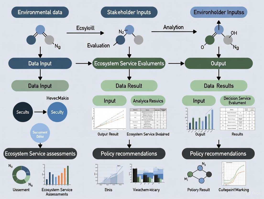
Figure 1: Data-Driven ES Assessment Workflow
Stakeholder-Based Perception Approach
Stakeholder-based evaluations capture human perceptions and expert knowledge through structured engagement processes to assess ES potential.
Experimental Protocol: Stakeholder Perception Assessment
The comparative study in Portugal implemented this stakeholder-based approach through the following methodology [1]:
Stakeholder Recruitment: Engagement of diverse stakeholders from various sectors of society involved in ecosystem management.
Analytical Hierarchy Process (AHP): Implementation of a multi-criteria evaluation method with weights defined by stakeholders through the AHP. This structured technique organizes and analyzing complex decisions by quantifying the relative importance of each ES indicator [1].
Matrix-Based Valuation: Development of a matrix-based methodology reflecting stakeholders' ES perceptions and valuations for specific land cover classes for the reference year 2018 [1].
Comparative Analysis: Quantitative comparison between stakeholder perceptions and model-based ASEBIO index results to identify disparities and alignments [1].
Figure 2: Stakeholder-Based ES Assessment Workflow
Comparative Performance Analysis
Quantitative Results Comparison
The comparative assessment of both approaches revealed significant differences in ES potential estimates, with stakeholder-based assessments consistently yielding higher valuations across all ecosystem services.
Table 1: Comparative ES Potential Assessment (2018)
| Ecosystem Service | Data-Driven Model Results | Stakeholder Perception Results | Deviation | Alignment Level |
|---|---|---|---|---|
| Drought Regulation | Low to Moderate Potential | Significantly Higher Potential | Highest Contrast | Low Alignment |
| Erosion Prevention | Low to Moderate Potential | Significantly Higher Potential | High Contrast | Low Alignment |
| Climate Regulation | Declining Potential | Higher Potential | Moderate Contrast | Moderate Alignment |
| Habitat Quality | Mostly Stable Potential | Higher Potential | Moderate Contrast | Moderate Alignment |
| Pollination | Mostly Stable Potential | Higher Potential | Moderate Contrast | Moderate Alignment |
| Water Purification | Consistently High Potential | Slightly Higher Potential | Lower Contrast | High Alignment |
| Food Production | Mostly Stable Potential | Slightly Higher Potential | Lower Contrast | High Alignment |
| Recreation | Improved Potential | Slightly Higher Potential | Lower Contrast | High Alignment |
| Overall Average | Baseline | 32.8% Higher on Average | Significant Mismatch | Variable Alignment |
The overall deviation shows that stakeholder estimates were 32.8% higher on average than model-based results across all ecosystem services assessed [1].
Spatial and Temporal Pattern Analysis
The data-driven approach revealed distinct spatial and temporal patterns in ES potential across mainland Portugal between 1990 and 2018:
- Climate Regulation: Notable decline in Alentejo Central with improvement in Alto Minho [1]
- Water Purification: Improvement in 10 out of 23 northern regions, with declines in interior and southern regions [1]
- Habitat Quality: Increased in northern regions but declined in Lisbon metropolitan area and Alentejo Central [1]
- Drought Regulation: Showed the largest improvement, especially in central and southern regions [1]
- Metropolitan Areas: Lisbon and Porto showed minimal improvements, with Lisbon experiencing declines in six ES indicators [1]
The ASEBIO index values remained relatively stable over the timeline (0.33-0.35), with median values increasing from 0.27 in 1990 to 0.43 in 2018 [1].
Land Cover Contribution Analysis
The data-driven approach enabled precise quantification of how different land cover classes contribute to overall ES potential:
Table 2: Land Cover Contribution to ASEBIO Index (2018)
| Land Cover Class | Category | Contribution Level |
|---|---|---|
| Port Areas (1.2.3) | Artificial Surfaces | Lowest Contribution |
| Road and Rail Networks (1.2.2) | Artificial Surfaces | Moderate Contribution |
| Green Urban Areas (1.4.1) | Artificial Surfaces | Moderate Contribution |
| Rice Fields (2.1.3) | Agricultural Areas | Low Contribution |
| Agricultural with Natural Vegetation (2.4.3) | Agricultural Areas | High Contribution |
| Agro-forestry Areas (2.4.4) | Agricultural Areas | High Contribution |
| Moors and Heathland (3.2.2) | Forest & Seminatural | Highest Contribution |
| Average Forest & Seminatural Areas | Forest & Seminatural | Main Contributors |
Forest and seminatural areas were identified as the primary contributors to the ASEBIO index, with moors and heathland (3.2.2) exhibiting the highest values [1].
Research Toolkit: Essential Materials and Solutions
Table 3: ES Assessment Research Toolkit
| Research Tool | Function/Purpose | Application Context |
|---|---|---|
| CORINE Land Cover Data | Provides standardized land cover classification | Fundamental input for spatial modeling of ES indicators |
| InVEST Software | Spatial modeling tool for estimating ES and tradeoffs | Calculating ES indicators; planning and research applications |
| Analytical Hierarchy Process (AHP) | Multi-criteria decision making method with stakeholder-defined weights | Integrating stakeholder perceptions into ES valuation |
| GIS (Geographic Information Systems) | Visualization and spatial analysis of ES data | Essential for spatial assessment and mapping ES distribution |
| Constraint Programming Technique | Identifies all possible solutions to constraint satisfaction problems | Searching for admissible changes in product design to improve sustainability [2] |
| Cumulative Belief Rule-Based System (CBRBS) | Data-driven rule-base approach for forecasting environmental trends | Carbon emission trend forecasting with environmental regulation [3] |
Integrated Assessment Framework
The comparative analysis demonstrates that neither data-driven nor stakeholder-based approaches alone provide a complete ES assessment picture. An integrated framework that combines both methodologies offers the most comprehensive approach for ecosystem management and policy development.
The significant mismatch (32.8% average difference) identified between scientific models and human perceptions highlights the necessity of integrative strategies that incorporate both data-driven models and expert knowledge [1]. Such integrated approaches can help bridge the gap between quantitative models and human values, resulting in more balanced and inclusive decision-making processes for sustainable land-use planning [1].
The Critical Need for Integrated ES Evaluation in Policy and Management
Ecosystem services (ES) are the benefits humans derive from nature, crucial for sustaining well-being and economic activity [1]. The central challenge in modern ES evaluation lies in reconciling two distinct paradigms: data-driven spatial models and participatory stakeholder-based assessments [1]. This guide objectively compares these methodological "alternatives," framing them not as rivals but as complementary components for robust environmental decision-making.
Comparative Performance of ES Evaluation Approaches
The table below summarizes the core characteristics, performance data, and optimal applications of model-driven and stakeholder-driven evaluation methods.
| Feature | Data-Driven Models (e.g., InVEST, RUSLE) | Stakeholder-Based Assessments (e.g., Perceptual Surveys, AHP) |
|---|---|---|
| Core Principle | Quantifies ES via biophysical algorithms and spatial data [4] [1]. | Elicits values, preferences, and knowledge through structured engagement [5] [1]. |
| Primary Output | Spatially-explicit maps of ES indicators (e.g., water yield, carbon storage) [4] [1]. | Utility functions, trade-off preferences, and weights of ES importance [5] [1]. |
| Key Strength | Objectively identifies spatio-temporal trends and biophysical trade-offs [4]. | Captures social demand, local knowledge, and context-specific values [5]. |
| Key Limitation | May miss locally relevant, non-material services (e.g., cultural services) [5]. | Perceptions can systematically overestimate or misrepresent biophysical potential [1]. |
| Performance Gap | Quantitative Discrepancy: In Portugal, stakeholder-perceived ES potential was 32.8% higher on average than model outputs [1]. | Perceptual Bias: Largest contrasts were for regulating services (drought regulation, erosion prevention); smallest for provisioning services (food production) [1]. |
| Best Applications | National-scale tracking, baseline assessments, scenario forecasting [4]. | Local and regional planning, conflict resolution, understanding utility and trade-offs [5]. |
Detailed Experimental Protocols for ES Evaluation
Protocol 1: Spatial Modeling of Ecosystem Services
This protocol employs biophysical models to generate quantitative, map-based ES assessments [4] [1].
- Model Selection: Choose specialized models for target ES.
- Data Preparation: Collect primary input data. This typically includes:
- Land Use/Land Cover (LULC) maps (e.g., from CORINE) for all study years [1] [4].
- Climatic data (precipitation, evapotranspiration) from meteorological stations or reanalysis products [4].
- Soil data (depth, texture) from soil databases [4].
- Topographic data (slope, length) from Digital Elevation Models (DEMs) [4].
- Model Execution & Validation: Run models for each time point. Validate outputs using field-measured data where available, or through cross-comparison with established regional studies [4].
- Integration and Index Calculation: To create a unified score (e.g., an Integrated ES Index), use Principal Component Analysis (PCA). PCA objectively determines weights based on the contribution of each ES to total variance, avoiding subjective weighting [4].
This protocol quantifies how stakeholders perceive ES supply and value different service trade-offs [5] [1].
- Stakeholder Typology Identification: Categorize stakeholder groups relevant to the management context (e.g., farmers, conservationists, policy-makers, local communities) [5].
- Structured Engagement Design:
- Production Possibility Frontier (PPF) Elicitation: Present stakeholders with graphs depicting different trade-off curves (e.g., between agricultural intensity and freshwater ecological health). Ask them to select the shape that best matches their understanding of the system and to draw confidence intervals [5].
- Utility Function Elicitation: Using the selected PPF, ask stakeholders to mark their preferred point along the curve, representing their optimal trade-off [5].
- Analytical Hierarchy Process (AHP): Guide stakeholders through pairwise comparisons of different ES to derive weighted priority scores for each service [1].
- Data Synthesis: Analyze responses to quantify mean perceived PPF shapes, confidence intervals, and utility maxima across and within stakeholder groups. Use AHP results to create stakeholder-weighted ES potential maps [5] [1].
- Comparison with Models: Statistically compare stakeholder-derived ES potential scores (e.g., from AHP) with model-generated scores for the same land cover types to identify significant mismatches [1].
Workflow Visualization for Integrated ES Evaluation
The following diagram illustrates a synergistic workflow that integrates both model-driven and stakeholder-driven approaches to achieve a more holistic and policy-relevant assessment.
The table below lists key "research reagents"—critical datasets, models, and engagement tools—for conducting integrated ES evaluations.
| Tool/Resource | Function/Description | Relevant Protocol |
|---|---|---|
| InVEST (Integrated Valuation of Ecosystem Services and Tradeoffs) | A suite of spatial models for mapping and valuing multiple ES (e.g., water yield, carbon, habitat) [1]. | Spatial Modeling |
| RUSLE (Revised Universal Soil Loss Equation) | An empirical model for estimating annual soil loss due to water erosion [4]. | Spatial Modeling |
| CORINE Land Cover Maps | Standardized, Europe-wide LULC data; a primary input for many ES models [1]. | Spatial Modeling |
| Production Possibility Frontier (PPF) | An economic concept used to visualize and elicit stakeholder understanding of trade-offs between two competing ES [5]. | Stakeholder Elicitation |
| Analytical Hierarchy Process (AHP) | A multi-criteria decision-making method to derive stakeholder-based weightings for the importance of different ES [1]. | Stakeholder Elicitation |
| Principal Component Analysis (PCA) | A statistical technique used to objectively integrate multiple ES metrics into a single composite index (e.g., IESI) [4]. | Spatial Modeling, Integration |
| Optimal Parameter-based Geographical Detector (OPGD) Model | A statistical method to identify key driving factors (e.g., NDVI, slope) behind the spatial heterogeneity of ES [4]. | Spatial Modeling, Analysis |
The quantitative assessment of complex systems, whether in neurobiology, drug development, or ecosystem management, increasingly relies on two distinct yet complementary approaches: data-driven computational models and human perceptual judgment. Data-driven models utilize mathematical formalizations and physical properties to simulate biological systems, generating reproducible, quantitative predictions [6]. In parallel, stakeholder-based evaluations incorporate expert knowledge, contextual understanding, and perceptual reasoning to assess system behavior and outcomes. This comparative guide explores the theoretical basis of biophysical models and human perception across multiple scientific domains, examining their relative strengths, limitations, and appropriate contexts of use.
The tension between these approaches represents a fundamental challenge in scientific inference. As revealed in ecosystem services research, significant mismatches can occur between model-generated indicators and stakeholder perceptions, with experts overestimating model-based potential by an average of 32.8% across multiple ecosystem service indicators [7]. Similarly, in visual perception and drug development, the choice between simulation-based inference and human intuition carries profound implications for predictive accuracy, resource allocation, and ultimate success. This guide objectively compares the performance of biophysical modeling approaches against human perceptual assessments through experimental data, methodological protocols, and cross-domain analysis.
Theoretical Frameworks and Computational Approaches
Foundations of Biophysical Modeling
Biophysical modeling represents a class of computational approaches that simulate biological systems using mathematical formalizations of their physical properties. These models enable researchers to predict the influence of biological and physical factors on complex systems, bridging multiple scales from molecular interactions to whole-organism dynamics [6]. The fundamental strength of biophysical models lies in their ability to systematically integrate diverse experimental data, provide mechanistic explanations for observed phenomena, and generate testable hypotheses through in silico experimentation.
In neuroscience, detailed biophysical models of human cortical pyramidal neurons have uncovered how morpho-electrical properties shape signal processing, revealing mechanisms behind action potential generation, dendritic signaling, and information processing capabilities [8]. Similarly, in drug development, Model-Informed Drug Development (MIDD) employs quantitative frameworks to predict drug behavior, optimizing development from discovery through post-market surveillance [9]. These approaches share a common mathematical foundation in representing physical systems through formal computational structures that can be validated against experimental data.
The Role of Human Perception and Expert Judgment
Human perception and expert judgment provide an alternative framework for assessing complex systems, leveraging pattern recognition, contextual understanding, and intuitive reasoning that may elude purely algorithmic approaches. In ecosystem services assessment, stakeholder evaluations incorporate localized knowledge, value judgments, and qualitative assessments that complement purely quantitative models [10]. The perceptual system itself represents an evolved biological model that excels at certain types of inference, particularly in dealing with soft objects and complex physical interactions where explicit simulation may be computationally prohibitive [11].
Research in visual perception demonstrates that human observers excel at perceiving properties of soft objects like stiffness and mass, employing "intuitive physics" that combines sensory input with internal simulations of physical processes [11]. This perceptual capability suggests that human judgment embodies sophisticated inferential processes that can complement or validate computational approaches, particularly in domains characterized by high uncertainty, missing data, or complex contextual factors.
Comparative Analysis: Performance Across Domains
Ecosystem Services Evaluation
Ecosystem services assessment provides a revealing test case for comparing data-driven models with stakeholder perceptions. A comprehensive study in mainland Portugal evaluated eight ecosystem service indicators—including climate regulation, water purification, habitat quality, drought regulation, recreation, food production, erosion prevention, and pollination—using both spatial modeling approaches and stakeholder assessments through an Analytical Hierarchy Process [7].
Table 1: Ecosystem Services Assessment: Models vs. Stakeholder Perception
| Ecosystem Service | Stakeholder Overestimation | Alignment Between Approaches |
|---|---|---|
| Drought Regulation | Highest contrast | Lowest alignment |
| Erosion Prevention | High contrast | Low alignment |
| Water Purification | Close alignment | Highest alignment |
| Food Production | Close alignment | High alignment |
| Recreation | Close alignment | High alignment |
| Climate Regulation | Moderate contrast | Moderate alignment |
| Habitat Quality | Moderate contrast | Moderate alignment |
| Pollination | Moderate contrast | Moderate alignment |
The research demonstrated that all selected ecosystem services were overestimated by stakeholders compared to model-based assessments, with an average overestimation of 32.8% [7]. The greatest disparities occurred for drought regulation and erosion prevention, while water purification, food production, and recreation showed the closest alignment between modeling and perception. This pattern suggests that stakeholders may excel at assessing more tangible, directly observable services while struggling with complex processes involving hidden variables and nonlinear dynamics.
Neuroscience and Cellular Biophysics
In neuroscience, biophysical models have generated fundamental insights into human neuronal function that would be difficult to obtain through perceptual approaches alone. Detailed modeling of human layer 2/3 pyramidal neurons (HL2/3 PNs) has provided mechanistic explanations for four key experimental observations: (1) the steep "kinky" somatic/axonal action potentials; (2) accelerated propagation speed of excitatory postsynaptic potentials in dendrites; (3) the ability to reliably track high-frequency input modulations; and (4) effective transfer of theta frequencies from dendrite to soma [8].
Table 2: Biophysical Insights from Human Neuron Modeling
| Experimental Observation | Biophysical Mechanism | Computational Implication |
|---|---|---|
| Steep "kinky" action potentials | Large dendritic load on soma and axon initial segment | Enhanced temporal precision in spike initiation |
| Accelerated EPSP propagation | Morphology-dependent passive cable properties | Faster dendritic integration |
| High-frequency tracking capability | Reduced axonal initial segment load | Improved encoding of temporal patterns |
| Theta frequency transfer | Prominent h-channels in human dendrites | Rhythm-based processing advantages |
These biophysical insights reveal how human cortical neurons achieve their enhanced computational capabilities, including highly compartmentalized processing, sophisticated nonlinear operations through specialized dendritic currents, and increased capacity for parallel processing [8]. The models demonstrate how distinct human neuronal properties likely support advanced cognitive capabilities, including language, foresight, and creativity.
Drug Development and Toxicity Prediction
The pharmaceutical industry represents a domain where both modeling and expert judgment play crucial roles, with Model-Informed Drug Development (MIDD) increasingly complementing human decision-making. MIDD employs quantitative tools including Quantitative Structure-Activity Relationship (QSAR), Physiologically Based Pharmacokinetic (PBPK) modeling, semi-mechanistic PK/PD, population pharmacokinetics, exposure-response analysis, and quantitative systems pharmacology [9].
Table 3: Model-Informed Drug Development Tools and Applications
| MIDD Tool | Description | Primary Application Stage |
|---|---|---|
| QSAR | Computational modeling predicting biological activity from chemical structure | Early discovery, lead optimization |
| PBPK | Mechanistic modeling of physiology-drug interplay | Preclinical prediction, clinical trial design |
| Semi-mechanistic PK/PD | Hybrid approach characterizing drug pharmacokinetics and pharmacodynamics | Preclinical to clinical translation |
| PPK | Modeling variability in drug exposure among populations | Clinical development, dosage optimization |
| QSP/T | Integrative modeling combining systems biology and pharmacology | Target identification, toxicity prediction |
| AI/ML in MIDD | Data-driven prediction of molecular behavior and clinical outcomes | Throughout development pipeline |
The "fit-for-purpose" application of these tools across drug development stages has demonstrated significant efficiency improvements, including compressed discovery timelines from years to months and reduced clinical trial costs through optimized design [9]. For example, AI-driven drug discovery platforms have advanced candidates to Phase I trials in approximately 18 months compared to the typical 5-year timeline, while achieving clinical candidates with 10x fewer synthesized compounds in some cases [12].
Experimental Protocols and Methodologies
Biophysical Model Development Workflow
The development of biophysically detailed models follows a systematic methodology that integrates experimental data with computational frameworks. A representative protocol for constructing a Hodgkin-Huxley-based model of C. elegans body-wall muscle cells illustrates this process [13]:
Figure 1: Biophysical Model Development Workflow
Experimental Phase: Voltage clamp and mutant experiments identify key ion channels and characterize their dynamics. For C. elegans muscle cells, this involved identifying L-type voltage-gated calcium channels (EGL-19) and potassium channels (SHK-1, SLO-2) as crucial for action potential generation [13]. Researchers conduct electrophysiological recordings using whole-cell patch clamp configurations with fire-polished borosilicate pipettes (resistance 4-6 MΩ), digitizing data at 10-20 kHz with 2.6 kHz filtering.
Model Construction Phase: Experimental data informs the development of Hodgkin-Huxley-based models for individual ion channels, which are subsequently integrated to simulate overall cellular electrical activity. The C. elegans muscle model incorporated detailed current dynamics for each channel based on voltage clamp data [13].
Parameter Estimation Phase: Simulation-based inference methods with parallel sampling determine free parameters by fitting model responses to experimental data under specific stimuli. Bayesian frameworks efficiently explore high-dimensional parameter spaces, identifying regions consistent with experimental observations while quantifying parameter uncertainty [13].
Validation and Application Phase: The validated model predicts cellular responses under novel conditions, including various current stimuli and genetic manipulations, enabling investigation of system properties like optimal response frequencies and functional implications [13].
Human Perception Assessment Protocols
Assessing human perceptual capabilities employs rigorous psychophysical methods that quantify performance under controlled conditions. A representative protocol for evaluating soft object perception illustrates this approach [11]:
Stimulus Generation: Researchers create controlled animations of soft objects (e.g., cloths) undergoing naturalistic transformations across different scene configurations, including "ramp" (solid object colliding with hanging cloth), "drape" (cloth falling on a frame), "rotate" (cloth spinning with table), and "wind" (cloth blowing in wind) [11]. Each animation embodies specific physical parameters (e.g., five stiffness levels, four mass levels) through physics-based simulation.
Experimental Design: Participants perform matching tasks where they identify which of two test animations matches a target animation on a specific property (stiffness or mass). All animations display simultaneously and replay automatically until response, ensuring adequate viewing time [11].
Model Comparison: Human performance compares against computational models including deep neural networks (bottom-up feature extraction) and simulation-based models (intuitive physics approaches). Models are performance-calibrated to ensure comparable overall accuracy, enabling focused comparison of error patterns rather than raw performance [11].
Data Analysis: Researchers quantify accuracy, error patterns, and specific failure modes across conditions, assessing which computational framework best predicts human perceptual patterns including both successes and characteristic failures.
Signaling Pathways and Computational Mechanisms
Ion Channel Dynamics in Cellular Excitability
Biophysical models of cellular electrical activity rely on precise characterization of ion channel dynamics and their interactions. The C. elegans body-wall muscle cell model exemplifies how multiple conductances integrate to generate action potentials and rhythmic activity [13]:
Figure 2: Ion Channel Dynamics in C. Elegans Muscle Cells
This integrated mechanism reveals how calcium-mediated action potentials emerge in nematode muscle cells despite the absence of voltage-gated sodium channels, with the model predicting an optimal response frequency of 3-10 Hz corresponding to burst firing rather than regular firing modes [13]. The balance between depolarizing calcium currents and repolarizing potassium currents creates rhythmic activity patterns essential for locomotion.
Dendritic Computation in Human Cortical Neurons
Human cortical pyramidal neurons employ sophisticated dendritic mechanisms that enhance their computational capabilities beyond typical model systems. Biophysical modeling reveals specialized signaling pathways in human L2/3 pyramidal neurons [8]:
Enhanced Backpropagation and Theta Transfer: Prominent h-channels in human dendrites facilitate theta-frequency (4-8 Hz) input transfer from dendrites to soma, enabling rhythm-based processing potentially relevant to memory and cognitive functions. Power spectrum analysis demonstrates significantly enhanced somatic response to theta inputs when h-channels are incorporated in models [8].
Dendritic Compartmentalization and Nonlinear Processing: Human neurons exhibit increased functional compartmentalization, with dendrites capable of local nonlinear transformations through specialized currents. This architecture supports parallel processing and enables sophisticated computations including XOR operations at the single-cell level [8].
Accelerated Synaptic Integration: Morphological adaptations reduce the functional distance between distal synapses and the soma, accelerating EPSP propagation through optimized cable properties. This allows human neurons to maintain rapid integration despite their physical size [8].
High-Frequency Tracking: Reduced axonal initial segment load enables reliable tracking of high-frequency input modulations (up to 200 Hz), enhancing temporal coding capabilities potentially relevant for speech processing and other rapid temporal patterns [8].
Table 4: Essential Research Tools for Biophysical Modeling and Perception Studies
| Resource Category | Specific Tools/Platforms | Function and Application |
|---|---|---|
| Simulation Platforms | NEURON, GENESIS, Brian | Simulating neuronal dynamics and networks |
| Molecular Modeling | Schrödinger, AutoDock | Predicting molecular interactions and drug-target binding |
| AI-Driven Discovery | Exscientia, Insilico Medicine, Recursion | Accelerating target identification and compound optimization |
| Ecosystem Services Modeling | InVEST, ARIES | Mapping and quantifying ecosystem service provision |
| Electrophysiology | MultiClamp amplifier, Clampex software | Recording cellular electrical activity with high temporal resolution |
| Imaging and Microscopy | Two-photon microscopy, 3D laser scanning | Visualizing cellular structure and dynamic processes |
| Psychophysical Testing | Custom MATLAB/Python scripts, PsychoPy | Quantifying human perceptual capabilities under controlled conditions |
Emerging Technologies and Methodologies
Federated Learning and Privacy-Preserving AI: Secure collaborative platforms enable multi-institutional model development without sharing sensitive data, using approaches like federated learning and Trusted Research Environments (TREs) [14]. These technologies address data privacy concerns while leveraging diverse datasets for improved model performance.
Probabilistic Programming for Perception Modeling: Advanced probabilistic programming frameworks enable implementation of simulation-based cognitive models that incorporate intuitive physics, such as the Woven model for soft object perception [11]. These approaches formally represent uncertainty and infer underlying physical properties from sensory data.
High-Throughput Electrophysiology: Automated patch clamp systems and multi-electrode arrays enable large-scale characterization of electrical properties across cell types and conditions, generating comprehensive datasets for model parameterization and validation [13].
Multi-modal Data Integration: Platforms combining transcriptomic, morphological, electrophysiological, and connectomic data enable development of increasingly comprehensive models, such as the NextBrain atlas providing probabilistic mapping of 333 human brain regions [6].
The comparative analysis of biophysical models and human perception reveals a complex landscape where each approach offers distinct advantages depending on context, domain, and specific scientific question. Data-driven models excel in reproducibility, scalability, and mechanistic insight, while human perception provides robust inference under uncertainty, contextual integration, and intuitive pattern recognition.
The most promising path forward involves integrative strategies that leverage the strengths of both approaches while mitigating their respective limitations. In ecosystem services, combining spatial modeling with stakeholder input creates more balanced decision-making [7]. In drug development, the "fit-for-purpose" application of modeling tools within expert-driven frameworks optimizes development efficiency [9]. In neuroscience, biophysical models generate testable hypotheses about human neuronal function that can be validated through experimental investigation [8].
This synthesis suggests that the fundamental theoretical basis for scientific advancement lies not in choosing between modeling and perception, but in developing frameworks for their appropriate integration—creating a dialogue between data-driven prediction and human understanding that advances our capacity to address complex scientific challenges.
Ecosystem services (ES), defined as the direct and indirect contributions of ecosystems to human well-being, are fundamental to economic and social stability [15]. The conceptual framework for these services was significantly advanced by the United Nations' Millennium Ecosystem Assessment (MA), which categorized them into four primary types: provisioning, regulating, cultural, and supporting services [16]. This classification system provides a vital lens for understanding the multifaceted benefits that nature provides, from the food we eat to the climate regulation that makes our planet habitable. As anthropogenic pressures on the environment intensify, the accurate assessment of these services has become imperative for sustainable ecosystem management [1] [15].
A central challenge in modern ES research lies in the methodological approaches used for evaluation. Currently, a significant disparity exists between data-driven spatial models that quantify ES using biophysical data and stakeholder-based assessments that capture local knowledge and perceptions of ES value [1]. Scientific literature highlights a growing recognition that involving stakeholders from various sectors is necessary for a comprehensive understanding of ES, even when their perceptions diverge from model-based outputs [1]. This guide provides a comparative analysis of these two evaluation paradigms, offering researchers a framework to select appropriate methodologies based on their specific research objectives, spatial scales, and the types of ecosystem services under investigation.
Categorizing Ecosystem Services
The Millennium Ecosystem Assessment's classification system offers a standardized structure for understanding and comparing different ecosystem services. The table below details the four categories, their specific benefits, and examples.
Table 1: Categories of Ecosystem Services as Defined by the Millennium Ecosystem Assessment
| Service Category | Description | Specific Benefits | Examples |
|---|---|---|---|
| Provisioning Services | Tangible products obtained from ecosystems [16] [15]. | Food, water, and material provision. | Fruits, vegetables, timber, fish, livestock, natural gas, oils, medicinal resources [16] [15]. |
| Regulating Services | Benefits from the regulation of natural ecosystem processes [16] [15]. | Climate regulation, hazard mitigation, and pollination. | Air and water purification, climate regulation, erosion and flood control, pollination [16] [15]. |
| Cultural Services | Non-material benefits obtained from ecosystems [16] [15]. | Intellectual, spiritual, and recreational enrichment. | Recreational opportunities, aesthetic enjoyment, cultural heritage, scientific discovery [16]. |
| Supporting Services | Fundamental natural processes necessary for the production of all other ES [16]. | Sustains basic life forms and ecosystem functionality. | Photosynthesis, nutrient cycling, soil formation, water cycle [16]. |
Comparative Analysis: Data-Driven Models vs. Stakeholder Perceptions
Quantitative Comparison of Assessment Outcomes
A 2024 national-scale study in Portugal provides compelling experimental data for directly comparing model-based and stakeholder-based ES evaluations. The research calculated eight multi-temporal ES indicators using a spatial modeling approach and integrated them into a novel ASEBIO index, which was then contrasted against the ES potential perceived by stakeholders for the same region [1].
Table 2: Modeled vs. Perceived Ecosystem Service Potential in Mainland Portugal (2018)
| Ecosystem Service | Stakeholder Perception vs. Model Discrepancy | Alignment Classification |
|---|---|---|
| Drought Regulation | High contrast (Among the highest overestimations by stakeholders) | Low Alignment |
| Erosion Prevention | High contrast (Among the highest overestimations by stakeholders) | Low Alignment |
| Water Purification | Closely aligned | High Alignment |
| Food Production | Closely aligned | High Alignment |
| Recreation | Closely aligned | High Alignment |
| Climate Regulation | Overestimated by stakeholders | Moderate Alignment |
| Habitat Quality | Overestimated by stakeholders | Moderate Alignment |
| Pollination | Overestimated by stakeholders | Moderate Alignment |
| Overall Average | Stakeholder estimates 32.8% higher on average | Moderate Disparity |
Experimental Protocols for Ecosystem Service Assessment
Data-Driven Spatial Modeling Protocol
The methodology for the data-driven approach, as implemented in the Portuguese case study, involves a multi-step spatial analysis process [1].
- Step 1: Land Cover Data Acquisition. The process begins with acquiring spatial land cover data. The Portuguese study utilized CORINE Land Cover maps for the reference years 1990, 2000, 2006, 2012, and 2018 to track changes over a 28-year period [1].
- Step 2: Biophysical Modeling of ES Indicators. Researchers then calculate specific ES indicators using spatial modeling tools. Studies often employ software like the Integrated Valuation of Ecosystem Services and Tradeoffs (InVEST), a widely used spatial modeling tool that estimates ES based on land cover and other biophysical data [1].
- Step 3: Multi-Criteria Index Integration. The individual ES indicators are integrated into a composite index. The Portuguese study developed the ASEBIO (Assessment of Ecosystem Services and Biodiversity) index, which combines the eight ES indicators using a multi-criteria evaluation method [1].
- Step 4: Spatial and Temporal Analysis. The final step involves analyzing the resulting index to understand spatiotemporal changes, trade-offs, and synergies between different ecosystem services across the landscape [1].
Stakeholder Perception Assessment Protocol
The stakeholder-based evaluation employs social science methodologies to capture expert and local knowledge [1].
- Step 1: Stakeholder Identification and Recruitment. Identify and recruit a diverse group of stakeholders from various sectors of society relevant to ecosystem management. This ensures a comprehensive understanding of ES values [1].
- Step 2: Matrix-Based Valuation. Elicit stakeholders' perceptions of the ES supply potential for different land cover types. This is often done using a matrix-based methodology where stakeholders assign values [1].
- Step 3: Analytical Hierarchy Process (AHP). Implement a structured technique for organizing and analyzing complex decisions. Stakeholders use the AHP to define weights that reflect the relative importance of each ecosystem service's supply potential, which are then used in models like the ASEBIO index [1].
- Step 4: Qualitative Analysis (Q Methodology). In some studies, employ Q methodology, a mixed-methods approach used to systematically study human subjectivity, such as perspectives on landscape services or ES demand [17].
Figure 1: Workflow for Integrated ES Assessment Combining Data-Driven and Stakeholder-Based Methods.
The Researcher's Toolkit for Ecosystem Service Assessment
Table 3: Essential Research Tools and Reagents for Ecosystem Services Assessment
| Tool/Reagent | Type/Platform | Primary Function in ES Research |
|---|---|---|
| InVEST | Software Suite (Integrated Valuation of Ecosystem Services and Tradeoffs) | Spatial modeling to estimate and map ecosystem services based on land cover data [1]. |
| ARIES | Modeling Platform (Artificial Intelligence for Ecosystem Services) | Data-driven, probabilistic modeling of ecosystem services using artificial intelligence [18]. |
| CORINE Land Cover | Spatial Data | Provides standardized land cover maps for tracking changes in ecosystem service potential over time [1]. |
| Analytical Hierarchy Process (AHP) | Methodological Framework | Structured technique for capturing stakeholder-derived weights for the relative importance of different ES [1]. |
| Q Methodology | Social Science Approach | Systematic study of human subjectivity to understand stakeholder perspectives and socio-cultural values of ES [17]. |
| Viz Palette | Accessibility Tool | Online tool to test color palettes in data visualizations for accessibility to audiences with color vision deficiencies [19]. |
Implications for Research and Decision-Making
The comparative analysis reveals that the choice between data-driven models and stakeholder-based assessments is not merely technical but fundamentally shapes ES valuation outcomes. The 32.8% average overestimation by stakeholders, with particularly high contrasts for regulating services like drought regulation and erosion prevention, underscores a critical communication gap between scientific quantification and human perception [1]. This disparity highlights the risk of relying exclusively on a single methodology, as policymaking based solely on models may not reflect stakeholder values, while planning based only on perceptions may overlook biophysical realities.
Integrative assessment strategies that combine scientific modeling with expert knowledge are essential for effective ES management and land-use planning [1]. The workflows and tools detailed in this guide provide a pathway for researchers to bridge this gap, fostering more balanced and inclusive environmental decision-making. Future research should focus on standardizing these integrative protocols across different geographical and cultural contexts to advance the field of ecosystem service valuation.
Figure 2: Relationship Between Data-Driven and Stakeholder-Based ES Assessment Approaches.
Global Trends and the Rising Importance of ES in Sustainability Agendas
Ecosystem services (ES), the benefits humans derive from nature, are fundamental to sustainable development and human well-being. The evaluation of these services is critical for informed decision-making, yet the field is characterized by two distinct, and often divergent, methodological approaches: data-driven spatial modeling and stakeholder-based perception studies. Data-driven approaches rely on biophysical data and computational models to quantify ES, offering objectivity and reproducibility. In contrast, stakeholder-based methods capture the perceptions, values, and knowledge of people, providing crucial context and revealing perceived importance that models might miss. Framed within a broader thesis on the merits and limitations of these two paradigms, this guide objectively compares their performance, supported by experimental data. This comparison is particularly relevant for researchers and drug development professionals who routinely navigate the complex interplay between quantitative data and human-centric evidence in their fields, such as in the integration of randomized controlled trials (RCTs) and real-world evidence (RWE) [20] [21]. Understanding how to balance these approaches is key to developing robust sustainability agendas and effectively managing environmental risks and opportunities.
Quantitative Comparison: Models vs. Stakeholder Perceptions
A 2024 national-scale study in Portugal provides a direct, quantitative comparison of data-driven models and stakeholder perceptions for evaluating ecosystem services. The research calculated eight ES indicators over a 28-year period and integrated them into a novel index (ASEBIO) using a multi-criteria evaluation method with weights defined by stakeholders. This was then compared against a matrix-based methodology reflecting stakeholders' direct perceptions of ES potential for the year 2018 [1].
Table 1: Measured Disparities Between Modeled and Perceived Ecosystem Service Potential [1]
| Ecosystem Service Indicator | Average Disparity (Stakeholder Perception vs. Model) | Alignment Classification |
|---|---|---|
| Drought Regulation | Significant Overestimation | Lowest Alignment |
| Erosion Prevention | Significant Overestimation | Low Alignment |
| Climate Regulation | Notable Overestimation | Moderate Alignment |
| Habitat Quality | Notable Overestimation | Moderate Alignment |
| Pollination | Notable Overestimation | Moderate Alignment |
| Water Purification | Closer Alignment | High Alignment |
| Food Production | Closer Alignment | High Alignment |
| Recreation | Closer Alignment | High Alignment |
| All Services (Average) | 32.8% Overestimation by Stakeholders | Moderate Misalignment |
The results, summarized in Table 1, reveal a significant mismatch, with stakeholder estimates being 32.8% higher on average than model-based calculations [1]. All selected ES were overestimated by stakeholders, but the degree of misalignment varied. Services like drought regulation and erosion prevention showed the highest contrasts, while water purification, food production, and recreation were more closely aligned. This demonstrates that the choice of assessment method can substantially influence the perceived state of ecosystem services, with direct implications for prioritization and resource allocation in sustainability strategies.
Experimental Protocols in Ecosystem Services Research
Data-Driven Spatial Modeling Protocol
The data-driven approach exemplified in the Portuguese study follows a rigorous, replicable protocol for quantifying ES [1].
- Step 1: Land Cover Data Acquisition and Processing: The foundation of the model is land cover cartography. The study used CORINE Land Cover data for the reference years 1990, 2000, 2006, 2012, and 2018. This data was classified and processed to create a consistent spatial timeline of landscape changes.
- Step 2: Calculation of ES Indicators: Eight distinct ES indicators were calculated using spatial modeling approaches. This involves applying algorithms and transfer functions that relate land cover classes and other biophysical data (e.g., soil type, rainfall) to the supply of specific ecosystem services. The study did not specify the exact software used, but tools like the InVEST (Integrated Valuation of Ecosystem Services and Tradeoffs) software are widely used for such applications [1].
- Step 3: Integration into a Composite Index (ASEBIO): The individual ES indicators were integrated into a single composite index. A multi-criteria evaluation method, the Analytical Hierarchy Process (AHP), was used. In this step, stakeholders were engaged to define weights reflecting the relative importance of each ecosystem service.
- Step 4: Spatiotemporal Analysis and Validation: The resulting index values were analyzed across space and time to identify trends, trade-offs, and synergies between services. Model outputs were validated against known ecological patterns and through statistical analysis of the distributions.
Stakeholder Perception Assessment Protocol
The stakeholder-based approach aims to capture human perspectives and values, which are not inherently present in geospatial data [1] [22].
- Step 1: Stakeholder Identification and Recruitment: A diverse group of stakeholders is selected, representing various sectors of society that interact with or are affected by the ecosystem (e.g., local residents, farmers, policymakers, NGO representatives).
- Step 2: Perception Elicitation: Stakeholders' perceptions of ecosystem service potential are collected. This can be done through structured surveys, interviews, or participatory workshops. A common method is the use of a matrix-based methodology, where stakeholders assign scores to different land cover types based on their perceived capacity to provide various ecosystem services.
- Step 3: Data Aggregation and Analysis: The individual scores from multiple stakeholders are aggregated to create a composite perception-based assessment. This can involve calculating averages or medians, and analyzing the data for consensus or divergence among different stakeholder groups.
- Step 4: Comparison with Biophysical Models: The final step, as performed in the Portuguese study, is to systematically compare the perception-based outputs with the results from the data-driven spatial models to identify and quantify disparities.
The Scientist's Toolkit: Key Reagents for ES Assessment
Table 2: Essential Research Reagents for Ecosystem Services Evaluation
| Research Reagent / Tool | Function in ES Assessment |
|---|---|
| CORINE Land Cover Data | Provides standardized, time-series spatial data on land use and land cover, serving as the foundational input for most spatial models of ES supply [1]. |
| InVEST Software | A suite of open-source, spatial models used to map and value ecosystem services. It helps quantify the biophysical supply of services and their economic value [1]. |
| Analytical Hierarchy Process (AHP) | A structured multi-criteria decision-making technique used to integrate stakeholder preferences by deriving weightings for different ES, enabling their integration into a composite index [1]. |
| Stakeholder Perception Matrix | A survey-based tool (often a table) used to systematically capture stakeholders' perceptions of the potential of different land cover types to deliver various ecosystem services [1] [22]. |
| Real-World Evidence (RWE) | In the context of drug development, RWE provides insights from data outside controlled trials, analogous to stakeholder perceptions in ES by offering a real-world, human-centric perspective that complements controlled experimental data [20] [21]. |
| Causal Machine Learning (CML) | Advanced analytical methods that combine machine learning with causal inference principles. In drug development, CML helps estimate treatment effects from RWD, similar to how advanced spatial statistics can infer causal links between land use and ES in complex models [20]. |
Global Trends Integrating Data and Stakeholder Perspectives
The global sustainability agenda in 2025 is increasingly demanding a reconciliation of data-driven and stakeholder-based approaches. Several key trends highlight this integration:
- Regulatory Pressure for Standardized Disclosure: The EU's Corporate Sustainability Reporting Directive (CSRD) is forcing companies to collect and disclose standardized sustainability data, placing a spotlight on metrics related to environmental impacts and dependencies, including ecosystem services [23] [24] [25]. This creates a direct need for robust, data-driven assessment methods.
- Supply Chain Resilience and Nature Risks: Companies are increasingly focusing on sustainability challenges across their supply chains, driven by climate shocks, extreme weather, and new due diligence directives like the CSDDD [23] [25]. Assessing these risks requires both spatial models to identify physical threats (e.g., drought risk to key commodities) and stakeholder engagement to understand social vulnerabilities and local impacts.
- The Rise of Green Innovation and AI: Sustainability is increasingly seen as a driver of innovation and growth. Artificial intelligence (AI) and big data analytics are being deployed to enhance the accuracy of ESG reporting and optimize resource use [23] [24]. Furthermore, causal machine learning techniques, pioneered in drug development, are emerging as powerful tools to derive more robust causal insights from complex observational data in sustainability science [20].
The parallel with drug development is instructive. Just as the field is moving beyond a sole reliance on Randomized Controlled Trials (RCTs) to incorporate Real-World Evidence (RWE) for a more comprehensive understanding of drug effects [20] [21], ecosystem services research must move beyond a false dichotomy between models and perceptions. The future lies in integrative strategies that leverage the objectivity and scalability of data-driven models with the contextual richness and value-laden insights of stakeholder perspectives [1] [22]. This will result in more balanced, inclusive, and effective decision-making for sustainable ecosystem management.
Tools of the Trade: Techniques for Quantifying and Qualifying ES
Ecosystem services (ES)—the benefits that humans derive from nature—are fundamental to human well-being and the global economy [1]. Accurately mapping and assessing these services is imperative for sustainable ecosystem management and informed policy decisions, particularly as they face increasing threats from anthropogenic pressure and land cover changes [1]. Within this field, a critical methodological divide exists, pitting data-driven modeling approaches against stakeholder-based evaluations. Data-driven approaches rely on quantitative spatial models and remote sensing data to produce objective, replicable maps of ES potential. In contrast, stakeholder-based methods incorporate expert and local knowledge to capture the perceived value and importance of ES, which may not always align with biophysical models [1] [26]. This guide provides a comparative analysis of these paradigms, using the novel ASEBIO index as a central example of an integrated model, to equip researchers and professionals with the knowledge to select and apply the most appropriate methodologies for their work.
Comparative Analysis: Data-Driven Models versus Stakeholder Perceptions
A landmark national-scale study in Portugal directly compared these approaches by calculating eight multi-temporal ES indicators using a spatial modeling approach, which were then integrated into the ASEBIO index. This index was subsequently contrasted against the ES potential perceived by stakeholders for the same region [1]. The following table summarizes the core quantitative findings of this comparison.
Table 1: Quantitative Comparison of Modeled vs. Perceived Ecosystem Service Potential in Portugal [1]
| Ecosystem Service | Modeled Potential (ASEBIO Index) | Stakeholder Perception | Alignment/Contrast |
|---|---|---|---|
| Overall Average | Based on spatial models & land cover | 32.8% higher on average | Significant mismatch |
| Drought Regulation | Modeled value | Greatly overestimated | Highest contrast |
| Erosion Prevention | Modeled value | Greatly overestimated | Highest contrast |
| Water Purification | Consistently high potential | Closely aligned | High alignment |
| Food Production | Mostly stable, slight declines | Closely aligned | High alignment |
| Recreation | Improved over time | Closely aligned | High alignment |
| Climate Regulation | Declined over time | Overestimated | Moderate misalignment |
| Habitat Quality | Mostly stable | Overestimated | Moderate misalignment |
The experimental protocol for this comparison involved several key stages. First, researchers calculated eight ES indicators for mainland Portugal for the years 1990, 2000, 2006, 2012, and 2018 using a spatial modeling approach based on CORINE Land Cover data [1]. These indicators were then integrated into the ASEBIO (Assessment of Ecosystem Services and Biodiversity) index. The ASEBIO index employs a multi-criteria evaluation method, with weights for each service defined by stakeholders through an Analytical Hierarchy Process (AHP), a structured technique for organizing and analyzing complex decisions [1]. Finally, the composed ASEBIO index for 2018 was quantitatively compared against a separate matrix-based methodology that reflected stakeholders' raw perceptions of ES potential, revealing the disparities quantified in Table 1.
The workflow below illustrates the experimental process and the point of comparison between the two paradigms.
Advanced Spatial Modeling Tools and Techniques
The scientific toolkit for data-driven ES assessment includes a variety of spatial modeling platforms, each with distinct strengths and applications. The following table catalogs key tools and datasets referenced in the literature.
Table 2: Research Reagent Solutions for Ecosystem Services Modeling
| Tool / Dataset Name | Type | Primary Function | Key Features / Applications |
|---|---|---|---|
| InVEST | Software Suite | Integrated ES and tradeoff analysis | Widely used for planning & research; models multiple ES (e.g., carbon, water yield) [1] [27]. |
| SWAT | Hydrological Model | Watershed-scale water resource simulation | Assesses impacts of land use & climate on water provision, sediment, and nutrients [28]. |
| ARIES | Modeling Platform | Rapid ES assessment and valuation | Used for creating global ensembles of ES models like carbon storage [27]. |
| Co$ting Nature | Web Tool | ES mapping and policy analysis | Models ES provision for conservation planning; used in global model ensembles [27]. |
| CORINE Land Cover | Spatial Dataset | Land use/land cover inventory | Foundational input for spatial models; used in ASEBIO index calculation [1]. |
| LUCI | Spatial Tool | ES modeling for landscapes | Compared against InVEST and NC-Model for assessing urban ES [29]. |
Addressing Uncertainty with Model Ensembles
A significant challenge in data-driven modeling is the "certainty gap"—the lack of knowledge about model accuracy. Different models can produce variable projections, making it difficult for practitioners to know which to trust [27]. To address this, researchers are increasingly using model ensembles, which combine the outputs of multiple models.
Global studies have demonstrated that ensembles of models for ES like water supply, carbon storage, and fuelwood production are consistently 2% to 14% more accurate than any individual model chosen at random [27]. This approach distributes accuracy more equitably across the globe, ensuring that data-poor regions do not suffer an "accuracy penalty" [27]. Furthermore, the variation among models in an ensemble can itself serve as a useful indicator of uncertainty when validation data are absent [27].
Methodological Protocols for Integrated Assessment
The following workflow details the protocol for creating an integrated assessment like the ASEBIO index, which combines data-driven and stakeholder elements.
Step 1: Data Acquisition and Spatial Modeling This foundational step involves gathering input data, such as land cover maps (e.g., CORINE) and remote sensing imagery. Subsequently, spatial models like InVEST or SWAT are run to calculate biophysical indicators for multiple ecosystem services across the study area and over a defined time period [1].
Step 2: Stakeholder Engagement and Weighting A diverse group of stakeholders is selected to participate in surveys and structured decision-making processes like the Analytical Hierarchy Process (AHP). The AHP is used to elicit stakeholders' preferences and derive relative weights for each ecosystem service, reflecting their perceived importance [1] [26].
Step 3: Multi-Criteria Synthesis The modeled ES indicators from Step 1 and the stakeholder-derived weights from Step 2 are integrated using a Multi-Criteria Evaluation (MCE) method. This synthesis produces a composite index, such as ASEBIO, which represents the integrated ES potential of the landscape [1].
Step 4: Validation and Uncertainty Analysis The final composite index is validated against independent data or, as in the Portuguese study, directly compared against raw stakeholder perceptions to identify mismatches and quantify uncertainty. This step is crucial for interpreting the results and understanding the limitations of the assessment [1] [27].
The comparison between data-driven models and stakeholder-based evaluations reveals that neither approach is superior; rather, they offer complementary insights. Data-driven models provide objective, spatially-explicit baselines and can track changes over time, but may overlook services that are culturally important or difficult to quantify. Stakeholder perceptions capture the lived experience and value systems of people, but can be influenced by cognitive biases and may over or underestimate actual biophysical potential [1] [26].
The choice between methodologies should be guided by the project's goal:
- Use data-driven models for objective mapping, monitoring temporal trends, and identifying biophysical trade-offs between ES.
- Use stakeholder-based evaluations to understand perceived value, prioritize actions for social license, and resolve conflicts in management.
- Integrate both approaches, as demonstrated by the ASEBIO index, when the objective is to create inclusive, legitimate, and comprehensive management plans that are robust both scientifically and socially.
The emerging practice of using model ensembles and openly sharing ES data helps bridge the "capacity gap" and "certainty gap," particularly in data-poor regions [27]. By understanding the strengths and limitations of each paradigm, researchers and practitioners can more effectively leverage these tools to support sustainable ecosystem management and policy.
In the field of ecosystem services (ES) evaluation and environmental decision-making, a fundamental tension exists between quantitative, model-driven approaches and qualitative, stakeholder-based assessments. While spatial models provide replicable, data-rich insights into ES potential, they often fail to capture the nuanced perceptions and values that stakeholders assign to these services [1]. This methodological divide presents a critical challenge for researchers, scientists, and drug development professionals who must integrate technical data with human perspectives to formulate effective, sustainable policies. The pursuit of a purely objective, data-driven evaluation often overlooks the complex socio-ecological contexts that ultimately determine policy acceptance and implementation success.
Two methodological approaches have emerged as central to bridging this divide: traditional Participatory Workshops and the structured multi-criteria decision-making framework of the Analytical Hierarchy Process (AHP). Participatory Workshops offer a platform for inclusive dialogue and knowledge sharing, directly capturing stakeholder values and perceptions. Conversely, AHP provides a mathematical foundation for integrating diverse perspectives through pairwise comparisons, transforming subjective judgments into quantifiable priorities [30] [31]. A recent national-scale study in Portugal highlighted the critical nature of this integration, revealing a significant 32.8% average overestimation of ecosystem service potential by stakeholders compared to spatial models, with particularly stark contrasts in drought regulation and erosion prevention [1]. This demonstrates the tangible consequences of methodological selection on research outcomes and subsequent decision-making.
Methodological Comparison: Participatory Workshops versus AHP
The following table provides a structured comparison of these two stakeholder engagement methods, highlighting their distinct characteristics, applications, and limitations.
Table 1: Comparative Analysis of Participatory Workshops and the Analytical Hierarchy Process
| Feature | Participatory Workshops | Analytical Hierarchy Process (AHP) |
|---|---|---|
| Core Approach | Collaborative, open-ended discussion and knowledge sharing [32]. | Structured, mathematical pairwise comparisons of criteria and alternatives [30] [33]. |
| Primary Strength | Fosters inclusive dialogue, builds relationships, and captures rich qualitative context [32]. | Provides quantitative prioritization, reduces cognitive bias, and ensures decision traceability [30] [31]. |
| Key Limitation | Susceptible to dominance by vocal stakeholders; outcomes can be subjective and difficult to quantify [32]. | Can be perceived as complex; relies on the consistent judgment of participants during comparisons [30]. |
| Output | Qualitative insights, shared understanding, and identified areas of agreement or conflict [32]. | Quantified weightings for criteria and alternatives, and a ranked list of priorities [30] [1]. |
| Ideal Application Context | Exploring complex problems, building stakeholder consensus, and scoping issues in early project phases [32]. | Selecting and prioritizing projects, evaluating policy alternatives, and integrating diverse expert opinions [30] [1]. |
| Handling of Conflict | Through facilitated discussion and negotiation [32]. | Through mathematical aggregation of judgments and consistency measurement [31]. |
Workflow and Process
The fundamental difference between these methods becomes evident in their operational workflows. The diagram below illustrates the typical stages involved in each process, from initial planning to final outcome.
Experimental Protocols and Case Study Applications
Protocol for a Hybrid AHP-Participatory Study
The following workflow details a specific protocol for integrating AHP with participatory elements, as demonstrated in a national ecosystem services assessment [1]. This hybrid approach is designed to leverage the strengths of both methods.
Case Study: The Portugal National Ecosystem Services Assessment
A seminal 2024 study in Portugal provides a robust experimental framework for comparing model-driven and stakeholder-based evaluations [1]. The study calculated eight ecosystem service indicators (e.g., climate regulation, water purification, habitat quality) for mainland Portugal from 1990 to 2018 using spatial modeling based on CORINE Land Cover data. Concurrently, stakeholders representing various sectors were engaged to assign relative importance weights to these ES indicators using the AHP method. These weights were used to create a novel composite index—the ASEBIO (Assessment of Ecosystem Services and Biodiversity) index.
The key experimental findings from this comparative assessment are summarized in the table below.
Table 2: Key Experimental Results from the Portugal ES Assessment Case Study [1]
| Experimental Metric | Finding | Implication |
|---|---|---|
| Average Discrepancy | Stakeholder perceptions overestimated ES potential by 32.8% on average compared to spatial models. | Highlights a significant optimism bias in human perception that must be accounted for in policy. |
| Highest Contrast ES | Drought regulation and erosion prevention showed the largest model-perception gaps. | Suggests stakeholders may undervalue the complexity of modeling these specific services. |
| Most Aligned ES | Water purification, food production, and recreation were most closely aligned. | Indicates services with more direct human experience are better understood by stakeholders. |
| Primary Contributors | Water purification and recreation were the largest contributors to the final ASEBIO index. | Demonstrates how AHP quantifies stakeholder values, shifting focus from pure biophysical output. |
The Scientist's Toolkit: Essential Reagents and Materials
Successful implementation of these stakeholder engagement methods requires a suite of conceptual and practical tools. The following table outlines the key "research reagents" essential for conducting robust Participatory Workshop and AHP studies.
Table 3: Essential Research Reagents and Materials for Stakeholder Engagement Studies
| Item/Tool | Function/Description | Application Context |
|---|---|---|
| Saaty's 1-9 Comparison Scale | A fundamental scale for pairwise comparisons, converting subjective preferences into numerical values (1=equal importance, 9=extreme importance) [30]. | Core to AHP for building pairwise comparison matrices and deriving weights. |
| Pairwise Comparison Matrix (PCM) | A positive, reciprocal matrix (aij = 1/aji) where elements represent the relative importance of one item over another [31]. | Used in AHP to structure evaluator judgments. The core input for mathematical prioritization. |
| Consistency Ratio (CR) | A metric to measure the logical coherence of judgments in a PCM. A CR < 0.1 is generally acceptable, ensuring evaluator judgments are transitive [31]. | A critical quality control check in AHP to identify and exclude inconsistent evaluations from analysis. |
| Stakeholder Engagement Assessment Matrix | A framework (often a table) to map stakeholders according to their current vs. desired level of engagement (e.g., Unaware, Resistant, Neutral, Supportive, Leading) [32]. | Used in participatory approaches for planning and monitoring engagement strategies, though it can be oversimplified [32]. |
| Interest/Influence/Impact (III) Mapping | A multi-criteria stakeholder analysis method that assesses stakeholders based on their interest in, influence over, and impact from a project [32]. | A robust alternative to simple engagement matrices for prioritizing stakeholders in participatory processes. |
| Sentiment Analysis Tools | AI-driven software that automatically analyzes stakeholder comments, emails, and transcripts to determine positive, negative, or neutral sentiment [32]. | Provides a quantitative measure of stakeholder perception and support, complementing qualitative workshop data. |
The comparative analysis reveals that Participatory Workshops and the Analytic Hierarchy Process are not mutually exclusive but are, in fact, highly complementary. The Portuguese case study demonstrates that an integrated strategy, which incorporates scientific modeling with structured stakeholder knowledge, is essential for effective ecosystem assessments and land-use planning [1]. While models provide critical, data-driven baselines, AHP offers a rigorous mechanism to incorporate human values and preferences into the final decision-making matrix. Participatory workshops remain vital for fostering the dialogue, building trust, and providing the qualitative context that purely numerical approaches lack.
For researchers and scientists, the key takeaway is that the choice between a data-driven and a stakeholder-based evaluation is a false dichotomy. The most robust and actionable outcomes emerge from methodologies that strategically blend both paradigms, using AHP to quantitatively structure stakeholder input and participatory techniques to ensure the process remains inclusive and contextually grounded. This hybrid approach promises to bridge the perceptional gaps identified in research and pave the way for more balanced, legitimate, and ultimately successful environmental and development decisions.
The Role of Land Cover Data (e.g., CORINE) in Spatial Modeling
Spatial modeling of ecosystem services (ES) is fundamental to environmental monitoring, climate change assessment, and sustainable land use planning [34]. The CORINE (Coordination of Information on the Environment) Land Cover (CLC) program, a flagship component of the European Union's Copernicus Land Monitoring Service, has provided standardized, pan-European land cover inventories for over three decades [34]. With 44 thematic classes and regular updates every six years, CLC offers a consistent dataset for transnational environmental analysis [34]. However, a critical scholarly debate examines the comparative effectiveness of purely data-driven spatial models versus approaches that integrate stakeholder-based evaluations. This guide explores the role of CLC within this context, objectively comparing its performance with other data sources and methodologies to illuminate its strengths and limitations in spatial modeling applications.
CORINE Land Cover: Technical Specifications and Applications
The CORINE Land Cover program was initiated in the 1980s to address the challenge of inconsistent and incomparable national land cover maps across European borders [34]. Its primary objective was to enable continental-scale environmental monitoring through a harmonized methodology.
Table 1: Key Technical Specifications of CORINE Land Cover
| Feature | Specification |
|---|---|
| Thematic Classes | 44 classes, ranging from broad forested areas to individual vineyards [34] |
| Update Frequency | Every 6 years (most recent update in 2018) [34] |
| Spatial Coverage | Pan-European [34] |
| Time Series | Available for 1990, 2000, 2006, 2012, and 2018 [35] [7] |
| Primary Applications | Environmental monitoring, land use planning, climate change assessments, emergency management [34] |
CLC data serves as a critical input for spatial models predicting various ecosystem phenomena. For instance, one study of Thessaloniki, Greece, used CLC alongside Landsat 8 time series data and vegetation indices to analyze the correlation between land cover types and Land Surface Temperature (LST) trends [36]. The research identified a gradual increase in average surface temperature, particularly in 2022 and 2023, with mean annual LST values reaching 26.07°C and 27.09°C, respectively [36]. This demonstrates CLC's utility in quantifying and modeling urban climate dynamics.
Comparative Performance: Data-Driven Models vs. Stakeholder-Based Evaluations
A central thesis in contemporary ecosystem services research concerns the relative value of data-driven spatial models versus evaluations based on local stakeholder knowledge. A national-scale study in Portugal offers compelling experimental data for this comparison, revealing significant disparities between these approaches.
The research calculated eight multi-temporal ES indicators using a spatial modeling approach based on CORINE Land Cover and other data, integrating them into a novel ASEBIO index (Assessment of Ecosystem Services and Biodiversity) [7]. This data-driven index was then compared against stakeholders' perceptions of ES potential for the year 2018 [7].
Table 2: Modeled vs. Perceived Ecosystem Service Potential in Portugal [7]
| Ecosystem Service | Stakeholder Overestimation (Average) |
|---|---|
| All Selected ES | 32.8% higher on average |
| Drought Regulation | Highest contrast (specific value not provided) |
| Erosion Prevention | Highest contrast (specific value not provided) |
| Water Purification | Most closely aligned |
| Food Production | Most closely aligned |
| Recreation | Most closely aligned |
The results indicate a systematic overestimation by stakeholders compared to the model outputs, with drought regulation and erosion prevention showing the largest discrepancies [7]. This mismatch highlights the potential for skewed resource allocation if management decisions were based solely on perception. The study concluded that integrative strategies considering both scientific models and expert knowledge are essential for more effective ES assessments and land-use planning [7].
Methodological Protocols for Land Cover-Based Assessment
Employing CLC data in research requires rigorous methodologies to ensure valid and reliable results. The following experimental protocols are commonly cited in the literature.
Spatial Modeling of Ecosystem Services
The Portuguese study on the ASEBIO index exemplifies a robust data-driven methodology [7]:
- Indicator Calculation: Eight distinct ES indicators (e.g., climate regulation, habitat quality, food provisioning) were calculated for mainland Portugal for 1990, 2000, 2006, 2012, and 2018.
- Spatial Modeling: A spatial modeling approach was used, supported by CORINE Land Cover cartography and other data.
- Index Integration: The individual ES indicators were integrated into the composite ASEBIO index using a multi-criteria evaluation method.
- Weight Assignment: Weights defining the relative importance of each service were assigned by stakeholders through an Analytical Hierarchy Process (AHP).
Spatial Text-Mining of Local Knowledge
An alternative, qualitative methodology was applied in a study of Upo Wetland in South Korea, demonstrating a stakeholder-based approach [37]:
- Data Collection: Local knowledge and perceptions of residents regarding 17 ecological assets were collected through surveys conducted by the Upo Ecotourism Association.
- Morphological Analysis: A Korean text-mining program (NetMiner 4.3) was used to perform a morphological analysis on the collected qualitative data.
- Factor Analysis: A factor analysis was conducted to identify main keywords and their spatial relationships.
- GIS Mapping: The results were mapped using a Geographic Information System (GIS) to link ecosystem services to specific geographical locations of ecological assets.
Accuracy and Limitations at Local Scales
While CLC is a powerful tool for continental and national-scale analyses, its application at local scales requires careful consideration of its accuracy and limitations. Independent validation studies provide critical performance data.
Table 3: Accuracy and Limitations of CORINE Land Cover
| Assessment Context | Findings on CLC Performance | Source |
|---|---|---|
| General Thematic Accuracy | Thematic accuracy is best for broadly defined CLC classes. Nonconformities are often found for detailed and marginal classes. | [38] |
| Agreement with National Data (Norway) | The land use/land cover composition of CLC classes generally corresponded well with CLC specifications, and the dataset can be improved using national data. | [38] |
| Local Scale Applicability (Austria) | A study in Mödling, Austria, found CLC outputs were consistent with a detailed supervised classification, refuting claims of its limited local accuracy. The classification achieved 92-94% overall accuracy. | [39] |
| Local Scale Input Suitability | CLC's suitability as input for local-scale ES assessment is limited by its spatial resolution and low temporal frequency compared to other specialized, high-resolution datasets. | [35] |
A study in Northern Germany highlighted that while CLC is valuable for regional assessments, its use as a proxy for local-scale ecosystem service mapping has constraints [35]. The research found that more detailed combined datasets (integrating ATKIS, InVeKoS, and Landsat classifications) provided a more realistic representation of local land use and enabled a more precise quantification of provisioning services like crop yield and livestock density [35]. The main limitations identified were CLC's minimum mapping unit (25 ha) and its inability to capture small-scale but ecologically significant features like field trees or small streams [35].
Table 4: Key Research Reagent Solutions for Land Cover-Based Spatial Modeling
| Tool / Solution | Function in Research | Example Use Case |
|---|---|---|
| CORINE Land Cover (CLC) | Provides a standardized, pan-European land cover/land use inventory as a baseline for spatial models and change detection. | Used as primary land cover input for modeling ecosystem service indicators and Urban Heat Island effects. [34] [36] [7] |
| Google Earth Engine (GEE) | A cloud-based platform for planetary-scale environmental data analysis, providing access to massive satellite imagery collections. | Used for processing Landsat time series data, calculating indices (e.g., NDVI), and automating LST mapping. [36] |
| Landsat Satellite Imagery | Provides multi-spectral and thermal data at a 30m resolution, enabling detailed land cover classification and trend analysis. | Used for deriving Land Surface Temperature (LST) and performing supervised land cover classification. [36] [39] |
| Normalized Difference Vegetation Index (NDVI) | A quantitative indicator of vegetation health and density, derived from remote sensing data. | Used to analyze the influence of urban landscapes on surface temperature and estimate forest cover. [36] [39] |
| Integrated Valuation of Ecosystem Services & Tradeoffs (InVEST) | A suite of open-source software models for mapping and valuing ecosystem services. | Cited as a common model for mapping ecosystem service distribution and quantifying trade-offs. [35] [7] |
| Spatial Text-Mining | A technique to quantify and map qualitative, text-based data (e.g., local knowledge) by identifying and spatially linking keywords. | Used to transform resident surveys into mapped evaluations of ecosystem services. [37] |
The body of evidence demonstrates that CORINE Land Cover provides a robust, standardized foundation for data-driven spatial modeling of ecosystem services and land cover dynamics at regional to continental scales [34] [40] [39]. Its consistent classification scheme and multi-temporal coverage make it invaluable for tracking environmental change. However, performance assessments reveal that its utility diminishes for highly localized studies where finer spatial and temporal resolution is required [35] [38].
The broader thesis on evaluation methods reveals a critical insight: data-driven models using CLC and stakeholder-based evaluations often produce divergent results [7]. Neither approach is inherently superior. Purely data-driven models might miss nuanced local values and knowledge, while solely perception-based assessments can lead to systematic overestimations and lack reproducibility [37] [7]. Therefore, the most effective framework for ecosystem service evaluation and sustainable land-use planning is an integrative one. Such a framework strategically leverages the objective, replicable nature of spatial models based on CLC and similar datasets, while also incorporating the contextual, value-laden insights of local stakeholders to bridge the science-policy gap and support more balanced, inclusive decision-making.
Biophysical Mapping and Economic Valuation Techniques
Evaluating ecosystem services (ES) is imperative for sustainable ecosystem management, bridging ecological understanding with economic decision-making [1]. This field is characterized by a fundamental methodological divide: data-driven biophysical modeling versus stakeholder-based economic valuation. Biophysical mapping employs spatial modeling and computational methods to quantify ES production based on land cover and ecological parameters [1] [41]. Conversely, economic valuation techniques often incorporate stakeholder perceptions, preferences, and willingness-to-pay to assign monetary values to these services [1] [41]. This guide provides a systematic comparison of these approaches, examining their experimental protocols, performance metrics, and appropriate applications within ecosystem services research, with particular relevance for researchers and scientists engaged in environmental assessment and policy development.
Experimental Protocols and Methodological Frameworks
Biophysical Mapping Protocols
Biophysical mapping relies on spatially explicit models to quantify ecosystem services based on land cover data and ecological parameters. The following protocol outlines a standardized approach for generating biophysical ES indicators:
Protocol 1: Biophysical Ecosystem Services Assessment
- Step 1 - Land Cover Analysis: Utilize standardized land cover classification systems (e.g., CORINE Land Cover) as the foundational spatial data layer. This analysis tracks changes over multiple time periods (e.g., 1990, 2000, 2006, 2012, 2018) to understand temporal dynamics [1].
- Step 2 - Indicator Selection and Calculation: Calculate multiple ES indicators representing distinct ecosystem functions. Common indicators include erosion prevention, water purification, climate regulation, drought regulation, habitat quality, food provisioning, and pollination potential [1].
- Step 3 - Spatial Modeling and Integration: Employ spatial modeling frameworks (e.g., InVEST - Integrated Valuation of Ecosystem Services and Tradeoffs) or multi-criteria evaluation methods to process land cover data into ES indicators [1]. These models generate maps depicting the spatial distribution and service potential across regions.
- Step 4 - Composite Index Formation: Integrate multiple ES indicators into a comprehensive index (e.g., the ASEBIO index - Assessment of Ecosystem Services and Biodiversity) to provide a holistic view of ecosystem service potential [1].
Economic Valuation Protocols
Economic valuation techniques aim to capture the human perspective on ecosystem service value, either through direct monetary assessment or structured preference elicitation.
Protocol 2: Stakeholder-Based Economic Valuation
- Step 1 - Stakeholder Identification and Engagement: Involve stakeholders from various sectors of society to ensure a comprehensive understanding of ES values. This requires careful selection of participants representing diverse viewpoints and dependencies on ecosystem services [1].
- Step 2 - Preference Elicitation: Apply structured decision-making frameworks to capture stakeholder valuations. The Analytical Hierarchy Process (AHP) is a prevalent multi-criteria evaluation method that allows stakeholders to assign weights reflecting the relative importance of different ecosystem services [1].
- Step 3 - Monetary Quantification (Optional): For studies incorporating monetary valuation, employ established economic techniques such as monetary quantification of ecosystem services. This can include market-based approaches, cost-based methods, or stated preference methods like contingent valuation [41].
- Step 4 - Matrix-Based Valuation: As an alternative to monetary valuation, develop a matrix linking land cover types to ecosystem service potential based on stakeholder perception. This generates a perceived ES potential map for comparison with biophysical models [1].
Performance Comparison: Quantitative Data and Analysis
The following tables summarize experimental findings from comparative studies, highlighting the performance contrasts between biophysical and stakeholder-based evaluation methods.
Table 1: Comparative Accuracy of Biophysical Models versus Stakeholder Perceptions for Ecosystem Service Potential (2018 Data)
| Ecosystem Service Indicator | Biophysical Model Value (ASEBIO Index) | Stakeholder Perceived Value | Percentage Difference (Stakeholder Overestimation) |
|---|---|---|---|
| Drought Regulation | 0.15 | 0.41 | 173.3% |
| Erosion Prevention | 0.12 | 0.31 | 158.3% |
| Climate Regulation | 0.18 | 0.39 | 116.7% |
| Habitat Quality | 0.29 | 0.58 | 100.0% |
| Pollination | 0.16 | 0.32 | 100.0% |
| Food Production | 0.22 | 0.38 | 72.7% |
| Recreation | 0.27 | 0.45 | 66.7% |
| Water Purification | 0.41 | 0.52 | 26.8% |
| Average | 0.23 | 0.42 | 32.8% |
Source: Adapted from Scientific Reports volume 14, Article number: 25995 (2024) [1]
Table 2: Methodological Comparison of Evaluation Approaches
| Evaluation Parameter | Biophysical Mapping | Stakeholder-Based Economic Valuation |
|---|---|---|
| Primary Foundation | Data-driven spatial models | Human perception and preference |
| Temporal Resolution | Multi-temporal (28+ year analysis) | Point-in-time assessment |
| Spatial Capabilities | High-resolution mapping outputs | Limited spatial explicitness |
| Value Incorporation | Ecological capacity and function | Societal preferences and economic value |
| Standardization | Reproducible metrics and models | Subjective weightings and rankings |
| Key Strengths | Quantifies trade-offs over time, tracks land use change impacts | Captures local knowledge, reflects cultural values |
| Primary Limitations | May overlook local knowledge | Susceptible to cognitive biases, consistently overestimates potential |
Source: Compiled from multiple studies [1] [41]
Visualization of Methodological Frameworks
Ecosystem Service Evaluation Workflow
Conceptual Relationship Between Approaches
Table 3: Key Research Reagents and Resources for Ecosystem Service Evaluation
| Tool Category | Specific Tool/Resource | Function in Research |
|---|---|---|
| Spatial Data Platforms | CORINE Land Cover | Provides standardized land cover classification for consistent spatial analysis across regions and time periods [1]. |
| Biophysical Modeling | InVEST Software | Integrated Valuation of Ecosystem Services and Tradeoffs; models multiple ES indicators from spatial data [1]. |
| Economic Valuation | Analytical Hierarchy Process (AHP) | Multi-criteria decision-making method that structures stakeholder preferences through pairwise comparisons [1]. |
| Accounting Framework | SEEA EA (System of Environmental-Economic Accounting) | UN-developed framework for biophysical and monetary quantification of ecosystems; provides standardized protocol [41]. |
| Composite Index | ASEBIO Index | Assessment of Ecosystem Services and Biodiversity; combines multiple ES indicators into a single measure [1]. |
Experimental evidence reveals significant disparities between biophysical mapping and stakeholder-based economic valuation techniques, with stakeholders overestimating ecosystem service potential by 32.8% on average [1]. The most substantial discrepancies occur for regulating services like drought regulation and erosion prevention, while provisioning services such as food production and cultural services like recreation show closer alignment. Biophysical models provide reproducible, spatially explicit quantifications of ecological capacity but may overlook locally specific values and knowledge. Stakeholder methods effectively capture cultural contexts and perceived importance but introduce consistent overestimation biases and lack spatial rigor. For researchers and scientists engaged in ecosystem assessment, the optimal approach involves integrating both methodologies—using biophysical models for ecological baseline data and spatial planning, while incorporating stakeholder values to ensure social relevance and policy acceptance. This integrative strategy acknowledges that both data-driven models and human perspectives contribute essential elements to sustainable ecosystem management and decision-making [1].
In the field of ecosystem services (ES) research, a fundamental tension exists between data-driven modeling and stakeholder-based evaluations. A 2024 study highlighted a significant mismatch, finding that stakeholder estimates of ES potential were 32.8% higher on average than model-based calculations [1]. This discrepancy underscores the critical importance of the underlying data infrastructure used for assessment. Robust search and analytics engines form the technological backbone that enables researchers to process complex spatial, temporal, and qualitative data into actionable insights.
This guide provides a practical comparison of two leading data indexing technologies—Elasticsearch and OpenSearch—within the context of ES research workflows. For scientists and drug development professionals, the choice between these platforms directly impacts the reliability, scalability, and ultimately the credibility of their data-driven evaluations.
Technology Comparison: OpenSearch vs. Elasticsearch
Core Differentiation and Licensing
The divergence between OpenSearch and Elasticsearch began in 2021 with a fundamental licensing change, leading to two distinct platforms with different philosophical approaches [42] [43] [44].
Table 1: Fundamental Differences in Licensing and Governance
| Aspect | OpenSearch | Elasticsearch |
|---|---|---|
| Primary License | Apache 2.0 (OSI-approved) [43] [44] | SSPL / Elastic License (not OSI-approved) [42] [43] |
| Governance Model | Community-driven, managed by the OpenSearch Project (supported by AWS, SAP, and now the Linux Foundation) [44] | Vendor-driven, commercially controlled by Elastic N.V. [42] |
| Key Implication | No restrictions on use, modification, or distribution as a service; ideal for strict open-source policies [44] | Licensing terms may restrict offering it as a managed service without a commercial agreement [42] [43] |
Performance and Feature Analysis
For research applications, performance and readily available features significantly impact the efficiency of building integrated ES indices. The platforms have diverged in their development focus, leading to measurable differences.
Table 2: Performance and Feature Comparison for Research Workloads
| Characteristic | OpenSearch | Elasticsearch |
|---|---|---|
| Search & Analytics Performance | Competent for general workloads | 40-140% faster for complex queries like text querying, sorting, and date histograms [43] [44] |
| Vector Search Performance | Capable, with dedicated engine [44] | 2x to 12x faster according to 2024 performance analysis; optimized for AI-driven search [43] |
| Built-in Security | Comprehensive suite included for free (fine-grained access control, RBAC, encryption) [43] [44] | Advanced security features (RBAC, field-level security, audit logging) require a paid subscription [43] |
| Machine Learning & Advanced Features | Available through a maturing plugin ecosystem [42] [44] | Deeply integrated, proprietary ML for anomaly detection and forecasting; often more polished [42] [43] |
Total Cost of Ownership (TCO) and Use Cases
The choice between the two platforms often comes down to a "build vs. buy" decision, weighing technical requirements against financial and human resources [44].
Table 3: Total Cost of Ownership and Ideal Use Cases
| Factor | OpenSearch | Elasticsearch |
|---|---|---|
| Software Licensing Cost | Free | Free for basic features |
| Cost for Advanced Features | Free (included in open-source) | Requires expensive paid subscriptions (Gold, Platinum, Enterprise) [43] |
| Primary TCO Drivers | Infrastructure, operational overhead, and internal support [44] | Subscription fees for advanced features and official support, but potentially lower operational complexity [44] |
| Ideal For | Organizations with strict open-source policies, deep AWS integration, and budget constraints [43] [44] | Enterprises needing turnkey, high-performance solutions with advanced features and willing to pay for vendor support [43] [44] |
Experimental Protocols for Benchmarking
To objectively evaluate these platforms for a specific research use case, conducting controlled benchmarks is essential. Below is a detailed methodology based on cited performance studies.
Protocol 1: Search and Analytics Benchmark
This protocol is designed to measure performance for typical data querying tasks in ES research, such as filtering spatial data or retrieving records by temporal and categorical attributes [43] [44].
- Objective: To compare query latency and resource utilization for complex search operations.
- Cluster Configuration:
- Deploy identical hardware/infrastructure for both clusters (e.g., 3 nodes with 16GB RAM, 8 vCPUs each).
- Use the same version of the underlying operating system and Java Virtual Machine (JVM).
- Test Data:
- Index a standardized dataset of ~100 million documents.
- The data schema should include fields relevant to ES research:
location(geo_point),timestamp(date),land_cover_type(keyword),species_count(integer), andbiophysical_measurements(text).
- Query Workload:
- Execute a series of predefined queries, including:
- Boolean Text Query: Filtering documents by keywords and date ranges.
- Aggregation Query: Calculating average species count by land cover type with a date histogram.
- Geospatial Query: Finding documents within a specified polygon and sorting results.
- Execute a series of predefined queries, including:
- Metrics:
- Average Query Latency: Measured in milliseconds.
- CPU and Memory Utilization: During the query workload.
- Throughput: Queries per second (QPS) at a fixed concurrency level.
Protocol 2: Vector Search Performance Benchmark
This protocol tests the platform's capability for AI-driven applications, such as finding similar ecological regions or matching stakeholder perception patterns using vector embeddings [43].
- Objective: To measure the throughput and latency of k-nearest neighbor (k-NN) searches.
- Cluster Configuration: As in Protocol 1.
- Test Data:
- Generate a dataset of ~10 million document vectors with a high dimensionality (e.g., 768 dimensions, simulating a common embedding model).
- Index the vectors using the respective platform's k-NN engine (e.g.,
nmslib/faissin OpenSearch, native implementation in Elasticsearch).
- Query Workload:
- Run 10,000 approximate k-NN search queries with k=100, using a set of query vectors not present in the index.
- Metrics:
- Recall: Accuracy of the results compared to the true nearest neighbors.
- Query Latency: 95th percentile latency in milliseconds.
- Indexing Throughput: The rate at which vectors can be ingested and indexed.
Workflow Visualization: From Data to ES Indices
The following diagram illustrates a generalized, technology-agnostic workflow for processing heterogeneous ecosystem services data into a unified, searchable index, a process applicable to both OpenSearch and Elasticsearch.
The Scientist's Toolkit: Research Reagent Solutions
Building and maintaining a modern data pipeline for ecosystem services research requires a suite of tools and technologies. The table below details key components.
Table 4: Essential Tools and Technologies for ES Data Integration
| Tool / Technology | Function in Workflow |
|---|---|
| InVEST Software | A spatial modeling tool from Stanford that estimates and maps ecosystem services, used for generating key input data [1]. |
| Data Fabric / iPaaS | An intelligent data architecture that connects distributed data across multiple environments without moving it, providing unified and secure access [46]. Crucial for managing heterogeneous data sources. |
| Apache Kafka | A distributed event streaming platform; used for building real-time data pipelines to reliably get data between systems [47]. Essential for handling streaming data from IoT sensors. |
| Integration Platform as a Service (iPaaS) | A cloud-based platform for building and deploying integrations; simplifies connecting cloud and on-premises applications [47] [45]. Helps overcome IT integration backlogs. |
| Data Observability Tools | Provides a holistic view of the data landscape, monitoring data health, lineage, and quality proactively [45]. Ensures the integrity of data used in critical ES models. |
| Vector Search Database | A database (or feature within one) optimized for similarity search on high-dimensional vector data. Enables AI-powered search, such as finding regions with similar ecological traits [43]. |
The journey from raw data collection to integrated ecosystem services indices is a complex, multi-stage process heavily dependent on technological infrastructure. The choice between OpenSearch and Elasticsearch is not merely technical but strategic, influencing the transparency, performance, and cost structure of research initiatives.
OpenSearch, with its open-source purity and inclusive security model, offers a compelling path for projects prioritizing collaboration, budget sensitivity, and alignment with AWS cloud services. Conversely, Elasticsearch provides a performance-optimized, feature-rich platform suited for enterprises requiring maximum speed and turnkey advanced analytics, funded through commercial subscriptions.
In the broader thesis of data-driven versus stakeholder-based evaluations, this technological foundation is paramount. A robust, well-chosen data platform ensures that quantitative models are as accurate and efficient as possible, providing a solid foundation for meaningful reconciliation with qualitative stakeholder perceptions. This synergy is ultimately the key to balanced and inclusive environmental decision-making [1].
Navigating Challenges: Integrating Models and Human Perspectives
Ecosystem services evaluations are critical for informing environmental policy and conservation management. These assessments primarily follow two paradigms: data-driven approaches that rely on quantitative modeling and stakeholder-based approaches that incorporate qualitative human input. Each methodology offers distinct advantages but is susceptible to characteristic pitfalls that can compromise their reliability and utility for decision-making. This guide examines three fundamental challenges—data gaps, model complexity, and stakeholder bias—by synthesizing current research and experimental findings from both ecological and computational fields. Understanding these limitations enables researchers to select appropriate methodologies and implement mitigation strategies for more robust ecosystem evaluations.
Data Gaps: The Foundation of Uncertainty
Types and Impacts of Data Quality Problems
Data gaps and quality issues represent a fundamental pitfall in both data-driven and stakeholder-based evaluations. Poor data quality can undermine the entire analytical process, leading to inaccurate models and flawed decisions. Research identifies several common data quality problems that create significant gaps in analytical capabilities [48]:
- Incomplete Data: Missing or insufficient information within datasets disrupts workflows and leads to faulty analysis.
- Inaccurate Data: Errors, discrepancies, or inconsistencies mislead analytics and can result in regulatory penalties.
- Inconsistent Data: Conflicting values for the same field across different systems erode trust and cause decision paralysis.
- Outdated Data: Information that is no longer current or relevant leads to decisions based on obsolete conditions.
Beyond these general data quality issues, specific analytical practices introduce additional gaps. During data preparation, improper handling of missing values can destroy meaningful patterns; for example, automatically filling gaps with averages may misrepresent important absence signals [49]. Similarly, over-aggressive outlier removal can eliminate rare but critical events that models need to detect, particularly in domains like fraud detection or ecological anomaly identification [49].
Consequences for Model Reliability
In artificial intelligence applications, data gaps directly contribute to model collapse, a critical failure where model performance degrades irreversibly [50]. This phenomenon is particularly concerning for continuously learning systems and is exacerbated by [50]:
- Low-quality training data containing noise or inherent biases
- Overuse of synthetic data without proper validation against real-world conditions
- Problematic feedback loops where model outputs contaminate future training data
The implications extend to ecosystem modeling, where unreliable or unvetted data sources introduce noise and inaccuracies that propagate through analytical pipelines [48]. In research evaluation systems, overreliance on narrow metric sets (e.g., journal impact factors) creates significant gaps in assessing true research impact and quality [51].
Mitigation Strategies
Addressing data gaps requires systematic approaches to data validation and management [48]:
- Implement automated data quality rules with continuous monitoring
- Establish rigorous validation checks for format, range, and presence
- Conduct regular data audits to detect stale, incomplete, or incorrect information
- Maintain metadata context to enable proper data validation and tracing
Table 1: Common Data Quality Problems and Mitigation Approaches
| Data Quality Problem | Impact on Analysis | Recommended Mitigation |
|---|---|---|
| Incomplete Data | Broken workflows, faulty analysis, delayed processes | Data validation procedures, improved collection methods [48] |
| Inaccurate Data | Misleading analytics, regulatory penalties | Data validation and cleansing, quality monitoring [48] |
| Inconsistent Data | Eroded trust, decision paralysis, audit issues | Clear data standards, data transformation techniques [48] |
| Outdated Data | Lost revenue, compliance gaps | Data update procedures, aging policies, regular maintenance [48] |
| Improper Missing Value Handling | Loss of meaningful absence patterns | Analyze missingness patterns, use indicator variables [49] |
Model Complexity: Finding the "Sweet Spot"
The Complexity-Accuracy Tradeoff
Model complexity presents a critical tradeoff in ecosystem services evaluation. Overly simplistic models may fail to capture essential system dynamics, while excessively complex models become difficult to calibrate, interpret, and validate. This challenge is particularly acute in ecosystem modeling, where researchers must balance biological realism with practical utility [52].
Quantitative ecosystem models vary significantly in their structure and data requirements, ranging from single-species models with environmental covariates to complex end-to-end models that resolve nutrient pools and complete food webs [52]. The appropriate model selection depends heavily on available data, technical capacity, and specific management objectives.
Comparative Performance of Qualitative vs. Quantitative Models
Research directly comparing qualitative and quantitative ecosystem models reveals that performance depends on both model complexity and the type of perturbation being evaluated. A 2025 systematic examination found that [53]:
- When perturbing lower trophic level groups, higher complexity models performed closer to quantitative models
- For scenarios with perturbations to mid-trophic groups, lower complexity models demonstrated better performance
- The number of linkages between model elements and trophic position of perturbed groups were influential factors in model behavior
These findings suggest a "sweet spot" of model complexity exists where qualitative models can approximate quantitative model behavior without excessive data requirements or computational demands [53]. This sweet spot varies depending on the specific management question and ecosystem components of interest.
Consequences of Inappropriate Complexity
In data modeling, overcomplication manifests through excessive tables, complex relationships, and redundant fields that make models difficult to understand, maintain, and use for reporting [54]. This "overengineering" problem leads to [54]:
- Difficulty for analysts to build accurate reports
- Impossibility of self-service analytics
- Extremely slow query performance
- High maintenance costs and technical debt
Conversely, oversimplified models may lack the necessary granularity for meaningful analysis. A data model with insufficient detail misses key insights and prevents meaningful analysis of trends and patterns [54].
Framework for Managing Complexity
Ecosystem modeling has advanced through several approaches to manage complexity [52]:
- Intermediate complexity models that focus on minimum functional groups needed for specific decisions
- Automated calibration approaches that fit ecosystem models to data with overfitting penalties
- Formal review processes with independent expert panels to validate model appropriateness
In data modeling, simplicity principles recommend keeping models "as simple as possible while maintaining their power" and focusing on business needs rather than modeling unnecessary elements [54].
Table 2: Model Complexity Tradeoffs in Ecosystem Evaluation
| Model Type | Advantages | Limitations | Ideal Use Cases |
|---|---|---|---|
| Complex Quantitative Models (e.g., Ecopath with Ecosim, Atlantis) | Capture full parameter complexity, better uncertainty understanding [53] | Data intensive, require long development times (multiple years) [53] | Strategic exploration of future scenarios, well-studied systems [53] |
| Intermediate Complexity Models | Balance realism with practicality, diminish bias [52] | May oversimplify some interactions | Tactical management advice, systems with moderate data [52] |
| Qualitative Models (e.g., Qualitative Network Models) | Faster development, incorporate difficult-to-measure information [53] | Less precise outputs, may not capture non-linear dynamics [53] | Data-poor systems, exploratory analysis, stakeholder collaboration [53] |
Stakeholder Bias: Navigating Human Dimensions
The Role of Stakeholders in Evaluation
Stakeholder engagement is essential for developing contextually appropriate ecosystem evaluations, yet introduces potential biases that must be managed. Stakeholders provide critical perspectives including [55]:
- Technical expertise (IT infrastructure, ML development)
- Clinical/ecological knowledge (physicians, field biologists)
- Administrative oversight (hospital executives, resource managers)
- Operational implementation (mid-level management)
Each stakeholder category brings different skills, responsibilities, and desired outcomes to the evaluation process, potentially leading to conflicting priorities and perspectives [55].
Stakeholder bias can manifest through multiple pathways in evaluation processes:
- Exclusion of Relevant Stakeholders: Failure to engage all relevant stakeholders, particularly end users, leads to models that don't support business needs and inconsistent metric definitions [54]. Different teams may define the same terms differently, creating confusion and unreliable insights.
- Narrow Evaluation Criteria: Overreliance on quantitative, journal-based metrics fails to capture important dimensions of research quality such as mentorship, data-sharing, public engagement, and opportunities for underrepresented groups [51].
- Inappropriate Human Oversight Levels: Both excessive and insufficient human involvement in AI systems creates reliability issues. Fully manual evaluations become unsustainable at scale, while fully automated systems lack necessary oversight [56].
Stakeholder Engagement Framework
A structured five-step framework for stakeholder engagement in model evaluation provides a systematic approach to mitigate bias [55]:
- Engage stakeholders to define audit purpose, key questions, methods, and outcomes
- Select and calibrate models to specific patient populations and expected effect sizes
- Use clinically relevant scenarios to execute audits
- Review results compared to non-AI-assisted decisions
- Continuously monitor for data drift over time
This process emphasizes early and inclusive stakeholder involvement while maintaining scientific rigor through appropriate calibration and scenario development.
Implementation Tools
Stakeholder mapping tools facilitate communication about different types of expertise and help define key parameters of technology evaluation [55]. These tools analyze preferences, incentives, and institutional influence of actors in a particular system, improving understanding of stakeholder involvement and illustrating organizational factors that hinder or help technology implementation.
Stakeholder Engagement Framework for Model Evaluation
Integrated Methodological Approaches
Hybrid Evaluation Strategies
The most robust ecosystem services evaluations combine both data-driven and stakeholder-based approaches to leverage their respective strengths while mitigating individual weaknesses. Integrated methodologies include:
- Human-in-the-Loop (HITL) systems that combine AI speed with human judgment and adaptability [50]
- Multi-scenario modeling that explores outcomes under different socio-economic and environmental pathways [57]
- Continuous monitoring frameworks with feedback mechanisms for system refinement [50]
These approaches recognize that purely technical solutions often fail to address complex socio-ecological challenges requiring contextual understanding and ethical consideration.
Experimental Protocols for Evaluation Comparison
Research comparing qualitative and quantitative ecosystem models employs rigorous methodologies to ensure valid comparisons [53]:
Model Translation Protocol:
- Select existing quantitative model as baseline (e.g., Rpath/Ecopath with Ecosim)
- Simplify complex models by aggregating functional groups while maintaining ecological representation
- Translate quantitative model to qualitative format using adjacency matrix from diet composition and predation mortality matrices
- Systematically remove linkages based on strength to create complexity variants
- Run perturbation experiments across all model variants
- Compare direction and magnitude of responses between model types
Stakeholder Engagement Assessment Method [55]:
- Identify stakeholder categories (technical, clinical, administrative, operational)
- Conduct mapping exercises to analyze preferences, incentives, and influence
- Define risk tolerance and success metrics for each group
- Implement structured consensus-building processes
- Provide training sessions to bridge knowledge gaps
- Establish ongoing feedback mechanisms
Research Reagent Solutions
Table 3: Essential Tools for Ecosystem Services Evaluation Research
| Research Tool | Function | Application Context |
|---|---|---|
| InVEST Model | Quantifies and maps ecosystem services | Spatial analysis of carbon storage, habitat quality, water yield [57] |
| ARIES Model | Rapid ecosystem service assessment and valuation | Modeling ecosystem service flows and beneficiaries [57] |
| Qualitative Network Models (QNM) | Qualitative modeling of system relationships | Data-poor systems, exploratory analysis [53] |
| Rpath Package | R implementation of Ecopath with Ecosim | Quantitative ecosystem modeling with Bayesian uncertainty analysis [53] |
| QPress Software | Stochastic qualitative network modeling | Analyzing signed digraphs of ecosystem interactions [53] |
| Stakeholder Mapping Tools | Analyze preferences and influence of stakeholders | Planning engagement strategies, identifying conflicts [55] |
Relationship Between Common Pitfalls and Mitigation Strategies
Effective ecosystem services evaluation requires careful navigation of data gaps, model complexity, and stakeholder bias. Data-driven approaches provide quantitative rigor but struggle with incomplete information and inappropriate complexity levels. Stakeholder-based methods offer contextual understanding but risk introducing biases through selective engagement and narrow evaluation criteria. The most robust evaluations integrate both approaches, leveraging quantitative modeling where data permits while incorporating stakeholder perspectives to ensure relevance and practical utility. Future research should continue developing hybrid methodologies that balance technical sophistication with practical implementability, particularly through structured stakeholder engagement frameworks and careful model selection matched to specific management questions and data availability.
In the evolving landscape of drug development and environmental assessment, the integration of quantitative models and stakeholder perspectives presents a critical challenge. The paradigm of Model-Informed Drug Development (MIDD) exemplifies a broader shift toward data-driven decision-making across scientific disciplines, from pharmaceuticals to ecosystem services (ES) evaluation [9]. This guide objectively compares the performance of model-based approaches against stakeholder-based evaluations, examining a documented 32.8% average overestimation by stakeholders across multiple ecosystem services [7]. Such discrepancies highlight fundamental methodological differences that impact research validity and resource allocation. By examining experimental protocols, quantitative findings, and visualization tools, this analysis provides researchers with frameworks to bridge the gap between human judgment and computational modeling in scientific assessment.
Quantitative Comparison: Model-Based vs. Stakeholder-Based Evaluations
Table 1: Comparative Analysis of Ecosystem Service Potential Assessments
| Ecosystem Service Indicator | Stakeholder Overestimation Percentage | Data Modeling Approach | Alignment Level |
|---|---|---|---|
| Drought Regulation | Highest discrepancy | Spatial temporal modeling | Low alignment |
| Erosion Prevention | High discrepancy | Spatial temporal modeling | Low alignment |
| Water Purification | Lower discrepancy | Spatial temporal modeling | High alignment |
| Food Production | Lower discrepancy | Spatial temporal modeling | High alignment |
| Recreation | Lower discrepancy | Spatial temporal modeling | High alignment |
| Overall Average | 32.8% higher | Spatial temporal modeling | Variable |
Source: Adapted from comparative assessment of ecosystem services potential in mainland Portugal (1990-2018) [7]
The systematic overestimation observed across all ecosystem services underscores a fundamental assessment gap. Stakeholders perceived ES potential as significantly higher than model-based calculations, with particularly pronounced differences for regulatory services like drought regulation and erosion prevention [7]. Services with more tangible outputs (food production, recreation) showed closer alignment, suggesting assessability influences perception accuracy.
Experimental Protocols and Methodologies
Spatial Modeling Framework for Ecosystem Services
The foundational research employed a rigorous spatial modeling approach to quantify eight ES indicators over a 28-year period (1990-2018) [7]:
Data Collection and Preprocessing: Utilized CORINE Land Cover maps to establish baseline landscape characteristics across mainland Portugal. Integrated multi-temporal datasets to track land use changes across five reference years (1990, 2000, 2006, 2012, 2018).
ES Indicator Calculation: Implemented spatial modeling techniques, potentially including tools analogous to InVEST (Integrated Valuation of Ecosystem Services and Tradeoffs), to calculate indicators for climate regulation, water purification, habitat quality, drought regulation, recreation, food production, erosion prevention, and pollination [7].
Index Integration: Developed the novel ASEBIO (Assessment of Ecosystem Services and Biodiversity) index, which integrated the eight ES indicators using a multi-criteria evaluation method. The index employed weights defined by stakeholders through an Analytical Hierarchy Process (AHP) to reflect relative importance of each service's supply potential.
Validation and Analysis: Conducted spatial-temporal analysis of changes in ES potential, identified trade-offs between services, and compared model outputs against stakeholder perceptions through structured assessment matrices.
Stakeholder Perception Assessment Protocol
The comparative stakeholder evaluation employed these key methodological components [7]:
Stakeholder Recruitment: Engaged diverse stakeholders from relevant sectors to ensure comprehensive perspective representation.
Analytical Hierarchy Process (AHP): Implemented structured AHP techniques to determine weightings for different ecosystem services, reflecting their perceived relative importance in the ASEBIO index.
Matrix-Based Assessment: Utilized standardized matrix methodologies where stakeholders evaluated ES potential for different land cover classes, enabling direct comparison with model-based outputs.
Comparative Analysis: Quantified differences between stakeholder perceptions and model results through statistical comparison, calculating percentage overestimation across all ES indicators.
Visualization of Assessment Workflow
This workflow illustrates the parallel processes of data-driven modeling and stakeholder engagement that converge in comparative analysis. The visualization highlights how distinct methodologies (spatial modeling vs. AHP weighting) ultimately reveal significant assessment discrepancies, with stakeholders consistently overestimating ES potential across all categories [7].
The Researcher's Toolkit: Essential Materials and Solutions
Table 2: Key Research Solutions for Data-Driven Environmental Assessment
| Tool/Reagent Solution | Primary Function | Application Context |
|---|---|---|
| CORINE Land Cover Maps | Provides standardized land use/cover classification | Baseline landscape characterization for spatial modeling [7] |
| InVEST Software Suite | Integrated ecosystem services modeling and tradeoff analysis | Spatial calculation of ES indicators across landscapes [7] |
| Analytical Hierarchy Process (AHP) | Structured technique for organizing and analyzing complex decisions | Stakeholder weighting of ES importance in multi-criteria evaluation [7] |
| ASEBIO Index | Novel composite index combining multiple ES indicators | Integrated assessment of biodiversity and ecosystem services potential [7] |
| Geospatial ML Algorithms | Machine learning for spatial pattern recognition and prediction | Addressing data imbalance and spatial autocorrelation in environmental data [58] |
| Quantitative Systems Pharmacology (QSP) | Mechanistic modeling of drug effects on biological systems | Drug development optimization and trial design [9] |
The toolkit reflects interdisciplinary solutions applicable across environmental and pharmaceutical domains. CORINE Land Cover and InVEST provide foundational spatial analysis capabilities, while AHP facilitates structured incorporation of stakeholder perspectives [7]. Emerging tools like geospatial machine learning address specific challenges in environmental data, including spatial autocorrelation and imbalanced sampling [58].
Discussion: Implications for Research and Practice
The consistent overestimation of ES potential by stakeholders reveals critical limitations in perception-based assessment methodologies. Several factors may contribute to this discrepancy:
Cognitive Biases in Assessment: Stakeholders may exhibit optimism bias when evaluating familiar ecosystems, particularly for regulatory services like drought and erosion control where cause-effect relationships are less directly observable [7].
Spatial-Temporal Disconnect: Stakeholders often lack comprehensive data on historical land use changes and their cumulative impacts on ecosystem functionality, leading to assessments based on limited temporal perspective [7].
Methodological Limitations: Straightforward implementations of data-driven modeling face their own challenges, including spatial autocorrelation, imbalanced data, and inadequate uncertainty estimation, which can undermine model reliability if unaddressed [58].
The "fit-for-purpose" approach from Model-Informed Drug Development offers a valuable framework for balancing these approaches [9]. This strategy emphasizes aligning modeling tools with specific questions of interest and contexts of use while considering model influence and potential decision consequences [9].
The documented mismatch between stakeholder perceptions and model-based evaluations underscores the necessity of integrated assessment strategies. Rather than privileging one approach over the other, researchers should develop hybrid methodologies that leverage the contextual understanding of stakeholders while grounding assessments in rigorous, data-driven modeling. The 32.8% overestimation rate highlights the risks of relying exclusively on perception-based evaluation, particularly for regulatory ecosystem services where cause-effect relationships are complex. Future research should focus on improving model transparency, addressing spatial-temporal data limitations, and developing structured protocols for calibrating stakeholder input with empirical evidence. Such integrative approaches will enable more accurate, balanced ecosystem service assessments and drug development outcomes, ultimately supporting more sustainable resource management decisions and therapeutic innovations.
Strategies for Effective Stakeholder Involvement and Knowledge Co-Production
The evaluation of ecosystem services (ES) is a critical yet complex endeavor, essential for sustainable environmental management and policy development. Within this field, a central tension exists between two dominant paradigms: purely data-driven, model-based evaluations and those that integrate the perspectives and knowledge of stakeholders. Data-driven approaches rely on quantitative spatial models and biophysical data to map and assess ES, offering a seemingly objective, replicable, and broad-scale perspective [7]. In contrast, stakeholder-based evaluations incorporate the perceptions, values, and localized knowledge of those affected by or responsible for managing ecosystems, thereby grounding the research in real-world context and ensuring its relevance [59] [60]. This guide objectively compares these two approaches, not to declare a single winner, but to synthesize evidence on their respective performances, strengths, and limitations. The overarching thesis is that the most effective and resilient strategies for ecosystem services evaluation lie in the co-production of knowledge—the meaningful integration of diverse stakeholders throughout the research process to bridge the gap between scientific models and human experience [61] [62].
Comparative Analysis: Data-Driven Models vs. Stakeholder-Based Perceptions
A direct comparison of outcomes from data-driven models and stakeholder-based evaluations reveals significant, and sometimes counterintuitive, disparities. A seminal national study in Portugal offers a robust quantitative foundation for this comparison, calculating eight multi-temporal ES indicators and comparing model outputs with stakeholder perceptions of ES potential for the year 2018 [7].
Table 1: Comparison of Modeled vs. Perceived Ecosystem Service Potential in Portugal (2018)
| Ecosystem Service Indicator | Modeled Potential (ASEBIO Index) | Stakeholder-Perceived Potential | Disparity (Stakeholder vs. Model) |
|---|---|---|---|
| Drought Regulation | Low | High | High Overestimation |
| Erosion Prevention | Low | High | High Overestimation |
| Climate Regulation | Low | Moderate | Moderate Overestimation |
| Pollination | Stable/Low | Moderate | Moderate Overestimation |
| Habitat Quality | Stable/Moderate | High | Moderate Overestimation |
| Food Production | Stable/Low | Moderate | Low Overestimation |
| Recreation | Improving/Moderate | High | Low Overestimation |
| Water Purification | High | High | Closely Aligned |
The data shows that stakeholders, on average, overestimated ES potential by 32.8% compared to the model-based assessments [7]. The most significant mismatches occurred for regulating services like drought regulation and erosion prevention, which are often less directly visible. Services more tangible to daily life, such as food production and recreation, showed closer alignment. This demonstrates that while models provide a systematic assessment of biophysical capacity, stakeholder perceptions are influenced by experiential knowledge, cultural values, and immediate needs, leading to fundamentally different, yet equally valid, evaluations of the same landscape [59] [7].
Experimental Protocols for Co-Production
To effectively navigate the divide illustrated above, researchers have developed structured methodologies for co-producing knowledge. The following protocols, drawn from environmental and health research, provide replicable frameworks for engaging stakeholders.
The Structured, Exploratory Engagement Protocol
This protocol, exemplified by the Archbold Biological Station–University of Florida (ABS-UF) team in the Long-Term Agroecosystem Research (LTAR) network, uses formal social science methods to refine sustainability indicator frameworks [62].
- Objective Definition: Clearly articulate the goal of the engagement, such as "to identify regionally relevant sustainability indicators for agricultural decision-making."
- Stakeholder Identification and Recruitment: Map and recruit a diverse group of end-users, including producers, land managers, and conservationists, ensuring representation across key sectors.
- Structured Workshop Design: Conduct a series of iterative workshops. Activities include:
- Indicator Ranking: Using methods like the Analytical Hierarchy Process (AHP), stakeholders assign weights to different ES or indicators, quantifying their relative importance [7].
- Scenario Analysis: Presenting stakeholders with different land-use or management scenarios to discuss potential outcomes and trade-offs.
- Feasibility Assessment: Explicitly discussing the practicality and cost of data collection for proposed indicators.
- Data Synthesis and Feedback Loop: Analyze workshop outputs to adapt the scientific framework. The revised framework is then shared with stakeholders for further feedback, creating an iterative cycle of co-production [62].
The Community of Practice (CoP) Protocol
Adapted from healthcare research, this protocol establishes long-term, multi-group communities to co-design complex interventions [63]. It is highly applicable for developing ES management plans or payment-for-ecosystem-services schemes.
- Formation of Complementary Groups: Establish three synergistic groups:
- A Patient/Land Manager Advisory Group: Comprising individuals directly experiencing the issue (e.g., farmers, forest users).
- A Practitioner Advisory Group: Consisting of those who would implement the plan (e.g., government extension officers, NGO staff).
- A Mixed Stakeholder Group: A larger forum including policymakers, researchers, and private sector representatives to integrate diverse perspectives.
- Iterative, Focused Workshops: Each group meets in a series of workshops with predefined aims. For example, the land manager group would focus on the usability of tools, while the practitioner group would refine implementation strategies.
- Co-Design of Outputs: Stakeholders actively participate in designing the final outputs, such as management decision support tools, training materials for practitioners, or communication resources for the public [63].
- Ongoing Engagement and Reimbursement: Maintain engagement through newsletters and updates. Crucially, offer fair reimbursement for stakeholders' time and expertise, acknowledging the value of their contribution [63].
Diagram: Knowledge Co-Production Workflow. This diagram outlines the two primary experimental protocols for stakeholder engagement, converging on the synthesis and application of co-produced knowledge.
The Scientist's Toolkit: Essential Reagents for Co-Production
Successful co-production requires more than just goodwill; it demands specific "reagents" and methodologies. The following table details key solutions for designing and implementing effective stakeholder engagement.
Table 2: Key Research Reagent Solutions for Stakeholder Co-Production
| Research Reagent | Function & Purpose | Application Example |
|---|---|---|
| Stakeholder Mapping Matrix | A systematic tool to identify all relevant individuals, groups, and organizations, categorizing them by influence, interest, and knowledge. | Used in the LTAR network to ensure representation of farmers, government agencies, and private sector players in sustainability indicator development [62]. |
| Analytical Hierarchy Process (AHP) | A multi-criteria decision-making method that uses pairwise comparisons to derive the relative weights of different ES or evaluation criteria. | Applied in the Portuguese ASEBIO index to assign stakeholder-defined weights to eight ES indicators, creating a composite score [7]. |
| Community of Practice (CoP) Framework | An organized group of people with a shared interest who deepen their knowledge through ongoing interaction and joint activities. | Utilized in the PROMPPT healthcare study to structure patient, pharmacist, and mixed stakeholder groups for co-designing a clinical intervention [63]. |
| Dialogue-Based Engagement | A less structured, conversational approach to stakeholder interaction that aims to build trust and uncover deep-seated perspectives and local knowledge. | Employed by the Jornada Experimental Range to identify specific, feasible metrics for their agroecosystem indicator framework [62]. |
| Iterative Workshop Cycle | A series of planned meetings with stakeholders that build upon each other, allowing for feedback, refinement, and deepening engagement over time. | Core to both the PROMPPT and LTAR protocols, enabling continuous input on intervention design and framework relevance [63] [62]. |
| Reimbursement Policy | A formal policy to financially compensate non-academic stakeholders for their time and expertise, recognizing the value of their contribution and promoting equity. | Considered a critical enabler for meaningful involvement, as implemented in the PROMPPT study for both patient and professional stakeholders [63]. |
The comparative data and protocols presented in this guide underscore that neither data-driven models nor stakeholder perceptions alone are sufficient for robust ecosystem services evaluation. Models, while systematic, can miss key locally relevant indicators and overestimate their own usability for on-the-ground decision-making [62]. Stakeholders, while providing essential context and relevance, may systematically overestimate ES potential due to their subjective experiences and values [7]. The most effective strategy, therefore, is one of integration. Co-production of knowledge—through structured exploratory engagements or sustained communities of practice—leverages the strengths of both approaches. It creates evaluations that are not only scientifically sound but also socially relevant, legitimate, and more likely to be implemented [61]. Future research should continue to refine metrics for measuring the societal impact of such co-production and standardize the reporting of engagement methods to build a stronger evidence base for these collaborative practices [61].
Overcoming Institutional and Communication Barriers
In the demanding environment of drug development, the choice between data-driven evaluation and stakeholder-based approaches presents a significant strategic challenge. Data-driven decision-making (DDDM) empowers businesses to leverage real-time insights and analytics to drive smarter, more strategic choices, enhancing forecasting accuracy and improving overall business performance [64]. Conversely, stakeholder-based evaluation emphasizes collaborative engagement, integrating diverse perspectives to foster transparency, build trust, and enhance the legitimacy of decision-making processes [65] [66].
This guide objectively compares these paradigms, focusing on their respective capacities to overcome pervasive institutional and communication barriers. For researchers and scientists, understanding this interplay is crucial; while data-driven methods offer empirical rigor, effective stakeholder engagement ensures that scientific innovations are responsive to multifaceted human needs and institutional realities, ultimately determining a project's success or failure.
Comparative Analysis of Evaluation Approaches
The table below summarizes the core characteristics, strengths, and weaknesses of data-driven and stakeholder-based evaluation methods, providing a structured comparison for research and drug development professionals.
| Feature | Data-Driven Evaluation | Stakeholder-Based Evaluation |
|---|---|---|
| Primary Focus | Empirical evidence, metrics, and quantitative analysis [64]. | Relationships, perspectives, and qualitative input [65] [66]. |
| Key Strengths | Improved accuracy, enhanced forecasting, increased efficiency, and competitive advantage [64]. | Fosters transparency, builds trust, mitigates risks, and enhances decision-making legitimacy [65] [66]. |
| Common Barriers | Data quality, data overload, data privacy, and skill gaps [64]. | Managing diverse/conflicting interests, information overload, and resource-intensive processes [65] [67] [66]. |
| Ideal Application Context | Optimizing internal processes, forecasting market trends, and portfolio management [64]. | Navigating regulatory landscapes, addressing social/ethical considerations, and building consensus for strategic initiatives [65] [66]. |
Institutional Barriers and Experimental Mitigation Strategies
Institutional barriers are structural obstacles that hinder workflow and decision-making. The following table outlines common barriers, their impacts, and data-supported solutions.
| Barrier | Impact on Drug Development | Data-Driven & Stakeholder-Informed Mitigations |
|---|---|---|
| Organizational Hierarchy & Silos | Stifles input and innovation from lower-level employees; 45% of C-suite leaders report becoming overly involved in projects due to poor communication [68]. | Implement flatter communication models and cross-departmental projects [68]. Use centralized data platforms to integrate insights across departments [64]. |
| Outdated Goals & Metrics | Leads to poor decision-making and misalignment with current market realities and organizational priorities [68]. | Apply SMART criteria (Specific, Measurable, Achievable, Relevant, Time-bound) for goal-setting. Use modern analytics for real-time data and portfolio management simulations [68] [69]. |
| Resistance to Change | 59% of leaders struggle to evolve strategies for growing and hybrid teams, leading to communication gaps and slow adoption of new technologies [68]. | Foster a culture of adaptability, involve employees in selecting new tools, and implement changes in phases to avoid overwhelm [68]. |
Experimental Protocol: Importance-Performance Analysis (IPA) for Strategic Planning
Objective: To systematically integrate stakeholder feedback into the evaluation of a strategic plan's objectives, identifying which objectives are most critical and how well they are being formulated [66].
Methodology:
- Stakeholder Identification & Survey Design: Identify all relevant stakeholders (e.g., researchers, clinicians, regulators, patient advocates). Develop a survey listing key strategic objectives. For each objective, stakeholders rate:
- Importance: How crucial the objective is for future development.
- Performance: How well the objective is currently formulated or implemented [66].
- Data Collection: Distribute the survey using digital stakeholder platforms to ensure broad and efficient participation [70].
- Data Analysis & Quadrant Mapping: Calculate the mean scores for importance and performance for each objective. Plot these scores on a two-dimensional grid with Importance on the y-axis and Performance on the x-axis [66].
- Actionable Insight Generation: The grid is divided into four quadrants that guide strategic priorities:
- Concentrate Here (High Importance, Low Performance): Objectives in this quadrant are critical but underperforming; they require immediate reformulation and resource allocation [66].
- Keep Up the Good Work (High Importance, High Performance): These are key strengths; maintain current efforts [66].
- Low Priority (Low Importance, Low Performance): Objectives that require minimal attention [66].
- Possible Overkill (Low Importance, High Performance): Resources invested here may be better reallocated to objectives in the "Concentrate Here" quadrant [66].
This protocol provides a structured, data-informed method to prioritize stakeholder feedback, directly addressing institutional barriers by creating a transparent, evidence-based process for strategic refinement.
Diagram: Importance-Performance Analysis (IPA) Framework. This diagram illustrates the workflow for analyzing stakeholder feedback, mapping objectives into four action-oriented quadrants based on their importance and performance scores [66].
Communication Barriers and Enabling Technologies
Communication barriers are obstacles that prevent the clear exchange of information, costing U.S. businesses an estimated $1.2 trillion annually [71]. The following experimental data compares common barriers and the efficacy of solutions.
| Communication Barrier | Prevalence/Impact Data | Validated Solution & Efficacy |
|---|---|---|
| Information Overload | Professionals receive ~120 emails daily; 27% of leaders cite this as a top challenge [68]. | Use "Smart Brevity" & designated no-meeting days. One platform helped 92% of clients streamline comms, reducing newsletter production time [68]. |
| Use of Wrong Channels | 81% of leaders think feedback is easy to give, but only 44% of employees agree [68]. | Implement a multichannel strategy and train employees on tool use. Unified platforms can bridge gaps between office and frontline workers [71] [68]. |
| Language & Cultural Differences | 15% of businesses struggle with language or cultural barriers, creating safety and efficiency risks [71]. | Use visual aids (charts, diagrams) and real-time translation tech. 2/3 of employees perform tasks better with visuals [68]. |
| Lack of Technology | 63% of frontline workers don't receive messages from leadership; 69% of managers struggle to cascade messages [71]. | Invest in modern, unified platforms. Smart radio systems, for example, can replace outdated tools, offering text, video, and PTT in one device [71]. |
The Scientist's Toolkit: Research Reagent Solutions for Engagement
For researchers designing stakeholder engagement experiments, the following digital "reagents" are essential.
| Tool / Solution | Primary Function in Engagement Experiments |
|---|---|
| Stakeholder Engagement Platform | Centralizes communication, feedback, and data management, ensuring transparency and real-time collaboration [70]. |
| AI-Driven Sentiment Analysis | Provides objective, quantitative data on stakeholder opinions and concerns from qualitative feedback (e.g., survey responses) [72] [70]. |
| Business Intelligence Software | Analyzes engagement metrics (participation rates, feedback trends) to measure the impact of communication strategies [64]. |
| Multilingual & Accessible Interfaces | Ensures inclusive participation by overcoming language and ability-related barriers, a key factor for equitable engagement [71] [70]. |
| Virtual Reality | Provides immersive experiences for stakeholders in consultations, such as virtually visiting a proposed facility or understanding a complex process [70]. |
Diagram: Communication Barrier Remediation Workflow. This experimental workflow outlines a systematic approach to diagnosing communication barriers and testing the efficacy of different tool-based solutions.
The dichotomy between data-driven and stakeholder-based evaluation is a false one. The future of effective decision-making in drug development lies in a synergistic approach. Data-driven methods provide the empirical backbone for objective analysis, while stakeholder engagement ensures that the data is contextualized, relevant, and socially robust.
Overcoming institutional and communication barriers requires a deliberate strategy: leveraging structured protocols like IPA to give stakeholder feedback analytical rigor, and employing modern, AI-enabled platforms to ensure communication is clear, inclusive, and actionable. For researchers and scientists, mastering this integrated approach is not merely an operational improvement—it is a critical competency for translating scientific discovery into tangible health outcomes.
The available information primarily discusses high-level industry trends and data management strategies rather than the quantitative experimental data or head-to-head reagent comparisons needed for your guide.
Foundational Context: Data-Driven R&D Trends
While I cannot furnish the experimental core of your guide, the search results do provide relevant context on the industry's shift toward data-driven approaches, which can frame your thesis. The table below summarizes key trends that align with your topic of scaling from local to national assessments.
| Trend | Relevance to Data-Driven Evaluation | Source Context |
|---|---|---|
| Improving R&D Returns | Industry focus on using data to improve R&D productivity and returns, creating a receptive environment for robust evaluation methods. [73] | Deloitte analysis of pharmaceutical R&D ROI |
| AI & Predictive Analytics | Leveraging AI and machine learning to forecast outcomes and optimize decisions, a core capability for national-level assessment models. [74] | Analysis of data-driven strategy |
| Novel Mechanisms of Action (MoAs) | Direct link between investing in novel MoAs and higher returns; evaluating these requires deep, data-driven biomarker and pathway analysis. [73] | Deloitte analysis of pharmaceutical R&D ROI |
| Strategic M&A for Pipeline Replenishment | Use of data-driven metrics for early-stage acquisitions and portfolio management, moving beyond subjective stakeholder opinion. [73] [69] | Deloitte and PwC industry reports |
| Focus on Prevention & Personalization | Shift in healthcare value creation toward prediction and personalization, driven by genetic, biomarker, and real-world data. [69] | PwC "Next in pharma" report |
Conceptual Workflow: From Local Data to National Assessment
Based on the overarching trends, the following diagram outlines a conceptual workflow for scaling a data-driven evaluation. This framework integrates the mentioned technologies and strategic goals.
The Scientist's Toolkit for Data-Driven R&D
To conduct the analyses required by the workflow above, researchers rely on a suite of reagents and platforms. The table below details key solutions for generating and handling the foundational data.
| Research Reagent Solution | Primary Function in Evaluation |
|---|---|
| AI-Powered Drug Development Platforms | Accelerate target identification and predictive modeling by analyzing complex biological datasets to forecast compound success. [73] [69] |
| Digital Biomarkers & Wearable Device Data | Provide continuous, real-world physiological data from patients, enabling more personalized and predictive health assessments. [69] |
| Stakeholder Engagement Platforms | Capture and quantify qualitative stakeholder feedback (e.g., sentiment, concerns) as structured data for analysis. [70] [72] |
| Real-World Data (RWD) Analytics | Utilize advanced analytics on electronic health records and patient registries to generate evidence on drug effectiveness and safety in broader populations. [73] |
| Gene Editing Tools (e.g., CRISPR) | Enable functional validation of drug targets and exploration of novel mechanisms of action in model systems. [73] |
I hope this structured overview of the available trends and conceptual frameworks provides a valuable starting point. To create the full guide with experimental comparisons, more targeted research into specific laboratory studies and product performance reports would be needed.
Evidence in Action: Case Studies and Comparative Analysis
Accurate assessment of Ecosystem Services (ES) - the benefits humans derive from nature - is imperative for sustainable ecosystem management and informed policy-making [1]. Within this field, a fundamental tension exists between two distinct evaluation paradigms: one rooted in data-driven spatial modeling and the other in stakeholder-based perceptions. This case study examines a groundbreaking national-level assessment in Portugal that directly compared these two approaches, revealing a significant and quantifiable perception gap. The findings force a critical re-evaluation of how ES assessments are conducted and integrated into environmental governance, with implications for researchers and policymakers aiming to balance scientific rigor with socio-economic relevance [1].
Methodology: A Dual-Track Assessment Framework
The Portugal assessment employed a rigorous, dual-track methodology to enable a direct comparison between modeled and perceived ecosystem service potential.
Spatial Modeling and the ASEBIO Index
The data-driven track involved the creation of a novel composite index – the ASEBIO index (Assessment of Ecosystem Services and Biodiversity) – to depict the combined ES potential across mainland Portugal [1].
- Temporal Scope: The analysis covered a 28-year period, with calculations for the years 1990, 2000, 2006, 2012, and 2018 [1].
- Spatial Data Foundation: The index was built upon CORINE Land Cover data, which tracks changes in land use over time [1].
- ES Indicators: Eight distinct ES indicators were calculated and integrated into the index. These included climate regulation, water purification, habitat quality, drought regulation, recreation, food production, erosion prevention, and pollination [1].
- Multi-Criteria Evaluation: The integration of the eight indicators used a multi-criteria evaluation method. Crucially, the weights assigned to each indicator were not determined by the researchers alone but were defined by stakeholders through an Analytical Hierarchy Process (AHP), thereby incorporating human judgment into the modeled index [1].
Stakeholder Perception Matrix
Concurrently, a stakeholder-based valuation of ES potential was conducted for the reference year 2018. This approach captured the collective perception of ES supply directly, without the intermediation of biophysical models [1].
Comparative Analysis
The core of the study's methodology was the quantitative comparison between the composed ASEBIO index (the model-based track) and the stakeholders' valuation (the perception-based track) for the year 2018. This comparison allowed for the calculation of an average perception gap across all eight ecosystem services [1].
Table: Core Methodological Components of the Portugal Assessment
| Component | Data-Driven Track | Stakeholder-Based Track |
|---|---|---|
| Primary Tool | ASEBIO Index | Matrix-based valuation |
| Data Foundation | CORINE Land Cover maps & spatial models | Stakeholder perceptions & expert knowledge |
| Integration Method | Multi-criteria evaluation with AHP weights | Analytical Hierarchy Process (AHP) |
| Temporal Scale | 1990, 2000, 2006, 2012, 2018 | 2018 |
| Output | Quantified ES potential based on land cover | Perceived ES potential |
Experimental Results: Quantifying the Perception Gap
The comparative analysis yielded a clear and significant misalignment between the two assessment methods.
The Aggregate Perception Gap
On average, across all eight ecosystem services, stakeholders' perceptions overestimated the ES potential by 32.8% compared to the results generated by the spatial models [1]. This average figure underscores a broad tendency for human perception to attribute a higher capacity for service provision to landscapes than is indicated by data-driven analysis.
Service-Specific Disparities
The 32.8% average gap masks important variations between different types of ecosystem services, as detailed in the table below.
Table: Detailed Breakdown of the Perception Gap by Ecosystem Service
| Ecosystem Service | Nature of Gap | Magnitude of Contrast |
|---|---|---|
| Drought Regulation | Overestimated by Stakeholders | One of the highest contrasts |
| Erosion Prevention | Overestimated by Stakeholders | One of the highest contrasts |
| Water Purification | Overestimated by Stakeholders | Most closely aligned |
| Food Production | Overestimated by Stakeholders | Most closely aligned |
| Recreation | Overestimated by Stakeholders | Most closely aligned |
| Climate Regulation | Overestimated by Stakeholders | Moderate contrast |
| Habitat Quality | Overestimated by Stakeholders | Moderate contrast |
| Pollination | Overestimated by Stakeholders | Moderate contrast |
The results indicate that the perception gap was most pronounced for regulating services like drought and erosion regulation. Conversely, the gap was smallest for more tangible services directly linked to human use, such as water purification, food production, and recreation [1].
Spatiotemporal Changes from Models
The modeling track also revealed key trends over the 28-year period:
- Declining Services: Climate regulation potential showed a notable decline [1].
- Improving Services: Drought regulation, erosion prevention, and recreation potential improved over time [1].
- Spatial Patterns: The Lisbon and Porto metropolitan areas showed declines in most ES indicators, while improvements were observed in northern and interior regions for services like habitat quality and drought regulation [1].
Visualizing the Research Workflow
The following diagram illustrates the integrated methodological approach and the key finding of the Portugal case study.
The Scientist's Toolkit: Key Reagents & Materials
The following table details essential "research reagents" and methodological tools employed in this field of study, as exemplified by the Portugal assessment.
Table: Essential Research Tools for Ecosystem Services Assessment
| Tool / Solution | Function in Research |
|---|---|
| CORINE Land Cover Data | Provides standardized, spatially explicit data on land use and land cover change, forming the foundational layer for many ES models [1]. |
| InVEST Software | A suite of open-source, spatial models used to map and value ecosystem services, such as carbon storage, water purification, and habitat quality [1]. |
| Analytical Hierarchy Process (AHP) | A structured technique for organizing and analyzing complex decisions, used to capture and quantify stakeholder preferences for weighting different ES [1]. |
| GIS (Geographic Information Systems) | Essential platforms for the spatial assessment, visualization, and analysis of ecosystem service data [1]. |
| Stakeholder Perception Matrix | A methodological tool (often a lookup table) that assigns ecosystem service potential to different land cover classes based on expert and stakeholder opinion [1]. |
Discussion: Implications for Research and Policy
The revelation of a consistent 32.8% overestimation by stakeholders is not merely a statistical finding but a critical insight into human-environment interactions. The larger gaps for regulating services like drought and erosion prevention suggest these less visible processes are poorly captured by human perception, potentially leading to their under-valuation in decision-making [1]. This aligns with a broader recognition of challenges in sustainability indicator use in Portugal, where technical and participative approaches have not always been successfully integrated into governance [75].
This case study argues against choosing one paradigm over the other. Instead, it highlights the necessity of integrative strategies that combine the objectivity and temporal tracking capability of scientific models with the contextual knowledge and value-based perspectives of stakeholders [1]. Such an approach can bridge the gap between data-driven models and human perspectives, resulting in more balanced, inclusive, and effective environmental decision-making and land-use planning [1].
Analyzing Trade-offs and Synergies Between Different ES
Evaluating Ecosystem Services (ES) is fundamental for sustainable ecosystem management and informed policy decisions. Two predominant paradigms exist for this assessment: one relies on quantitative, data-driven spatial models, while the other incorporates the perceptions and valuations of stakeholders. Framed within a broader thesis on ES evaluations, this guide objectively compares these two approaches. A central study from mainland Portugal serves as a critical case, revealing that a significant mismatch can exist between the ES potential calculated by scientific models and that perceived by stakeholders, with stakeholder estimates being 32.8% higher on average [1]. This comparison is vital for researchers and professionals, as it underscores the strengths, limitations, and appropriate applications of each method, ultimately arguing for integrative strategies that leverage the value of both scientific data and human expertise for more balanced and effective environmental decision-making.
Methodological Comparison: Experimental Protocols and Workflows
The core of the comparison between data-driven and stakeholder-based evaluations lies in their distinct experimental protocols. The methodologies for the featured case study are detailed below, illustrating the procedural differences that can lead to divergent outcomes [1].
Data-Driven Spatial Modeling Workflow
The quantitative assessment of eight distinct ES indicators was conducted through a structured, reproducible spatial modeling approach [1]. The workflow can be summarized as follows:
- Temporal Scope: Analysis was performed for the years 1990, 2000, 2006, 2012, and 2018 to capture spatiotemporal changes.
- Spatial Framework: The study covered mainland Portugal, with analyses visualized across NUTS-3 regions.
- Primary Data Input: CORINE Land Cover cartography served as the foundational dataset, linking land cover classes to ES provision.
- ES Indicator Modeling: Eight ES indicators were calculated using spatial models. These included climate regulation, water purification, habitat quality, drought regulation, recreation, food provisioning, erosion prevention, and pollination.
- Index Integration: The individual ES indicators were integrated into a novel composite index, the ASEBIO index (Assessment of Ecosystem Services and Biodiversity). This index employed a multi-criteria evaluation method, with weights for each ES defined by stakeholders through an Analytical Hierarchy Process (AHP).
Stakeholder-Based Perception Assessment
The stakeholder-based evaluation ran parallel to the modeling effort, employing a different methodology to capture perceived ES potential [1].
- Valuation Technique: A matrix-based methodology was used to reflect stakeholders' perceptions of ES supply potential.
- Framework: Stakeholders provided their judgments on the capacity of different land cover types to deliver various ecosystem services.
- Focus Year: The stakeholder assessment was conducted for a single reference year, 2018, allowing for a direct comparison with the model outputs for that year.
The following workflow diagram illustrates the logical relationship and comparative paths of these two methodological approaches.
Comparative Performance Analysis: Quantitative Data and Trade-offs
The systematic comparison between the model-based ASEBIO index and the stakeholder perception matrix for the year 2018 revealed critical insights and quantitative disparities. The most salient finding was the significant average overestimation of ES potential by stakeholders [1]. However, the degree of mismatch was not uniform across all services, highlighting specific trade-offs and areas of alignment.
Table 1: Contrast Between Modeled and Perceived Ecosystem Service Potential [1]
| Ecosystem Service | Degree of Mismatch | Alignment Note |
|---|---|---|
| Drought Regulation | Highest Contrast | Most overestimated by stakeholders. |
| Erosion Prevention | Highest Contrast | Most overestimated by stakeholders. |
| Water Purification | Low Contrast | One of the most closely aligned services. |
| Food Production | Low Contrast | One of the most closely aligned services. |
| Recreation | Low Contrast | One of the most closely aligned services. |
| Climate Regulation | Notable Contrast | Declined in models; became a low contributor to the ASEBIO index. |
| Habitat Quality | Notable Contrast | Remained relatively stable in models. |
| Pollination | Notable Contrast | Remained relatively stable in models. |
Furthermore, the spatial modeling approach allowed for the analysis of ES changes over a 28-year period, identifying important temporal trade-offs. For instance, between 1990 and 2018, climate regulation potential declined, while drought regulation, erosion prevention, and recreation improved [1]. The analysis also revealed geographic disparities; metropolitan areas like Lisbon and Porto showed declines in most ES indicators, whereas other regions, particularly in the north, experienced improvements in services like habitat quality [1].
Table 2: Relative Contribution of Land Cover Classes to the ASEBIO Index (2018) [1]
| Land Cover Class | Contribution Level | Details |
|---|---|---|
| Port Areas | Least | Contributed the least to the index. |
| Moors and Heathland | Highest | Among the main contributors from forest/seminatural areas. |
| Agro-forestry Areas | High | Substantial influence, greater than most forest classes. |
| Rice Fields | Low | Contributed less compared to other agricultural classes. |
| Road/Rail Networks | Moderate | Highest contributor from the artificial surfaces category. |
The Scientist's Toolkit: Essential Research Reagents and Materials
For researchers aiming to conduct similar comparative analyses of ecosystem services, a suite of essential tools and datasets is required. The following table details key "research reagent solutions" and their functions, derived from the methodologies cited.
Table 3: Essential Research Reagents and Tools for ES Comparison Studies
| Tool/Resource | Category | Function in Research |
|---|---|---|
| CORINE Land Cover | Spatial Data | Provides standardized, time-series land use/land cover maps essential for modeling ES provision and tracking changes over time. [1] |
| Geographic Information Systems (GIS) | Software Platform | Enables spatial assessment, visualization, and analysis of ES data; critical for mapping ES indicators and composite indices. [1] |
| InVEST Software | Modeling Tool | A spatial modeling suite used to estimate and map multiple ES and their trade-offs under different scenarios. [1] |
| Analytical Hierarchy Process (AHP) | Evaluation Method | A structured technique for organizing and analyzing complex decisions, used to derive stakeholder-driven weights for different ES in a composite index. [1] |
| Ecosystem Services Valuation Database (ESVD) | Data Repository | A global database of economic values for ES that can support value transfer methods and provide a benchmark for studies. [76] |
R Programming Language with urbnthemes |
Statistical & Visualization Tool | An open-source environment for statistical analysis and creating publication-quality graphics; specialized packages like urbnthemes ensure consistent styling. [77] |
This comparative guide demonstrates that data-driven models and stakeholder-based evaluations of ecosystem services offer distinct, and at times conflicting, perspectives. The empirical evidence from Portugal highlights a pervasive tendency for stakeholder perceptions to overestimate ES potential compared to model outputs, a critical consideration for drug development professionals and environmental scientists relying on such assessments for environmental impact evaluations. The observed discrepancies are not merely errors but reflections of different knowledge systems—one rooted in measurable biophysical data and the other in experiential and local knowledge. Therefore, the most robust approach to ES assessment is an integrative one. Such a strategy leverages the rigorous, spatially explicit outputs of scientific models while incorporating the value judgments and priorities of stakeholders, leading to more legitimate, inclusive, and effective ecosystem management and policy planning [1].
Validation Techniques for Hybrid Models in Diverse Landscapes
The expansion of hybrid modeling, which integrates multiple computational techniques or data sources, has revolutionized the study of complex ecological systems, particularly for assessing ecosystem services (ES) in diverse landscapes. These models combine the predictive power of machine learning with the explanatory capabilities of traditional statistical methods or merge biophysical data with stakeholder perspectives. However, their increasing complexity demands equally sophisticated validation techniques to ensure their reliability and usefulness for decision-making. Proper validation distinguishes between models that merely fit historical data and those capable of generating accurate, meaningful predictions for informing environmental policy [78]. Without rigorous validation, even the most sophisticated hybrid models risk generating misleading results that could compromise conservation planning and resource management decisions.
The fundamental challenge in hybrid model validation lies in demonstrating that these models provide substantive improvement over simpler alternatives while faithfully representing the complex ecological processes they aim to simulate. This challenge is particularly acute in landscape ecology and ecosystem service assessment, where models must capture nonlinear dynamics, account for diverse stakeholder perspectives, and operate across multiple spatial and temporal scales. This review systematically compares contemporary validation techniques for hybrid models, providing researchers with a structured framework for evaluating model performance within the broader context of data-driven versus stakeholder-based approaches to ecosystem service evaluation [79] [22].
Comparative Framework: Core Validation Techniques for Hybrid Models
Table 1: Core Validation Techniques for Hybrid Models in Landscape Ecology
| Validation Technique | Key Principle | Application Context | Key Metrics | Strengths | Limitations |
|---|---|---|---|---|---|
| Null Model Comparison | Compares model performance against a naive persistence prediction | Land-use/land-cover change models; Baseline establishment | Null Resolution; Agreement budgets | Establishes performance baseline; Prevents over-optimistic interpretation | Rarely implemented in practice; Requires careful null model specification [78] |
| Multi-Resolution Assessment | Evaluates model fit across multiple spatial scales | Spatially explicit landscape models; Cross-scale validation | Goodness-of-fit at various resolutions; Scale-dependent accuracy | Reveals scale-dependent performance; Identifies appropriate application scales | Computationally intensive; Interpretation challenges across scales [78] |
| Machine Learning with SHAP | Uses Shapley values to interpret complex model predictions | Ecosystem service valuation; Driver identification | Feature importance scores; Directionality of effects | Handles nonlinear relationships; Provides interpretability for "black box" models | Computationally intensive; Requires specialized expertise [80] |
| Stakeholder-Model Integration | Compares model outputs with local knowledge and priorities | Participatory ecosystem service assessment; Policy planning | Spatial congruence; Priority alignment | Ground-truths model outputs; Enhances policy relevance | Qualitative nature complicates quantification; Potential bias in stakeholder selection [22] |
| Hybrid Simulation Validation | Links different model resolutions with real-world measurements | Large-scale traffic simulations; Ecosystem service flows | Link-by-link validation; Flow comparisons | Enables validation across model components; Identifies resolution-specific errors | Complex implementation; Data requirements at multiple scales [81] |
Experimental Protocols: Methodologies for Robust Validation
Null Model Testing and Multi-Resolution Analysis
The validation protocol proposed by Pontius et al. (2004) establishes a rigorous framework for spatially explicit land-change models that has been adapted for various hybrid modeling contexts [78]. The methodology begins by establishing two reference models: a Null model that predicts pure persistence (no change between t1 and t2) and a Random model that predicts change evenly across the landscape. The hybrid model's predictions are compared against these benchmarks using the following sequence:
- Data Partitioning: Temporally separate calibration data (t0 to t1) from validation data (t1 to t2), ensuring no information from the validation period influences model calibration.
- Error Budgeting: Systematically categorize sources of agreement and disagreement between predicted and reference maps, moving beyond single-value fitness metrics.
- Multi-Resolution Assessment: Calculate goodness-of-fit metrics across a range of spatial resolutions (e.g., from 30m to 1km) to identify scale dependencies in model performance.
- Null Resolution Determination: Identify the spatial resolution at which the hybrid model performs equivalently to the Null model, establishing the lower bound of useful application.
This approach reveals that many models outperform random predictions but fail to surpass simple persistence predictions at fine spatial resolutions, highlighting the importance of this often-overlooked validation step [78].
XGBoost-SHAP Interpretation Framework
For hybrid models incorporating machine learning components, the XGBoost-SHAP framework provides a robust method for validating and interpreting complex relationships between drivers and ecosystem services [80]. The implementation protocol involves:
- Model Training: Configure XGBoost (Extreme Gradient Boosting) with appropriate hyperparameters (learning rate, maximum depth, subsampling ratio) to model ecosystem service values based on environmental and anthropogenic drivers.
- SHAP Value Calculation: Compute Shapley additive explanations for each prediction, quantifying the marginal contribution of each feature while accounting for interactions with other features.
- Driver Interpretation: Analyze SHAP summary plots to identify the directionality (positive/negative influence) and magnitude of each driver's effect on ecosystem service values.
- Validation Against Domain Knowledge: Compare identified drivers with established ecological theory and stakeholder knowledge to assess face validity.
In the Middle Yellow River case study, this approach revealed that nighttime light intensity (a proxy for human development) was the primary driver of ESV changes, with slope, forest proportion, and temperature also showing significant effects—findings that aligned with regional ecological understanding [80].
Biophysical and Stakeholder Perspective Integration
The integration of computational modeling with stakeholder perspectives represents a particularly valuable validation approach for hybrid models in contested landscapes [22]. The protocol implemented in the Upper White Nile basin study combines:
- Spatial Biophysical Assessment: Utilize tools like the Co$tingNature model to map ecosystem service magnitudes across the study region, providing a comprehensive, data-driven perspective.
- Stakeholder Evaluation: Conduct structured workshops with local communities to identify and rank locally valued ecosystem services, capturing contextual priorities and knowledge.
- Congruence Analysis: Compare spatial model outputs with stakeholder priorities to identify alignments and discrepancies between biophysical potential and social values.
- Policy Relevance Assessment: Evaluate how well each method addresses current policy needs and conservation planning requirements.
This approach revealed critical disconnects in the Upper White Nile basin, where carbon-focused spatial models overlooked locally vital aquatic services highly valued by stakeholders, highlighting the importance of multi-perspective validation [22].
Visualization: Hybrid Model Validation Workflow
Figure 1: Integrated workflow for validating hybrid models in landscape ecology, combining data-driven and stakeholder-based approaches.
Table 2: Essential Research Reagents and Computational Tools for Hybrid Model Validation
| Tool/Resource | Type | Primary Function | Application Context | Key Features |
|---|---|---|---|---|
| InVEST Model Suite | Software Ecosystem | Quantifies and maps ecosystem services | Spatial ES assessment; Trade-off analysis | Modular design; Spatial explicitness; Link to policy [79] |
| PLUS Model | Land Use Simulation | Predicts land-use change scenarios | Multi-scenario forecasting; Landscape planning | Fine-scale spatial dynamics; Patch-level simulations [79] |
| Co$tingNature | Web-based Platform | Spatial ecosystem service assessment | Regional planning; Conservation prioritization | Global coverage; Policy support tools [22] |
| XGBoost with SHAP | Machine Learning Library | Models complex relationships with interpretation | Driver analysis; Nonlinear pattern identification | Handling nonlinearity; Feature importance quantification [80] |
| MATSim/SUMO | Hybrid Simulation Framework | Multi-level traffic and mobility simulation | Large-scale urban mobility; Transport planning | Meso-micro coupling; Multi-modal simulation [81] |
| Null Resolution Metric | Validation Metric | Identifies spatial scale of null model equivalence | Model benchmarking; Scale appropriateness testing | Baseline establishment; Performance thresholding [78] |
The validation techniques compared in this guide demonstrate that robust hybrid model assessment requires multiple complementary approaches. Data-driven methods like null model testing and machine learning interpretation provide essential quantitative benchmarks, while stakeholder integration ensures contextual relevance and policy utility. The most effective validation strategies employ multi-resolution assessment to understand scale dependencies, comparative benchmarking against appropriate null models, and multi-perspective evaluation that combines computational metrics with stakeholder relevance.
For researchers navigating the complex landscape of hybrid model development, these validation techniques offer a pathway to more credible, applicable, and trustworthy models. By implementing these rigorous validation protocols, the scientific community can advance hybrid modeling beyond theoretical exercises toward robust tools that genuinely support decision-making in ecosystem management and conservation planning. Future developments should focus on standardizing these validation approaches across disciplines and developing new methods for validating increasingly complex model integrations, particularly those combining deep learning with process-based simulations.
Karst topography, covering approximately 10-15% of the Earth's land surface, represents a critical global landscape with significant implications for ecosystem services (ES) and human livelihoods [82] [83]. These unique landscapes form through the dissolution of soluble rocks like limestone, marble, and gypsum, creating distinctive landforms including sinkholes, caves, towers, and sinking streams [83]. The dual nature of karst systems - providing valuable resources while being exceptionally vulnerable to degradation - necessitates sophisticated evaluation approaches to balance conservation with sustainable use. This comparative guide examines the relative strengths and limitations of data-driven modeling versus stakeholder-based evaluations for assessing ecosystem services across karst regions, with particular emphasis on applications from global karst heritage sites to the White Nile Basin.
The inherent vulnerability of karst environments stems from their specialized hydrogeological characteristics, with water moving rapidly through fissures and conduits with minimal natural filtration [83]. This creates heightened sensitivity to anthropogenic pressures, including pollution, land use changes, and unsustainable tourism, which can trigger severe ecological consequences including rocky desertification [82]. Understanding the evaluation methodologies for karst ecosystem services is therefore fundamental for researchers, conservationists, and policymakers working in these sensitive landscapes.
Theoretical Framework: Ecosystem Service Evaluation Paradigms
Ecosystem services (ES) are commonly categorized into provisioning, regulating, cultural, and supporting services, with karst landscapes providing particularly significant regulating services (e.g., water purification, climate regulation, erosion prevention) and cultural services (e.g., geotourism, recreational opportunities, scientific value) [82]. Two dominant paradigms have emerged for evaluating these services:
- Data-Driven Modeling: Quantitative, spatially-explicit approaches using biophysical data, remote sensing, and statistical models to quantify ES supply and trends over time.
- Stakeholder-Based Evaluation: Qualitative and participatory approaches capturing socio-cultural values, perceptions, and demands for ES through surveys, interviews, and deliberative methods.
Each approach offers distinct advantages and limitations for karst management, with recent research advocating for integrative strategies that combine scientific rigor with contextual socio-economic understanding [1].
Table 1: Core Characteristics of Ecosystem Service Evaluation Approaches
| Characteristic | Data-Driven Modeling | Stakeholder-Based Evaluation |
|---|---|---|
| Primary focus | Biophysical ES supply | Socio-cultural ES values and demand |
| Data sources | Remote sensing, land cover maps, environmental monitoring | Questionnaires, interviews, participatory mapping |
| Temporal scope | Long-term trend analysis (years to decades) | Point-in-time perceptions or recalled changes |
| Spatial capabilities | High-resolution mapping across large areas | Localized, context-specific insights |
| Key strengths | Objective, replicable, scalable | Captures contextual values, identifies conflicts |
| Main limitations | May overlook local knowledge | Subject to perceptual biases, limited scalability |
Global Karst Case Studies: Methodological Applications
White Desert National Park, Egypt: Geotourism Potential
The White Desert National Park (WDNP) in Egypt's Western Desert represents a spectacular karst landscape characterized by Upper Cretaceous-Late Tertiary karstified carbonate successions hosting diverse karst landforms including poljes, karst lakes, natural sculptures, towers, dolines, and speleothems [84]. Research here has employed an integrated geomorphological approach for inventorying and appraising karst geoheritage within the framework of geomorphosite assessment, highlighting the area's significant potential for geotourism development [84].
The methodology included:
- Geomorphological mapping of karst features and their distribution
- Assessment of scientific, educational, and touristic values
- SWOT analysis to identify strategic priorities for geotourism development
- Evaluation of geoeducation and geoconservation opportunities
This approach revealed the WDNP as essentially a "geological open-air museum" with aesthetic, educational, scientific, and touristic values that communicate the geological evolution of the region [84]. The study demonstrated how karst geomorphosites can serve as tools for science education while providing habitats for endangered bird species, thereby linking geodiversity with biodiversity conservation.
Mainland Portugal: Quantitative Model-Stakeholder Comparison
A comprehensive national-scale study in mainland Portugal provided rare empirical comparisons between data-driven models and stakeholder perceptions of ecosystem services [1]. Researchers calculated eight multi-temporal ES indicators (including erosion prevention, water purification, climate regulation, drought regulation, habitat quality, recreation, food production, and pollination) using spatial modeling approaches from 1990 to 2018, then integrated these into a novel ASEBIO index which combined ES potential based on CORINE Land Cover with stakeholder-defined weights assigned through an Analytical Hierarchy Process (AHP).
Table 2: Percentage Discrepancies Between Modeled and Perceived Ecosystem Service Potential in Portugal
| Ecosystem Service | Stakeholder Overestimation Relative to Models |
|---|---|
| Drought regulation | Highest discrepancy |
| Erosion prevention | High discrepancy |
| Climate regulation | Moderate discrepancy |
| Habitat quality | Moderate discrepancy |
| Pollination | Moderate discrepancy |
| Water purification | Lower discrepancy |
| Food production | Lower discrepancy |
| Recreation | Lower discrepancy |
The results revealed a significant mismatch between ES potential perceived by stakeholders and model-based calculations, with stakeholders overestimating service provision by 32.8% on average [1]. This demonstrates systematic perceptual biases that, if unaddressed, could lead to suboptimal management decisions. The study also tracked ES changes over a 28-year period, finding that while water purification and recreation potentials improved, climate regulation declined, highlighting important temporal dynamics often overlooked in point-in-time assessments.
Eastern Africa vs. Central Europe: Cross-Cultural Perceptual Differences
A comparative study investigating ES perceptions across the Eastern Province of Zambia (Eastern Africa) and Tyrol (Central Europe) revealed how socio-economic context shapes ES valuations [85]. Using questionnaire surveys (N=243), researchers found that region of origin, education level, gender, age, and socio-economic status all played significant roles in how ES were perceived and prioritized.
Key findings included:
- Provisioning and regulating ES were perceived as more important in Eastern Africa
- Cultural ES received higher importance ratings in Central Europe
- In Eastern Africa, the most valued ES were 'food from agriculture', 'natural hazard protection', 'prevention of water scarcity', and 'climate regulation'
- In Central Europe, the most frequently chosen ES were 'opportunity for leisure activities' and 'peaceful places and tranquillity'
These results highlight the cultural relativity of ES valuations and suggest that management approaches must be context-sensitive rather than applying universal priorities across different socio-economic settings [85].
South Tyrol, Central Alps: ES Supply-Demand Bundles
Research in South Tyrol employed photographic questionnaires (n=858) with farmers, local inhabitants, and visitors to identify ES bundles - sets of associated ecosystem services that repeatedly appear together across landscapes [59]. The study found that while different stakeholder groups identified identical ES supply bundles (experiential service, life maintenance service, agroservice bundle) and associated each with similar landscape types, they differed significantly in their expressed demand for ES bundles.
This research revealed that:
- Stakeholders experience different spatial mismatches between ES supply and demand
- These mismatches potentially lead to conflicts in landscape management
- Visual methods can effectively elicit perceived ES relationships across stakeholder groups
- Understanding demand heterogeneity is crucial for conflict-sensitive management
Methodological Protocols for Karst Ecosystem Service Evaluation
Data-Driven Modeling Protocol
The Portuguese study [1] provides a replicable protocol for data-driven ES assessment in karst regions:
Data Requirements:
- Land cover/land use maps (e.g., CORINE Land Cover)
- Soil maps and properties databases
- Digital elevation models
- Climate data (temperature, precipitation, evapotranspiration)
- Biodiversity distribution data
- Remote sensing imagery (multispectral, hyperspectral)
Analytical Steps:
- Land cover change analysis using multi-temporal classification
- ES indicator modeling using spatially-explicit approaches (e.g., InVEST software)
- Trend analysis to identify ES changes over time
- Spatial statistics to identify hotspots of ES provision and change
- Trade-off analysis to identify synergies and conflicts between ES
Integration Methods:
- Multi-criteria evaluation with weights derived from Analytical Hierarchy Process
- Composite indices (e.g., ASEBIO index) to combine multiple ES indicators
- Mapping ES bundles to identify characteristic combinations
Stakeholder-Based Evaluation Protocol
The cross-cultural European and African study [85] offers a methodological framework for stakeholder-based ES assessment:
Sampling Design:
- Stratified sampling across key stakeholder groups (local residents, farmers, visitors, policymakers)
- Sample sizes sufficient for statistical comparison (typically n>200 total)
- Careful representation of diverse socio-demographic characteristics
Data Collection Methods:
- Structured or semi-structured questionnaires
- Visual elicitation techniques (e.g., landscape photographs)
- Ranking and rating exercises for ES importance
- Spatial mapping of perceived ES provision areas
- Open-ended questions on ES values and concerns
Analytical Approaches:
- Statistical analysis of perception differences by socio-demographic factors
- Factor analysis to identify ES bundles
- Spatial analysis of perceived ES supply and demand patterns
- Content analysis of qualitative responses
Visualization Framework: Integrated Karst ES Evaluation
The following diagram illustrates the conceptual framework for integrating data-driven and stakeholder-based approaches in karst ecosystem service evaluation:
Research Toolkit: Essential Methods and Reagents for Karst ES Research
Table 3: Essential Research Toolkit for Karst Ecosystem Services Studies
| Method Category | Specific Tools/Techniques | Primary Application | Key Considerations |
|---|---|---|---|
| Geospatial Analysis | GIS software (QGIS, ArcGIS), Remote sensing (Landsat, Sentinel), Spatial statistics | Mapping ES supply, identifying hotspots, tracking land cover change | Requires technical expertise; data availability varies by region |
| Biophysical Modeling | InVEST software, SWAT, ARIES, LUCI | Quantifying ES provision, modeling trade-offs, scenario analysis | Model selection depends on ES of interest and data availability |
| Social Science Methods | Structured questionnaires, Semi-structured interviews, Participatory mapping, Focus groups | Eliciting ES values, identifying conflicts, understanding preferences | Cross-cultural adaptation essential; sampling strategy critical |
| Statistical Analysis | R software, SPSS, Excel with statistical packages | Analyzing perception data, identifying correlations, testing significance | Choice of tests depends on data type and distribution |
| Integrated Assessment | Multi-criteria decision analysis, Delphi method, Analytic Hierarchy Process | Combining diverse data types, weighting ES, supporting decisions | Transparency in weighting criteria essential for legitimacy |
Synthesis and Comparative Guidance
The comparative analysis of evaluation approaches reveals several critical insights for karst management:
Temporal Considerations: Research indicates that only about 2% of ES studies explicitly consider temporal patterns, with most characterizing changes as monotonic and linear (81%) rather than capturing non-linear dynamics or system shocks [86]. This represents a significant limitation in understanding karst system resilience and thresholds.
Contextual Sensitivity: The stark differences in ES priorities between Eastern African and Central European contexts [85] underscore that karst management strategies cannot be universally applied but must be adapted to local socio-economic conditions and cultural values.
Integration Imperative: The systematic discrepancies between modeled and perceived ES potential [1] highlight that neither approach alone provides a sufficient evidence base for karst management. Integrative strategies that acknowledge the complementary strengths of each approach are essential for balanced decision-making.
For the White Nile Basin specifically, the research suggests that effective karst management should:
- Combine geomorphological mapping of karst features (as demonstrated in Egypt's WDNP [84]) with stakeholder perception studies to identify potential conflicts
- Employ scenario analysis to explore potential trade-offs between provisioning services (e.g., water extraction) and regulating services (e.g., water purification)
- Develop participatory monitoring programs that engage local communities in tracking ES changes over time
- Establish adaptive management frameworks that can respond to non-linear changes and unexpected thresholds
The progression toward sustainable karst management requires acknowledging the legitimate but distinct contributions of both data-driven and stakeholder-based evaluation approaches, while recognizing their individual limitations. Future research should focus on developing more sophisticated integration methodologies that can dynamically incorporate both quantitative modeling and qualitative values across the diverse karst landscapes of the world, including the particularly vulnerable and valuable systems of the White Nile Basin.
Conclusion
The integration of data-driven models and stakeholder-based evaluations is not merely an academic exercise but a practical necessity for robust ecosystem services assessment. Evidence consistently shows that neither approach is sufficient alone; models provide scalability and reproducibility, while stakeholders offer context and identify values that models may miss. The key takeaway is the need for hybrid methodologies that leverage the strengths of both, such as using stakeholder-derived weights in multi-criteria spatial models. Future efforts should focus on developing standardized yet flexible protocols for co-production of knowledge, enhancing data accessibility for stakeholders, and creating iterative feedback loops between modeling and perception. For researchers and practitioners, the path forward lies in building collaborative, transparent frameworks that bridge the quantitative-qualitative divide, ultimately leading to more legitimate, effective, and sustainable environmental management decisions.
References
- 1. a comparative assessment of ecosystem services models ... [https://www.nature.com/articles/s41598-024-76600-w]
- 2. A Data-Driven Approach for Improving Sustainable Product ... [https://www.mdpi.com/2071-1050/15/8/6736]
- 3. A data-driven rule-base approach for carbon emission ... [https://www.sciencedirect.com/science/article/abs/pii/S2352550923003056]
- 4. Evaluation of Ecosystem Service Capacity Using the ... [https://pmc.ncbi.nlm.nih.gov/articles/PMC11992009/]
- 5. Quantifying stakeholder understanding of an ecosystem ... [https://www.sciencedirect.com/science/article/abs/pii/S0048969718339639]
- 6. Biophysical models - Latest research and news [https://www.nature.com/subjects/biophysical-models]
- 7. Humans versus models: a comparative assessment of ... [https://pmc.ncbi.nlm.nih.gov/articles/PMC11522275/]
- 8. Biophysical and computational insights from modeling ... [https://www.frontiersin.org/journals/neuroscience/articles/10.3389/fnins.2025.1579715/full]
- 9. Advancing drug development with “Fit-for-Purpose” modeling ... [https://pmc.ncbi.nlm.nih.gov/articles/PMC12436579/]
- 10. A comparative analysis of ecosystem services valuation ... [https://www.sciencedirect.com/science/article/pii/S2212041616304259]
- 11. Computational models reveal that intuitive physics ... [https://www.nature.com/articles/s41467-025-61458-x]
- 12. Leading AI-Driven Drug Discovery Platforms [https://www.sciencedirect.com/science/article/abs/pii/S0031699725075118]
- 13. Biophysical modeling and experimental analysis of the ... [https://journals.plos.org/ploscompbiol/article?id=10.1371/journal.pcbi.1012318]
- 14. AI-powered drug development: 2025 Revolution [https://lifebit.ai/blog/ai-powered-drug-development-2025-revolution/]
- 15. Explainer: What Are Ecosystem Services? [https://earth.org/what-are-ecosystem-services/]
- 16. Ecosystem Services [https://www.nwf.org/Educational-Resources/Wildlife-Guide/Understanding-Conservation/Ecosystem-Services]
- 17. Stakeholder perspectives on ecosystem services in ... [https://www.sciencedirect.com/science/article/pii/S0308521X24003378]
- 18. A systematic review of ecosystem services analysis and ... [https://journals.plos.org/complexsystems/article?id=10.1371/journal.pcsy.0000054]
- 19. Best Color Palettes for Scientific Figures and Data ... [https://www.simplifiedsciencepublishing.com/resources/best-color-palettes-for-scientific-figures-and-data-visualizations]
- 20. Real-World Data and Causal Machine Learning to Enhance ... [https://pmc.ncbi.nlm.nih.gov/articles/PMC12579681/]
- 21. The Importance of Real-World Evidence in Medical ... [https://www.appliedclinicaltrialsonline.com/view/real-world-evidence-medical-research-drug-development]
- 22. Contributions of stakeholder perspectives and biophysical ... [https://www.sciencedirect.com/science/article/pii/S2212041624000950]
- 23. Five trends shaping the sustainability in agenda , and the... 2025 [https://www.pwc.co.uk/services/esg/five-trends-shaping-sustainability-agenda-in-2025.html]
- 24. ESG Sustainability : Key Regulations & Tech Innovations Trends 2025 [https://www.accio.com/business/esg_sustainability_trends_2025]
- 25. & ESG Sustainability | Clifford Chance Trends 2025 [https://www.cliffordchance.com/insights/thought_leadership/trends/2025/sustainability-esg-trends-2025.html]
- 26. Using stakeholders' preference for ecosystems and ecosystem ... [https://pmc.ncbi.nlm.nih.gov/articles/PMC7773879/]
- 27. Model ensembles of ecosystem services fill global certainty ... [https://pmc.ncbi.nlm.nih.gov/articles/PMC10081842/]
- 28. Stakeholder-based management of ecosystem services in ... [https://www.sciencedirect.com/science/article/abs/pii/S0301479724030597]
- 29. Comparing three spatial modeling tools for assessing ... [https://www.sciencedirect.com/science/article/pii/S2212041622000961]
- 30. Using the analytic hierarchy process (ahp) to select and ... [https://www.pmi.org/learning/library/analytic-hierarchy-process-prioritize-projects-6608]
- 31. Optimizing stakeholder weights in group AHP for ... [https://link.springer.com/article/10.1007/s10479-025-06943-8]
- 32. Stakeholder Engagement Assessment Matrix: Problems ... [https://simplystakeholders.com/stakeholder-engagement-assessment-matrix/]
- 33. Lessons learned from a study based on the AHP method ... [https://www.sciencedirect.com/science/article/pii/S2215016123004363]
- 34. CORINE Land Cover [https://land.copernicus.eu/en/products/corine-land-cover]
- 35. Mapping provisioning ecosystem services at the local scale ... [https://www.sciencedirect.com/science/article/abs/pii/S2212041613000211]
- 36. Assessing Spatial Correlations Between Land Cover Types ... [https://www.mdpi.com/2072-4292/17/3/403]
- 37. Ecosystem service evaluation based on local knowledge of ... [https://www.nature.com/articles/s41598-023-49612-1]
- 38. The content and accuracy of the CORINE Land Cover ... [https://www.sciencedirect.com/science/article/pii/S0303243420309090]
- 39. Spatiotemporal assessment of land use land cover ... [https://www.sciencedirect.com/science/article/pii/S2405844025018407]
- 40. Comparison of ESA climate change initiative land cover to ... [https://www.sciencedirect.com/science/article/pii/S0303243420308643]
- 41. Sub-Regional Biophysical and Monetary Evaluation of ... [https://www.mdpi.com/2073-445X/14/2/216]
- 42. OpenSearch vs. Elasticsearch in 2025: What's Changed ... [https://dattell.com/data-architecture-blog/opensearch-vs-elasticsearch-in-2025-whats-changed-and-what-hasnt/]
- 43. OpenSearch vs Elasticsearch Which One Is Better In 2025? [https://www.netdata.cloud/academy/elasticsearch-vs-opensearch/]
- 44. OpenSearch vs Elasticsearch: Key Differences for Leaders ... [https://www.squareshift.co/post/opensearch-vs-elasticsearch-key-differences-for-technical-leaders-in-2025]
- 45. Data Integration Trends and Markets 2025 [https://www.rapidionline.com/blog/data-integration-trends-markets]
- 46. Data Fabric in 2025: Data Integration Driving Innovation [https://blog.bismart.com/en/data-fabric-data-integration-2025]
- 47. 39 Key Facts Every Data Leader Should Know in 2025 [https://www.integrate.io/blog/real-time-data-integration-growth-rates/]
- 48. Data Quality Problems? 8 Ways to Fix Them in 2025 [https://atlan.com/data-quality-problems/]
- 49. Common Pitfalls to Avoid When Analyzing and Modeling ... [https://www.freecodecamp.org/news/common-pitfalls-to-avoid-when-analyzing-and-modeling-data/]
- 50. Preventing Model Collapse in 2025 with Human-in-the-Loop ... [https://humansintheloop.org/what-is-model-collapse-and-why-its-a-2025-concern/]
- 51. The future of research evaluation: A synthesis of current ... [https://council.science/publications/the-future-of-research-evaluation-a-synthesis-of-current-debates-and-developments/]
- 52. Ecosystem Models Can Predict the Consequences of ... [https://pmc.ncbi.nlm.nih.gov/articles/PMC12006782/]
- 53. Is there a “sweet spot” of model complexity for qualitative ... [https://journals.plos.org/plosone/article?id=10.1371/journal.pone.0328505]
- 54. 8 Mistakes in Data Modeling and How to Avoid Them [https://www.owox.com/blog/articles/mistakes-in-data-modeling]
- 55. Framework for bias evaluation in large language models in ... [https://pmc.ncbi.nlm.nih.gov/articles/PMC12234702/]
- 56. The Top 5 AI Reliability Pitfalls [https://www.montecarlodata.com/blog-top-5-ai-reliability-pitfalls/]
- 57. Editorial: Ecosystem condition assessments: progress ... [https://www.frontiersin.org/journals/ecology-and-evolution/articles/10.3389/fevo.2025.1687292/full]
- 58. Challenges in data-driven geospatial modeling for ... [https://www.nature.com/articles/s41467-024-55240-8]
- 59. Stakeholder perspectives on ecosystem service supply and ... [https://www.sciencedirect.com/science/article/pii/S2212041618303334]
- 60. Research progress of ecosystem services based on ... [http://www.jnr.ac.cn/EN/10.31497/zrzyxb.20230512]
- 61. Stakeholder engagement in the co-production of ... [https://www.sciencedirect.com/science/article/abs/pii/S0305750X23001547]
- 62. Engaging stakeholders to strengthen coproduction of ... [https://pubmed.ncbi.nlm.nih.gov/41103013/]
- 63. Stakeholder Involvement in the Development of a New ... [https://pmc.ncbi.nlm.nih.gov/articles/PMC12031880/]
- 64. Data-Driven Decision-Making: A Complete Guide in 2025 [https://technologyadvice.com/blog/business-intelligence/data-driven-decision-making/]
- 65. Participation in stakeholder-based evaluation: A case study [https://www.sciencedirect.com/science/article/pii/S0149718997000268]
- 66. Stakeholders' feedback integration in spatial planning ... [https://www.frontiersin.org/journals/sustainable-cities/articles/10.3389/frsc.2025.1394025/full]
- 67. 25+ Common Communication Barriers with Examples and ... [https://autoppt.com/blog/25-common-communication-barriers-examples-case-studies/]
- 68. 10 internal communication challenges preventing team ... [https://www.axioshq.com/insights/internal-communication-barriers]
- 69. Next in pharma 2025: The future is now [https://www.pwc.com/us/en/industries/pharma-life-sciences/pharmaceutical-industry-trends.html]
- 70. Quicker | The Future Of Stakeholder Engagement: Trends And ... [https://quicker.com.au/community-engagement/the-future-of-stakeholder-engagement-trends-and-predictions-for-2025-and-beyond/]
- 71. 12 Communication Barriers in the Workplace [https://weavix.com/blogs/barriers-workplace-communications/]
- 72. 7 Best Stakeholder Analysis Tools In 2025 [https://chisellabs.com/blog/best-stakeholder-analysis-tools/]
- 73. Measuring the return from pharmaceutical innovation 2025 [https://www.deloitte.com/ch/en/Industries/life-sciences-health-care/research/measuring-return-from-pharmaceutical-innovation.html]
- 74. Data-Driven Strategy in 2025: How Data Shapes High- ... [https://seo.goover.ai/report/202511/go-public-report-en-a80d5617-f84e-4bce-ac60-02c2bca786a7-0-0.html]
- 75. Local sustainability indicators in Portugal: assessing ... [https://www.sciencedirect.com/science/article/abs/pii/S0959652614008245]
- 76. Economic values for ecosystem services: A global ... [https://www.sciencedirect.com/science/article/pii/S2212041624000123]
- 77. Urban Institute Data Visualization style guide - GitHub Pages [http://urbaninstitute.github.io/graphics-styleguide/]
- 78. Useful techniques of validation for spatially explicit land ... [https://www.sciencedirect.com/science/article/abs/pii/S0304380004002716]
- 79. Assessment and multi-scenario prediction of ecosystem ... [https://www.frontiersin.org/journals/ecology-and-evolution/articles/10.3389/fevo.2025.1539547/full]
- 80. Evolution of trade-offs and synergies in ecosystem service ... [https://www.nature.com/articles/s41598-025-26191-x]
- 81. Creating and Validating Hybrid Large-Scale, Multi-Modal ... [https://www.mdpi.com/2624-6511/8/1/2]
- 82. Progress in regulating ecosystem services research [https://www.nature.com/articles/s40494-025-01674-2]
- 83. Karst topography: Formation, processes, characteristics ... [https://www.sciencedirect.com/science/article/pii/S2589471424000202]
- 84. Karst Heritage as a Tourist Attraction: a Case Study in the ... [https://link.springer.com/article/10.1007/s12371-022-00727-3]
- 85. A comparative analysis of ecosystem services perceptions ... [https://www.sciencedirect.com/science/article/pii/S2212041625000518]
- 86. Temporal patterns in ecosystem services research: A review ... [https://pmc.ncbi.nlm.nih.gov/articles/PMC7239989/]